Unseasonably warm temperatures continue through the weekend across the Southwest and southern U.S., with more than 100 record or near record maximum temperatures forecast through the rest of the week and over the weekend. Elevated to critical fire weather conditions will persist across the Plains and Southeast U.S. this weekend. Read More >
A long-lived supercell thunderstorm produced widespread wind and hail damage, and several tornadoes as it tracked east/northeast across eastern Colorado Tuesday afternoon and evening, May 24th. The first tornado was reported in northeastern Adams county at 5:48 PM. Then two more brief tornado touchdowns occured as the storm moved east to near Akron, CO by 6:44 PM. No damage was reported from the first three tornadoes.
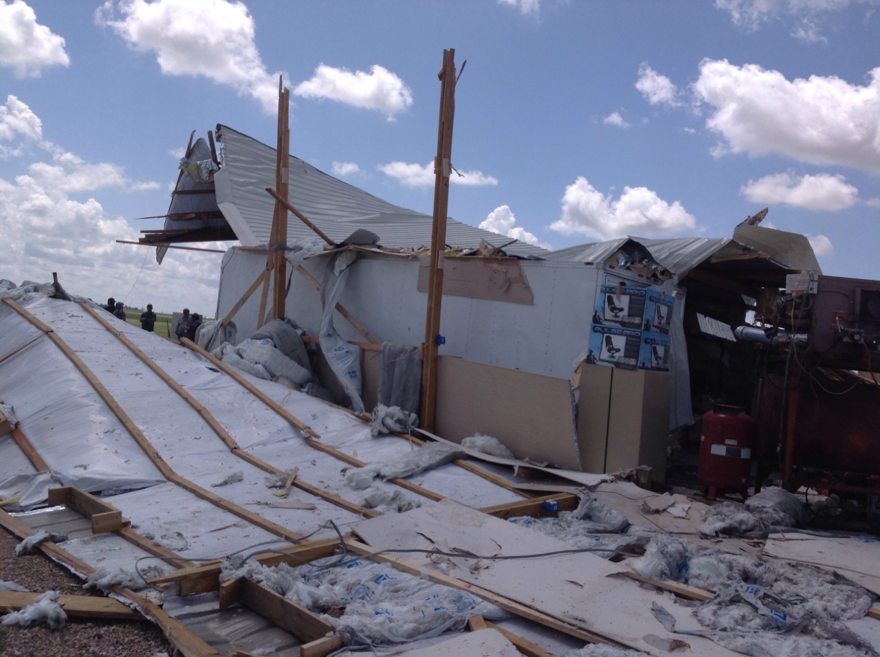
A stronger EF-1 tornado (86-110 mph winds) developed near 6:50 PM as the storm tracked east to near Platner, Colorado. Here, significant damage occurred to a pole shed, where the tornado lifted the entire shed and destroyed it. Debris from this shed traveled around 1 mile to the southeast where the tornado lifted. Only minor structural damage occurred elsewhere on the farm northeast of Platner.
Tornado Path:
Tornado Damage Photos:
Another EF-1 tornado occurred as the storm moved to the Washington/Yuma county line, near the intersection of County Road 46 and County Road AAA.

WSR-88D Radar Imagery:
Here's a view of the National Weather Service's KFTG Denver WSR-88D Radar Storm Relative Velocity and Reflectivity at the time of the EF-1 tornado by Platner.
Wind and Hail Damage:
Widespread wind and hail damage also occurred in Washington county, with a nearly 6 mile wide swath of damage from near Akron to the east/northeast (just north of Highway 34) into Yuma county. Thousands of acres of wheat were damaged or destroyed, siding was cracked and windows were knocked out of homes, numerous farm buildings and pole sheds were significantly damaged, and center pivot irrigation systems knocked over. Below are a few pictures of that damage.