Overview
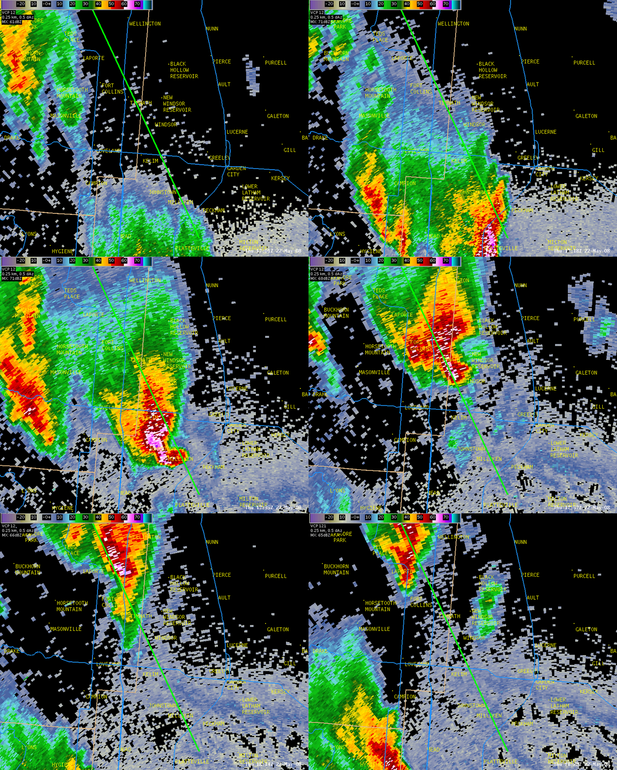
A powerful tornado swept north-northwestward across Weld County, carving a path of destruction, nearly 39 miles in length. The continuous path of damage was over 24 miles across western Weld County. The tornado, up to one-mile wide at times, initially touched down northeast of Platteville and finally lifted 6 miles west-northwest of Wellington. A tornado assessment in the aftermath of the tornado revealed extensive areas of damage. On the enhanced Fujita Scale there were pockets of EF3 damage, mainly near the Missile Silo Park Campground, and to businesses and homes in eastern Windsor. Farmers also reported extensive damage to crops and irrigation equipment.
There was one fatality, and 78 injuries ranging from broken bones to minor cuts and lacerations. One man was killed when he tried to escape a trailer park in his motor home. Tractor trailers were flipped along U.S. Highway 85, and over 200 power poles were snapped or blown down. Approximately 60,000 people were left without electricity. The tornado overturned 15 railroad cars and destroyed a lumber car on the Great Western Railway of Colorado. The tornado also flattened Windsor's main feedlot and destroyed a dairy barn. Most of the four-hundred cows were killed in the tornado or destroyed later. In addition to the damaging winds, the thunderstorm also produced damaging hail up to the size of baseballs.
Preliminary estimates from FEMA indicated 850 homes were damaged, and nearly 300 homes were significantly damaged or destroyed. The Poudre Valley Rural Electric Association reported $1 million of damage to electric transmission lines. Privately insured damages totaled $147 million in 2008 dollars, making it the state's costliest tornado disaster.
Tornado:
|
Tornado - LOCATION
Track Map
|
|||||||||||||||||
The Enhanced Fujita (EF) Scale classifies tornadoes into the following categories:
| EF0 Weak 65-85 mph |
EF1 Moderate 86-110 mph |
EF2 Significant 111-135 mph |
EF3 Severe 136-165 mph |
EF4 Extreme 166-200 mph |
EF5 Catastrophic 200+ mph |
 |
|||||
Photos & Video:
 |
 |
 |
| The tornado west of Greeley |
A high tension power line snapped at the base taken near Missile Silo Campground |
Damage to a home in Windsor |
 |
 |
 |
| A small professional building in Windsor. |
Damage in Windsor |
Widespread damage to homes in a Windsor neighborhood. |
 |
 |
 |
| A collapsed roof in Windsor |
Damage in Windsor |
An aerial view of the damage in Windsor |
Radar:
 |
 |
| Radar Reflectivity animation starting at 11:01 AM MDT and ending at 12:28 PM MDT The bright green line is the approximate path of the tornado | Radar Storm-Relative Velocity animation starting at 11:01 AM MDT and ending at 12:28 PM MDT The bright green line is the approximate path of the tornado |
 |
 |
| Radar Reflectivity animation starting at 10:31 AM MDT and ending at 1:30 PM MDT The bright green line is the approximate path of the tornadoes. The animation follows the track of the storm from south of Platteville all the way into Laramie, Wyoming. | Radar Storm-Relative Velocity animation starting at 10:31 AM MDT and ending at 1:30 PM MDT The bright green line is the approximate path of the tornadoes. The animation follows the track of the storm from south of Platteville all the way into Laramie, Wyoming. |
 |
Media use of NWS Web News Stories is encouraged! Please acknowledge the NWS as the source of any news information accessed from this site. |
 |