Overview
(Updated 5/30/2016 @ 1:35 PM MDT) 15 tornadoes were reported in Colorado and observed by spotters and chasers during the afternoon of May 28, 2018. Three of the 15 tornadoes occurred in Kit Carson County which is serviced by the Goodland, KS National Weather Service Office. To see information on the Kit Carson County tornadoes, visit their storm summary page (Coming Soon). Severe thunderstorms formed the afternoon of Memorial Day, 2018, (May 28). Some of the strongest storms formed across northeast Colorado, along a surface convergence boundary. The surface convergence boundary extended from Kit Carson County north into Washington County, and then though Morgan and Weld Counties. Intense convection that developed right on top of the boundary generated several tornadoes, with a few occurring simultaneously, especially across extreme southeast Washington County and northern Kit Carson County. No damage has been reported from any of the tornadoes, and there have been no injuries or fatalities. The heaviest damage (not necessarily from the strongest tornado) occurred in Cope, CO, from an EF-1 tornado causing extensive damage to a carport and garage on the southeast side of town, and downed a few trees. The storms also produced hail up to the size of tennis balls in Washington County. Further west, across the foothills west of Denver and across Denver Metro, instability was weaker and thus marginally severe hail occurred, including accumulating hail across the southern part of the metro area.
 |
||
| Storm Report Locations |
Tornadoes:
|
Tornado #1 7 mi E of Thurman
Tornado #2 4 mi S of Arickaree School
Tornadoes #3 and #4 7 mi SSW of Arickaree School
Tornado #5 4 mi SSE of Goodrich
Tornado #6 5 mi WSW of Cope
Tornado #7 5 mi WSW of Cope
Tornado #8 8 mi ENE of Thurman
Tornado #9 7 mi S of Grover
Tornado #10 6 mi S of Keota
Tornado #11 5 mi E of Fort Morgan
Tornado #12 Cope
|
||||||||||||||||||||||||||||||||||||||||||||||||||||||||||||||||||||||||||||||||||||||||||||||||||||||||||||||||||||||||||||||||||||||||||||||||||||||||||||||||||||||||||||||||
The Enhanced Fujita (EF) Scale classifies tornadoes into the following categories:
| EF0 Weak 65-85 mph |
EF1 Moderate 86-110 mph |
EF2 Significant 111-135 mph |
EF3 Severe 136-165 mph |
EF4 Extreme 166-200 mph |
EF5 Catastrophic 200+ mph |
 |
|||||
Photos:
Photos are from Washington and Kit Carson Counties between 5:15 and 6:30 PM MDT.
 |
 |
 |
 |
| Photo by Jon Stone | 8 miles southwest of Cope. Photo by Kevin Manross |
Several miles southwest of Cope Photo by Jeff Frame |
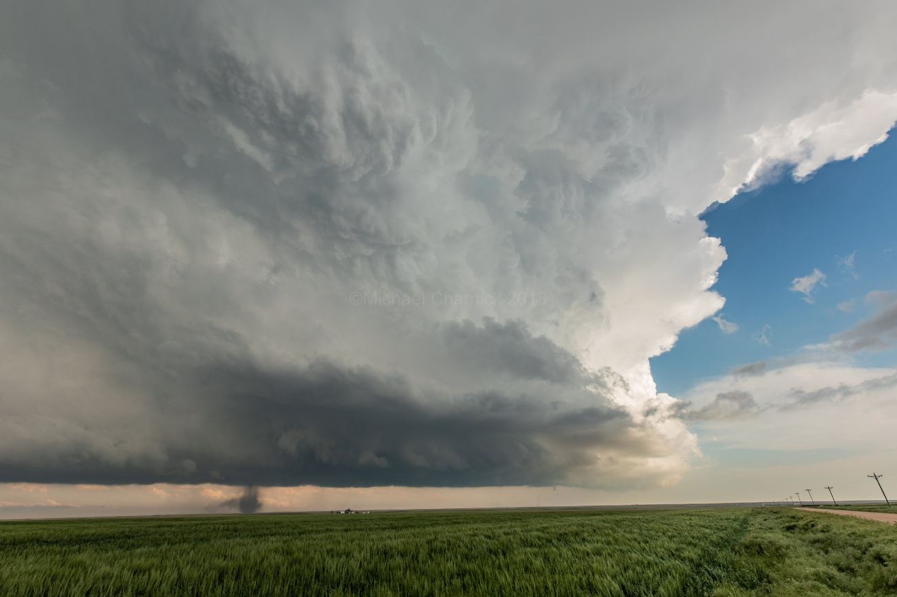
Photo by Mike Charnick |
 |
 |
 |
 |
| Photo by Mike Charnick | Photo by Mike Charnick | Photo by Mike Charnick | Taken from near Flagler Photo by Purdue EAPS Spotters |
 |
 |
 |
 |
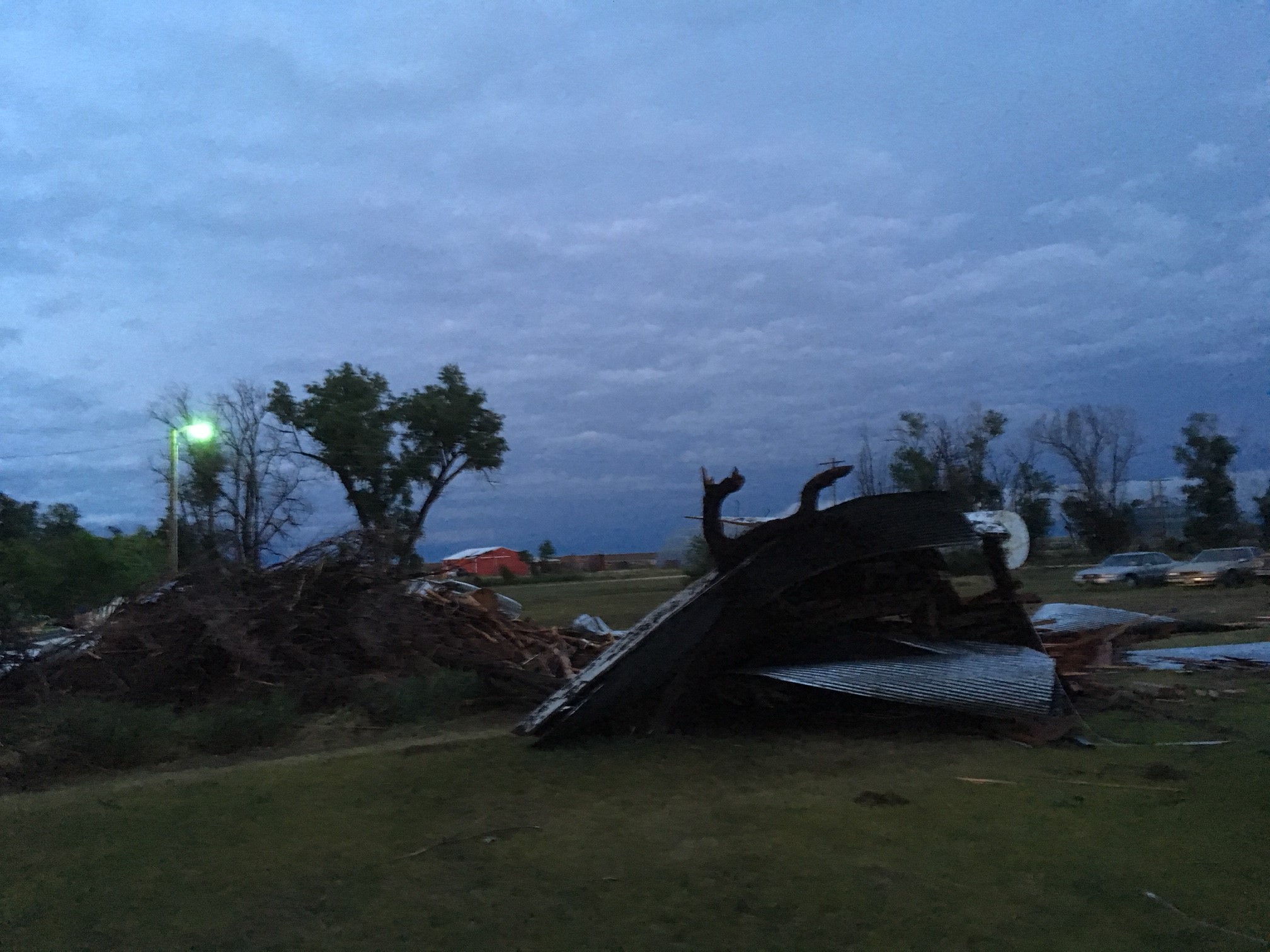
| Damage in Southeast Cope from an EF-1 Tornado Courtesy Bryant Mccall |
Damage in Southeast Cope from an EF-1 Tornado Courtesy Bryant Mccall |
Damage in Southeast Cope from an EF-1 Tornado Courtesy Bryant Mccall |
Damage in Southeast Cope from an EF-1 Tornado Courtesy Bryant Mccall |
 |
|||
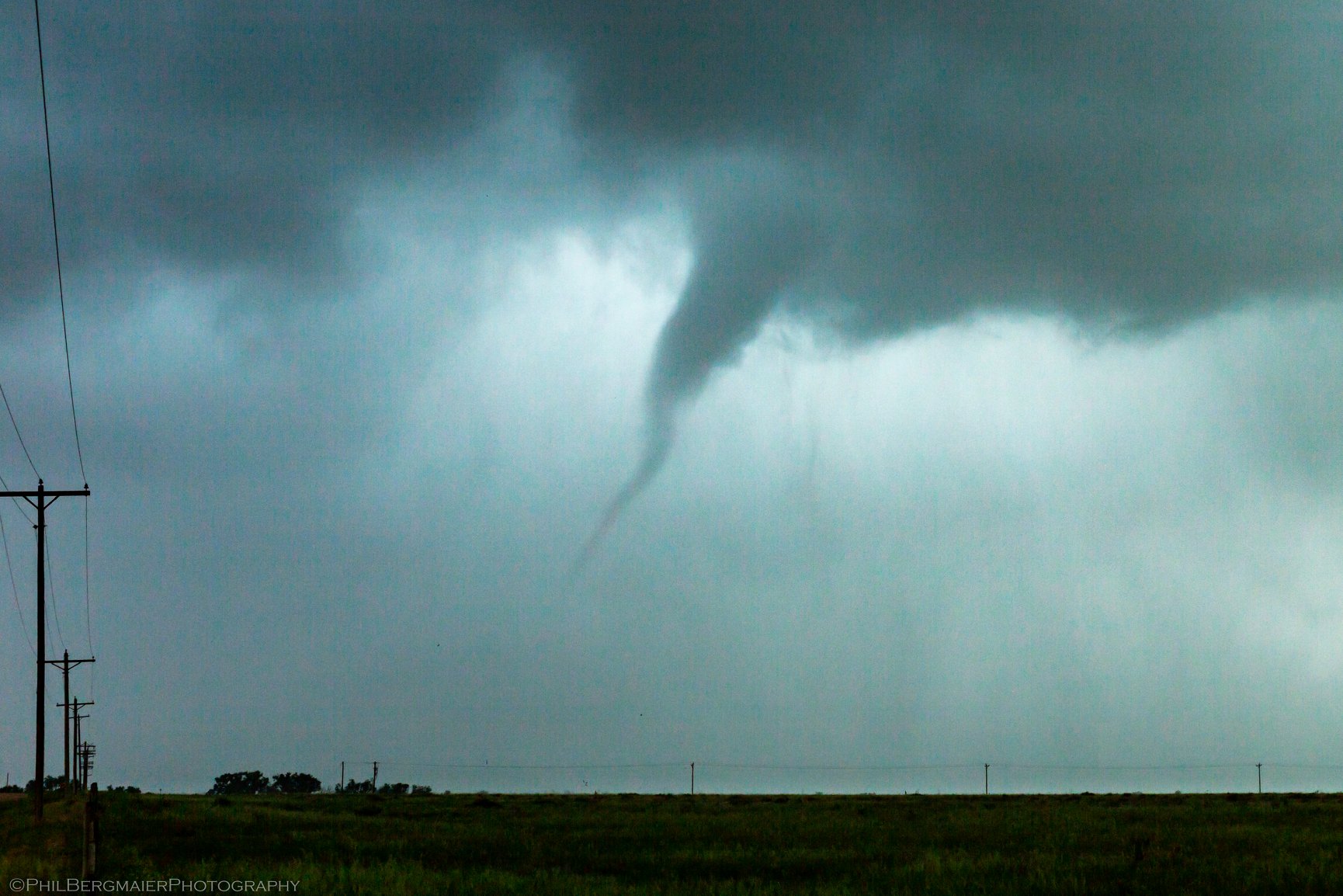
| Tornado in Cope at 542 PM. Courtesy Phil Bergmaier |
Radar:
This tab is undercontruction
| Caption | Caption | Caption | Caption |
 |
Media use of NWS Web News Stories is encouraged! Please acknowledge the NWS as the source of any news information accessed from this site. |
 |