
Unseasonably warm temperatures continue today through the weekend across the Southwest and southern U.S., with more than 100 record or near record maximum temperatures forecast through the rest of the week and over the weekend. Elevated to critical fire weather conditions will persist across the southern Plains today, moving into the central Plains and Southeast U.S on Saturday. Read More >
Summary of June 8-9th Storm Event
A strong storm system moved across the area Monday afternoon into Tuesday morning. This system produced severe thunderstorms and high winds, across northeast Colorado, with snow across the mountains, valley areas and higher foothills. In addition rainfall amounts of 1 to 2 inches occurred across the plains.
Severe Thunderstorms
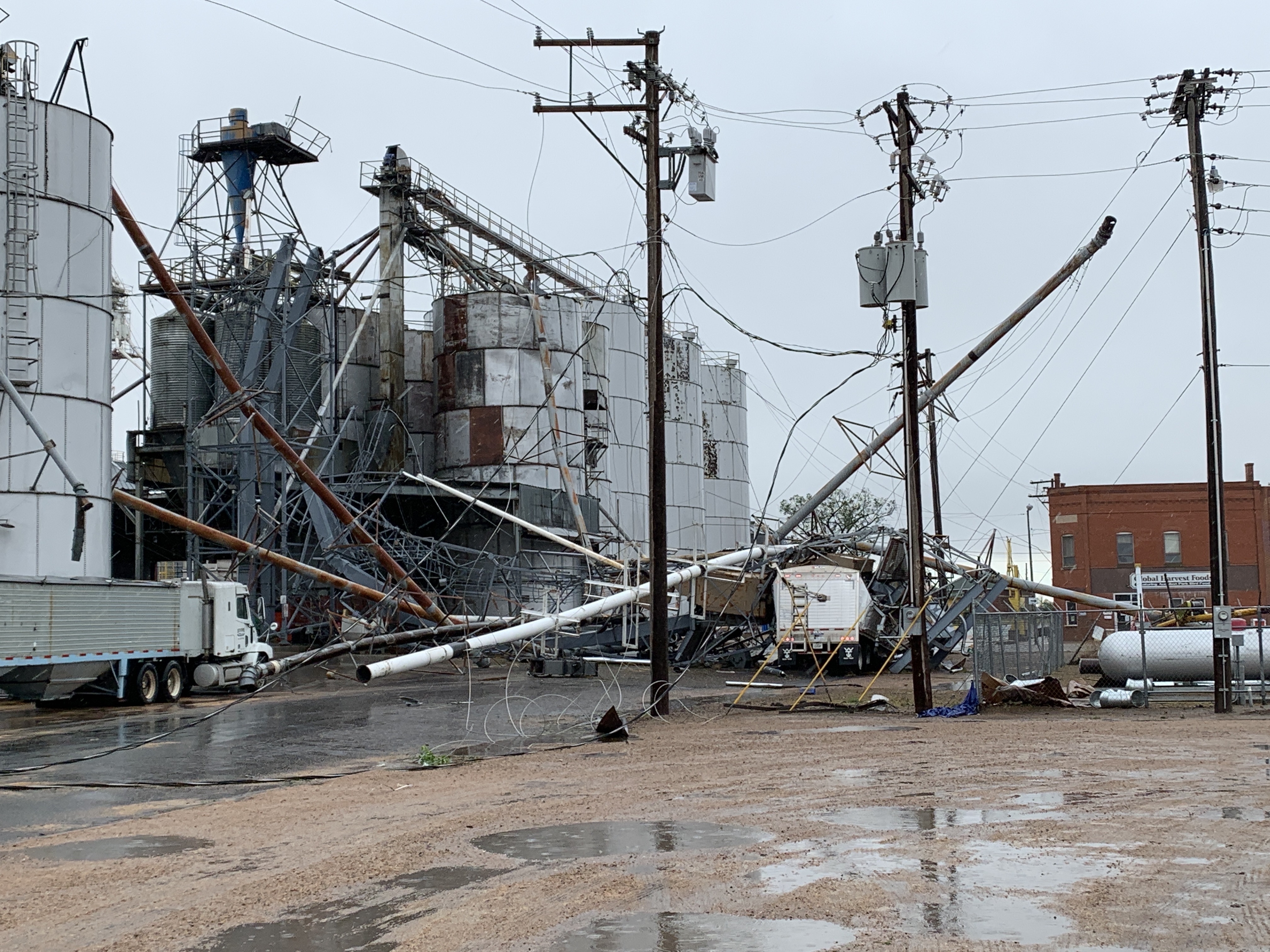
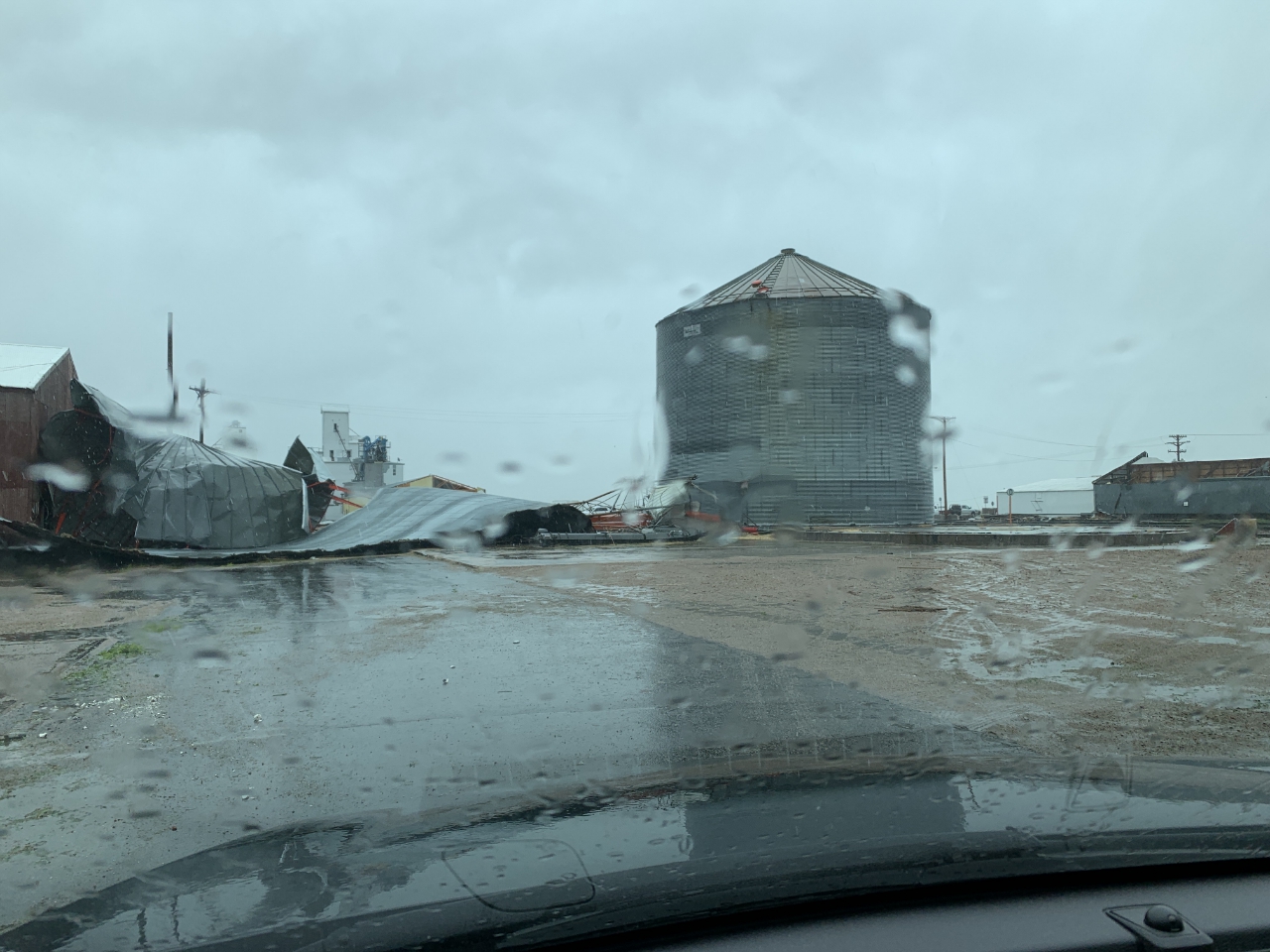
Severe thunderstorms, Monday night, produced damaging winds and a few hail reports, over portions of northeast Colorado. Wind gusts from 60 to 80 mph occurred, with a few localized gusts up to 100 mph, in and around the Akron area. The swath of damaging winds extended from central Washington County into Logan County and across western areas of Phillips and Sedgwick counties.
Highest Thunderstorm Wind Gusts

Damage Pictures in an around the Akron area.
 |
 |
 |
 |
 |
 |
 |
 |
Radar Reflectivity Loop Monday night.
 |
0.5 Velocity Loop Monday night.
 |
High Winds
Meanwhile, high winds associated with a strong cold front, affected northeast Colorado Monday night into Tuesday morning as well. Wind gusts from 50 to 70 mph occurred across the plains.
Highest Wind Gusts, not associated with Thunderstorms, Monday night into Tuesday morning.
| Location | Gust |
| 2 ENE Limon | 71 MPH |
| Limon | 70 MPH |
| Akron | 68 MPH |
| 2 ENE Limon | 67 MPH |
| Fort Morgan Airport | 64 MPH |
| 4 NNW Pawnee Buttes | 64 MPH |
| Briggsdale | 64 MPH |
| Keenesburg | 64 MPH |
| 1 NW Briggsdale | 62 MPH |
| Fort Morgan | 61 MPH |
| 1 ENE Limon | 60 MPH |
| 8 S Holyoke | 60 MPH |
| Strasburg | 60 MPH |
| 1 SE Strasburg | 60 MPH |
| 5 N Pawnee Pass | 60 MPH |
| Sterling | 59 MPH |
| 3 WSW Sterling | 59 MPH |
| Denver Arapahoe | 59 MPH |
| 2 SSE Denver Intl Airport | 58 MPH |
| Hugo | 58 MPH |
| 7 SSW Hugo | 58 MPH |
| Sterling | 58 MPH |
| Wiggins | 58 MPH |
Snowfall
Finally, snow occurred in the mountains, higher valleys and across South Park. Some areas of the northern Mountains, received heavy snow, with amounts up to 15 inches.


