2019 Bomb Cyclone
March 13th, 2019
Overview:
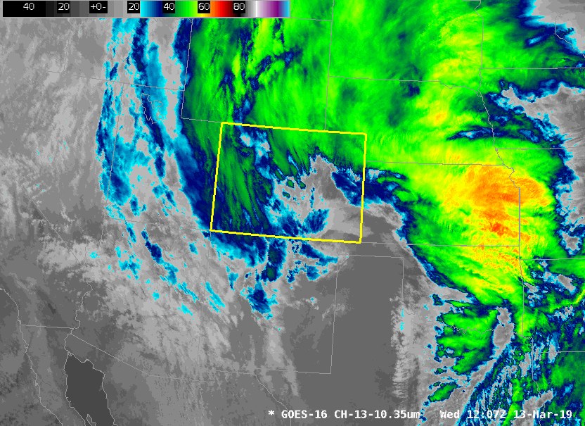
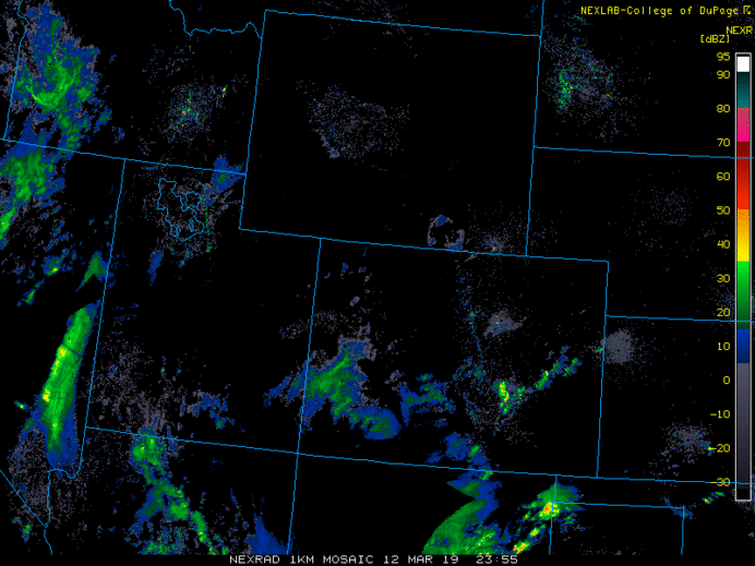
On March 13th, 2019 an extremely powerful low pressure system developed over southern Colorado, setting a record for the lowest pressure ever recorded over Colorado, at Lamar, of 970.4 mb. The system officially met the criteria of a "Bomb Cyclone", in which barometric pressure readings dropped in excess of 24 mb (0.71 in Hg) over a 24-hour period.
This storm created widespread blizzard conditions across northeast Colorado, Palmer Divide and over El Paso County. Wind gusts from 60 to 80 mph, with locally up to 100 mph. In addition, 1 to 3 feet of snow fell across the mountains with up to 52" at Wolf Creek Pass.
Impacts:
- Nearly 1400 airline flights at Denver International Airport (DIA) were cancelled prior to and during the storm. Virtually no planes flow in or out of DIA on Wednesday. 5000 passengers, spent the night at DIA, due to cancelled flights.
- All major Highways and Interstates were closed outside of the Denver area, including I-76 northeast to the Nebraska border, I-70 to the Kansas line, and I-25 south to Colorado Springs. In addition I-25 was closed from Wellington to the Wyoming line.
- Multiple multi-car accidents occurred, and numerous travelers were stranded in cars and at rest stops over northeast Colorado and the Palmer Divide. 1,500 people were stranded over northern El Paso county alone. Rescue operations for accidents and stranded motorists were severely curtailed by hazardous weather and road conditions throughout the storm. The Colorado National Guard was activated to aid search and rescue operations which numbered over 100.
- Numerous trees and power poles were blown down in rural and urban areas. At one point 445,000 customers were without power...some well into Thursday and pockets into Friday.
- Numerous schools and businesses were closed on Wednesday. Many schools remained closed on Thursday as well.
- 1 known fatality occurred as a Colorado State Trooper was killed along I-76 northeast of Denver.
Total Snowfall
Peak Wind Gusts
- 96 mph at Colorado Springs Airport (Highest Gust on Record)
- 89 mph at La Junta Municipal Airport
- 81 mph at Limon Municipal Airport
- 80 mph Gust at Denver International Airport (3rd Highest Gust on Record)
- 78 mph Gust at Pueblo Memorial Airport
- 78 mph Gust at Lamar Municipal Airport
Satellite Imagery of the Storm (courtesy of NWS Pueblo)
Radar Imagery of the Storm (courtesy of NWS Pueblo)
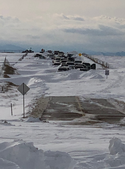
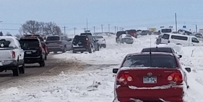
Photos
Abandoned Cars in Arapahoe County (Courtesy of Arapahoe County Sheriff)
Abandoned Cars on Woodmen Road in El Paso County (Courtesy of KOAA)
For more information about "Bomb Cyclones" NWS Pueblo has an excellent write up at https://www.weather.gov/pub/Bombogenesis_20190313