Denver/Boulder, CO
Weather Forecast Office
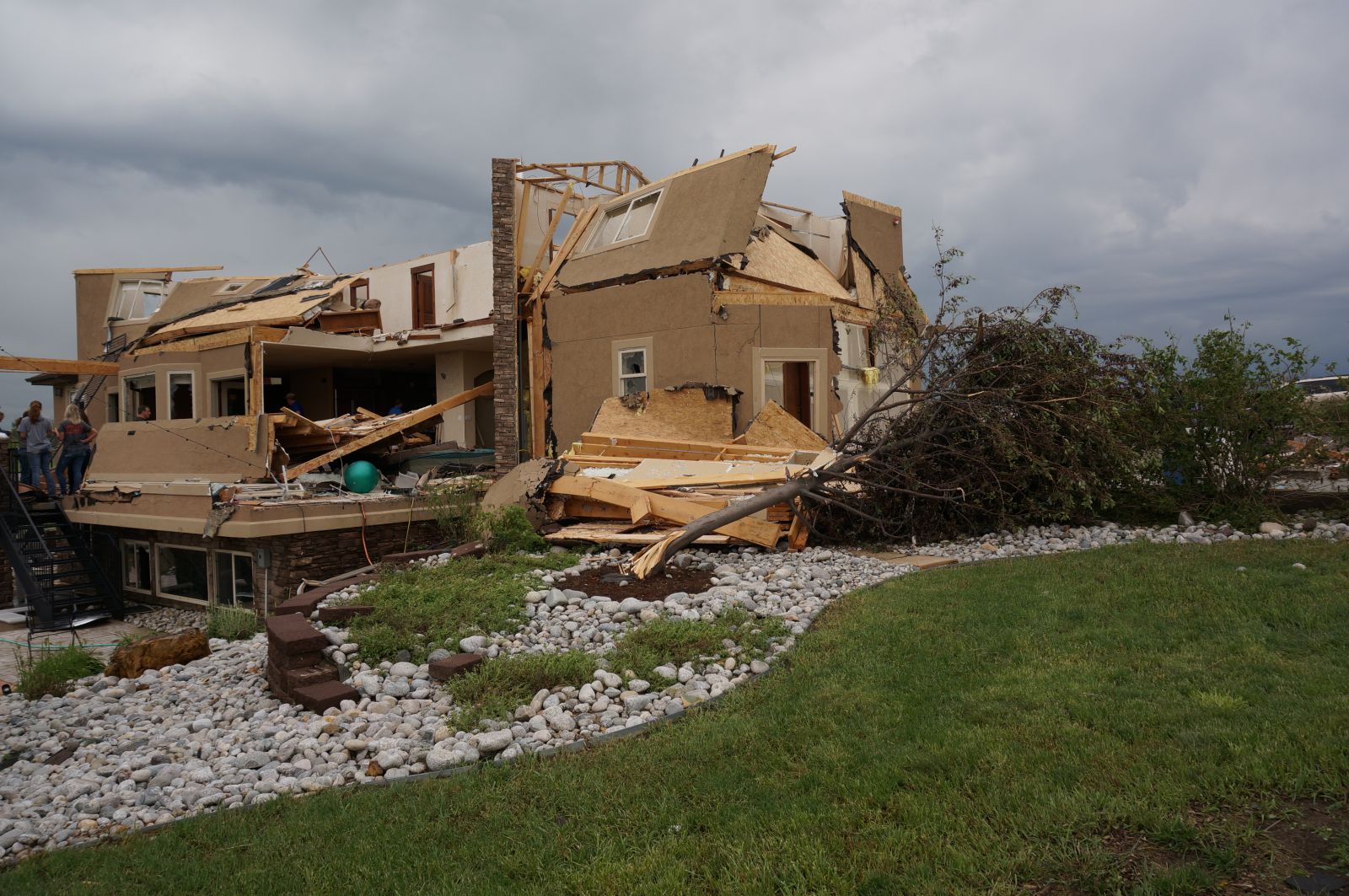
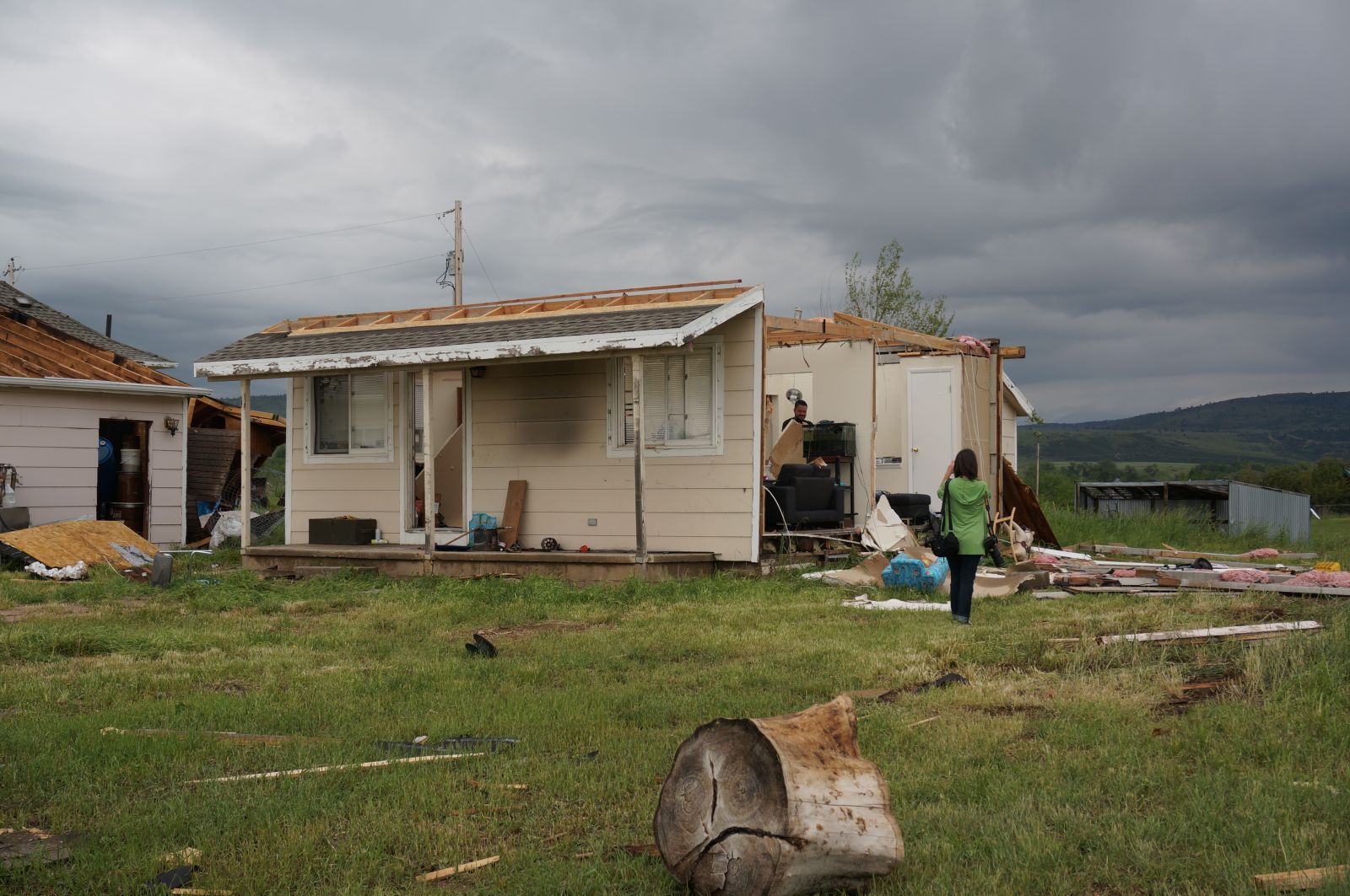
On the evening of June 4th, 2015 a rare EF3 tornado, with estimated wind speeds up to 140 mph, tracked almost due west along the Boulder, Larimer county line. The tornado was a quarter mile wide, at times, and had a path length of 6 miles. This is the strongest tornado on record, that has affected Boulder and Larimer counties, since official ratings began in 1950. 28 homes were damaged with three being destroyed. Fortunately, there were only a few minor injuries and no deaths.
Tornado track and intensity based on NWS Storm Survey
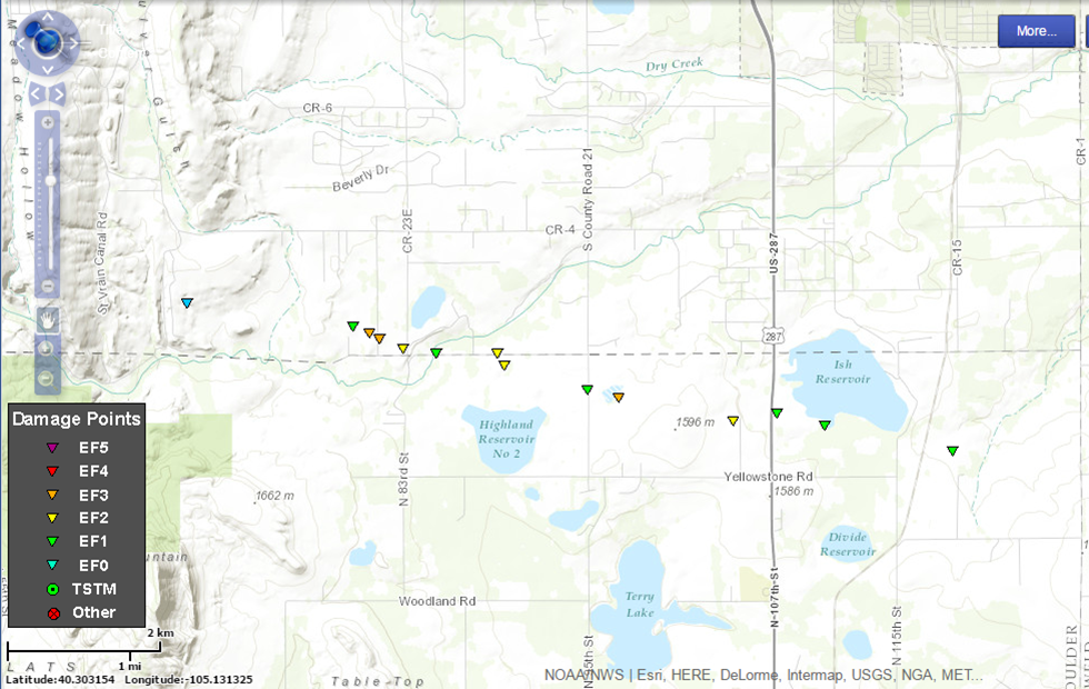 |
EF scale: The Enhanced Fujita scale classifies tornadoes into the following categories:
EF0...Weak......65 to 85 MPH
EF1...Weak......86 to 110 MPH
EF2...Strong....111 to 135 MPH
EF3...Strong...136 to 165 MPH
EF4...Violent...166 to 200 MPH
EF5...Violent...>200 MPH
Video of Tornado courtesy of Cory Reppenhagen
Reflectivity Loop at 0.5 Degrees
 |
Storm Relative Velocity Loop at 0.5 Degrees
 |
Damage pictures near the Boulder/Larimer county line
.jpg) |
 |
 |
US Dept of Commerce
National Oceanic and Atmospheric Administration
National Weather Service
Denver/Boulder, CO
325 Broadway
Boulder, CO 80305-3328
303-494-3210 for a recording call 303-494-4221
Comments? Questions? Please Contact Us.

