|
A persistent, large-scale trough over the U.S. favored an active period of weather across the Gulf Coast region, with parts of Central Alabama experiencing waves of wintry precipitation and a shot of Arctic air over a span of 5 days.
Leading up to the first significant cycle of winter weather on February 15/16, 2021, an Arctic air mass had been established across the Central U.S. for days as steady northerly flow emanated from a strong Canadian surface high. Another area of high pressure over the Western Atlantic, extending into the Gulf of America, helped keep the frigid air mass at bay for much of Central Alabama. However, the leading edge of the freezing air mass was not too far away, and began to nudge into far northwest Central Alabama on Friday the 12th. A few upper-level impulses tracked along an expansive thermal gradient, the result of opposing flow from the cold & warm high pressure centers, encompassing the Gulf Coast region. This resulted in spells of precipitation, some of which fell in the form of freezing rain and sleet from the evening of Friday the 12th to Sunday the 14th for portions of west and northwest Central Alabama / mainly northwest of Birmingham and Tuscaloosa. A light glaze of ice occurred in some areas.
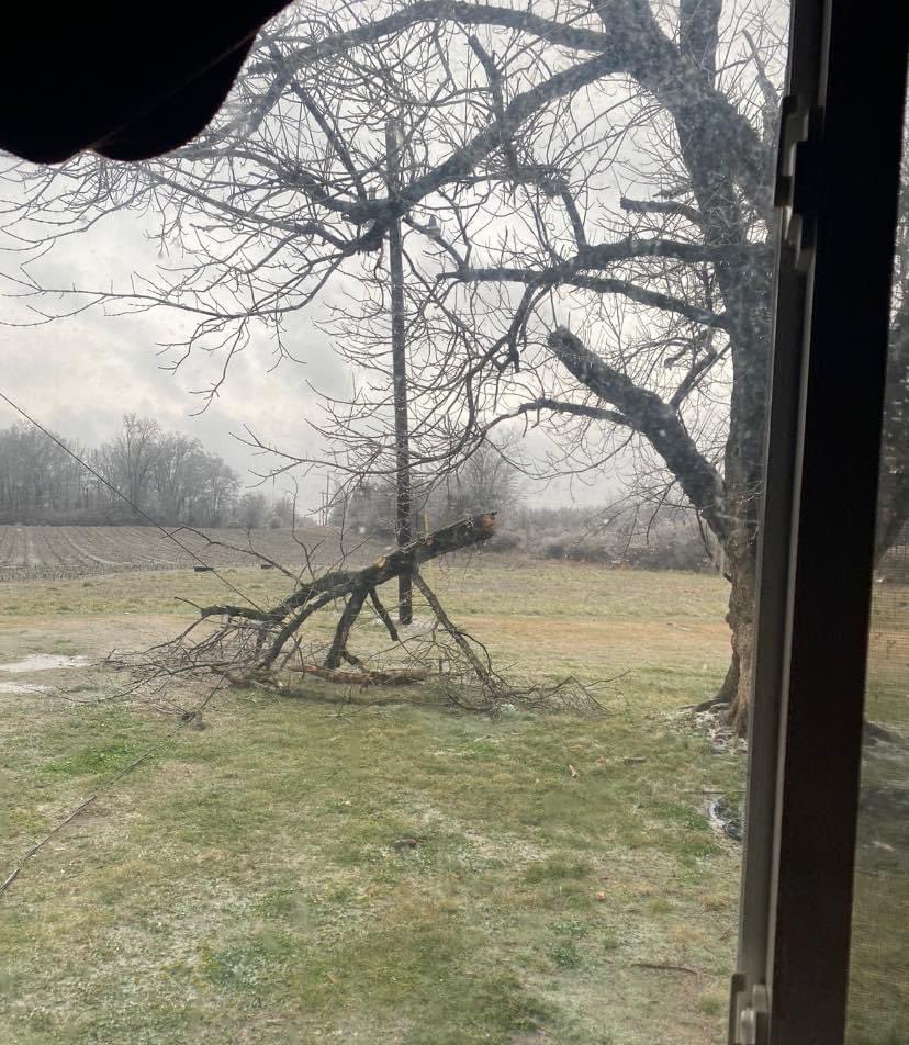
A larger disturbance moving through Texas aided in the development of a surface low over the northern Gulf of America Sunday the 14th into Monday the 15th, of which tracked northeastward into the Mid-Atlantic region by late Monday. A large area of precipitation developed and overspread the region. Much of Central Alabama was still involved within the ‘warmer’ side of the air mass and received rain. Freezing air at the surface was still confined to far west and northwest Central Alabama. The freezing air mass was shallow and, while surface temperatures were in the upper 20s to lower 30s (F), the wind pattern a few thousand feet above the surface favored an influx of warmer air from the south at as much as 50 degrees. This type of vertical temperature profile was a classic setup for freezing rain (rain that falls and freezes on contact on surfaces at ground level, forming a coat of ice). Over time, some low-level cooling occurred and allowed for sleet to mix in with the freezing rain. The hardest hit counties were those under an Ice Storm Warning, including: Pickens, Lamar, Fayette, Marion, and Winston (and locations in North Alabama / NWS Huntsville’s service area). As much as ½ inch of ice accretion occurred in areas, with lesser amounts closer to ¼ inch more common. The weight of the ice caused trees to bend or fall over, tree branches to break, and power outages. The coating of ice made for dangerous or impossible travel across the warning area. Weak instability values aloft yielded a few lightning strikes where frozen precipitation was occurring.
On the ‘warmer’ side of the system, rain affected the rest of Central Alabama, with some thunderstorms toward Montgomery / Troy / Auburn areas. Gravity waves were evident on RADAR and presumably, along with a front in the area, had a role in quick-hitting wind gusts along the Interstate 20 corridor, with Tuscaloosa recording a wind gust of 49 mph, Birmingham 32 mph, and other public reports of gusty but non-measured winds. An EF-2 tornado hit Damascus, GA (far southwest part of the state / NWS Tallahassee’s service area) during the afternoon.
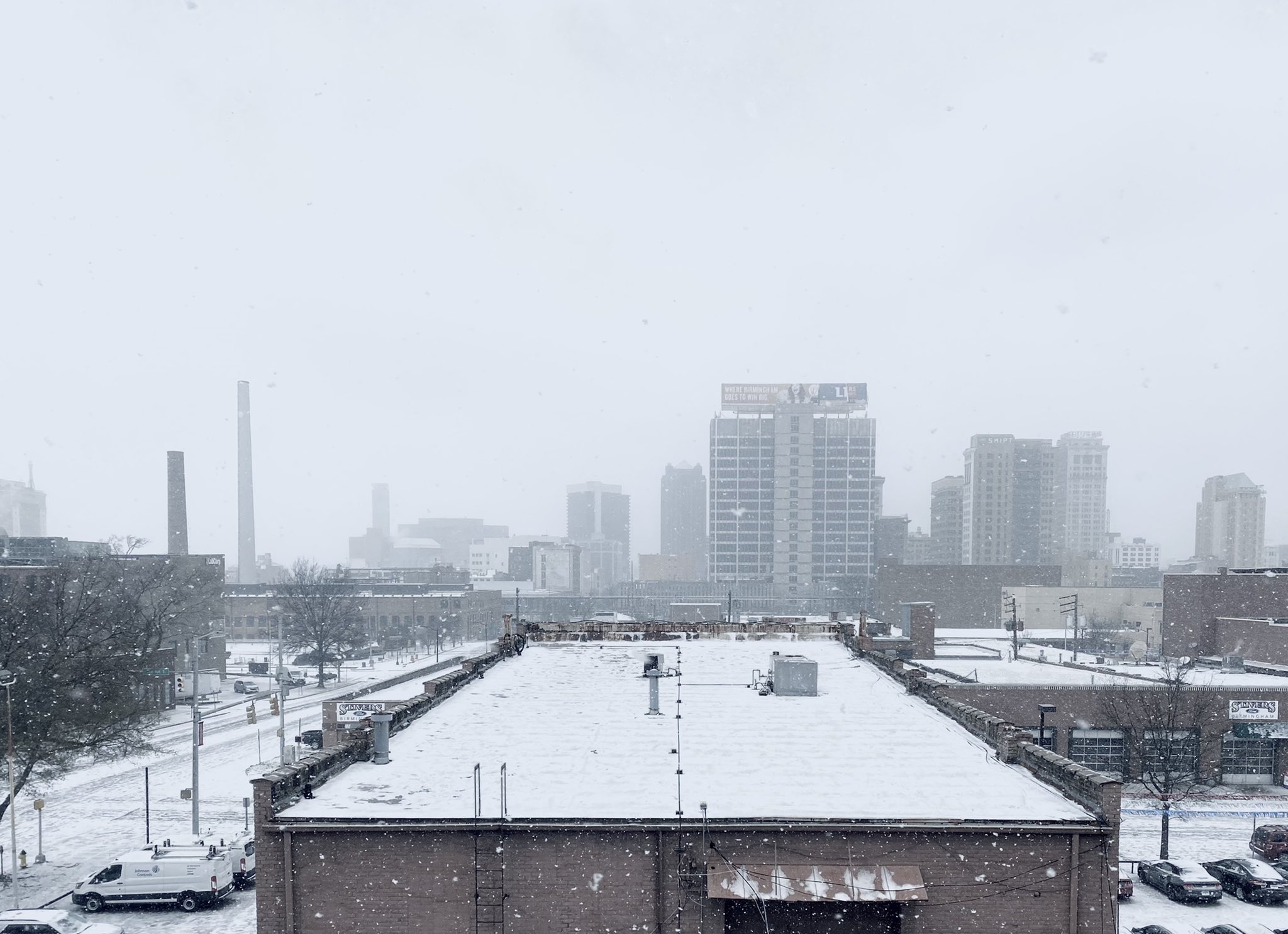
As the storm system exited, it opened the door for the Arctic air mass to move further into Alabama. Temperatures fell sharply through the night, bottoming out from the low 10s to low 20s on the morning of Tuesday the 16th with a wind chill factor in the single digits. Much of the region remained below freezing through the day. To add to the busy period of weather, a remaining shallow cloud layer produced snow showers into the early afternoon. The snow was dry and fluffy in nature with light accumulations occurring in various areas. There were even some enhancements from bodies of water and industrial plants in Central and North Alabama.
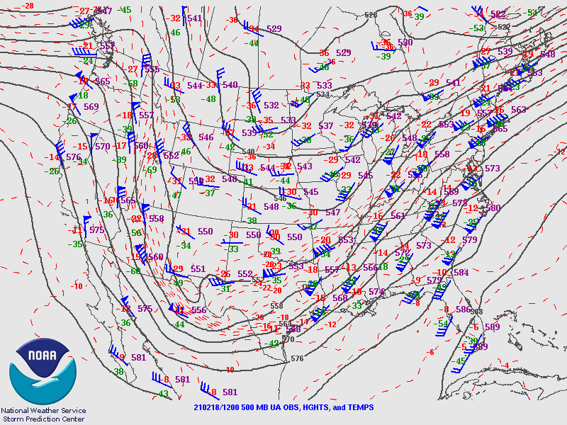
A second cycle of notable wintry weather affected similar areas across northwest Central Alabama on Wednesday the 18th as yet another disturbance, embedded within large-scale troughing, moved through. A southwest to northeast temperature gradient was still present. While temperatures in the 40s and 50s returned to much of the area, Hamilton, Haleyville, and surrounding communities remained at or a few degrees below freezing through the afternoon. A Winter Storm Warning was in effect for Lamar, Marion, and Winston Counties. By mid afternoon, precipitation, in the form of snow and sleet, began moving in from Mississippi. This of course turned to rain as it moved farther east into warmer air, though there were a few instances of sleet mixed in during the onset along the Interstate 59 corridor. Region-wide precipitation continued through the evening, with snow and sleet accumulating to as much as 3 inches in Marion and Winston counties (as much as 6 inches just north in NWS Huntsville’s service area), with pockets of heavy rain and isolated thunderstorms farther south and east. Slightly warmer air aloft was making its way north with surface temperatures also rising by a couple of degrees. This resulted in the transition line between rain and frozen precipitation moving northward during the mid to late evening hours, meaning areas that previously received frozen precipitation changed to a cold rain. Even so, a few locations managed to hang onto the 32 degree mark through the night, allowing for at least some wintry mix to continue as the storm system began to pull away and precipitation drew to a close.
|


.png)