NWS Birmingham, Alabama
Weather Forecast Office
|
Weather Review - June 26, 2009 |
 |
|
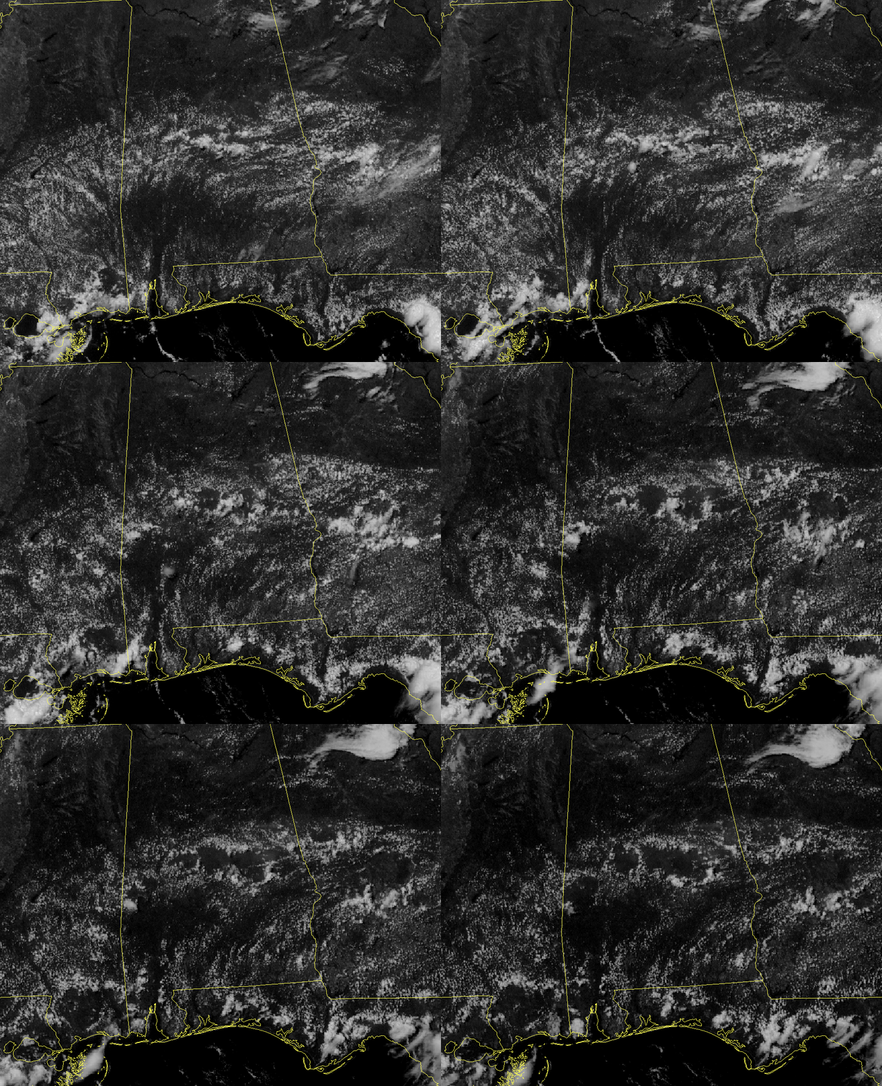
The above image is a visible satellite captured at 1215 pm CDT. As evident by the clouds through south central Mississippi, central Alabama and central Georgia, there is a weak boundary which has been the focus for convection over the last couple of days. The green lines are isobars of geopotential height at 500 millibars (mb). These lines depict what is commonly referred to as 'upper level flow' and average a height of about 20,000 feet. This day's upper level flow is out of the north-northeast. There are two main features being highlighted today. First, the convection that is beginning around the time of the top image. A thunderstorm, pointed out by the red arrow, is forming over extreme western Chilton County. At the time of initiation, winds at approximately 200 mb, or 35,000 feet, were blowing at 66 mph (58 knots). Once the storm reached the 200 mb level, these winds 'ripped off' the top of the storm and blew it downwind. You can follow the top of the storm in the animation below as it moves to the south-southwest towards the coast. The animation is from 1215 pm until 245 pm CDT. Today's second feature is the rings that are created within the cloud field after the storms dissipate. These rings are caused by outflow winds or winds that are forced to the ground as a storm dissipates. These winds spread out in all directions and can become the focus for further convection later in the day. |
 |
Current Hazards
National Outlooks
Tropical
Local Storm Reports
Public Information Statement
Graphical Hazardous Weather Outlook
Current Conditions
Regional Weather Roundup
Rivers and Lakes
Drought Monitor
Forecasts
Fire Weather
Aviation Weather
Graphical Forecasts
Forecast Discussion
Air Quality
Climate and Past Weather
Past Events
Storm Data
Tornado Database
Daily Rainfall Plots
Tropical Cyclone Reports
Warnings and Other Products
Tornado Warnings
Severe Thunderstorm Warnings
Flash Flood Warnings
Winter Weather Warnings
Special Weather Statements
Non-Precipitation Warnings
Flood/River Flood Warnings
Productos en Español
Conciencia y Preparación
Previsión de 7 Días
Weather Safety
NOAA Weather Radio
Severe Weather Preparedness
Severe Safety Rules
Tornado Safety Rules
Severe Safety w/ ASL
Awareness Weeks
Severe Weather
Hurricane Preparedness
Summer Safety Campaign
Winter Weather
US Dept of Commerce
National Oceanic and Atmospheric Administration
National Weather Service
NWS Birmingham, Alabama
465 Weathervane Road
Calera, AL 35040
205-664-3010
Comments? Questions? Please Contact Us.

