Alabama Tornado Database |
|||||||||||
| 2007 Tornado Occurrences (42) () Indicates Total Path Data Multi-State | |||||||||||
| Tornado # of Year | Year | Month | Day | Time (CST) | County | Damage Scale | Path Length (Miles) | Maximum Path Width (Yards) | Fatalities | Injuries | Location |
| 42 | 2007 | 10 | 23 | 1250 | Butler Event Report Small Risk |
F0 Warnings |
0.10 | 60 | 0 | 0 | 2 NW Georgiana A weak tornado briefly touched down near I-65 and State Highway 106. The tornado blew down several trees and power lines. Thunderstorms moving northeast blew down trees and power lines in Butler and Crenshaw Counties during the early morning hours of October 23. A couple of homes in Crenshaw County suffered roof damage. A weak tornado also caused minor damage along I-65 in Butler County. Start: 31.6500/-86.7700 End: 31.6500/-86.7700 |
| 41 | 2007 | 10 | 23 | 0040 | Lowndes Event Report Storm Survey Small Risk |
F1 Warnings |
3.25 | 100 | 0 | 0 | 5.1 ESE Lowndesboro - 2.9 SSW Manack The tornado first touched down just west of Caffey Road, near Robinsons Lake, in northeastern Lowndes County. It then moved northeast, crossing US-80 and County Road 37, before lifting. The most concentrated damage occurred at Mt. Olive Church and the Auxiliary Mt. Olive Church, on Frederick Douglass Road. A wing of the auxiliary church had its entire roof blown off, a couple windows blown out, and the steeple was blown 100 yards over a house. The main church building sustained damage to about 20% of its roof. Multiple trees were also blown down in the church area. Start: 32.2500/-86.5400 End: 32.2900/-86.5100 |
| 40 | 2007 | 10 | 22 | 2301 | Bibb Event Report Storm Survey Slight Risk |
F1 Warnings |
7.71 | 200 | 0 | 0 | 3.1 SW Harrisburg - 1.8 SSW Ingate The tornado touched down about southwest of the Harrisburg Community, west of Alabama Route 5. It then tracked north northeast for over 7 miles, roughly parallel to Route 5, and lifted after crossing Bear Creek Road, west of Brent. The tornado damage was very minimal for a majority of the path, and was limited to a few snapped trees. The damage increased along Bear Creek Road, about 2 miles west of Brent, where at least 3 homes suffered minor damage and several outbuildings were destroyed. Numerous soft and hardwood trees were snapped off in this area. Start: 32.8400/-87.2700 End: 32.9500/-87.2300 |
| 39 | 2007 | 10 | 22 | 2144 | Hale Event Report Storm Survey Slight Risk |
F1 Warnings |
9.31 | 50 | 0 | 2 | 3.3 S Sledge - 1.7 ENE Rosemary The tornado touched down along County Road 12, just east of the Laneville Community. It then tracked north northeast, crossing County Road 16 and State Highway 61, before lifting near the intersection of State Highway 61 and County Road 24. At least 20 homes sustained damage, with 11 of the homes severely damaged. One airplane hangar near the intersection of County Road 24 and State Highway 61 suffered major damage. Numerous trees were either uprooted or snapped off along the path, and at least 20 vehicles sustained varying degrees of damage. The highest winds affected areas near the intersection of County Road 10 and Dodge City Road. There were two minor injuries as a result of the storm. Start: 32.5200/-87.5700 End: 32.6600/-87.5400 |
| 38 | 2007 | 10 | 22 | 1533 | Mobile Event Report Storm Report Slight Risk |
F1 Warnings |
0.70 | 200 | 0 | 0 | 0.7 SE Bayou La Batre Airport - 0.7 ENE Bayou La Batre Airport The National Weather Service in Mobile conducted a damage assessment of the tornadic thunderstorms that moved across south Mobile County late Monday afternoon, October 22nd. Meteorologists from the Weather Service in Mobile found that a tornado first touched down just south of Memory lane southeast of Bayou La Batre Airport. This area was where most of the damage occurred. A manufactured home was broadsided by the tornado and the home was overturned and demolished. Another manufactured home was pushed several feet by the winds but stayed anchored into the ground. A shed was completely destroyed by the winds. Several other homes were damaged in the area. Trees and power lines were also blown down. Seven people took refuge in a bathtub, fortunately their home only suffered some siding and roof damage. The tornado then tracked north northeast, paralleling Walker Road and lifted just south of Roy E Ray Road. A couple of homes were damaged and sheds and travel trailers were damaged along this track. Trees were also blown down. At the end of the track of the tornado, just south of Roy E Ray Road, several homes suffered roof and eave damage. Trees and power lines were also damaged in this area. A resident said the tornado struck around 436 pm CDT. The tornado was rated at an EF1 (86 to 109 mph) on the Enhanced Fujita Scale. The length of the tornado track was about three-quarters of a mile and the width of the tornado was 200 yards. There were no injuries caused by the tornado. The tornado damaged fifteen to twenty residences with one destroyed and two severely damaged. Others suffered minimum to moderate damage. Start: 30.4400/-88.2100 End: 30.4500/-88.2100 |
| 37 | 2007 | 10 | 22 | 1407 | Mobile Event Report Slight Risk |
F0 Warnings |
0.10 | 50 | 0 | 0 | Dauphin Island A waterspout moved ashore near Dauphin Island and quickly dissipated on the beach. The weak tornado dissipated over the beach and no damage was found. Start: 30.2500/-88.1200 End: 30.2500/-88.1200 |
| 36 | 2007 | 10 | 18 | 1405 | Lawrence Event Report Slight Risk |
F1 Warnings |
0.16 | 100 | 0 | 0 | 10 S Mt Hope - 9.8 S Mt Hope An EF1 tornado producing estimated maximum winds of 90 mph, a path length of 0.15 miles, and a maximum path width of 100 yards tracked through the Sipsey Wilderness Area of the Bankhead National Forecast in Lawrence County. Numerous large trees were uprooted with several others snapped or sheared at the tops. Start: 34.3100/-87.5000 End: 34.3100/-87.5000 |
| 35 | 2007 | 10 | 18 | 1342 | Marion Event Report Storm Survey Slight Risk |
F0 Warnings |
0.06 | 50 | 0 | 0 | 2.3 NNE Thorn Hill A tornado briefly touched down on Alabama Highway 129, southwest of the city of Haleyville. The tornado only struck one structure, a house that sustained damage to its carport, awning, and the front half of its roof. The tornado also damaged several trees and at least one power pole along its short path. Start: 34.2000/-87.6600 End: 34.2000/-87.6600 |
| 34 | 2007 | 10 | 18 | 1215 | Lamar Event Report Slight Risk |
F0 (F0) Warnings |
0.03 | 25 | 0 | 0 | 5.2 W Vernon A Lamar Sheriff's Deputy observed and photographed a brief tornado touchdown. Subsequent investigation yielded no discernable damage in the area. Start: 33.8300/-88.2100 End: 33.8300/-88.2100 |
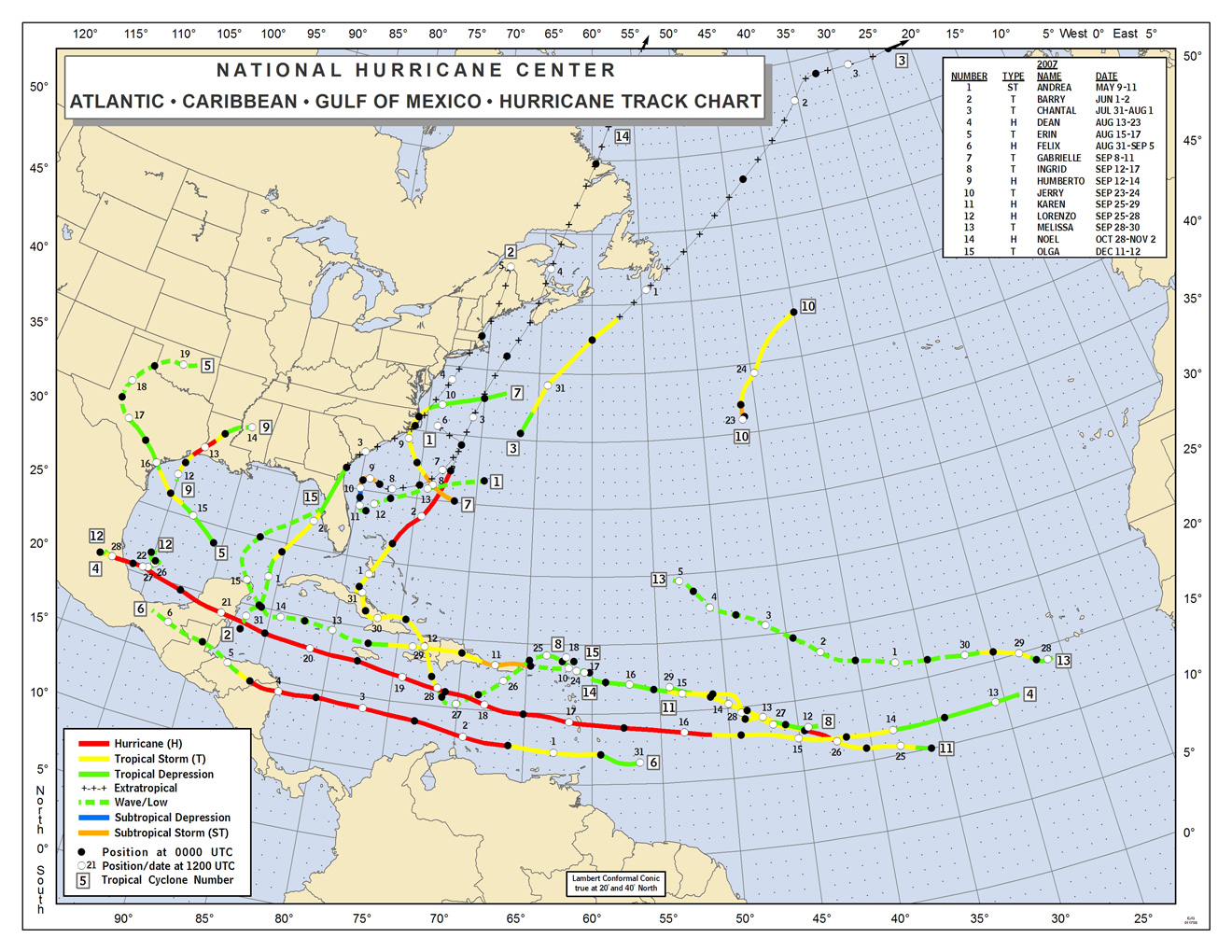
| 33 | 2007 | 09 | 21 | 1634 | Barbour Event Report Tropical Depression #10 Information 2007 Atlantic Tropical Map 2007 Tropical Depression Ten Report Slight Risk |
F0 (F0) Warnings |
0.36 | 20 | 0 | 0 | 3.3 W Blue Springs A Barbour Sheriff's Deputy reported a tornado near the intersection of CR 23 and CR 8, just southeast of Clio. The deputy observed debris, but there was no subsequent damage found. Tropical Depression #10 spawned an isolated tornado. Start: 31.6600/-85.5700 End: 31.6600/-85.5800 |
| 32 | 2007 | 06 | 19 | 1200 | Morgan Event Report Storm Survey Slight Risk |
F0 (F0) Warnings |
0.25 | 25 | 0 | 0 | 2.2 SSW Trinity Representatives from the National Weather Service and Morgan County Emergency Management completed a survey of damage in the city of Trinity, AL. The survey found evidence of an EF-0 tornado on the Enhanced Fujita Scale, with highest winds of 65 mph. The damage was confined mostly to uprooted trees and snapped limbs. One residence sustained some damage, mainly to sheds and fencing at the back of the property. An upper level circulation or disturbance known in meteorology as a Mesoscale-Convective-Vorticity center tracked eastward through the central Tennessee Valley during the morning hours. A moist an unstable airmass enabled rapid low-topped shower development by late morning as this system tracked through the area. A brief weak tornado was sighted in Trinity. This was in close proximity to the upper level circulation mentioned above. As this shower entered Madison, AL further to the east, a NWS employee observed thunder being heard, likely from a cloud to cloud lightning flash. Otherwise, no other cloud to ground lightning was noted, making this tornado an interesting phenomenon for further study. The University of Alabama-Huntsville ARMOR dual-polarization radar located at the Huntsville International Airport was in close proximity to this tornado and identified a couple of small low-level circulations within a band these showers, one in the vicinity of the tornado. Start: 34.5900/-87.0900 End: 34.5900/-87.0900 |
| 31 | 2007 | 04 | 14 | 1805 | Dale Event Report Moderate Risk |
F1 (F0) Warnings |
5.83 | 150 | 0 | 0 | 3.0 NW Ozark-5.0 NE Ozark A tornado touched down on County Road 38 producing minor damage to a barn. It then traveled east across Marley Mill Road and destroyed a barn, shed and greenhouse. A residential gable collapsed and several pines were snapped. A few homes on Hawridge Road in the Post Oak Community suffered moderate damage. Also, a carport and shed were destroyed. A portion of County Road 50 was closed due to debris. Also, a home on Robin Parker Road was damaged when several pines snapped, with one landing on the roof. Several areas, especially along Roy Parker Road, were without power for several hours until crews could repair lines taken down by fallen trees. Start: 31.4800/-85.6900 End: 31.5000/-85.5900 |
| 30 | 2007 | 04 | 14 | 1711 | Bullock Event Report Storm Survey Moderate Risk |
F1 (F0) Warnings |
3.2 | 100 | 0 | 0 | 17 S Union Springs A tornado touched down about one mile southwest of the intersection of US Highway 29 and County Road 53 around 611 PM CDT. The tornado tracked northeast and was on the ground for 3 miles. The tornado damage path was 100 yards wide at its widest point. One barn was completely destroyed near the Jamback Community. Numerous trees were uprooted or snapped off along the path. Several homes sustained minor roof damage. Start: 31.8800/-85.7200 End: 31.9000/-85.6700 |
| 29 | 2007 | 04 | 14 | 1612 | Conecuh Event Report Moderate Risk |
F1 (F0) Warnings |
0.25 | 50 | 0 | 0 | 2.5 NNW Castleberry A weak tornado developed along the leading edge of a large bow echo just northwest of Castleberry. The tornado blew down trees and damaged a residence just west of County Road 23. Estimated wind speeds were 85 to 90 mph. No injuries occurred. Start: 31.3300/-87.0400 End: 31.3300/-87.0400 |
| 28 | 2007 | 04 | 14 | 1500 | Crenshaw Event Report Moderate Risk |
F0 (F0) Warnings |
0.54 | 40 | 0 | 0 | 5 NW Saville A weak EF-0 tornado did some minor damage in the extreme north part of the county near Clearview. The tornado touched down near County Road 11 and damaged a poultry farm, three of the buildings on the farm had their tin roofs damaged. Three other buildings had parts of their roofs taken off. None of the chickens were injured. An eye witness said the tornado looked like pencil dropping out of the sky. The tornado continued northeast and dissipated near Highway 97. A church located in this area had shingles taken off and a tree fell on the roof. Start: 32.0300/-86.3900 End: 32.0300/-86.3900 |
| 27 | 2007 | 04 | 14 | 1233 | Monroe Event Report Moderate Risk |
F1 (F0) Warnings |
1.06 | 200 | 0 | 0 | Vredenburgh A few minutes after the huge microburst occurred, a tornado touched down just southwest of County Road 56 south of Vredenburgh. Most of the structural damage occurred north of County Road 56. A very old home was pushed from its blocks and roof was lifted off. The tornado then moved northeast and damaged a church that was located near the home. Many trees were blown down in this area. Another church a few hundred yards to the northeast of the first church had part of the back of the building blown off. A convergence pattern was observed in the fallen trees from southwest of County Road 56 to northeast of the home. The tornado either dissipated or went back into the clouds near the second church. The tornado wind speed was estimated at 105 mph. No injuries were reported. People who lived only a short distance away said they never heard or observed the tornado. The tornado ended near where a huge microburst had occurred a few minutes earlier. Start: 31.8200/-87.3200 End: 31.8200/-87.3000 |
| 26 | 2007 | 04 | 11 | 1654 | Macon-Russell Event Report Storm Survey Event Information Slight Risk |
F1 (F0) Warnings |
11.47 | 400 | 0 | 0 | 6.8 SE Tuskegee-Uchee A tornado touched down along County Road 10...approximately 6.8 miles southeast of Tuskegee or 4.4 miles northwest of Warriorstand. The tornado tracked east southeast across the remainder of eastern Macon County and crossed into Russell County. The tornado lifted near the intersection of State Highway 51 and Cowpen Road near the Uchee Community. The tornado damage path was 12.1 miles long and was 400 yards wide at its widest point. Hundreds of trees were either snapped off or blown over along the path. The highest winds were estimated around 90 mph...an EF1 tornado...although much of the damage was consistent with EF0 damage. The tornado was on the ground from approximately 554 PM until 616 PM. Start: 32.3700/-85.6000 End: 32.3300/-85.4000 |
| 25 | 2007 | 04 | 11 | 1618 | Tallapoosa Event Report Storm Survey Event Information Slight Risk |
F1 (F0) Warnings |
0.9 | 50 | 0 | 0 | Dadeville A tornado touched down at the intersection of Lafayette Street and Fulton Street...on the northeast side of US Highway 280 in Dadeville. The tornado tracked east southeast for about 1 mile...and lifted just past the railroad tracks and Woodyard Street. The tornado damage path was 50 yards wide at its widest point. At least three homes were damaged due to numerous uprooted trees. Spencer Lumber Company... located at the corner of Fulton Street and Oak Street...sustained damage including roof damage to metal sheds on their property. The highest winds were estimated at 90 mph...or an EF1 tornado. The tornado was on the ground from approximately 518 PM until 520 PM. Start: 32.8400/-85.7600 End: 32.8300/-85.7400 |
| 24 | 2007 | 04 | 11 | 1605 | Elmore Event Report Storm Survey Event Information Slight Risk |
F0 (F0) Warnings |
0.09 | 25 | 0 | 0 | 4.8 SE Wetumpka A brief tornado touch down occurred about 4.8 miles southeast of Wetumpka. The tornado caused minor damage to at least one home and knocked a few trees over. The damage occurred near Ridgefield Drive near the New Bingham Community. The tornado damage path was less than a tenth of a mile long and 25 yards wide at its widest point. Additional funnel cloud reports were received as the storm moved through southern Elmore County...but no additional damage was discovered. The tornado was on the ground at about 505 PM. Start: 32.4800/-86.1500 End: 32.4800/-86.1500 |
| 23 | 2007 | 04 | 11 | 1447 | Bibb-Chilton Event Report Storm Survey Event Information Slight Risk |
F1 (F0) Warnings |
0.98 | 200 | 0 | 0 | Randolph A tornado touched near the intersection of County Road 36 and New Hope Village...just east of Randolph in far southeastern Bibb County. The tornado tracked east southeast and lifted just across the Chilton County line along County Road 73. The tornado damage path was 1.5 miles long and was 200 yards wide at its widest point. Several trees were either blown down or snapped off along the short path. One home was damaged by a fallen tree and one home suffered minor shingle damage. The highest winds were estimated between 90 and 95 mph...an EF1 tornado. The tornado was on the ground from approximately 347 PM until 349 PM. Start: 32.9100/-86.8900 End: 32.9000/-86.8700 |
| 22 | 2007 | 04 | 11 | 1414 | Jefferson Event Report Event Information Storm Survey Slight Risk |
F1 (F0) Warnings |
0.57 | 40 | 0 | 0 | 2.7 NNW Sayre The tornado touched down on Tate Mill Road, just northwest of County Road 140 or Warrior Jasper Road. The tornado tracked east southeast and lifted on Humber Road in the Bagley Community. The tornado damage path was approximately one half mile long and 40 yards wide at its widest point. Several windows were blown out of homes and automobiles. One 18-wheeler carrying a load was overturned. One office trailer was overturned. Several hardwood trees were either snapped off or uprooted. At least one of the trees fell on a home and produced damage. The tornado was witnessed by several people in the area. The highest winds were estimated between 90 and 95 mph...an EF1 tornado. The tornado was on the ground from approximately 314 PM until 316 PM. Start: 33.7500/-86.9800 End: 33.7500/-86.9800 |
| 21 | 2007 | 04 | 03 | 2233 | Jackson Event Report Storm Survey Slight Risk |
F1 (F0) Warnings |
2.57 | 100 | 0 | 0 | 1.1 SSE Davistown-3.6 SE Davistown This tornado formed three miles east of the Langston Community, which is just south of the Tennessee River in southern Jackson County, and moved to the southeast before ending one mile southeast of the Macedonia Community near the Macedonia Primitive Baptist Church. Most of the damage along its path was rated EF-0, except for a small area of EF-1 damage in Macedonia where maximum wind speeds were estimated to be 95 m.p.h. About half a mile from the crossroads at Macedonia on County Road 38, the tornado did the most damage. Parts of a two-story family dwelling roof and siding were carried away, a couple century old harwood trees were uprooted, a large outbuilding was completely destroyed, and the roof was ripped off another nearby building. Some of the debris from this property was scattered more than half a mile away. At the Corinth Missionary Church windows were broken and fascia board was ripped from the main structure, while another smaller building on the church property was blown slighly off its foundation. Roofing shingles were ripped off Macedonia Primitive Baptist Church and parts of Macedonia School, where a communications tower was bent in half. A line of thunderstorms developed across the Mid Mississippi Valley during the afternoon hours and moved southeast into the Tennessee Valley during the overnight hours. After several cell mergers as the line moved into southern middle Tennessee, the line intensified and accelerated southeast across northern Alabama. Two tornadoes developed in the vicinity of mergers of the squall line with thunderstorms that developed ahead of the line. Start: 34.5400/-86.0100 End: 34.5100/-86.9800 |
| 20 | 2007 | 04 | 03 | 2126 | Madison Event Report Storm Survey Slight Risk Started in Tennessee |
F0 (F0) Warnings |
8.96 (9.27) |
75 (75) |
0 (0) |
0 (0) |
2.3 WNW Elkwood-1.1 S Hazel Green Airport This tornado developed in extreme southwest Lincoln County, Tennessee and moved southeast across northwest Madison County, Alabama. The damage caused by this tornado was mainly a few snapped utility poles and downed trees, but there also was some minor damage to a few homes. Wind speeds were estimated at 60 m.p.h. Start: 34.9900/-86.7700 End: 34.9000/-86.6500 |
| 19 | 2007 | 03 | 01 | 1756 | Shelby Event Report Storm Survey Event Information Service Assessment High Risk Day |
F1 Warnings |
0.65 | 100 | 0 | 0 | 6 SW Alabaster The tornado touched down along County Road 17, about 6 miles southwest of Alabaster, and tracked a short distance to the east-northeast. At least 15 large pine trees were snapped off. One home suffered major roof damage and a barn sustained roof damage. Start: 33.1600/-86.8600 End: 33.1600/-86.8500 |
| 18 | 2007 | 03 | 01 | 1727 | Russell-Lee Event Report Storm Survey Storm Survey 2 Event Information Service Assessment High Risk Day Continued into Georgia |
F1 (F2) Warnings |
2.77 (12.2) |
100 (300) |
0 (0) |
0 (1) |
3.0 NNE Ladonia-3.0 W Midland The tornado touched down near the Russell-Lee County Line, on the northwest side of Phenix City. Damage near the touchdown point in Russell County was very light with only minor tree damage. The tornado that touched down near the Russell-Lee County Line tracked northeastward across southern Lee County. It strengthened as it approached Lake Oliver on the Chattahoochee River. The greatest damage was from Summerville Road into the River Oak and Rock Island areas. Numerous pine trees were snapped off and some hardwoods were uprooted. At least 20 residential properties reported tree damage. At least 25 homes suffered shingle, window or minor structural damage. Some of the fallen trees landed on homes and produced moderate damage. The tornado then continued eastward into Muscogee County, Georgia. A survey conducted by the National Weather Service in Peachtree City and the National Weather Service in Calera, Alabama, concluded that an EF2 tornado, that originated in Russell County, Alabama, tracked across northwest and north central Muscogee County. The tornado first touched down in extreme northeast Russell County, Alabama about three miles from the Georgia State Line, then crossed into extreme southeast Lee County, Alabama, and then entered Georgia as it moved across the north end of Lake Oliver, about 1.5 miles west-southwest of Green Island Hills. The tornado continued to travel east-northeast across north Muscogee County, including the north suburbs of Columbus (Green Island Hills, Brookstone, Autumn Ridge, Hamilton Station, and Old Moon Road), before finally lifting three miles west of Midland in north central Muscogee County. The overall tornado path length was approximately 12 miles, with about nine miles of the tornado path within Georgia. The maximum path width was 300 yards. The heaviest damage occurred in the 6200 block of Brookstone Boulevard just north of U.S. Highway 80 in the northwest part of Columbus. Several homes in this area suffered heavy damage and at least one injury was confirmed. In addition, several commercial buildings on Veterans Parkway sustained substantial structural damage. Windows were blown out, large air conditioning units were tossed about, large metal business signs were blown down, and power poles were twisted and blown down. The Hawthorn Suites on North Lake Parkway was destroyed from roof and water damage. Nearby, the Ramada Inn under construction also suffered considerable damage while a nearby Holiday Inn Express sustained minor damage. In addition, several churches, including Wynnbrook Baptist, Saint Mark's United Methodist, and Old Moon Road Churches were heavily damaged. Hundreds of trees were down in the area, a number of which fell on parked cars. Many power lines were down and thousands were left without power, some for over a day. Start: 32.5100/-85.0500 End: 32.5500/-85.0200 |
| 17 | 2007 | 03 | 01 | 1606 | Jefferson Event Report Storm Survey Event Information Service Assessment High Risk Day |
F1 Warnings |
0.9 | 400 | 0 | 0 | 1.3 WNW Oakwood-0.9 SE Adamsville The tornado touched down in the Adamsville Community, near Abbey Road, and then tracked northeastward. It lifted about 100 yards north of US Highway 78 near Solomon Street. Dozens of trees were either uprooted or snapped off. Many trees fell on homes and caused significant structural damage. One home had a large portion of its roof lifted off. Start: 33.5800/-86.9500 End: 33.5900/-86.9400 |
| 16 | 2007 | 03 | 01 | 1545 | Winston-Cullman Event Report Storm Survey Storm Survey 2 Event Information Service Assessment High Risk Day |
F2 Warnings |
9.62 | 100 | 0 | 0 | Lewis Smith Lake-4.9 NW Crane Hill The tornado touched down near the intersection of County Road 41 and County Road 62, about 2 miles north of Arley. It then tracked northeastward, crossed Smith Lake, crossed County Road 77, before it moved into Cullman County. Several homes and barns were damaged along the path. One chicken house was totally destroyed and two others sustained major damage. Numerous trees were either uprooted or snapped off. Representatives from the National Weather Service in Birmingham conducted an aerial survey in Winston and Cullman Counties relating to storm damage reported during the March 1, 2007 tornado outbreak. It was determined that this damage was caused by an EF-2 tornado on the Enhanced Fujita Scale with maximum estimated winds of 110-115 mph. The damage track extended 9.1 miles and was a maximum of 100 yards wide, but most of this occurred in Winston County. The track extended less than 3/4 of a mile into extreme western Cullman County, north of County Road 141 and south of the Nesmith Community. By the time the tornado reached Cullman County, it had weakened to a low-end EF-1 tornado, with estimated winds of 75 mph and a path width of 25 to 50 yards. The tornado was responsible only for tree damage within Cullman County before lifting around 3:57 pm CST. Start: 34.0800/-87.2500 End: 34.1500/-87.1100 |
| 15 | 2007 | 03 | 01 | 1512 | Barbour Event Report Storm Survey Event Information Service Assessment High Risk Day |
F1 Warnings |
2.4 | 75 | 0 | 0 | 6.7 NNE Eufaula The tornado touched down about a half mile west of the US 431 bridge at Cowikee Creek. The tornado tracked northeastward through the Lakepoint Resort State Park and ended in the Eufaula National Wildlife Refuge. At least 100 pine trees were snapped off and several power lines were blown down. The tornado was seen by several individuals as it crossed the bridge over US Highway 431. The tornado damage path was 2.4 miles long and was 75 yards wide at its widest point. Start: 31.9830/-85.1300 End: 31.9870/-85.0890 |
| 14 | 2007 | 03 | 01 | 1500 | Tuscaloosa Event Report Storm Survey Event Information Service Assessment High Risk Day |
F1 Warnings |
3.73 | 100 | 0 | 0 | 1.4 WNW Samantha-3.1 NE Samantha The tornado touched down about 2 miles northwest of Samantha, near the intersection of Lesueur Road and Nazareth Church Road. It then tracked northeastward, crossed US Highway 43, and lifted near the intersection John Swindle Road and Joe Namath Road. Numerous trees were either snapped or uprooted along the path. One brick home lost a portion of its roof. Start: 33.4300/-87.6400 End: 33.4500/-87.5800 |
| 13 | 2007 | 03 | 01 | 1459 | Fayette Event Report Storm Survey Event Information Service Assessment High Risk Day |
F1 Warnings |
11.22 | 150 | 0 | 0 | 0.7 S Bluff-1.9 WSW Bazemore The tornado touched down near the intersection of State Highway 107 and Paul Colburn Road, near the Bluff Community. It then tracked northeastward and crossed US Highway 43, before lifting just northeast of AL 129 and CR 24. Several homes and storage buildings were damaged along the path. Numerous trees were blown down or snapped off. Start: 33.8100/-87.9000 End: 33.8900/-87.7300 |
| 12 | 2007 | 03 | 01 | 1448 | Lowndes-Montgomery Event Report Storm Survey Event Information Service Assessment High Risk Day |
F2 Warnings |
24.55 | 600 | 0 | 6 | 1.4 ENE Sandy Ridge-2.7 NE Garters Hill What would eventually become a large tornado first touched down in far southeastern Lowndes County, along US Highway 31 in the Sandy Ridge Community. The tornado tracked northeastward, roughly parallel to US 31, before moving into extreme southwestern Montgomery County. During its short path in Lowndes County, the tornado damaged several structures and downed numerous trees. After crossing into Montgomery County, the Lowndes County tornado continued to move northeastward, affecting the Davenport, Fleta, Ada, and Sprague Communities, as well as the Ridgeland Farm subdivision. The tornado eventually lifted just east of US Highway 231 near the Carters Hill Community. Two of the injuries occurred when an automobile was thrown off the road over 300 feet. In all at least 39 homes suffered varying degrees of damage. Three of the homes were completely destroyed. At least 23 out-buildings or barns were damaged. Five large chicken houses were completely obliterated near the Davenport Community. One high voltage power transmission line was totally destroyed. Fourteen grain silos were destroyed. Four of the grain silos were picked up and thrown up to one half of a mile away from where they were anchored. At least 10 automobiles were significantly damaged. Hundreds of trees were snapped off or uprooted along the damage path. Start: 32.0300/-86.4500 End: 32.2100/-86.0900 |
| 11 | 2007 | 03 | 01 | 1348 | Dale-Henry Event Report Storm Survey Storm Report Service Assessment Continued into Georgia High Risk Day |
F1 (F1) Warnings |
30.09 (37.94) |
150 (150) |
0 (0) |
6 (6) |
3.0 SW Echo-3.0 SSW Hatcher The tornado touched down southwest of the community of Echo and traveled northeast along State Road 27 before it crossed into western Henry County. The damage assessment indicated that the EF-1 tornado damaged 24 mobile homes and destroyed five others. Four residents of a mobile home were injured when the tornado damaged their mobile home. The tornado also demolished 18 chicken houses, which killed 140,000 chickens. The tornado's path missed the Ft. Rucker, Alabama WSR-88D RDA site by less than a quarter mile. Numerous trees and utility poles were snapped. Dale County was declared a federal disaster area. After the EF-1 tornado crossed into western Henry County from eastern Dale County, it traveled northeast causing sporadic tree damage along County Roads 7 and 40. It then tore through the Bethlehem community, and damaged 51 mobile homes and destroyed 28 others. Two persons were injured when the tornado damaged their mobile home. The tornado overturned a semi on State Road 10 before lifting. The tornado descended two miles southwest of the community of Otho along County Road 97. It destroyed 14 homes and damaged 27 others in Otho. Numerous trees and utility poles were also blown down there and in the Stonebridge Subdivision. The tornado exited the northeast part of the county at Lake Eufaula. After crossing from Alabama across Lake Eufaula, the tornado damaged several homes along Lakeview Drive, Macedonia Road, and Pataula Heights Lane. The tornado then approached Pataula Shores Circle and crossed State Highway 39. It snapped or uprooted many pines in and around Mt Zion Church Road, Frontage Trail and Hatcher Road before crossing the Clay-Quitman County Line. The tornado moved along Hatcher Road before it lifted. Numerous trees were snapped. Start: 31.4500/-85.5100 End: 31.7000/-85.1000 |
| 10 | 2007 | 03 | 01 | 1308 | Coffee Event Report Storm Survey Storm Report Storm Video Storm Video Storm Video Service Assessment High Risk Day |
F4 Warnings |
10.33 | 500 | 9 | 50 | 1.6 SW Enterprise-5.6 NE Enterprise A tornado touched down just southwest of the Enterprise Municipal Airport. It caused minor damage to some houses. Four chicken houses were destroyed. The tornado then traveled northeast and quickly intensified as it moved into the Enterprise city limits. It severely damaged the high school just north of the downtown. Eight students were killed as walls collapsed on them while they took shelter in the interior hallways. Fifty more were injured. The football stadium was destroyed. Many vehicles surrounding the schools were overturned or tossed about. Several state roads were impassible due to debris and fallen utility poles and lines. The ninth fatality occurred where a woman was standing behind a living room window of her home as the glass shattered. A nearby elementary school was heavily damaged with no deaths or injuries reported there. Damage near the high school and in northeast Enterprise reached low end EF-4. Damage assessments indicated 239 homes destroyed, 374 homes with major damage, 529 homes with minor damage, and 251 homes affected. Coffee County was declared a federal disaster area, with preliminary FEMA individual assistance figures totalling over $1 million. Start: 31.2800/-85.9200 End: 31.3800/-85.7800 |
| 9 | 2007 | 03 | 01 | 1227 | Wilcox-Dallas Event Report Storm Survey Storm Survey 2 Service Assessment Event Information NASA Before & After Photo High Risk Day |
F4 Warnings |
18.32 | 500 | 1 | 2 | 2.4 E Prairie-3.8 WNW Kings Landing A significant tornado first touched down around 1227 pm at State Highway 28 near Miller's Ferry Dam. The tornado then tracked northeast across William "Bill" Dannelly Reservoir moving ashore on Sand Island Drive. This is where most of the severe damage occurred with numerous homes damaged or destroyed. One resident had arrived at his home on the lake to eat lunch when the tornado hit and he was killed when his newer model manufactured home was destroyed. The straps holding the home down all snapped in the same place. He was thrown out of his home and later found in the debris. Neighbors next door had sought shelter in an underground storm shelter outside their house seconds before the tornado hit. When they safely emerged from the shelter, they found their home destroyed. Most of the homes on Sand Island are vacation homes with part-time residents. If the tornado had struck on the weekend when more people are present, the loss of life would likely have been greater. Around 40 homes(four of these were slab homes)were damaged or destroyed along Sand Island Drive with some of the debris scattered up to two miles downstream. The tornado continued quickly to the northeast through sparsely populated areas. Damage did occur to homes and hunting camps along this path. However, the damage here was only rated as EF-0 and EF-1 on the Enhanced Fujita Scale. The tornado crossed into Dallas County. In all, one person died and two people were slightly injured by the tornado. The injuries occurred along Sand Island Drive when a single wide trailer was destroyed with the occupants being thrown from the trailer. They were protected from flying debris by part of the trailer that had fallen on top of them. The highest wind speed of the tornado was estimated at 185 mph. A tornado that had previously caused EF-4 damage in Wilcox County crossed the Wilcox-Dallas County Line about 6.4 miles southeast of the town of Alberta. The tornado then tracked northeastward and ended along the Alabama River, east of the Whites Bluff Community. The most concentrated damage in Dallas County occurred just south of Five Points along County Road 31 and along County Road 33. Twenty seven homes suffered varying degrees of damage, and two homes were completely destroyed. At least six outbuildings were damaged. Numerous trees and power lines were either snapped off or uprooted along the path. Start: 32.1200/-87.4100 End: 32.2700/-87.1400 |
| 8 | 2007 | 03 | 01 | 1205 | Butler Event Report Service Assessment High Risk Day |
F0 Warnings |
3.15 | 30 | 0 | 0 | 2.5 NNW Industry-4.8 NNE Industry A weak tornado blew down several trees east of Georgiana. A tractor trailer was blown off State Highway 106 by the wind. Start: 31.6300/-86.6400 End: 31.6600/-86.5900 |
| 7 | 2007 | 02 | 13 | 1822 | Autauga Event Report Storm Survey Event Information Slight Risk |
F1 Warnings |
1.10 | 200 | 0 | 0 | 2.2 ENE Mulberry - 2.52 E Mulberry The tornado touched down briefly central Autauga County, about 5 miles west of Autaugaville, near the intersection of State Highway 14 and County Road 33. Several trees were snapped off and uprooted. The roof of a carport was lifted off and thrown into the front yard of another residence, and a tractor shed in the same area had sheet metal blown off its roof. Start: 32.4700/-86.7500 End: 32.4500/-86.7400 |
| 6 | 2007 | 02 | 13 | 1748 | Bibb Event Report Storm Survey Event Information Slight Risk |
F0 Warnings |
7.47 | 250 | 0 | 0 | 4.64 W Six Mile - 1.24 WSW Ashby The tornado touched down just west of County Road 26, north of State Highway 25, and continued across the Six Mile Community, before eventually lifting just west of Ashby. This tornado did not cause widespread damage along the whole path, but there was evidence of sporadic building and tree damage along the entire path. Start: 33.0200/-87.0800 End: 33.0100/-86.9500 |
| 5 | 2007 | 02 | 13 | 1710 | Tuscaloosa-Bibb Event Report Storm Survey Event Information Slight Risk |
F1 Warnings |
9.71 | 400 | 0 | 0 | 3.1 WSW Hagler - 1.04 ESE Harmon The tornado touched down in southeastern Tuscaloosa County in the Talladega National Forest, and from there moved nearly due east. The heaviest damage was near the intersection of County Road 1 and US Highway 82 on the Bibb and Tuscaloosa County Line. Several trailers, homes, barns and sheds were damaged along the path. Additionally, numerous trees were snapped off and downed. The tornado continued into Bibb County where it lifted just north of Eoline. Start: 33.0100/-87.4000 End: 33.0100/-87.2300 |
| 4 | 2007 | 02 | 13 | 1701 | Hale-Perry Event Report Storm Survey Event Information Slight Risk |
F0 Warnings |
6.5 | 25 | 0 | 0 | 0.7 SE Whitsitt - 2.47 SW Scott Station The tornado touched down in far eastern Hale County just west of the town of Newbern, and then traveled east-southeast. The most extensive damage occurred in the Newbern area, on Baby Road. Several old barns and metal sheds were lightly damaged, and numerous trees were downed, including at least one that fell onto a mobile home. The tornado then continued on into extreme western Perry County. Damage in Perry County was sporadic and light, mainly limited to downed trees. Start: 32.5900/-87.5700 End: 32.5700/-87.4600 |
| 3 | 2007 | 01 | 07 | 2029 | Barbour Event Report Storm Survey Slight Risk |
F1 Warnings |
2.7 | 200 | 0 | 0 | 2.9 S Terese - 1.9 SE Terese The tornado touched down in the White Oak Shores Community, about nine miles south of Eufaula along Walter F. George Lake. Several hundred trees were snapped off or uprooted along the path. Numerous mobile homes were damaged and some were totally destroyed at White Oak Shores. The tornado then tracked northeastward across White Oak Creek Park and into the far southern part of the Woodlawn Subdivision. The tornado track ended at the Chattahoochee River. Start: 31.7600/-85.1700 End: 31.7800/-85.1500 |
| 2 | 2007 | 01 | 07 | 1950 | Dale Event Report Slight Risk |
F0 Warnings |
0.50 | 50 | 0 | 0 | 3.9 NW Ozark - 3.4 NW Ozark A weak tornado touched down briefly near Marley Mill. It damaged two structures and uprooted several trees on Marley Mill Road. Start: 31.4900/-85.7000 End: 31.4900/-85.6900 |
| 1 | 2007 | 01 | 07 | 1610 | Tallapoosa Event Report Storm Survey Slight Risk |
F1 Warnings |
1.0 | 50 | 0 | 0 | 1.7 S Barnesville - 1.2 S Walnut Hill The tornado touched down south of the Walnut Hill Community, near the intersection of Prospect Road and State Highway 49. The tornado damaged a few homes and destroyed a mobile home on Butterfly Lane. The tornado tracked northeastward and damaged another home on Sandy Drive before lifting. Overall, at least three homes sustained damage, one trailer was totally destroyed and about 40 trees were snapped off. Maximum winds were estimated at 85 to 90 mph. Start: 32.6800/-85.8000 End: 32.6800/-85.7800 |

