Alabama Tornado Database
|
| 2004 Tornado Occurrences (56) () Indicates Total Path Data Multi-State |
| Tornado # of Year |
Year |
Month |
Day |
Time (CST) |
County |
Damage Scale |
Path Length (Miles) |
Maximum Path Width (Yards) |
Fatalities |
Injuries |
Location |
| 56 |
2004 |
12 |
07 |
0402 |
Lamar
Event Summary
Slight Risk
Started in Mississippi |
F2
(F2)
Warnings |
3.0
(8.0) |
75
(200) |
0
(0) |
0
(0) |
10.9 W Millport-8.6 NW Millport
A tornado crossed the Mississippi Alabama State Line at 402 AM. The tornado caused F2 damage along its relatively short path in Mississippi. The tornado produced only F0 damage in Alabama. The tornado path in Alabama started near the Luxapallia Creek in far southwest Lamar County. The tornado snapped off and uprooted numerous trees along its entire northeastward path. The tornado ended near the intersection of Baines Circle and CR 12. One home sustained shingle damage and a few out-buildings were damaged near the ending point. The tornado was approximately 3.0 miles long and 75 yards wide at its widest point in Alabama. The tornado began approximately 3 miles southwest of Steens, Mississippi where it produced the most significant damage.
Start: 33.5700/-88.2700
End: 33.5800/-88.2400
|
| 55 |
2004 |
11 |
27 |
1155 |
Baldwin
Storm Info
Event Summary
Slight Risk
Continued into Florida |
F1
(F1)
Warnings |
1.0
(4.0) |
200
(200) |
0
(0) |
0
(0) |
Seminole
An F1 tornado touched down just west of Seminole and damaged several homes near the Styx and Perdido Rivers. Most of the damage was to roofs with numerous trees blown down. The tornado tracked east and moved into Escambia County Florida. No injuries were reported.
Start: 30.5200/-87.4800
End: 30.5200/-87.4800
|
| 54 |
2004 |
11 |
27 |
1145 |
Baldwin
Storm Info
Event Summary
Slight Risk
|
F0
Warnings |
0.1 |
50 |
0 |
0 |
1 S Elsanor
A weak tornado briefly touched down just west of County Road 87 south of Elsanor. The tornado turned over a couple of trailers that were damaged during Hurricane Ivan. Trees were also blown down. The tornado went back into the clouds near County Road 87.
Start: 30.5300/-87.5800
End: 30.5300/-87.5800
|
| 53 |
2004 |
11 |
27 |
1135 |
Baldwin
Storm Info
Event Summary
Slight Risk
|
F0
Warnings |
1.5 |
200 |
0 |
0 |
2 NW Robertsdale-2 NNW Robertsdale
A weak F0 tornado touched down just northeast of Robertsdale. The tornado first touched down along County Road 55 and moved northeast before dissipating just west of U. S. Highway 90. Trees were blown down with some minor structural damage along the track of the storm. A truck was also blown over. No injuries occurred. This weak tornado actually split from the same storm that spawned the tornado in Summerdale at about the same time.
Start: 30.5700/-87.7500
End: 30.5900/-87.7300
|
| 52 |
2004 |
11 |
27 |
1135 |
Baldwin
Storm Info
Event Summary
Slight Risk
|
F2
Warnings |
4.5 |
300 |
0 |
4 |
1.7 SW Summerdale-2.9 NE Summerdale
An F2 touched down just west of Summerdale along County Road 32. The tornado then tracked east northeast and moved through downtown Summerdale. The tornado continued moving east and went back into the clouds east of Summerdale. Most of the damage from the tornado occurred in downtown Summerdale. Bleachers from a new ball field were found about a quarter mile away next to a house. A school bus was pushed sideways 15 to 20 feet by the winds. Five homes were destroyed with 35 to 40 homes suffering damage. Four minor injuries were reported. People heard the warning and took cover before the tornado hit. This same area was hit hard by Hurricane Ivan in September.
Start: 30.4700/-87.7200
End: 30.5100/-87.6600
|
| 51 |
2004 |
11 |
24 |
0809 |
Lee
Storm Survey
Event Information
Event Summary
Moderate Risk |
F0
Warnings |
0.2 |
30 |
0 |
0 |
3.0 SE Opelika-3.1 SE Opelika
National Weather Service Meteorologists surveyed the damage on the outskirts of Opelika. The brief touch down and minor damage was the result of a weak tornado. The tornado has been rated an F0. Additional damage across Lee County was due to straight line winds. A very brief tornado touched down on the far southeast side of Opelika, east of SR 169. Several structures received minor damage. A few trees and power lines were also blown down. The tornado damage path was 0.25 miles long and 30 yards wide at its widest point. The tornado was on the ground at 809 am CST and lifted within one minute.
Start: 32.6200/-85.3300
End: 32.6200/-85.3300
|
| 50 |
2004 |
11 |
24 |
0755 |
Baldwin
Event Summary
Moderate Risk |
F0
Warnings |
0.1 |
30 |
0 |
0 |
Fairhope
The large waterspout that moved across Mobile Bay moved ashore near Fairhope and quickly dissipated. No damage from the weak tornado was found.
Start: 30.5200/-87.9000
End: 30.5200/-87.9000
|
| 49 |
2004 |
11 |
24 |
0735 |
Tallapoosa
Storm Survey
Event Information
Event Summary
Moderate Risk |
F0
Warnings |
0.8 |
30 |
0 |
0 |
1.8 SE Daviston-2.7 SE Daviston
A brief tornado touched down between Daviston and the Frog Eye Community. Several large trees were snapped off or blown over just north of Drake Road. The brief tornado moved northeast across Hodnett Mill Creek and ended before crossing into Chambers County. The tornado only affected rural areas and no structures were damaged. The tornado path was 0.8 miles long and 30 yards wide at its widest point.
Start: 33.0300/-85.6200
End: 33.0200/-85.6000
|
| 48 |
2004 |
11 |
24 |
0724 |
Montgomery
Storm Survey
Event Information
Event Summary
Moderate Risk |
F0
Warnings |
4.8 |
75 |
0 |
0 |
2.8 SW Cecil-2.0 E Cecil
National Weather Service Meteorologist surveyed the minor damage near Cecil. The damage was consistent with a weak tornado. The tornado damage was rated an F0. Several trees were blown down or snapped off along the path. At least two barns and several out-buildings sustained damage or were destroyed. One garage had its roof blown off and at least three homes suffered shingle damage. The tornado damage path was 4.8 miles long and 75 yards wide at its widest point.
Start: 32.2700/-86.0300
End: 32.3000/-85.9700
|
| 47 |
2004 |
11 |
24 |
0710 |
Mobile
Event Summary
Moderate Risk |
F0
Warnings |
0.1 |
20 |
0 |
0 |
Mon Louis
A weak tornado briefly touched down near Mon Louis. The tornado damaged several trees before dissipating.
Start: 30.4300/-88.1000
End: 30.4300/-88.1000
|
| 46 |
2004 |
11 |
24 |
0709 |
Tallapoosa-Clay
Storm Survey
Event Information
Event Summary
Moderate Risk |
F1
Warnings |
13.7 |
300 |
0 |
1 |
2.9 N Hackneyville-5.9 SE Ashland
The tornado first touched down near Little Hillabee Creek and County Road 5 in far northern Tallapoosa County. The tornado snapped and uprooted numerous trees along its path until it reached the Bluff Springs Community in southern Clay County. At least 10 permanent residences suffered varying degrees of damage in Bluff Springs. Numerous out-buildings, garages and sheds were totally destroyed. Several vehicles sustained damage mainly from falling trees and flying debris. One man suffered minor injuries while inside a garage that was destroyed near Bluff Springs. The heaviest damage occurred in the vicinity of Gortney Road and CR 35. The tornado continued northeast knocking trees down along the way. The tornado dissipated near SR 49 just north of the Mellow Valley Community. The tornado damage path was 13.7 miles long and 300 yards wide at its widest point.
Start: 33.1200/-85.9400
End: 33.2300/-85.7500
|
| 45 |
2004 |
11 |
24 |
0659 |
Talladega-Calhoun
Storm Survey
Event Information
Event Summary
Moderate Risk |
F2
Warnings |
15.2 |
500 |
1 |
0 |
3.5 SE Lincoln-Anniston
The tornado touched down in the vicinity of the Talladega Superspeedway. Two concession stands within the infield area of the race track had their roofs blown off. The Bush Garage area received building damage and the garage doors were bowed out. Debris was scattered between the garage area and Victory Lane. One digital leader board was completely destroyed and another one sustained major damage. The tornado continued on a northeast path across northern Talladega County. Numerous trees were blown down or snapped off along the path. Several out-building were destroyed and sheet metal was lofted into trees. The tornado moved into the Eastaboga area where it caused severe damage. Two homes suffered major roof damage, two porches were destroyed and many trees were blown down. The tornado continued northeastward into southwest Calhoun County. In Bynum, two mobile homes were heavily damaged by fallen trees. One of the trees smashed a mobile home killing a 75 year old woman around 712 am. In the Coldwater area, one home was significantly damaged and a shed was destroyed. Numerous trees were still being knocked down along the path. The tornado then moved into the southwestern part of Anniston. A cinder block building sustained major structural damage and an animal shelter received major roof damage. Several other businesses sustained damage near Anniston. The total tornado damage path length was 15.2 miles and was 500 yards wide at its widest point.
Start: 33.5800/-86.0700
End: 33.6500/-85.8300
|
| 44 |
2004 |
11 |
24 |
0648 |
Elmore
Storm Survey
Event Information
Event Summary
Moderate Risk |
F0
Warnings |
2.4 |
50 |
0 |
0 |
3.2 NW Millbrook-2.6 NW Millbrook
The same storm that produced the Autaugaville tornado dropped another tornado near Millbrook. The tornado touched down just east of Interstate 65 where it damaged several homes. Several churches sustained damage mainly from fallen trees. One 3/4 inch gas main was broken by fallen trees. Numerous trees and power lines were blown down or snapped off along the tornado path. The tornado damage path was 2.4 miles long and 50 yards wide at its widest point.
Start: 32.5009/-86.4108
End: 32.5154/-86.3745
|
| 43 |
2004 |
11 |
24 |
0648 |
Talladega
Storm Survey
Event Information
Event Summary
Moderate Risk |
F0
Warnings |
3.3 |
100 |
0 |
0 |
0.6 SW Winterboro-2.6 NE Winterboro
A weak tornado touched down in Winterboro near the intersection of SR 21 and Bob White Road. Numerous trees were blown down or snapped along the short path. Two homes sustained minor roof damage and one home had its roof destroyed. The tornado damage path was 3.3 miles long and 100 yards wide at its widest point.
Start: 33.3200/-86.2000
End: 33.3500/-86.1700
|
| 42 |
2004 |
11 |
24 |
0641 |
Talladega-St. Clair
Storm Survey
Event Information
Event Summary
Moderate Risk |
F0
Warnings |
5.7 |
250 |
0 |
0 |
10.7 NW Talladega-5.9 SW Lincoln
National Weather Service Meteorologists surveyed the damage in the vicinity of Logan Martin Lake through Talladega and St. Clair Counties. The weak tornado damage was rated an F0. The weak tornado touched down just north of the Country Club Estates area, near Griffits Lake Shore Subdivision. Numerous trees and power lines were knocked down near the beginning of the path. One tree landed on a home producing considerable damage. The tornado moved northeast and crossed Logan Martin Lake. Several vehicles were damaged by fallen trees and several homes suffered mainly roof damage near Skyline Drive. Numerous trees and power lines were blown down in this area. The tornado continued northeast and crossed the lake again near the SR 34 bridge. From this point, the tornado moved almost parallel to the lake and damaged several homes. Numerous trees and power lines were blown down. Homes and vehicles were mainly damaged by fallen trees. The tornado dissipated near CR 207 and Windsong Island. The tornado damage path was 5.7 miles long and 250 yards wide at its widest point. The tornado was on the ground from 641 am CST until 652 am CST.
Start: 33.5021/-86.2742
End: 33.5379/-86.1841
|
| 41 |
2004 |
11 |
24 |
0636 |
Talladega
Storm Survey
Event Information
Event Summary
Moderate Risk |
F1
Warnings |
0.9 |
50 |
0 |
0 |
1.5 SE Childersburg-2.1 SE Childersburg
The tornado briefly touched down in the vicinity of Childersburg. The heaviest damage occurred on Coleman Ridge Road. One mobile home was destroyed, one manufactured home was heavily damaged, one house sustained minor damage and several out-buildings and barns suffered moderate damage. The short tornado path was 0.9 miles long and was 50 yards wide at its widest point. Several eyewitnesses reported hearing the tornado before it hit.
Start: 33.2500/-86.3500
End: 33.2500/-86.3300
|
| 40 |
2004 |
11 |
24 |
0624 |
Autauga
Storm Survey
Event Information
Event Summary
Moderate Risk |
F2
Warnings |
9.7 |
500 |
0 |
1 |
3 S Autaugaville-4 W Prattville
The tornado touched down 2.5 miles to the southwest of Autaugaville. The tornado then moved northeastward across Clark's Landing, where it destroyed several mobile homes, travel campers, and boats. After crossing Swift Creek, the tornado crumpled 2 high-voltage power line towers before moving across the Forester Community, where it partially damaged or completely destroyed several structures. Shortly after crossing CR 14, the tornado dissipated. Numerous structures and homes were destroyed along the path of the tornado. One woman sustained minor head injuries as she rode out the tornado in her car. The tornado damage path was 9.7 miles long and was 500 yards wide at its widest point.
Start: 32.3800/-86.6700
End: 32.4700/-86.5500
|
| 39 |
2004 |
11 |
24 |
0556 |
Dallas
Storm Survey
Event Information
Event Summary
Moderate Risk |
F0
Warnings |
1.1 |
50 |
0 |
0 |
10 SE Selma-10.6 SE Selma
A weak tornado touched down near CR 30 just west of the Polk Community. A few mobile homes suffered minor damage. Numerous trees were blown down or snapped off along the short path. Additional minor damage occurred near CR 451. The tornado damage path was 1.1 miles long and 50 yards wide at its widest point.
Start: 32.3000/-86.9000
End: 32.2800/-86.8800
|
| 38 |
2004 |
11 |
24 |
0549 |
Autauga-Chilton-Coosa
Storm Survey
Event Information
Event Summary
Moderate Risk |
F2
Warnings |
49.0 |
1400 |
0 |
0 |
1.1 NE Jones-0.8 SE Hanover
National Weather Service Meteorologist made a few trips to the damage areas across Autauga, Chilton and Coosa Counties. The damage was consistent with a very large tornado with a long damage path. The tornado damage was rated an F2, but the strength of the tornado may have been stronger but the tornado affected mostly rural areas. The F2 tornado first touched down between Jones and Bethel Grove generally producing only tree damage until it reached the county line. The tornado then traveled on a northeast heading into southern Chilton County between Pletcher and Billingsley. The tornado was fairly weak at this time, blowing down and snapping off several large trees in rural areas. As the tornado approached the west side of Interstate 65, the tornado increased to F2 intensity and caused considerable damage to several structures. Continuing northeast, the tornado weakened a bit as it crossed Interstate 65 in the vicinity of mile marker 202, approximately 3 miles south of the Clanton Exit. The tornado was still strong enough at this time to down several large trees and block the northbound lanes of traffic. After crossing the interstate, the tornado regained F2 intensity moving through the Cooper Community. The tornado produced extensive structural damage in Cooper. Several homes, businesses, mobile homes and out-buildings were damaged or destroyed. Hundreds of trees were blown down or snapped off in this area. The tornado moved across eastern Chilton County and went across Lake Mitchell. At Lake Mitchell, on the Chilton Coosa County Line, numerous homes and mobile homes were destroyed generally between Blue Creek and Cargle Creek. The tornado crossed Lake Mitchell and moved into the Coosa Wildlife Management Area along Hatchet Creek. Hundreds of trees were splintered in this area. The tornado then moved through rural Coosa County crossing US 231 just south of the Hanover Community. The tornado dissipated shortly after US 231. The tornado damage path was 49.1 miles long and an astounding 1400 yards wide at its widest point. No injuries or fatalities were reported with this strong tornado.
Start: 32.6000/-86.9000
End: 33.0000/-86.1800
|
| 37 |
2004 |
11 |
24 |
0528 |
Jefferson
Storm Survey
Event Information
Event Summary
Moderate Risk |
F0
Warnings |
1.0 |
50 |
0 |
0 |
3.9 S McCalla-3.4 SE McCalla
The damage from this brief tornado was generally confined to a small area near the intersections of Riles Drive, Lou George Loop and Fletcher Road. The tornado touched down near Riles Drive and damaged a few out-buildings. As the tornado moved northeast, numerous trees were uprooted or snapped off at the intersection of Lou George Loop and Fletcher Road. Debris from one of the out-buildings could be seen at least 40 feet up in a large tree. Two homes received minor damage from fallen trees and one vehicle was destroyed. At least 4 manufactured homes suffered mainly minor damage. The tornado dissipated before reaching Hannah Lane or Harper Road. The tornado path was 1.0 mile long and 50 yards wide at its widest point.
Start: 33.2915/-87.0127
End: 33.3005/-86.9990
|
| 36 |
2004 |
11 |
24 |
0507 |
Dallas
Storm Survey
Event Information
Event Summary
Moderate Risk |
F1
Warnings |
14.7 |
300 |
0 |
1 |
0.5 N Marion Junction-2.3 E Summerfield
National Weather Service Meteorologists surveyed the damage across northern Dallas County and determined it was produced by and F1 tornado. The tornado first touched down near Marion Junction and moved northeastward across northern Dallas County. The tornado moved across mainly rural areas of the county at this time, but did partially damage several structures. Numerous trees were snapped off or blown down along the path. The tornado crossed SR 14 and SR 219 before dissipating on the southern end of the Summerfield Community. One person suffered minor injuries during the tornado. The tornado damage path was 14.6 miles long and 300 yards wide at its widest point.
Start: 32.4300/-87.2300
End: 32.5200/-87.0200
|
| 35 |
2004 |
11 |
24 |
0443 |
Marengo-Dallas
Storm Survey
Event Information
Event Summary
Moderate Risk |
F0
Warnings |
5.0 |
50 |
0 |
0 |
7.9 E Thomaston-2.4 NW Safford
A weak tornado touched down near the Marengo Dallas County Line. The tornado moved through mainly rural areas and caused very little structure damage. Numerous trees were blown down or snapped off along the entire tornado path. The tornado damage path was 5.0 miles long and 50 yards wide at its widest point.
Start: 32.2700/-87.4800
End: 32.3000/-87.4000
|
| 34 |
2004 |
11 |
24 |
0440 |
Choctaw
Event Summary
Moderate Risk |
F0
Warnings |
0.5 |
30 |
0 |
0 |
Silas
A weak tornado briefly touched down just southeast of Silas. The weak tornado damaged several trees.
Start: 31.7700/-88.3300
End: 31.7700/-88.3300
|
| 33 |
2004 |
11 |
24 |
0435 |
Clarke
Event Summary
Moderate Risk |
F1
Warnings |
3.0 |
100 |
0 |
0 |
Chilton-5.6 NW Fulton
An F1 tornado touched down just southwest of Highway 154 near Chilton. The tornado moved northeast along Highway 154 for about three miles before dissipating. The tornado damaged thirteen homes and destroyed three manufactured homes. Most of the homes were damaged when the tornado first touched down just southwest of Chilton. The area that the tornado struck is not heavily populated. No injuries were reported.
Start: 31.776/-87.8547
End: 31.8074/-87.8194
|
| 32 |
2004 |
11 |
24 |
0410 |
Marengo
Storm Survey
Event Information
Event Summary
Moderate Risk |
F2
Warnings |
11.9 |
200 |
0 |
2 |
10.1 SW Thomaston-3.7 SE Thomaston
A tornado touched down just north of the Shiloh Community on CR 73. Three mobile homes received extensive damage and two homes suffered moderate damage. The tornado moved northeast and damaged a carport and mobile home near Thomaston. Numerous trees and power lines were blown down or snapped off along the entire path of the tornado. Two people suffered minor injuries. The tornado damage path was 11.9 miles long and 200 yards wide at its widest point.
Start: 32.1537/-87.7372
End: 32.2465/-87.5662
|
| 31 |
2004 |
11 |
23 |
2138 |
Lamar-Marion
Storm Survey
Event Information
Event Summary
Slight Risk |
F1
Warnings |
13.9 |
250 |
0 |
0 |
1.2 SE Detroit-3.3 SE Hamilton
The tornado touched down approximately 1.2 miles southeast of Detroit, just east of US 17 in northern Lamar County. The tornado moved northeast crossing County Road 16 and Dinky Line Road. The tornado continued northeast and moved into Marion County. The tornado crossed CR 10, CR 35, US 78 and CR 42. The most extensive damage occurred in Lamar County close to the tornado touch down point while Marion County damage was mainly limited to tree damage. Several manufactured homes suffered varying degrees of damage, numerous out-buildings were damaged or destroyed, three large grain silos were damaged and several homes were damaged. A few homes were left standing but were uninhabitable. One of the grain silos was deposited over 200 yards from were it was anchored. Hundreds of trees and power lines were snapped off or knocked down along the path. The total tornado damage path was 13.9 miles long and the width at the widest point was 250 yards. Quarter size hail was also reported with this storm as it moved through Marion County.
Start: 34.0168/-88.1533
End: 34.1142/-87.9418
|
| 30 |
2004 |
10 |
19 |
1900 |
Conecuh
Event Summary
Slight Risk |
F0
Warnings |
0.5 |
30 |
0 |
0 |
Owassa
A weak tornado blew down several trees near Owassa and Interstate 65. The weak tornado stayed on the ground for about a half mile before going back into the clouds.
Start: 31.5000/-86.9300
End: 31.5000/-86.9300
|
| 29 |
2004 |
10 |
18 |
1727 |
Limestone
Event Summary
Slight Risk |
F0
Warnings |
2.0 |
35 |
0 |
0 |
2 WSW Lester-Lester
A F-0 tornado with maximum wind speeds at 60 mph touched down and destroyed a few trees and power lines.
Start: 34.9700/-87.1800
End: 34.9800/-87.1500
|
| 28 |
2004 |
10 |
18 |
1610 |
Lauderdale
Storm Survey
Event Summary
Slight Risk
Continued into Tennessee |
F1
(F1)
Warnings |
2.0
(2.7) |
50
(50) |
0
(0) |
0
(0) |
Lexington-2 N Lexington
Another tornado touched down at Lexington and destroyed several large trees and a couple of out buildings as it crossed over into Tennessee. Maximum wind speed of this tornado before it moved into Tennessee was at 80 mph.
Start: 34.9700/-87.3700
End: 35.0000/-87.3700
|
| 27 |
2004 |
10 |
18 |
1545 |
Colbert-Lauderdale
Storm Survey
Event Summary
Slight Risk |
F1
Warnings |
7.0 |
200 |
0 |
3 |
2 E Riverton-2 NW Petersville
A tornado touched down and demolished two sheds and destroyed several trees in its path as it moved northeast toward the Natchez Trace. Maximum wind speeds with the tornado were at 100 miles an hour. The tornado continued its path into Lauderdale County and heavily damaged two mobile homes, slightly injuring three people. A barn was also destroyed near where the mobile homes were damaged. Maximum wind speeds of the tornado where the most damage occurred was also at 100 mph.
Start: 34.8800/-88.0500
End: 34.8700/-87.7000
|
| 26 |
2004 |
9 |
16 |
0500 |
Macon
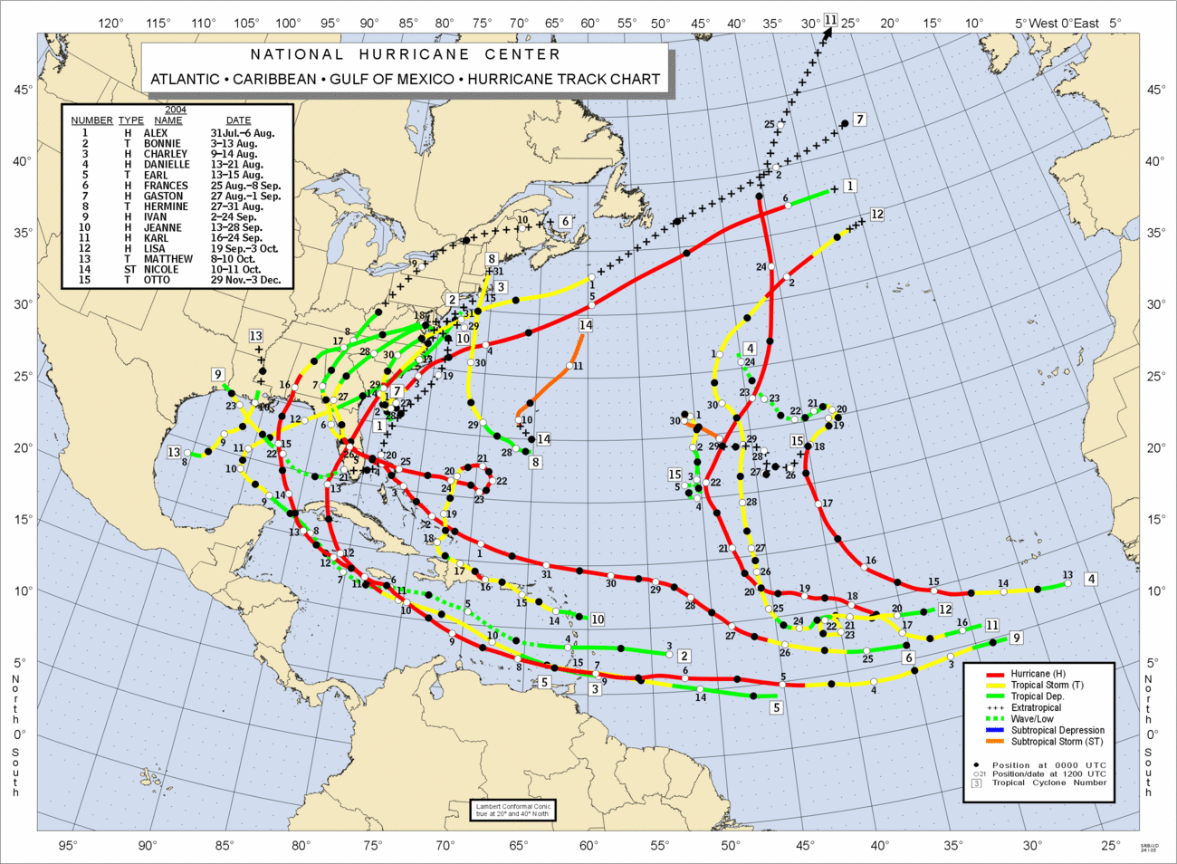
Hurricane Ivan
Ivan Paper
Event Summary
More Ivan Information
Hurricane Ivan Report
2004 Atlantic Tropical Map
Ivan Satellite Loop
Slight Risk |
F0
Warnings |
0.1 |
25 |
0 |
0 |
9 SE Tuskegee
A brief weak tornado was reported near Tuskegee. Several trees were blown down. This weak tornado was associated with an outer rain band of the Tropical System Ivan.
Start: 32.3300/-85.5800
End: 32.3300/-85.5800
|
| 25 |
2004 |
9 |
16 |
0405 |
Barbour
Hurricane Ivan
Ivan Paper
Event Summary
Hurricane Ivan Report
2004 Atlantic Tropical Map
Ivan Satellite Loop
Slight Risk |
F0
Warnings |
0.1 |
40 |
0 |
0 |
8 E Clayton
A brief weak tornado was reported east of Clayton. Several trees were knocked down. This weak tornado was associated with an outer rain band of the Tropical System Ivan.
Start: 31.8800/-85.3200
End: 31.8800/-85.3200
|
| 24 |
2004 |
9 |
16 |
0249 |
Montgomery
Hurricane Ivan
Ivan Paper
Event Summary
More Ivan Information
Hurricane Ivan Report
2004 Atlantic Tropical Map
Ivan Satellite Loop
Slight Risk |
F0
Warnings |
0.1 |
35 |
0 |
0 |
5 E Snowdoun
A brief weak tornado was reported east of Snowdoun. Several trees were blown down. This weak tornado was associated with an outer rain band of the Tropical System Ivan.
Start: 32.2500/-86.2200
End: 32.2500/-86.2200
|
| 23 |
2004 |
9 |
16 |
0205 |
Pike
Hurricane Ivan
Ivan Paper
Event Summary
More Ivan Information
Hurricane Ivan Report
2004 Atlantic Tropical Map
Ivan Satellite Loop
Slight Risk |
F0
Warnings |
0.1 |
30 |
0 |
0 |
13 E Troy
A brief weak tornado was reported east of Troy. Several trees were blown down at the touchdown spot. This weak tornado was associated with an outer rain band of the Tropical System Ivan.
Start: 31.8000/-85.7500
End: 31.8000/-85.7500
|
| 22 |
2004 |
9 |
16 |
0156 |
Barbour
Hurricane Ivan
Ivan Paper
Event Summary
More Ivan Information
Hurricane Ivan Report
2004 Atlantic Tropical Map
Ivan Satellite Loop
Slight Risk |
F0
Warnings |
0.2 |
40 |
0 |
0 |
2 S Clio
A brief weak tornado was reported across the extreme southwest portion of Barbour County. Several trees were knocked down. This weak tornado was associated with an outer rain band of the Tropical System Ivan.
Start: 31.6800/-85.6200
End: 31.6800/-85.6200
|
| 21 |
2004 |
9 |
16 |
0125 |
Pike
Hurricane Ivan
Ivan Paper
Event Summary
More Ivan Information
Hurricane Ivan Report
2004 Atlantic Tropical Map
Ivan Satellite Loop
Slight Risk |
F0
Warnings |
0.1 |
30 |
0 |
0 |
1 E Troy
A brief weak tornado was reported just east of Troy. Several trees were blown down over a short distance. This weak tornado was associated with an outer rain band of the Tropical System Ivan.
Start: 31.8000/-85.9500
End: 31.8000/-85.9500
|
| 20 |
2004 |
9 |
15 |
1840 |
Conecuh
Hurricane Ivan
Event Summary
Hurricane Ivan Report
More Ivan Information
2004 Atlantic Tropical Map
Ivan Satellite Loop
Slight Risk |
F0
Warnings |
1 |
30 |
0 |
0 |
2 S Castleberry-2 SW Castleberry
A weak tornado developed about two miles south of Castleberry and dissipated just southwest of Castleberry. The weak tornado caused minor damage to timber.
This weak tornado was associated with an outer rain band of the Tropical System Ivan.
Start: 31.2700/-87.0200
End: 31.2800/-87.0300
|
| 19 |
2004 |
9 |
15 |
1820 |
Escambia
Hurricane Ivan
Event Summary
Hurricane Ivan Report
More Ivan Information
2004 Atlantic Tropical Map
Ivan Satellite Loop
Slight Risk |
F0
Warnings |
3 |
30 |
0 |
0 |
1 W Dixie-4 NW Dixie
A weak tornado developed ahead of Hurricane Ivan just west of Dixie. The weak tornado moved quickly west northwest and dissipated about four miles northwest of Dixie. The weak tornado caused minor tree damage.
Start: 31.1500/-86.7500
End: 31.1800/-86.7800
|
| 18 |
2004 |
9 |
15 |
1302 |
Baldwin
Hurricane Ivan
Event Summary
Hurricane Ivan Report
More Ivan Information
2004 Atlantic Tropical Map
Ivan Radar Loop
Ivan Satellite Loop
Slight Risk
Started in Florida |
F0
(F0)
Warnings |
3
(5) |
30
(30) |
0
(0) |
0
(0) |
3 SE Josephine-1 SW Josephine
A weak tornado entered Baldwin County from Escambia County in Florida near Ono Island and moved rapidly west northwest and dissipated just southwest of Josephine. The weak tornado caused minor damage. Most of the area had been evacuated due to Hurricane Ivan.
Start: 30.2800/-87.5000
End: 30.3000/-87.5500
|
| 17 |
2004 |
8 |
20 |
1423 |
Jackson
Event Summary
Slight Risk |
F0
Warnings |
1 |
30 |
0 |
0 |
1 W Skyline-Skyline
A short lived weak tornado touched down and uprooted three trees one mile west of Skyline.
Start: 34.8200/-86.1300
End: 34.8200/-86.1200
|
| 16 |
2004 |
7 |
14 |
1640 |
Colbert
Event Summary
Slight Risk |
F0
Warnings |
0.3 |
128 |
0 |
0 |
7 SW Cherokee
A short lived weak tornado downed a few trees in a short and concentrated path.
Start: 34.6800/-88.0500
End: 34.6800/-88.0500
|
| 15 |
2004 |
7 |
14 |
1625 |
Colbert
Event Summary
Slight Risk |
F0
Warnings |
0.2 |
60 |
0 |
0 |
Cherokee
A short lived weak tornado downed a few trees and snapped power lines.
Start: 34.7500/-87.9700
End: 34.7500/-87.9700
|
| 14 |
2004 |
7 |
14 |
1520 |
Madison
Event Summary
Slight Risk |
F0
Warnings |
1 |
50 |
0 |
1 |
2 SW Huntsville-3 SW Huntsville
A short lived tornado produced scattered wind damage just southwest of Huntsville with a few trees snapped in half and one tree fell onto a home. One person was slightly injured due to the falling tree.
Start: 34.7200/-86.6300
End: 34.7000/-86.6500
|
| 13 |
2004 |
7 |
6 |
1728 |
Madison
Event Summary
Slight Risk |
F0
Warnings |
0.1 |
20 |
0 |
0 |
Owens Crossroads
A small and short lived tornado developed and briefly touched down at Owens Crossroads. No damage was reported.
Start: 34.5800/-86.4700
End: 34.5800/-86.4700
|
| 12 |
2004 |
6 |
25 |
1723 |
Mobile
Event Summary
Slight Risk |
F0
Warnings |
0.1 |
20 |
0 |
0 |
2 SE Dauphin Island
A small tornado briefly touched down on Sand Island which is just southeast of Dauphin Island. No damage was reported. The tornado then moved east as a waterspout. The spout remained just offshore.
Start: 30.2300/-88.1000
End: 30.2300/-88.1000
|
| 11 |
2004 |
5 |
31 |
1320 |
Geneva
Event Summary
Slight Risk |
F0
Warnings |
0.2 |
50 |
0 |
0 |
Coffee Springs
A weak tornado briefly touched down and toppled trees and power lines. Reported by the Geneva County EMA.
Start: 31.1700/-85.9200
End: 31.1700/-85.9200
|
| 10 |
2004 |
5 |
31 |
0329 |
Jefferson
Storm Survey
Event Summary
Slight Risk |
F0
Warnings |
4.2 |
150 |
0 |
0 |
Bluff Park-2 E Hoover
An F0 tornado began near the crest of Shades Mountain in Bluff Park. This tornado traveled east southeast, moving through Bluff Park and Hoover, and ended near Rocky Ridge Road just east of Interstate 65. At least 73 homes were damaged, mainly by fallen trees. At least 5 homes suffered major damage. Several automobiles were damaged or destroyed by fallen trees. Several businesses along US 31 and on Lorna Road sustained varying degrees of roof damage. Numerous trees were knocked down, snapped off, or uprooted along the path. The tornado path was 4.24 miles long and 150 yards wide at its widest point.
Start: 33.4000/-86.8700
End: 33.4100/-86.7800
|
| 9 |
2004 |
5 |
31 |
0322 |
Jefferson
Storm Survey
Event Summary
Slight Risk |
F0
Warnings |
1.7 |
150 |
0 |
0 |
1 SW Hueytown-1.9 SE Hueytown
An F0 tornado touched down just east of Virginia Drive and traveled east southeast across the southern part of Hueytown. The tornado crossed Hueytown Road and ended just west of Brookline Drive. At least 20 homes were damaged by falling trees and 6 homes suffered major damage. The tornado path was 1.7 miles long and 150 yards wide at its widest point. Thousands of electric customers were left without power for several hours after the storm.
Start: 33.4300/-86.9800
End: 33.4300/-86.9500
|
| 8 |
2004 |
5 |
30 |
2355 |
Madison
Storm Survey
Event Summary
Moderate Risk
Continued into Tennessee |
F1
(F1)
Warnings |
8.5
(23.5) |
150
(150) |
0
(0) |
0
(0) |
New Sharon-3 NE Fisk
A F1 tornado touched down in New Sharon along Charity Lane and moved eastnortheast to the Tennessee State Line. Several buildings sustained roof damage. In addition, widespread tree and power line damage occurred.
Start: 34.9500/-86.6500
End: 34.9900/-86.5100
|
| 7 |
2004 |
5 |
30 |
2326 |
Limestone
Storm Survey
Event Summary
Moderate Risk |
F1
Warnings |
9.0 |
100 |
0 |
3 |
2 S Cairo-2 SW Elkmont
A F1 tornado touched down in western Limestone County near Lentzville and raced eastnortheastward to just southwest of Elkmont. Several mobile homes were damaged or destroyed resulting in 3 minor injuries. In addition, numerous trees and power poles were knocked down.
Start: 34.8300/-87.1300
End: 34.9200/-87.0000
|
| 6 |
2004 |
5 |
30 |
2320 |
Lauderdale
Storm Survey
Event Summary
Moderate Risk |
F1
Warnings |
2.5 |
75 |
0 |
0 |
3 N Anderson-5 NNE Anderson
A tornado briefly touched down just north of Anderson. The tornado snapped several trees and removed the roofs from a few homes.
Start: 34.9700/-87.2700
End: 34.9800/-87.2300
|
| 5 |
2004 |
5 |
30 |
2309 |
Lauderdale
Storm Survey
Event Summary
Moderate Risk |
F1
Warnings |
4.0 |
100 |
0 |
0 |
2 SE Killen-2 S Elgin
A tornado touched down just southeast of Killen and tracked eastward to just south of Elgin. Numerous trees were snapped and twisted with a few of the trees falling on structures.
Start: 34.8500/-87.5200
End: 34.8200/-87.3800
|
| 4 |
2004 |
5 |
30 |
2252 |
Lauderdale
Storm Survey
Event Summary
Moderate Risk |
F1
Warnings |
6.0 |
150 |
0 |
0 |
6 W Florence-Florence
A F1 tornado touched down 6 miles west of Florence and tracked eastward, just north of the Tennessee River into McFarland Park in Florence. Hundreds of trees were snapped with several of them falling on structures.
Start: 34.8000/-87.7700
End: 34.8000/-87.6700
|
| 3 |
2004 |
5 |
30 |
2240 |
Lauderdale
Storm Survey
Event Summary
Moderate Risk |
F1
Warnings
SPC Day 1 Outlook
SPC Day 2 Outlook
SPC Day 3 Outlook |
3.2 |
70 |
0 |
0 |
3 W Murphy Crossroads-1 NE Murphy Crossroads
Emergency management reported numerous trees and powerlines snapped and twisted. The F1 tornado touched down 3 miles west of Murphy Crossroads and moved northeast to the Alabama Tennessee State Line.
Start: 34.9800/-87.9300
End: 35.0000/-87.8700
|
| 2 |
2004 |
3 |
5 |
2133 |
Limestone
Event Summary
Slight Risk |
F0
Warnings
SPC Day 1 Outlook
SPC Day 2 Outlook
SPC Day 3 Outlook |
1.5 |
75 |
0 |
0 |
8 ESE Athens- 10 E Athens
Another short lived tornado touched down near the Limestone Correctional Facility. Damage was principally confined to the roof and one wall of a wooden outbuilding at the Limestone Correctional Institute, a few isolated downed pine trees, and damage to some shingles and eave facings.
Start: 34.8100/-86.8029
End: 34.8160/-86.7700
|
| 1 |
2004 |
3 |
5 |
2128 |
Limestone
Event Summary
Slight Risk |
F0
Warnings
SPC Day 1 Outlook
SPC Day 2 Outlook
SPC Day 3 Outlook |
2 |
75 |
0 |
0 |
6.5 ESE Athens- 7.0 ESE Athens
A short lived tornado touched down and moved east-northeast to near East Limestone School. A few trees were twisted and uprooted in its path. Maximum wind speeds of the tornado was around 70 miles an hour.
Start: 34.7700/-86.8800
End: 34.7700/-86.8700
|

