Alabama Tornado Database
|
| 2001 Tornado Occurrences (55) |
| Tornado # of Year |
Year |
Month |
Day |
Time (CST) |
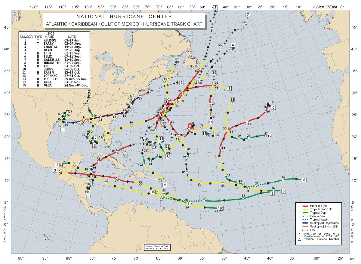
County |
Damage Scale |
Path Length (Miles) |
Maximum Path Width (Yards) |
Fatalities |
Injuries |
Location |
| 55 |
2001 |
12 |
14 |
0348 |
Elmore
Event Report
Small Risk |
F0 |
0.1 |
30 |
0 |
0 |
0.3 E Kent
A few homes with moderate roof damage and motor home blown over. The damage occurred along CR 44 in the Kent Community.
Start: 32.6200/-85.9500
End: 32.6200/-85.9500
|
| 54 |
2001 |
11 |
25 |
0030 |
Dale
Event Report
News Story
Moderate Risk |
F1 |
0.1 |
100 |
0 |
2 |
Ewell
An F1 tornado touched down just south of Ewell and destroyed a double wide mobile home. Its two occupants were seriously injured.
Start: 31.4000/-85.5800
End: 31.4000/-85.5800
|
| 53 |
2001 |
11 |
25 |
0012 |
Dale
Event Report
News Story
Moderate Risk |
F1 |
2.0 |
100 |
0 |
25 |
2.2 SW Daleville-1 NE Daleville
A strong F1 tornado touched down just southwest of Daleville, near the northwest corner of Cairns Army Airfield at Fort Rucker. Several maintenance buildings sustained minor roof damage. One aircraft suffered minor damage from flying sheet metal. The tornado tracked northeast into Daleville and damaged 25 businesses along Highway 85, including a church, gas station, two supermarkets, a bank and several homes. It destroyed a restaurant and two industrial park buildings. The tornado lifted the roof off of the Daleville Inn and Landing Zone Lounge, causing its walls to collapse. Of the 125 patrons inside, 23 suffered minor injuries and two serious injuries. One restaurant was destroyed. Nearly 40 businesses and 1,000 residential customers lost power after the tornado toppled numerous power poles. The intersection of Highways 85 and 134 in Daleville was closed and a curfew was imposed for 24 hours.
Start: 31.2800/-85.7300
End: 31.3200/-85.7000
|
| 52 |
2001 |
11 |
24 |
2127 |
Pike
Storm Survey
Event Report
News Story
Moderate Risk |
F1 |
11.8 |
75 |
0 |
0 |
3.9 S Spring Hill-0.7 S Brundidge
Numerous trees and power lines were damaged. Several homes had roof damage. Damage occurred in Spring Hill, Mims Creek, and Brundidge.
Start: 31.6360/-85.9701
End: 31.7108/-88.8115
|
| 51 |
2001 |
11 |
24 |
2042 |
Pike
Storm Survey
Event Report
News Story
Moderate Risk |
F0 |
0.2 |
50 |
0 |
0 |
0.3 NW Ansley-0.4 NE Ansley
A few trees blown down on along short path in the Ansley community.
Start: 31.8800/-86.1200
End: 31.8800/-86.1200
|
| 50 |
2001 |
11 |
24 |
2030 |
Covington
Event Report
News Story
Moderate Risk |
F0 |
0.2 |
60 |
0 |
0 |
Rose Hill
A weak tornado produced a path of damage to trees in a wooded area southwest through south of the community.
Start: 31.4500/-86.3300
End: 31.4500/-86.3300
|
| 49 |
2001 |
11 |
24 |
1928 |
Covington
Event Report
News Story
Moderate Risk |
F0 |
0.1 |
20 |
0 |
0 |
River Falls
Trees and power lines were blown down in the community as a weak tornado briefly touched down. Dime sized hail was also reported.
Start: 31.3500/-86.5500
End: 31.3500/-86.5500
|
| 48 |
2001 |
11 |
24 |
1910 |
Escambia
Event Report
News Story
Moderate Risk |
F0 |
0.1 |
20 |
0 |
0 |
Brewton
A weak tornado produced some minor roof damage to a few houses in East Brewton. A few trees and power lines were blown down as well.
Start: 31.1200/-87.0700
End: 31.1200/-87.0700
|
| 47 |
2001 |
11 |
24 |
1830 |
Butler
Event Report
News Story
Moderate Risk |
F0 |
0.1 |
20 |
0 |
0 |
Garland
A weak tornado briefly touched down, uprooting a few trees near the community of Grace, which is to the northwest of Garland.
Start: 31.5500/-86.8300
End: 31.5500/-86.8300
|
| 46 |
2001 |
11 |
24 |
1742 |
Butler
Event Report
News Story
Moderate Risk |
F1 |
6.0 |
150 |
0 |
3 |
3.6 W McKenzie- 2 SE Georgiana
A tornado touched down in a wooded area just north of Odom Crossroads, which is to the west of McKenzie. The tornado then crossed County Road 29, where a mobile home was destroyed. Three occupants of the mobile home were injured. The tornado continued to move toward the northeast over mostly wooded areas, but crossed over County Roads 28 and 8. Tree damage occurred along this portion of the storms path. The tornado eventually crossed US Highway 31 and into a mainly wooded area south of Georgiana. The damage path of the tornado, which was again mostly to trees north of Highway 31, ended near Rocky Creek, where the tornado lifted back into the clouds.
Start: 31.5485/-86.7779
End: 31.6153/-86.7135
|
| 45 |
2001 |
11 |
24 |
1710 |
Clay-Randolph
Storm Survey
Event Report
News Story
Moderate Risk |
F1 |
6.1 |
300 |
0 |
0 |
4.1 NE Lineville-12.1 NW Wedowee
Widespread tree damage, one church damaged, and several barns destroyed. Damage occurred at Black's Chapel, Ingram Rd, Wakefield Rd, Foster's Bridge Rd, Mt Moriah Rd, and Monroe.
Start: 33.3700/-85.7000
End: 33.4200/-85.6200
|
| 44 |
2001 |
11 |
24 |
1708 |
Butler
Event Report
News Story
Moderate Risk |
F0 |
3.0 |
100 |
0 |
0 |
1.8 WSW Georgiana-2.3 N Georgiana
A weak tornado moved nearly 3 miles across mostly wooded areas to the west of Georgiana. Most of the damage along the path of the tornado was to trees. The tornado first touched down near County Road 16 near Panther Creek. From there the tornado moved northeast, crossing State Road 106, at which point some minor structural damage occurred to a church. The tornado then passed near the intersection of County Roads 25 and 37. Shortly thereafter, the tornado lifted back up into the cloud.
Start: 31.6300/-86.7700
End: 31.6700/-86.7400
|
| 43 |
2001 |
11 |
24 |
1642 |
Conecuh
Event Report
News Story
Moderate Risk |
F0 |
0.1 |
20 |
0 |
0 |
Evergreen
A weak tornado downed trees and power lines around the community.
Start: 31.4300/-86.9700
End: 31.4300/-86.9700
|
| 42 |
2001 |
11 |
24 |
1603 |
Calhoun
Storm Survey
Event Report
News Story
Moderate Risk |
F1 |
7.7 |
250 |
0 |
5 |
2.6 S Alexandria-1.8 W Jacksonville
10 to 20 homes damaged, numerous outbuildings and barns destroyed, and several mobile homes damaged. The damage occurred from just west of US 431 near Cane Creek to Broadwells Mill.
Start: 33.7300/-85.8800
End: 33.8200/-85.8000
|
| 41 |
2001 |
11 |
24 |
1559 |
Talladega
Storm Survey
Event Report
News Story
Moderate Risk |
F2 |
9.1 |
200 |
0 |
0 |
4.1 SE Winterboro-7.0 SE Talladega
The tornado tracked across Germany Mountain damaging several homes, a few mobile homes, and downed numerous trees.
Start: 33.2700/-86.1500
End: 33.3700/-86.0200
|
| 40 |
2001 |
11 |
24 |
1554 |
Autauga
Storm Survey
Event Report
News Story
Moderate Risk |
F1 |
9.8 |
50 |
0 |
0 |
9.4 SW Pine Level-4.6 NW Pine Level
Several homes and mobile homes were damaged in and around Poseys Crossroads.
Start: 32.4800/-86.5800
End: 32.6300/-86.5200
|
| 39 |
2001 |
11 |
24 |
1542 |
Talladega
Storm Survey
Event Report
News Story
Moderate Risk |
F2 |
3.1 |
400 |
0 |
15 |
3.6 W Sylacuaga-2.6 NW Sylacauga
40 to 50 homes damaged, 10 mobile homes destroyed, numerous outbuildings destroyed. The main damage occurred in Oak Grove and Odena.
Start: 33.1700/-86.3200
End: 33.2000/-86.2800
|
| 38 |
2001 |
11 |
24 |
1510 |
St. Clair
Storm Survey
Event Report
News Story
Moderate Risk |
F2 |
4.5 |
100 |
0 |
2 |
0.5 SW Pell City-3.7 NE Pell City
Numerous buildings damaged in Pell City.
Start: 33.5800/-86.2800
End: 33.6200/-86.2300
|
| 37 |
2001 |
11 |
24 |
1501 |
Cherokee
Storm Survey
Event Report
News Story
Moderate Risk |
F2 |
8.2 |
200 |
2 |
4 |
2.7 SSW Sand Rock-5.5 NE Sand Rock
Several homes damaged or destroyed. Two fatalities occurred in a mobile home just east of Sand Rock.
Start: 34.2500/-85.7700
End: 34.3300/-85.6800
|
| 36 |
2001 |
11 |
24 |
1425 |
Dekalb
Storm Survey
Event Report
News Story
Moderate Risk |
F2 |
7.1 |
100 |
0 |
0 |
S Fyffe-SE Rainsville
The tornado first touched down at 2:25 pm along CR 65 southwest of Peaks Corner causing tree damage. The tornado tracked northeast to CR 52 where a small barn was destroyed. As the tornado continued northeastward, several chicken barns received heavy damage, and many trees were snapped off at mid-trunk. A narrow path of damage continued northeast removing the roof from a cinder-block building, knocking down a wall, and moving a small pickup truck several feet. The tornado continued northeast destroying a trailer home, snapping off trees, and damaging more chicken barns along CR 44. The tornado descended a steep hill into the Pine Ridge community damaging a church before it ended. The width of the tornado was approximately 100 yards wide with a track length of 7.1 miles. There were no injuries reported with this tornado.
Start: 34.3800/-85.9200
End: 34.4500/-85.8200
|
| 35 |
2001 |
11 |
24 |
1350 |
Madison
Storm Survey
Event Report
News Story
Moderate Risk |
F2 |
2.6 |
300 |
0 |
0 |
4 SW New Hope-2 NW New Hope
The same storm that spawned the Union Grove Tornado moved northeast across the Tennessee River and produced another tornado in southeastern Madison County. This tornado, rated an F2 on the Fujita scale, touched down around 1:50 pm about 3.6 miles west-southwest of the city of New Hope near the base of Lemley Mountain where it downed trees and produced light damage to some homes. The tornado then strengthened as it moved northeast through a mobile home community where several mobile homes were thrown and demolished. After crossing US 431 and damaging several businesses, the tornado lifted about three-quarters of a mile northeast of the US 431/Old US 431 intersection around 1:54 pm. Despite damage to at least 21 homes, including eight that were completely demolished, there were no known injuries. In the mobile home community where the greatest damage occurred, residents stated they heard the Tornado Warning on televison and through NOAA Weather Radio and took cover in underground storm shelters.
Start: 34.5000/-86.4500
End: 34.5500/-86.4300
|
| 34 |
2001 |
11 |
24 |
1341 |
Marshall
Storm Survey
Event Report
News Story
Moderate Risk |
F2 |
2.0 |
300 |
0 |
7 |
Union Grove
A supercell thunderstorm produced a tornado in the Union Grove area. The tornado began at 1:41 pm, 5.3 miles northwest of Union Grove, near Shumate Mountain. The tornado moved northeast crossing CR 240 and ending at 1:44 pm near the base of Benton Round Mountain. The heaviest damage occurred southwest of CR 240. Ten to 15 mobile homes were destroyed, 5 homes suffered varying degrees of damage, several outbuildings and barns were destroyed, an ultra-lite hangar was destroyed, 2 hunting cabins were destroyed, and 7 people received minor injuries.
Start: 34.4369/-86.5315
End: 34.4561-86.5070
|
| 33 |
2001 |
11 |
24 |
1331 |
Jefferson-St. Clair
Storm Survey
Event Report
Tornado Video
News Story
Moderate Risk |
F2 |
13.4 |
125 |
0 |
1 |
2.8 SW Argo-1.5 ENE St. Clair Springs
Several homes and homes were damaged along Interstate 59. Numerous trees were downed. The damage occurred from near the Deerfoot Parkway on I-59 to near Argo.
Start: 33.6500/-86.5700
End: 33.7700/-86.3800
|
| 32 |
2001 |
11 |
24 |
1319 |
Blount-Etowah
Storm Survey
Event Report
News Story
Moderate Risk |
F4 |
10.1 |
500 |
0 |
22 |
2.9 SE Oneonta-1.0 N Altoona
Numerous homes and mobile homes were destroyed along with extensive tree damage. The damage occurred from near the Mt Carmel Church to Altoona.
Start: 33.9200/-86.4300
End: 34.0300/-86.3000
|
| 31 |
2001 |
11 |
24 |
1302 |
Cullman
Storm Survey
Event Report
News Story
Moderate Risk |
F0 |
0.2 |
50 |
0 |
0 |
Goodhope
At the rest area on Interstate 65, south of Cullman, a funnel cloud had been reported at 1257 pm. At the Shell Station just off I-65, a witness reported another funnel cloud off to the west around 1 pm. Another witness reported a brief touchdown in a rural area with only a few trees blown down.
Start: 34.1000/-86.8800
End: 34.1000/-86.8700
|
| 30 |
2001 |
11 |
24 |
1300 |
Choctaw
Event Report
News Story
Moderate Risk |
F0 |
0.1 |
20 |
0 |
0 |
Toxey
A weak tornado downed trees and power lines, and produced some minor roof damage, just northeast of Toxey.
Start: 31.9000/-88.3000
End: 31.9000/-88.3000
|
| 29 |
2001 |
11 |
24 |
1259 |
Cullman
Storm Survey
Event Report
News Story
Moderate Risk |
F1 |
2.1 |
200 |
0 |
0 |
SW Vinemont-W Vinemont
North of Cullman damage was reported at Terri Pines Country Club and in the town of Vinemont. At Terri Pines several tall trees were damaged, either uprooted or snapped off at mid-trunk. One witness at the golf course reportedly saw a funnel; another witness reported a sudden end to a downpour, the sky turning black, then a sudden return of the downpour with the sky becoming lighter. From the golf course, the storm moved northeast. The tornado appeared to have lifted or weakened as it crossed I-65 with only minimal debris from the trees along the road. The tornado continued northeasterly to Vinemont just west of US 31 and south of CR 1292. The tornado reached F1 strength destroying 2 chicken barns and severely damaging a third, scattering debris at least a mile away. A mobile home downhill from the chicken barns had parts of it's roof torn off, and there were several holes in the side of the mobile home caused by debris projectiles. The final damage along the track was to a frame garage which was shifted off it's slab in a twisting motion causing it to collapse on itself. Witnesses at this location reported hearing a load roaring noise similar to a jet aircraft.
Start: 34.2300/-86.9000
End: 34.2500/-86.8700
|
| 28 |
2001 |
11 |
24 |
1256 |
Marengo
Storm Survey
Event Report
News Story
Moderate Risk |
F0 |
0.6 |
50 |
0 |
0 |
4.3 SE Myrtlewood-4.0 SE Myrtlewood
Several trees and power lines were downed in Half Acre.
Start: 32.2200/-87.9000
End: 32.2300/-87.9000
|
| 27 |
2001 |
11 |
24 |
1237 |
Tuscaloosa
Storm Survey
Event Report
News Story
Moderate Risk |
F0 |
0.2 |
30 |
0 |
0 |
6.1 E Abernant-6.3 E Abernant
Brief touchdown near mile marker 100 on I-59 near Bucksville.
Start: 33.2800/-87.1000
End: 33.2800/-87.0800
|
| 26 |
2001 |
11 |
24 |
1235 |
Choctaw
Event Report
News Story
Moderate Risk |
F0 |
0.1 |
20 |
0 |
0 |
Gilbertown
A weak tornado downed several trees near Griffins Mills.
Start: 31.8700/-88.3200
End: 31.8700/-88.3200
|
| 25 |
2001 |
11 |
24 |
1234 |
Hale
Storm Survey
Event Report
News Story
Moderate Risk |
F0 |
2.9 |
75 |
0 |
0 |
1.3 SW Cedarville-1.7 NW Cedarville
A few trees were downed and a few buildings were damaged.
Start: 32.6000/-87.6800
End: 32.6300/-87.6500
|
| 24 |
2001 |
11 |
24 |
1210 |
Lawrence-Morgan
Storm Survey
Event Report
News Story
Moderate Risk |
F2 |
4.9 |
300 |
0 |
2 |
6 N Five Points-SE Trinity
The same supercell thunderstorm that produced the tornado in Haleyville produced another tornado near the Lawrence-Morgan county line. The tornado began at 12:10 pm 1 mile southwest of Caddo near CR 214. The tornado moved northeast through Caddo and into Morgan County. The tornado ended at 12:15 pm near North Mountain Road in Trinity. Emergency Management officials estimated that around 25 homes sustained varying degrees of damage including 3 homes that were totally destroyed, one mobile home demolished, and 2 homes received significant damage. Additional damage was reported to several businesses and one church. Numerous trees were snapped or uprooted and numerous outbuildings were destroyed. Two minor injuries were reported in Caddo.
Start: 34.5500/-87.0500
End: 34.6200/-87.0800
|
| 23 |
2001 |
11 |
24 |
1145 |
Choctaw
Event Report
News Story
Moderate Risk |
F0 |
0.1 |
20 |
0 |
0 |
Butler
A small and weak tornado move through the area just southwest of Butler. Trees and power lines were reported down in the area. In addition, golfball sized hail was also observed in Jachin.
Start: 32.0800/-88.2200
End: 32.0800/-88.2200
|
| 22 |
2001 |
11 |
24 |
1139 |
Tuscaloosa
Storm Survey
Event Report
News Story
Moderate Risk |
F1 |
2.0 |
75 |
0 |
0 |
5.8 SW Samantha-3.8 SW Samantha
Several trees were downed and one home was damaged. The damage occurrd near the intersection of Rue Road and CR 90.
Start: 33.3500/-87.6800
End: 33.3800/-87.6700
|
| 21 |
2001 |
11 |
24 |
1121 |
Marion-Winston
Storm Survey
Event Report
News Story
Moderate Risk |
F2 |
1.9 |
70 |
0 |
13 |
8.4 NE Whitehouse-0.7 NE Haleyville
Extensive damage occurred in downtown Haleyville.
Start: 34.2200/-87.6300
End: 34.2300/-87.6000
|
| 20 |
2001 |
11 |
24 |
1102 |
Hale
Storm Survey
Event Report
News Story
Moderate Risk |
F0 |
0.2 |
50 |
0 |
0 |
0.8 NE Moundville-0.6 NE Moundville
A few trees downed and minor damage to a nursery and a mobile home.
Start: 33.0000/-87.6000
End: 33.0000/-87.6200
|
| 19 |
2001 |
11 |
24 |
1055 |
Pickens-Lamar-Fayette-Walker
Storm Survey
Event Report
News Story
Moderate Risk |
F3 |
38.9 |
300 |
2 |
1 |
5.7 SW Kennedy-1.0 S Carbon Hill
Extensive structural damage occurred along the path. 2 fatalities occurred in a mobile home just southwest of Kennedy.
Start: 33.5254/-88.0526
End: 33.8767/-87.5279
|
| 18 |
2001 |
10 |
13 |
1345 |
Baldwin
Storm Survey
Event Report
Research Article
High Risk |
F0 |
0.3 |
30 |
0 |
0 |
Spanish Fort
An F0 tornado touched down along the eastern portions of Meaher Park on the Causeway just west of Spanish Fort. The tornado jumped across the Causeway and touched down in the Pineda Island subdivision. Several trees were damaged along the tornado path.
Start: 30.6800/-87.9000
End: 30.6800/-87.9000
|
| 17 |
2001 |
10 |
13 |
1338 |
Perry
Event Report
Research Article
High Risk |
F1 |
1.5 |
50 |
0 |
0 |
0.6 SW Uniontown-1.0 NNW Uniontown
Several trees and power lines downed along with minor roof damage. One apartment building had its roof torn off.
Start: 32.4500/-87.5200
End: 32.4700/-87.5200
|
| 16 |
2001 |
10 |
13 |
1244 |
Baldwin
Storm Survey
Event Report
Research Article
High Risk |
F2 |
0.7 |
200 |
0 |
0 |
Robertsdale
An F2 tornado touched down southeast of Robertsdale. The tornado first touched down just south of County Road 83 and Hubard road intersection where it tracked north and damaged seventeen manufactured homes and completely destroyed three others. Several large Pecan trees were also blown down. No injuries were reported.
Start: 30.5500/-87.7200
End: 30.5500/-87.7200
|
| 15 |
2001 |
10 |
13 |
1240 |
Baldwin
Storm Survey
Event Report
Research Article
High Risk |
F0 |
0.2 |
30 |
0 |
0 |
Foley
Another tornado briefly touched down, about 20 minutes after the first one, near the Grove Home Park. The F0 blew down several trees and a large fence near the Park along County Road 65.
Start: 30.4200/-87.6800
End: 30.4200/-87.6800
|
| 14 |
2001 |
10 |
13 |
1235 |
Marengo
Event Report
Research Article
High Risk |
F1 |
7.1 |
450 |
0 |
0 |
3.6 NNE Dixons Mill-5.5 SW Hugo
Numerous trees and power lines downed. The damage path was from near Dixons Mill to near Octagon.
Start: 32.1000/-87.7700
End: 32.2200/-87.7500
|
| 13 |
2001 |
10 |
13 |
1225 |
Baldwin
Storm Survey
Event Report
Research Article
High Risk |
F3 |
1.0 |
440 |
0 |
0 |
Foley
An F3 tornado initially touched down just south of the Grove Home Park on County Road 16. The tornado then tracked north just east of County Road 65 to County Road 12, just southwest of Foley. The tornado blew down numerous trees, destroyed a manufactured home and damaged several others in the Grove Home Park. The tornado destroyed two large cement block buildings and damaged another three near County Road 12. A large panel truck filled with heavy tools was picked up and carried about 60 feet, and several other cars were thrown 15 to 25 feet. No injuries were reported.
Start: 30.4200/-87.6800
End: 30.4200/-87.6800
|
| 12 |
2001 |
10 |
13 |
1200 |
Baldwin
Storm Survey
Event Report
Research Article
High Risk |
F0 |
0.2 |
30 |
0 |
0 |
Gulf Shores
A strong waterspout moved ashore in Gulf Shores near State Highway 59 where it damaged several small booths associated with the Shrimp Festival. The tornado tracked north and damaged some roofs to homes along 6th avenue.
Start: 30.2800/-87.6800
End: 30.2800/-87.6800
|
| 11 |
2001 |
10 |
13 |
0635 |
Baldwin
Storm Survey
Event Report
Research Article
High Risk |
F0 |
0.1 |
20 |
0 |
0 |
Montrose
An F0 tornado briefly touched down along U. S. Highway 98 near Montrose. The tornado blew several trees down.
Start: 30.5700/-87.9000
End: 30.5700/-87.9000
|
| 10 |
2001 |
10 |
13 |
0630 |
Baldwin
Storm Survey
Event Report
Research Article
High Risk |
F1 |
0.1 |
30 |
0 |
0 |
Fairhope
An F1 tornado touched down for a short time near Fairhope. The tornado caused major damage to a warehouse roof and two large metal doors were blown in. Several trees and a fence were also blown down.
Start: 30.5200/-87.9000
End: 30.5200/-87.9000
|
| 9 |
2001 |
8 |
31 |
1702 |
Talladega
Event Report
Small Risk |
F1 |
3.5 |
30 |
0 |
0 |
3.0 WSW Lincoln-1.6 NNW Lincoln
Several trees downed and several mobile homes damaged or destroyed. The tornado touched down near Exit 165 on I-20 producing damage in and around Lincoln.
Start: 33.6000/-86.1700
End: 33.6300/-86.1300
|
| 8 |
2001 |
6 |
11 |
1705 |
Covington
Tropical Storm
Allison Information
Event Report
More Allison
Information
Tropical Storm Allison Information
2001 Tropical Map
Slight Risk |
F0 |
3.5 |
50 |
0 |
0 |
3 S Libertyville-3 ESE Libertyville
An F0 tornado first touched down on State Road 55 several miles south of Libertyville, near the Stanley community. Six homes, and a church sustained some minor roof damage, and two outbuildings were also damaged. The tornado tracked northeast, crossing County Roads 32 and 34, and passing just east of the New Shady Grove Church. Trees were blown down at these locations. The tornado then lifted back into the cloud just north of County Road 34.
Start: 31.1975/-86.4511
End: 31.2352/-86.4111
|
| 7 |
2001 |
6 |
11 |
0640 |
Mobile
Tropical Storm
Allison Information
Event Report
Tropical Storm Allison Information
More Allison
Information
2001 Tropical Map
Slight Risk |
F0 |
2.5 |
75 |
0 |
0 |
Mobile Bates Field
An F0 tornado first touched down in southwest Mobile county about 8 miles southwest of the Mobile Regional Airport. The initial touchdown was near Jeff Hamilton Road, just to the east of Newman Road. The weak tornado moved across open fields and forest, moving across Newman Road near the Branson subdivision. The tornado then moved through the subdivision, blowing down several trees. Some homes were damaged as a result of the fallen trees, while other homes suffered roof damage due to the high winds. The tornado then moved north and crossed Airport Boulevard just west of Newman Road. More trees were blown down here, and several more homes suffered damage, mainly to roofs, from either fallen trees or high winds. The tornado then lifted back into the cloud, about 5 miles southwest of the Mobile Airport. The line of thunderstorms that produced the tornado was associated with the remnants of Tropical Storm Allison, which were moving east across the region.
Start: 30.6000/-88.3400
End: 30.6400/-88.3400
|
| 6 |
2001 |
5 |
24 |
1802 |
Blount
Storm Survey
Event Information
Event Report
Slight Risk |
F0 |
1.0 |
30 |
0 |
0 |
6.4 NW Oneonta-6.2 NW Oneonta
A brief touchdown with no damage near Rosa. The tornado was observed and photgraphed.
Start: 34.0200/-86.5500
End: 34.0200/-86.5500
|
| 5 |
2001 |
5 |
24 |
1648 |
Jackson
Storm Survey
Event Information
Event Report
Slight Risk |
F1 |
0.5 |
80 |
0 |
0 |
Aspel
A tornado caused damage about 1 mile north of the town of Aspel, near the intersection of County Roads 11 and 101. The tornado path was approximately ½ mile long, 100 yards wide, beginning on the west side of County Road 11. The path began behind a home located on CR11. No damage was noted to the home, but several trees within 50 yards of the home were snapped off or blown down. Across CR11, two homes were struck and both received minor damage. One of the residents was asleep when the tornado struck. He said the storm was loud, rousing him from his sleep, and it was over by the time he realized what was happening. A window on the right front of his home was sucked out, a large Cedar tree just to the left of the home was broken off just above the ground and found by a back fence, approximately 300 yards northeast. Several large trees were knocked over in the backyard, and a fallen tree killed two cows. A large barn was heavily damaged, and another smaller barn had its tin roofing pulled off. The second home sustained some roof damage due to a fallen tree along with a few shingles being torn off. Several trees were also knocked down in the front yard.
Start: 34.6200/-86.1700
End: 34.6200/-86.1700
|
| 4 |
2001 |
3 |
12 |
1300 |
Covington
Storm Survey
Event Report
Moderate Risk |
F1 |
3.2 |
75 |
2 |
1 |
7.5 NNE Red Level-7.9 NNE Red Level
A tornado touched down along the leading edge of a bow echo in the Pigeon Creek area just north of Red Level. The tornado destroyed a manufactured home with three people inside. Two of the occupants were killed and one was injured. The tornado appeared to have first touched down where the home was located. All totaled throughout the county, twelve homes were destroyed, nineteen had major damage and five had minor damage. Eleven vehicles were also destroyed.
Start: 31.5100/-86.6500
End: 31.5200/-86.6000
|
| 3 |
2001 |
3 |
2 |
1829 |
Montgomery
Storm Survey
Event Report
Small Risk |
F1 |
2.2 |
100 |
0 |
0 |
Montgomery
Numerous trees downed and roof damage to many homes. The tornado damage occurred in the Woodmere area, Beauvoir subdivision, and over to Taylor Rd.
Start: 32.3500/-86.2039
End: 32.3637/-86.1702
|
| 2 |
2001 |
2 |
16 |
1339 |
Madison
Storm Survey
Event Report
Moderate Risk |
F0 |
4.4 |
30 |
0 |
0 |
NW Huntsville
A small tornado described by eye witnesses as a smooth funnel touched down in northwest Huntsville. The damage began near the intersection of Capshaw Road and Wall Triana Highway. The tornado damage path extended nearly due east for some distance before turning east-northeast and ending just west of Rideout Road. A damage survey was conducted of this event by meteorologists from UAH who described the damage path as narrow, focused, and convergent. Additional damage occurred in northeast Huntsville in the Chase area and may possibly have been another weak tornado touchdown.
Start: 34.7800/-86.7700
End: 34.8000/-86.6800
|
| 1 |
2001 |
1 |
19 |
0922 |
Montgomery
Storm Survey
Event Report
Slight Risk |
F0 |
2.3 |
100 |
0 |
4 |
2.1 E Montgomery-4.0 ENE Montgomery
Trees downed and minor structure damage. The damage occurred from Greenwood Cemetary through the Forest Hills area and into the Johnstown area and Gunter Industrial Park.
Start: 32.3800/-86.2700
End: 32.4000/-86.2300
|

