 Hurricane Awareness Tour stop #4
Montgomery, AL
 |
 |
2018 Hurricane Awareness Tour Coming to Montgomery, AL! |
 |
| Event Info | The Planes | Participants | Directions & Parking | Event Flyers |
|
Ever been fascinated by hurricanes or wondered how in the world people fly safely into them? Have a passion for flying and love viewing various aircraft? Then mark your calendar for the 2018 Hurricane Awareness Tour on May 10th! As part of a week-long tour along the Gulf Coast, the NOAA Hurricane Hunters will be making a stop at the Montgomery Regional Airport (Dannelly Field) on Thursday, May 10th. Come tour two of the Hurricane Hunter aircraft, speak with the pilots, and walk through vendor exhibits from various local agencies and organizations. The event is FREE to the public!
More details to come, so check back later! |
|
What: 2018 Hurricane Awareness Tour Where: Montgomery Regional Airport (Dannelly Field) When: Thursday, May 10th Admission: FREE! Things To Do:
|
 |
 |
WC-130J - "Hercules" The WC-130J is a high-wing, medium-range aircraft used in weather reconnaissance missions. This plane is configured to penetrate tropical disturbances and storms, hurricanes and winter storms and obtains data on the movement, size and intensity of these systems. The WC-130J is the weather data collection platform for the 53rd Weather Reconnaissance Squadron. It carries a minimal crew of five: pilot, co-pilot, navigator, aerial reconnaissance weather officer and weather reconnaissance loadmaster. The crew collects and reports weather data as often as every minute. |
|
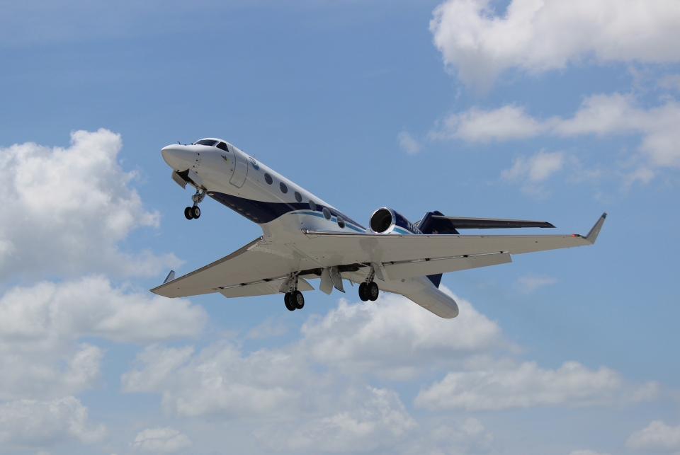
NOAA Gulfstream IV-SP (G-IV) - "Gonzo" NOAA’s Gulfstream IV-SP (G-IV) jet is a high-tech, high-flying, and high-speed platform used for hurricane forecasting and research. It is a sophisticated twin-engine jet piloted by NOAA Corps officers and crewed by NOAA civilian engineers and meteorologists. The G-IV flies around and over developing tropical cyclones to create a detailed picture of the surrounding upper atmosphere. It has a range of nearly 4,000 nautical miles and a cruising altitude of 45,000 feet. |
 |
 |
 |
 |
 |
 |
|
 |
 |
 |
 |
 |
|
Directions From I-65:
|
Parking Information:
|
 |
 |
 |
 |
 |
 |

