|
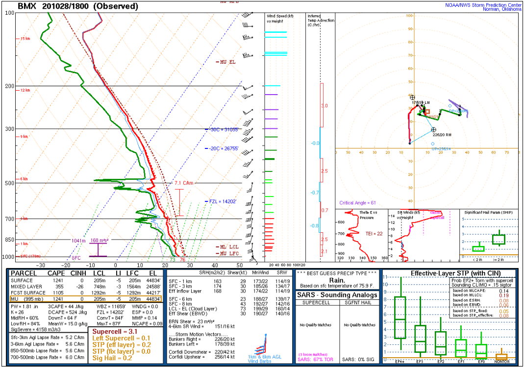
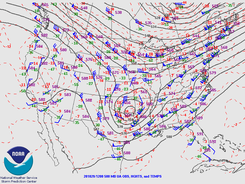
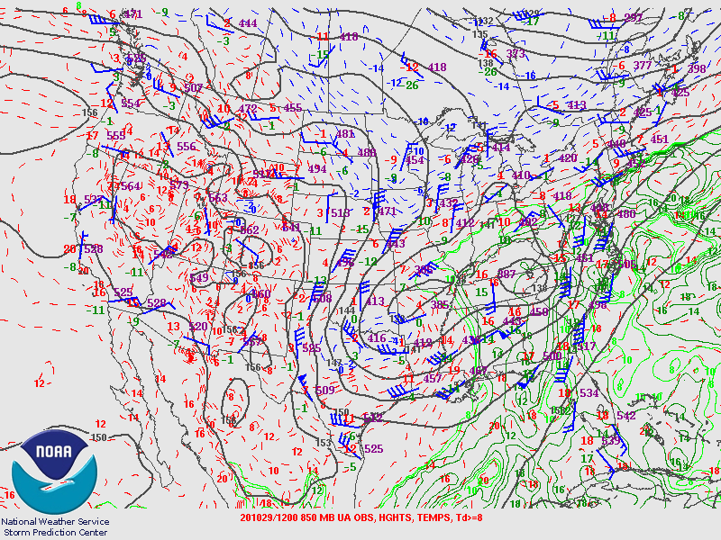
Zeta developed over the Western Caribbean Sea on Saturday, October 24, 2020 and slowly moved west. It impacted portions of the Yucatan Peninsula late Monday October 26 through October 27th. The tropical storm emerged into the Southern Gulf of America on Tuesday, October 27th. Zeta turned northwest and became a hurricane on Wednesday October 28th. An approaching upper level low and associated cold front was moving across the Southern Plains while ridging was positioned off the Southeast Atlantic Coastline. These features helped steer the system more to the northeast into Alabama. Despite marginal sea-surface temperatures and increasing wind shear, the storm's fast motion kept it from weakening significantly.
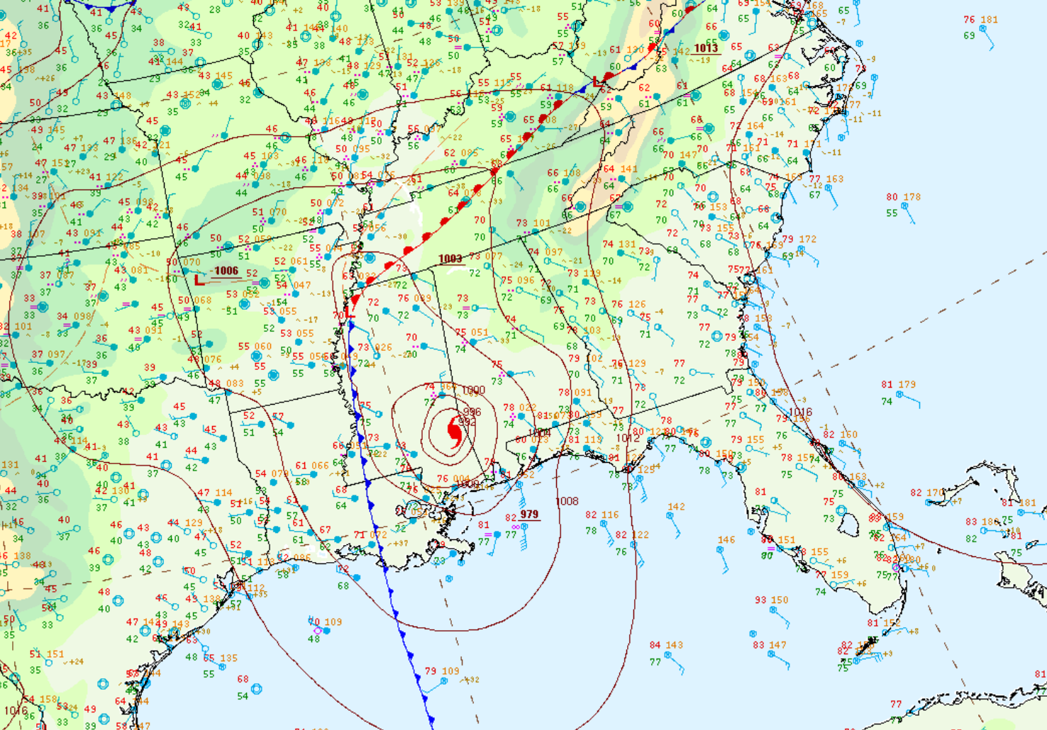
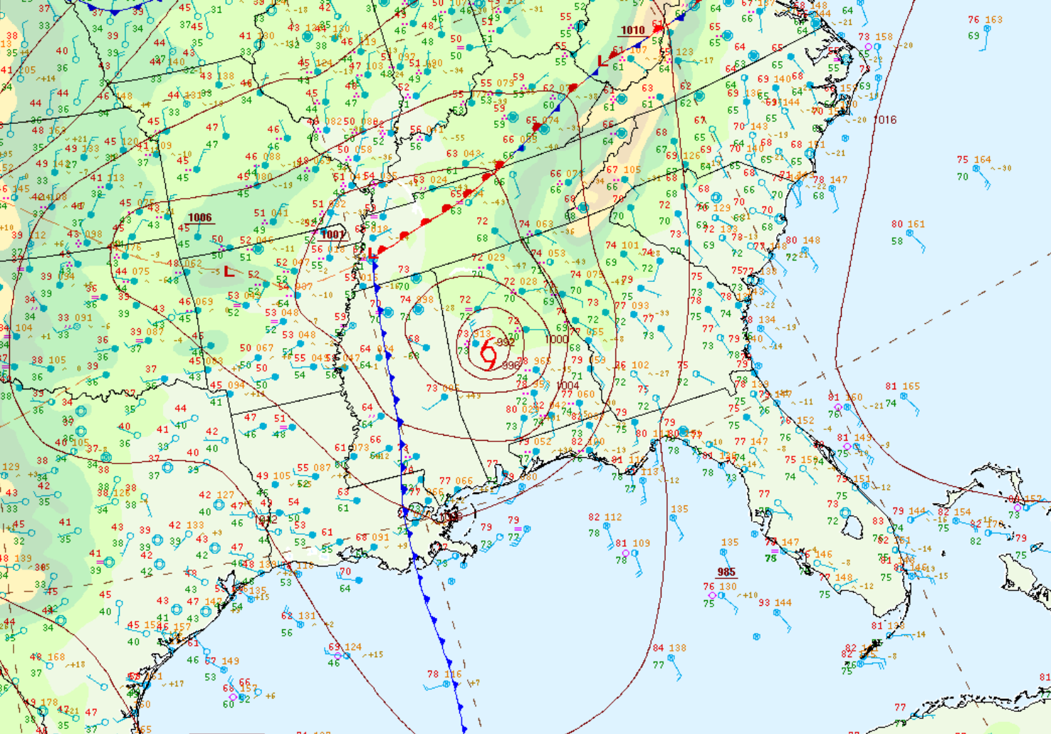
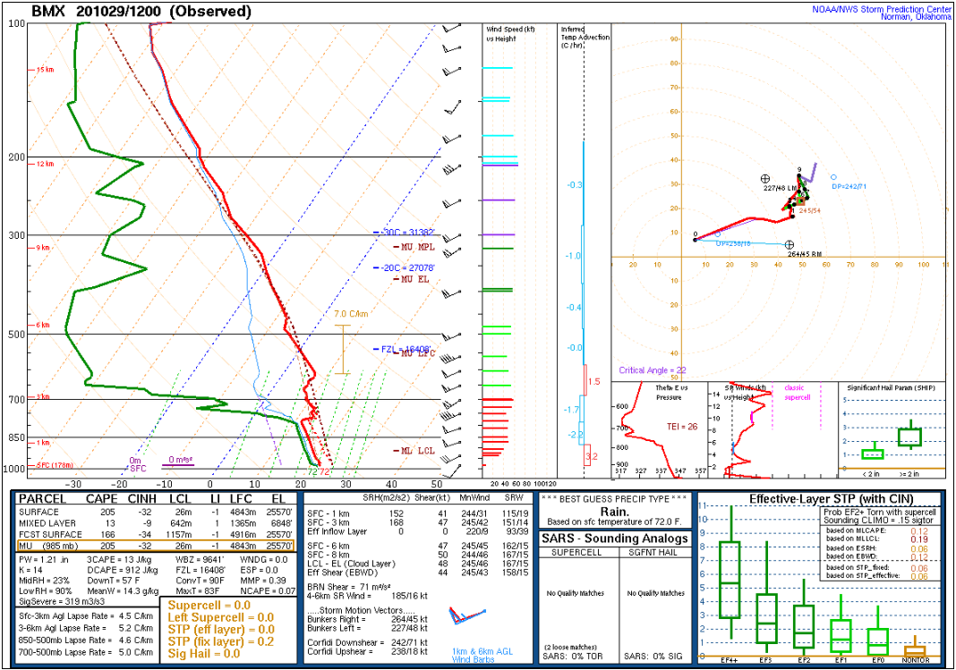
Zeta made landfall in southeast Louisiana late on Wednesday, then moved northeast into far interior southwest Alabama late Wednesday night. The system slowly weakened to tropical storm strength as it tracked into our southwest counties very early Thursday morning. The storm further increased its forward speed with time, becoming positioned near the Alabama/Georgia state line east of Gadsden by 4 am Thursday.
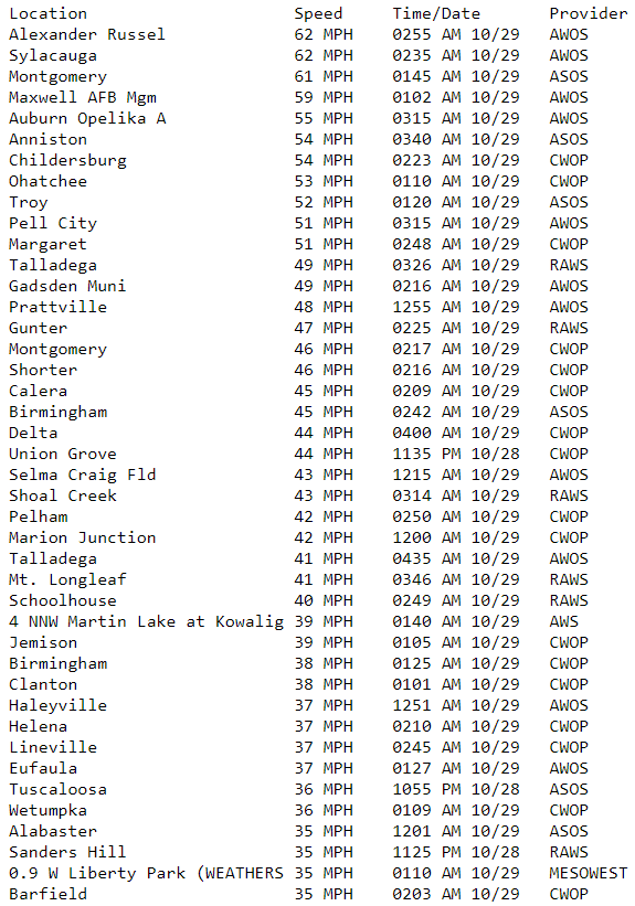
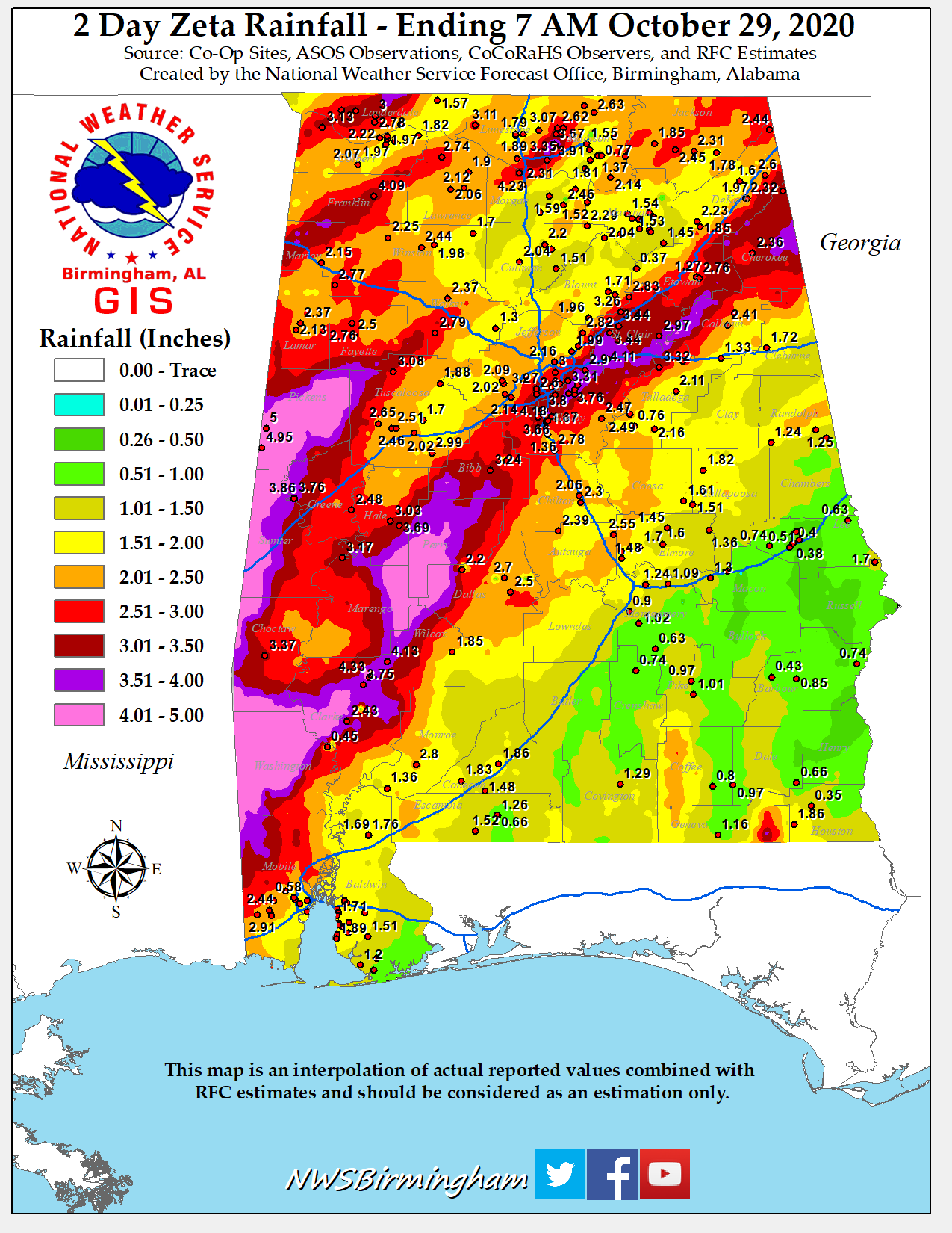
Zeta produced widespread wind gusts over 40-50 mph with some with some locations experiencing gusts of 50-70 mph. These strong winds caused widespread tree and power line damage across southwest, south-central and east-central parts of the state. On the morning of October 28th, Alabama Power reported at least 494,000 outages across the state. Rainfall totals were generally in the 2-5 inch range, with locations south of Interstate 85 picking up less than 1 inch of rain. Thankfully, no tornadoes were produced by Zeta. All of the damage was due to winds, which were most intense near the decaying eyewall center and to the southeast of the circulation center. Strong southerly winds were observed in Mobile, Montgomery and other locations that converged toward the circulation center as it moved northeast across the state.
|