|
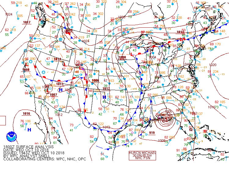
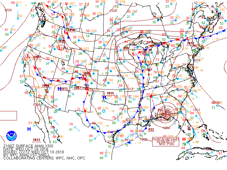
In the era of record keeping, Major Hurricane Michael was an unprecedented storm for the Florida Panhandle, making landfall near Mexico Beach, FL as an intensifying, high-end category four storm with sustained winds of 155 mph/with higher gusts. In fact, Michael was just shy of category five strength as lessening wind shear and sea surface temperatures as high as 1.5 degrees Celsius above normal provided a favorable environment for steady intensification up until landfall. The storm’s final intensity will be assessed by the National Hurricane Center in post-analysis. Catastrophic damage was done to communities in its path from extreme winds and devastating, life-threatening storm surge in excess of 10 feet. Impacts extended well inland due to the storm’s fast forward speed.
While the center of Michael bypassed Central Alabama to the southeast and then east, the overall size of the storm and its close proximity brought a period of breezy winds and rain to a portion of our forecast area. In all, limited impacts were felt, mainly for communities near and south of Interstate 85, where 3-5 inches of rain fell (with locally higher totals) and peak wind gusts the range of 35-45 mph were measured. There were scattered reports of downed trees and some power outages as well. Not too far to the southeast and east, wind gusts were much higher and resulted in more damage. Central Alabama was certainly spared from this storm.
|