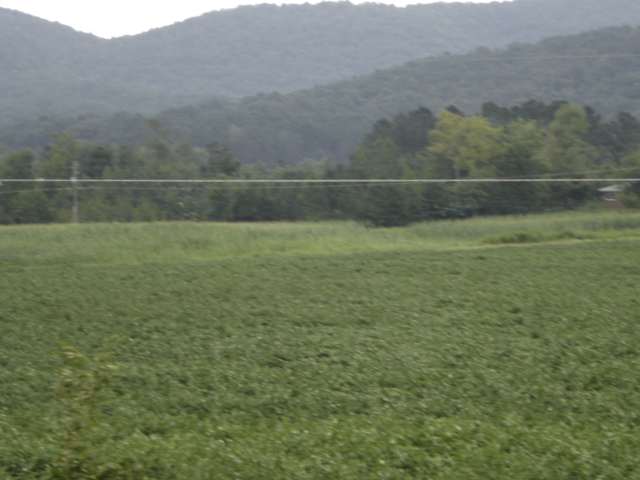
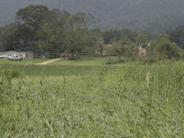
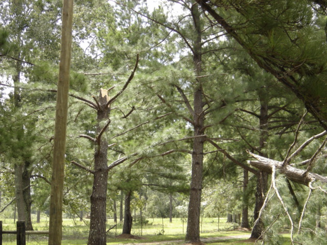
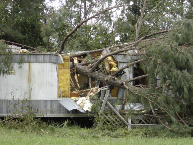
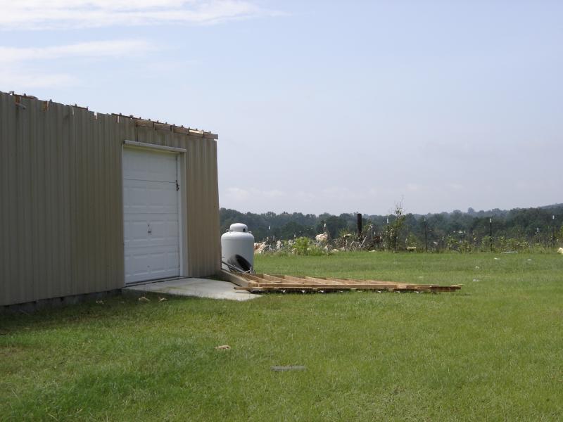
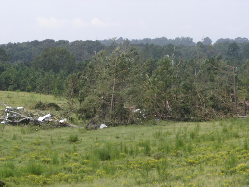
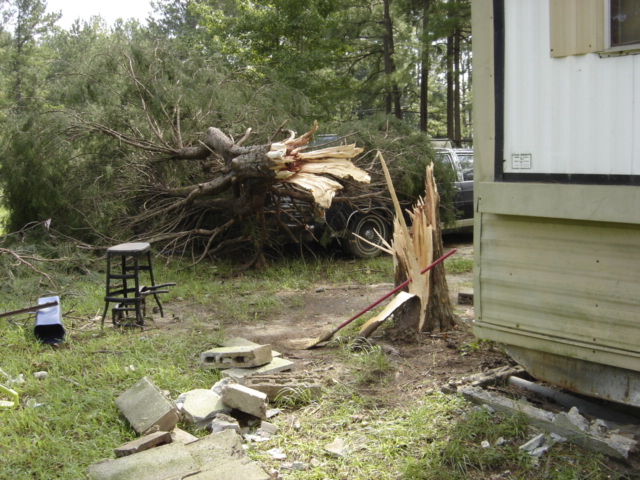
National Weather Service meteorologists conducted a ground survey on Tuesday, August 30, 2005. It was determined that an F1 tornado occurred with winds estimated around 80 MPH in Calhoun County. The tornado touched down at approximately 3:53 PM CDT, just east of State Highway 9 in the Nances Creek community. This is about 6 miles southwest of Piedmont. The tornado crossed State Highway 9 moving northwest and damaged three homes along Hollingsworth Road. The tornado lifted around 3:56 PM CDT near Hurricane Mountain. The tornado damage path was 1.52 miles long and 30 yards wide at its widest point. Several trees were uprooted or snapped off along the path of the tornado. At least two homes and a mobile home were damaged along Hollingsworth Road. No deaths or injuries were reported with this tornado. A Tornado Watch was in effect for Calhoun County from 3:25 PM CDT until Midnight CDT.
 |
|
National Weather Service meteorologists conducted a ground survey on Tuesday, August 30, 2005. This survey was followed by an aerial survey performed on Wednesday, August 31, 2005. It was determined that an F0 tornado occurred with winds estimated around 70 MPH. The tornado touched down at approximately 3:16 PM CDT, 1.31 miles west of Mitchell in Northwestern Bullock County. The tornado crossed State Highway 110 and moved into Eastern Montgomery County. The tornado then crossed County Road 2 before lifting around 3:25 PM CDT 1.42 miles north-northeast of Cecil. The tornado damage path was 5.94 miles long and 300 yards wide at its widest point. Numerous trees were uprooted or snapped off along the path of the tornado. Several structures, homes, and mobile homes were also damaged. No deaths or injuries were reported with this tornado. A Tornado Warning was in effect for Bullock County from 2:59 PM CDT until 3:30 PM CDT. A Tornado Watch was in effect for Bullock and Montgomery Counties from 10:25 AM CDT until 7:00 PM CDT.
|
 |
National Weather Service meteorologists conducted a storm survey in Tallapoosa County. It was determined that an F1 tornado occurred with winds estimated around 80 MPH. The tornado touched down at approximately 1:55 PM CDT just east of State Highway 49 or about 1.7 miles southwest of Reeltown. The tornado traveled northwest and ended at approximately 1:58 PM CDT near the intersection of County Road 45 and Sulphur Springs Road. Numerous trees were uprooted or snapped off along the path of the tornado. Several homes suffered varying degrees of damage. The tornado damage path was 3.25 miles long and 300 yards wide at its widest point. No deaths or injuries were reported with this tornado. A Tornado Watch was in effect for Tallapoosa County from 10:25 AM CDT until 7:00 PM CDT.
 |
|
National Weather Service meteorologists conducted a storm survey in Macon County. It was determined that an F0 tornado occurred with winds estimated around 70 MPH. The tornado touched down at approximately 4:19 PM CDT, about 3 miles northwest of Interstate 85 Exit 38. The tornado touched down near the intersection of State Highway 199 and County Road 27. The tornado moved north- northwest and lifted around 4:24 PM CDT, approximately 1/2 mile southeast of the Woodland community. Numerous trees were uprooted or snapped off along the path of the tornado. The tornado damage path was 3 miles long and 400 yards wide at its widest point. No deaths or injuries were reported with this tornado. A Tornado Warning was in effect for Macon County from 3:48 PM CDT until 4:45 PM CDT. A Tornado Watch was in effect for Macon County from 10:25 AM CDT until 7:00 PM CDT.
|
 |