Remnants of Hurricane Cindy
Hurricane Cindy made landfall late Tuesday night, July 5, 2005, on the Extreme Southeastern Louisiana Coast. The sustained winds were around 75 mph. The storm continued on a northeastward path and entered Central Alabama on Wednesday, July 6 as a tropical depression. Showers and thunderstorms associated with the outer bands moved across Central Alabama late Wednesday morning through Wednesday evening.
...Autauga County F1 tornado...survey details...
National Weather Service meteorologists surveyed the damage near Autaugaville and determined the damage was the result of a tornado. The tornado touched down at approximately 1:27 PM CDT along County Road 13, 5 miles north of Autaugaville. Several trees were snapped off or blown down, and one out-building sustained damage. The tornado damage path was 1/4 of a mile long and 30 yards wide at its widest point. A Tornado Warning was in effect for Autauga County from 1:16 PM CDT until 1:45 PM CDT.
...Autauga County F0 tornado...survey details...
National Weather Service meteorologists surveyed the damage near Autauga Hills and determined the damage was caused by a weak tornado. The tornado briefly touched down at approximately 2:56 PM CDT near the intersection of State Highway 14 and County Road 27. This location is roughly half way between Prattville and Autaugaville. The damage was limited to only a few snapped off trees. The tornado was witnessed by a law enforcement official. The tornado damage path was less than 1/4 of a mile long and 25 yards wide at its widest point. A Tornado Warning was in effect for Autauga County from 2:44 PM CDT until 3:05 PM CDT.
...Macon County F1 tornado...survey details...
National Weather Service meteorologists surveyed the damage near the Woodland Community and determined the damage was the result of a tornado. The tornado touched down at approximately 2:34 PM CDT near the intersection of County Road 56 and State Road 199, 8 miles northwest of Tuskegee. Several large trees were snapped off or blown down along the very short path. One auto body shop was totally destroyed. A man was injured when he was thrown several yards out of the body shop. A shed and several vehicles also sustained damage. The tornado damage path was 75 yards long and only 25 yards wide at its widest point. A Tornado Warning was in effect for Macon County from 1:54 PM CDT until 2:45 PM CDT.
...Macon/Elmore F0 tornado...survey details...
National Weather Service meteorologists surveyed the damage across Far Northwestern Macon County and into Southeastern Elmore County and determined the damage was the result of a tornado. The tornado touched down at approximately 1:55 PM CDT in the western part of Shorter. The tornado tracked northward across the Tallapoosa River and lifted at approximately 2:03 PM CDT between County Road 4 and County Road 143, 2.5 miles southwest of the Tuckabatchie Community. A few structures suffered minor roof damage in Shorter. Several trees were snapped off or blown down along the path. The tornado damage path was 5.6 miles long and 150 yards wide at its widest point. A Tornado Warning was in effect for Macon County from 1:54 PM CDT until 2:30 PM CDT. A Tornado Warning was in effect for Elmore County from 1:51 PM CDT until 2:30 PM CDT.
...Montgomery County F0 tornado...survey details...
National Weather Service meteorologists surveyed the damage in Northeastern Montgomery County and determined the damage was the result of a tornado. The tornado touched down at approximately 1:42 PM CDT 2.6 miles south southwest of Cecil, just west of County Road 37. The tornado lifted just north of Interstate 85 at approximately 1:50 PM CDT, 1.5 miles north-northeast of the Waugh Community. One baseball field complex sustained damage and several trees were snapped off or blown down along the path. The tornado damage path was 7.6 miles long and 30 yards wide at its widest point. A Tornado Warning was in effect for Montgomery County from 1:38 PM CDT until 2:00 PM CDT.
...Elmore County F0 tornado...survey details...
National Weather Service meteorologists surveyed the damage west of Tallassee and determined the damage was the result of a tornado. The tornado touched down at approximately 2:17 PM CDT 2 miles southwest of Tallassee near County Road 8 and East Acres Road. The tornado tracked northward and ended at approximately 2:18 PM CDT 2.2 miles northwest of Tallassee near County Road 86. Several trees were snapped off or blown down along the path. Three homes and one barn sustained minor damage. Out-buildings suffered roof damage. The tornado damage path was 1.3 miles long and 75 yards wide at its widest point. A Tornado Warning was in effect for Elmore County from 1:51 PM CDT until 2:30 PM CDT.
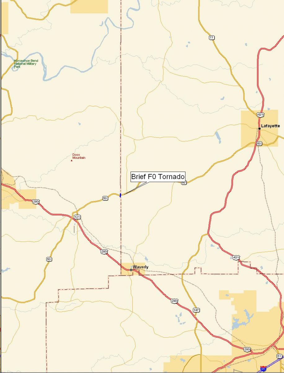
..Tallapoosa-Chambers Counties F0 tornado...survey details...
Law enforcement officials witnessed a brief tornado touchdown along State Road 50 4.2 miles east of Camp Hill, or 12.5 miles southwest of Lafayette. The witnesses reported a brief tornado touchdown right on the county line with little or no damage. The tornado occurred at 3:34 PM CDT. A Tornado Warning was in effect for Tallapoosa County from 2:30 PM CDT until 3:45 PM CDT. A Tornado Warning was in effect for Chambers County 3:34 PM CDT until 4:00 PM CDT.
...Lee County F0 tornado...survey details...
National Weather Service meteorologists surveyed the damage east of Opelika and determined the damage was the result of a tornado. The tornado touched down at approximately 3:40 PM CDT, 8.5 miles east of Opelika, along County Road 158 just east of Lee Road 259. Two mobile homes sustained minor damage, dozens of trees and power lines were snapped off or blown down, a few porches and out-buildings were damaged, and a spare tire was removed from a vehicle and thrown several yards away. The tornado path length was only 1.2 miles long and 200 yards wide at its widest point. A Tornado Warning was in effect for Lee County from 3:26 PM CDT until 3:45 PM CDT.

