National Weather Service United States Department of Commerce

Waugh (Montgomery) EF-1 Tornado
December 25th, 2012

 
EF-1
Estimated Maximum Wind:
90 mph
Injuries/Fatalities:
None
Damage Path Length:
0.7 miles
Maximum Path Width:
100 yards
Approximate Start Point/Time:
32.3527/-86.0452 at 1029 pm
Approximate End Point/Time:
32.3628/-86.0422 at 1029 pm
 

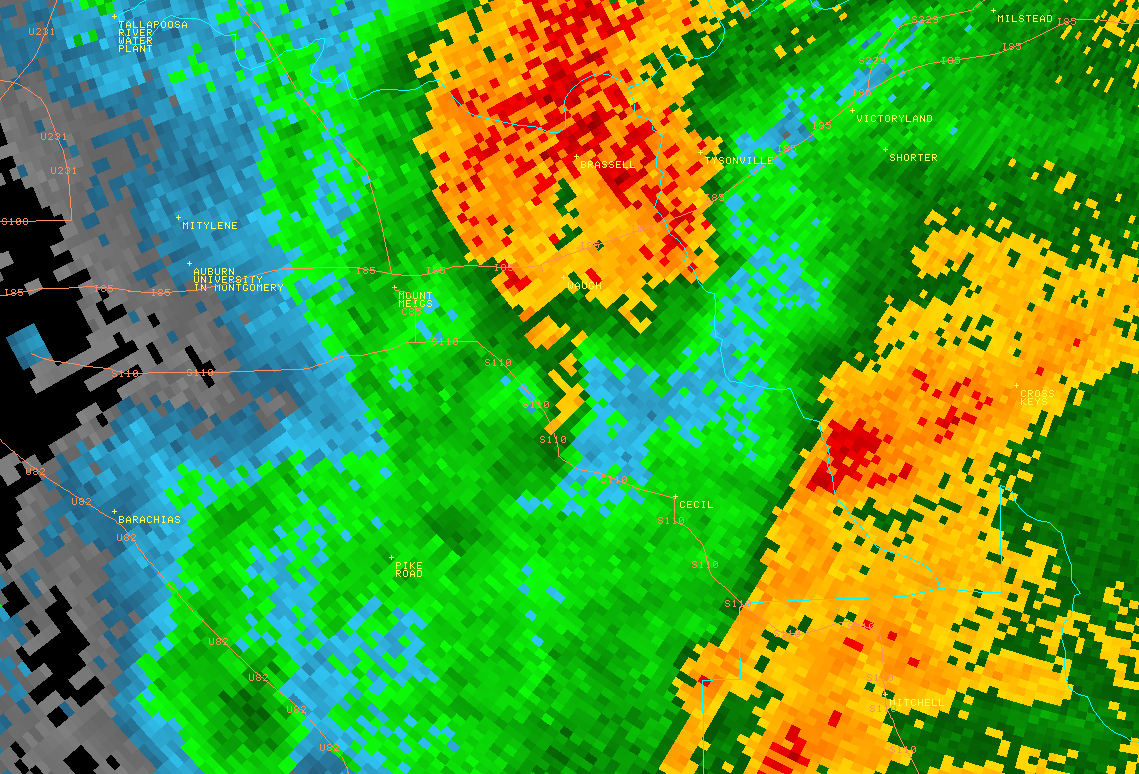
National Weather Service Meteorologists have surveyed storm damage in Montgomery County and determined that the damage was the result of a brief EF-1 tornado. The tornado touched down along County Road 107 (Marler Road) where it caused some minor shingle damage to a single-family residence. The tornado continued north-northeast and crossed Avenue of the Oaks before lifting at the end of Dellsena Lane. Approximately fifty trees were either snapped or uprooted along the path.


Radar Data 

Radar Image
This is an image of the 0.5 degree reflectivity data from KMXX at 1029 pm.  Notice the small "hook" feature just south of Waugh.  Click to enlarge.

Radar Image
This is an image of the 0.5 degree SRM data from KMXX at 1029 pm.  Notice the very weak rotation just south of Waugh.  Click to enlarge.