National Weather Service United States Department of Commerce

Farmersville (Lowndes) EF-1 Tornado
December 25th, 2012

 
EF-1
Estimated Maximum Wind:
105 mph
Injuries/Fatalities:
None
Damage Path Length:
2 miles
Maximum Path Width:
300 yards
Approximate Start Point/Time:
32.0513/-86.8505 at 809 pm
Approximate End Point/Time:
32.0661/-86.8205 at 809 pm
 

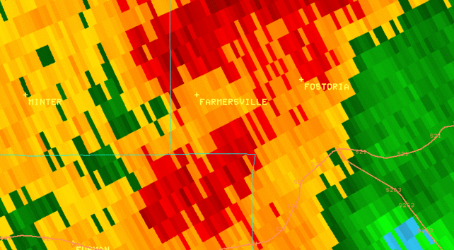
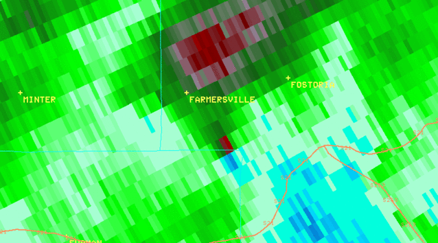
National Weather Service Meteorologists have surveyed storm damage in Lowndes County and determined that the damage was the result of an EF-1 tornado. The tornado touched down just inside the county line on Farmersville Road causing minimal tree damage, then continued east- northeast causing additional tree damage on County Road 7. The tornado lifted just to the east of CR 7.


Radar Data 

Radar Image
This is an image of the 0.5 degree reflectivity data from KMXX at 809 pm.  Click to enlarge.

Radar Image
This is an image of the 0.5 degree SRM data from KMXX at 809 pm. Click to enlarge.