|
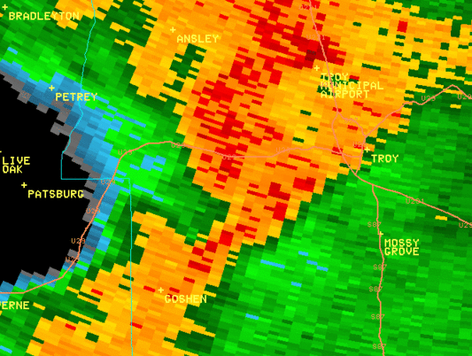
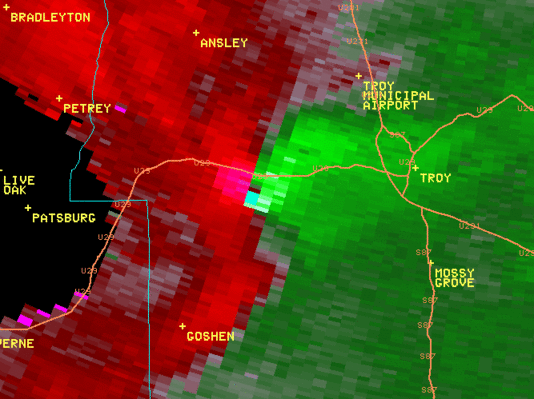
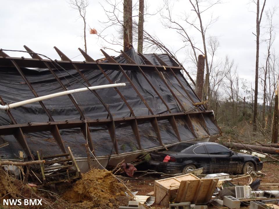
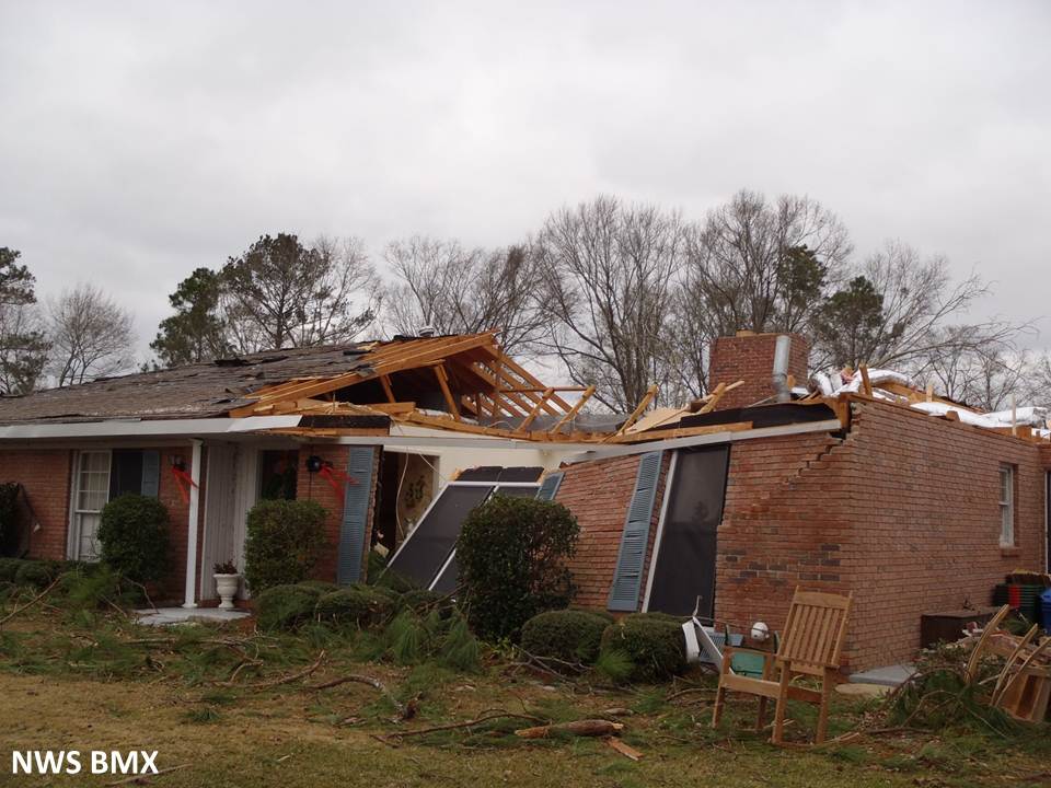
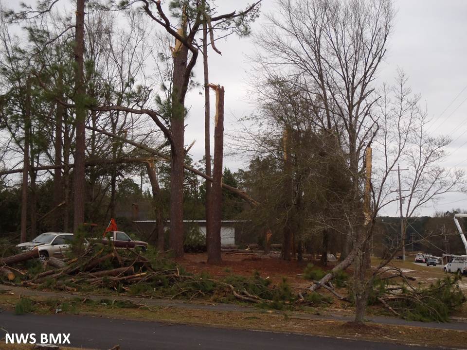
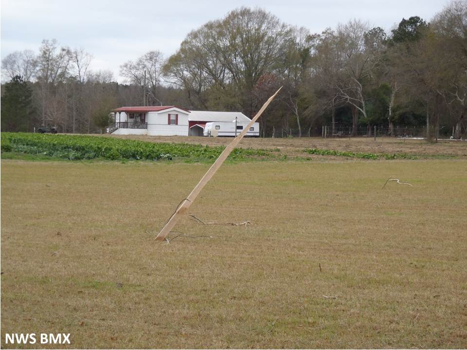
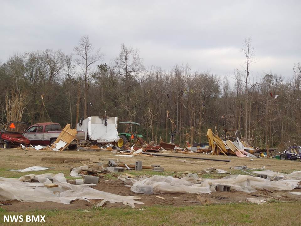
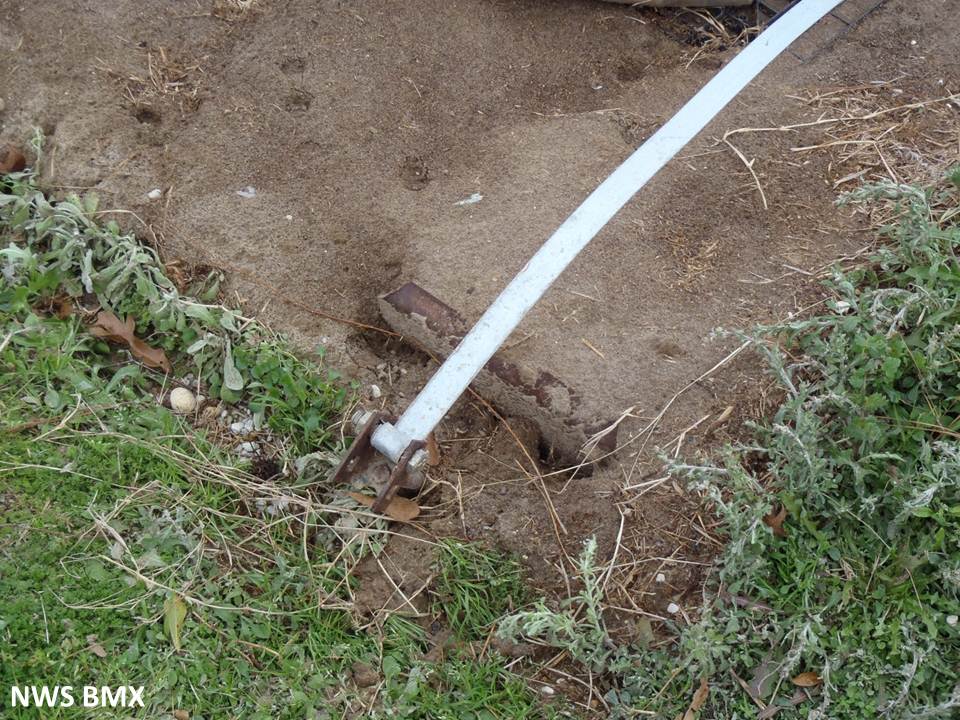
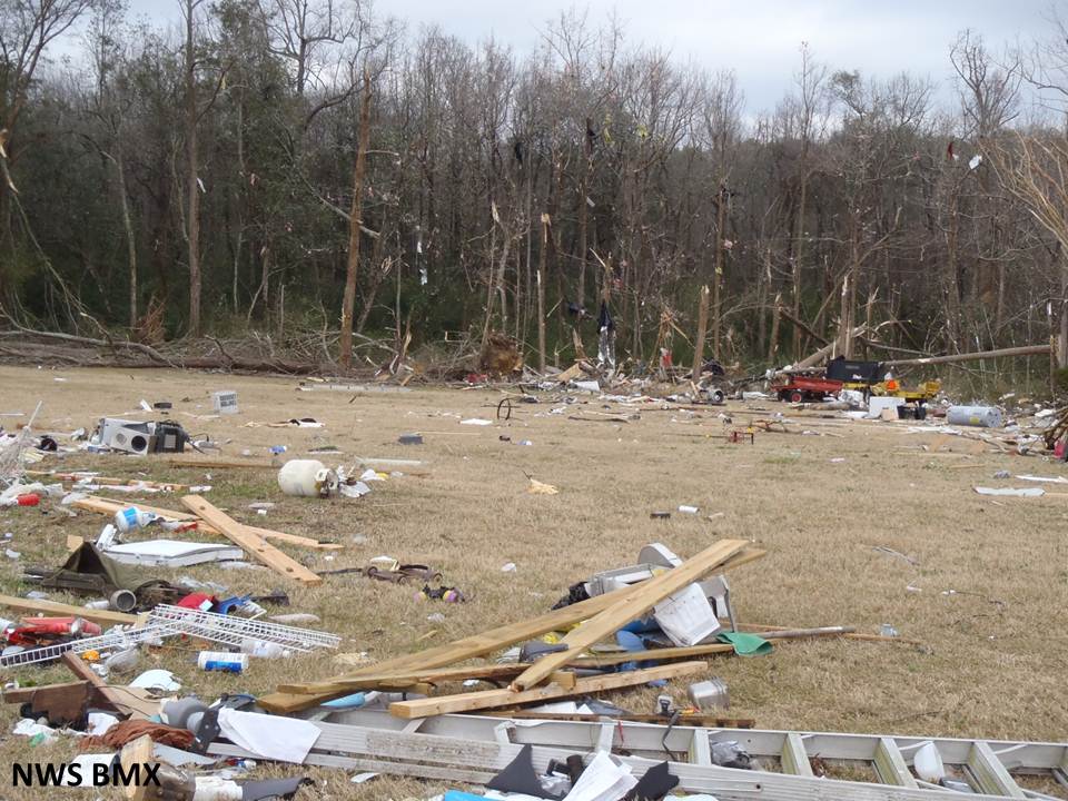
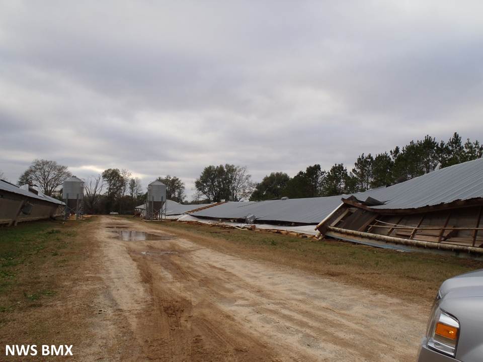
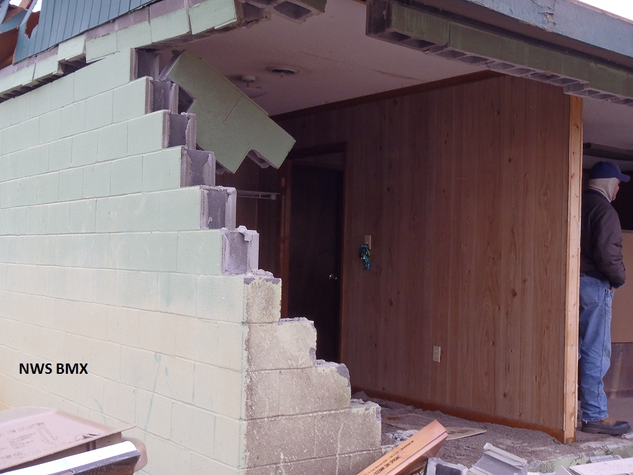
National Weather Service meteorologists have surveyed the damage in west Pike County and determined that it was the result of an EF-2 tornado. The tornado touched down just inside the county line on Brantley Road near an open field causing only minor tree damage. It traveled northeast to County Road (CR) 2219, where it caused significant damage to 2 chicken barns, a home and a small barn before crossing CR 2201. As it continued to the northeast, the tornado traveled parallel to the Conecuh River on CR 2214 for more than two miles, causing widespread damage with hundreds of trees snapped or uprooted and damaging several homes. As it passed CR 11, a single-wide manufactured home had its anchors ripped out of the ground and rolled 75 yards into a wooded area, while leaving the wooden post porch intact. The home fell apart as it rolled, leaving a trail of debris that lead into the woods, where the frame split in two and was wrapped around the trees. Two occupants were injured and required medical attention. The tornado continued over mainly fields and wooded areas, crossing Hwy 29 just west of CR 1165. The tornado crossed the Conecuh River and intensified as it approached the River Ridge Subdivision on CR 1101. Numerous large tall trees were uprooted, scores of pines were snapped, and a portion of the wall of a brick home collapsed causing major damage. From there, it continued northeast to the Brantley Woods Motor Home Park just north of CR 1148 on the west side of US Hwy 231, between the Troy Airport and the Conecuh River. A large swath of softwood trees were mowed down about 20 feet off the ground, and 3 single-wide manufactured homes were destroyed. One of the homes had its anchors ripped out of the ground and begin to roll, but because the park was heavily wooded, it was stopped from tumbling over onto and crushing the next home. From there, the tornado continued over marshy low lands and forested areas for another 3 miles before lifting at CR 103 north of Needmore Road.
The NWS would like to thank the Pike County Emergency Management Agency, as well as the Pike and Dale County Sheriff departments, for their assistance in conducting the surveys in Pike County.
|