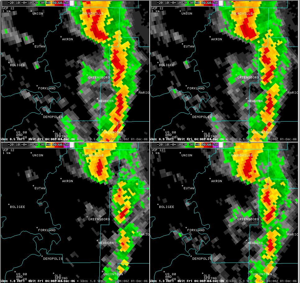
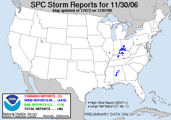
Hale County Tornadoes - November 30, 2006
National Weather Service meteorologists and the Hale County Emergency Management surveyed the storm damage that affected HaleCounty. It has been determined that the damage was the result of a three distinct tornadoes.
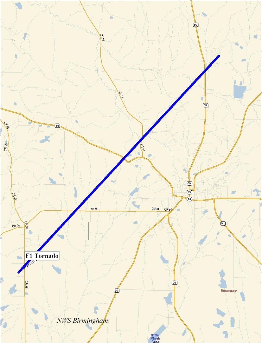
The first tornado touched down at approximately 935 PM, just west of County Road 35 between County Road 24 and County Road 73. This location is about 7 miles southwest of Greensboro or 4 miles northwest of Cedarville. The tornado tracked northeastward and crossed County Road 24, County Road 28, State Highway 14, County Road 21, County Road 19 and State Highway 69. The tornado lifted at approximately 951 PM just north of County Road 4 near its intersection with State Highway 69. The tornado damage path was 11.3 miles long and was 75 yards wide at its widest point. One barn was destroyed and several out-buildings were damaged or destroyed along the path. Hundreds of trees were either snapped off or blown down. One tractor and one automobile were damaged. This tornado has been rated an F1 on the Fujita Scale.
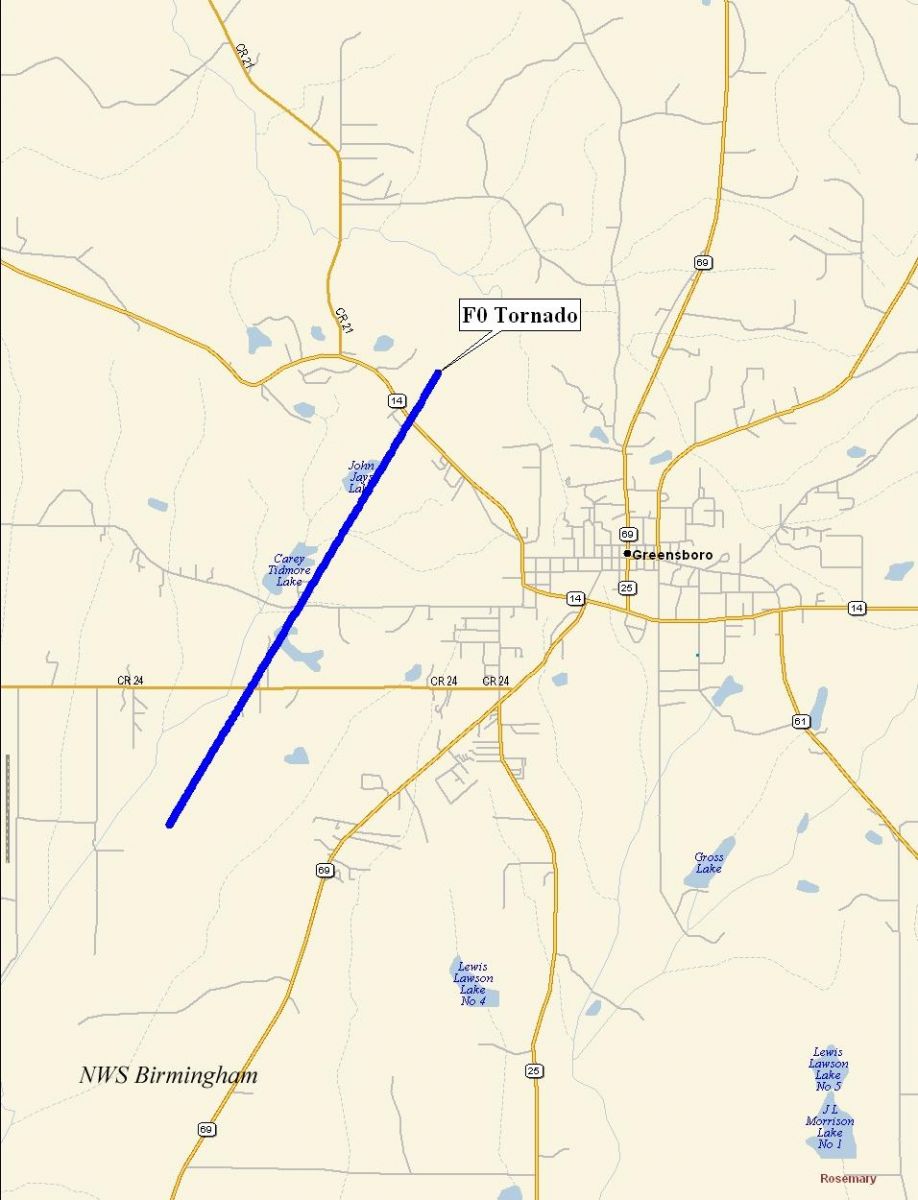
The second tornado touched down just east of the Greensboro Municipal Airport around 940 PM. The tornado tracked northeastward and crossed County Road 24, County Road 28 and State Highway 14. Several trees were knocked down or were snapped off at the Lakeview Country Club. The Hale County Jail suffered roof damage. Additional trees were blown down along the path. The tornado lifted at approximately 946 PM. The tornado damage path was 3.3 miles long and 25 yards wide at its widest point. This tornado has been rated an F0 on the Fujita Scale.
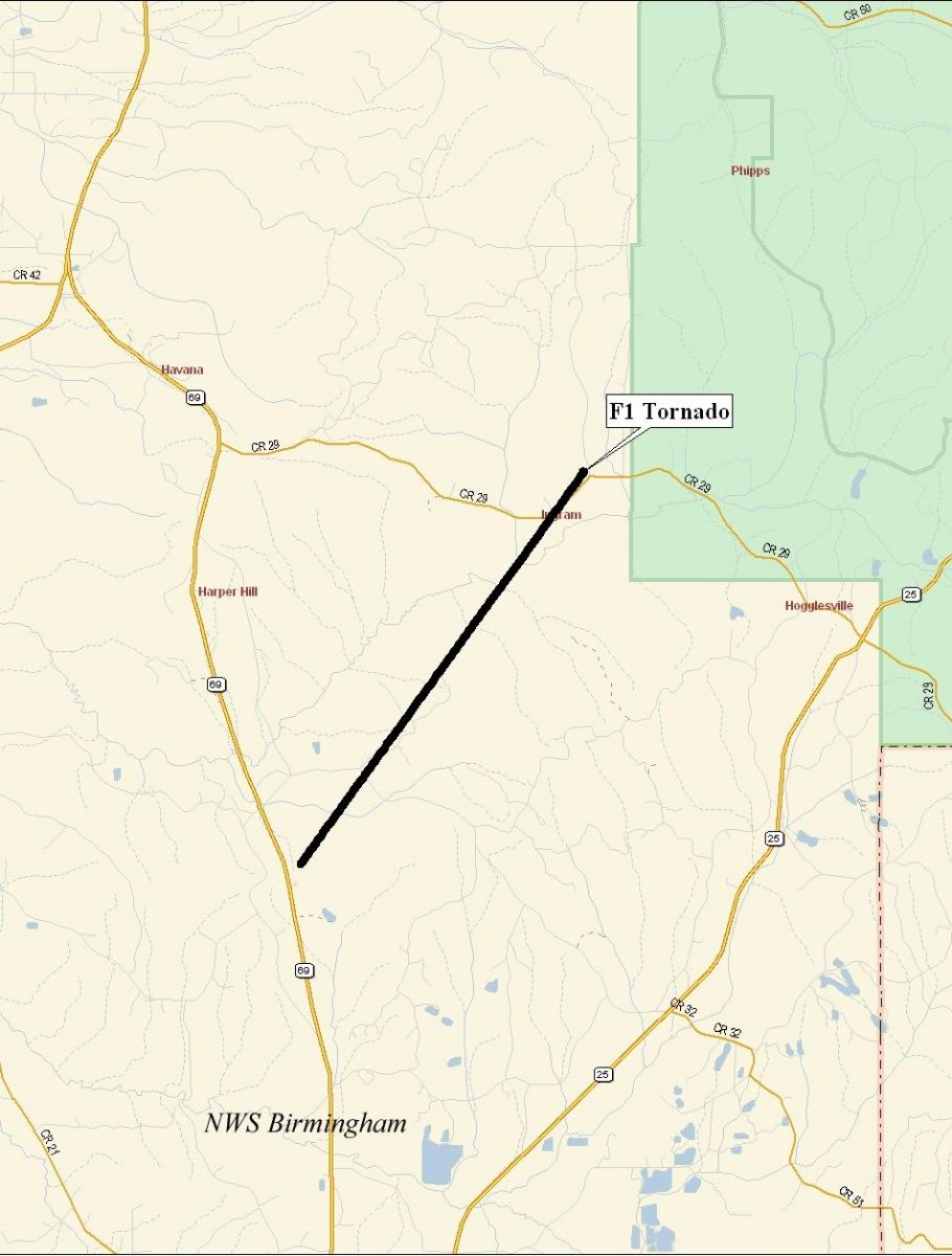
The third tornado affecting Hale County touched down at 953 PM just south of the intersection of State Highway 69 and County Road 32. This location is approximately half way between the Havana community and Greensboro. The tornado tracked northeastward and lifted about 959 PM at the southwestern edge of the Talladega National Forest Area near County Road 29. Hundreds of trees were either snapped off or were blown down along the path. The tornado damage path was 5.8 miles long and 75 yards wide at its widest point. This tornado has been rated an F1 on the Fujita Scale.
|
|
||||||||||||||||||||