|
Event Summary
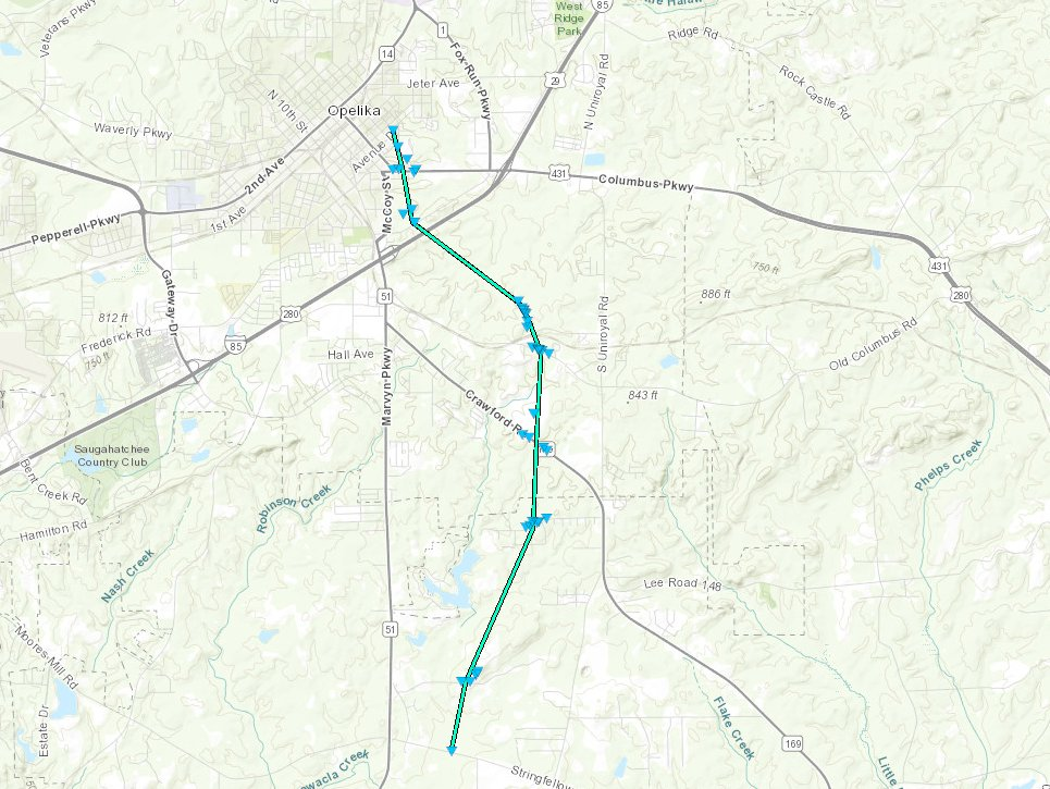
A rare summertime Alabama tornado occurred during the late-afternoon hours of July 21, 2018 in central Lee County. Before the development of the tornado-producing thunderstorm, a large thunderstorm complex moved through Georgia and far Eastern Alabama during the early-morning hours, leaving behind a large northwest-to-southeast oriented outflow boundary from Northern Alabama to Southeastern Alabama. This boundary would be a key factor later in the day. Central Alabama was situated between large-scale troughing to the northeast and large-scale ridging to the west, placing a belt of strong northwesterly wind shear (for July standards in the Southeastern U.S.), with bulk shear values around 40-50 knots. While surface winds were mostly out of the west across the area, they were more southerly across Eastern Alabama/adjacent to the outflow boundary, providing at least modest values of low-level helicity/shear. Since dew points were maintained, cloud breaks allowed for strong-to-extreme instability values as surface heating ensued, with surface-based CAPE values ranging from ~3,000 to 5,000 J/kg.
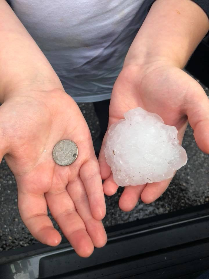
Afternoon thunderstorms rapidly developed along and near the outflow boundary across Eastern Alabama. Nearly every thunderstorm was producing severe-caliber hail (1+ inches), with the largest report coming in around 3 inches. A southeastward-moving thunderstorm in Lee County fed off the primed atmosphere of high instability and wind shear. Additionally, two outflow boundaries came to an apex right at the thunderstorm's updraft. The process of ingesting the localized helicity/shear aided in the development of a tornado. This storm also produced hail to around golf ball size.
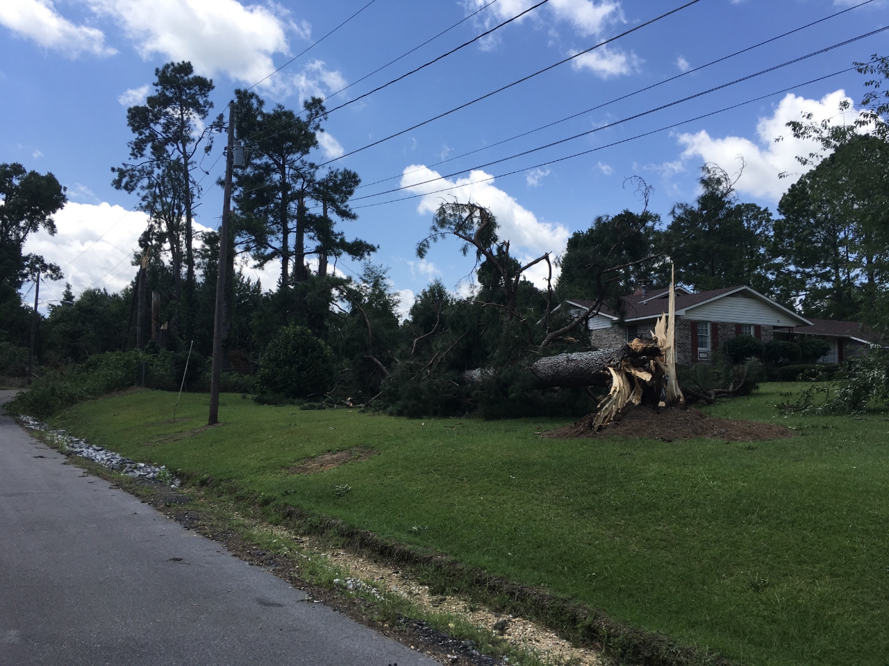
The tornado uprooted numerous trees, with some trees and large branches snapped. In two locations, tree damage was fairly dense. Several homes and vehicles were impacted by fallen trees and large branches. The worst structural damage directly related to the wind was the removal of some shingles from roofs, and a rolled camper.
-----------------------------------------------------------------------------------
There were several additional severe thunderstorms across eastern Alabama during this event. Storms from Cleburne County south to Russell County produced large to very large hail: 1" to as much as 3" in diameter. One storm in Russell County produced significant straight-line wind damage, uprooting and snapping trees.
|