|
Event Summary
|
|
EF-1
|
|
Estimated Maximum Wind:
|
95 mph
|
|
Injuries/Fatalities:
|
None |
|
Damage Path Length:
|
7.23 miles
|
|
Maximum Path Width:
|
325 yards
|
|
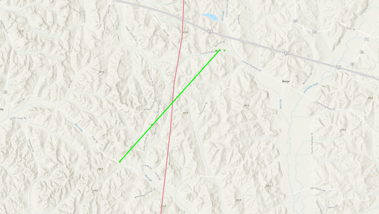
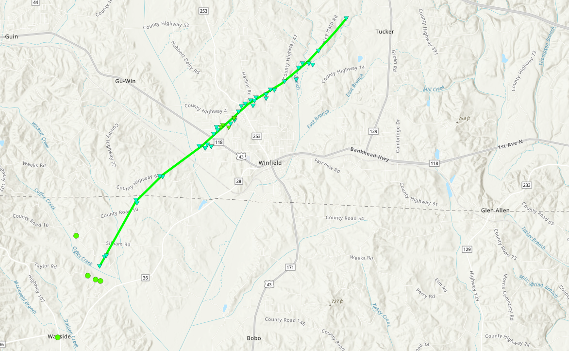
Approximate Start Point/Time:
|
2 NNE Wayside
33.8984/-87.8774
at 6:52 pm CDT
|
|
Approximate End Point/Time:
|
1 W Tucker
33.9716/-87.7897
at 7:01 pm CDT
|
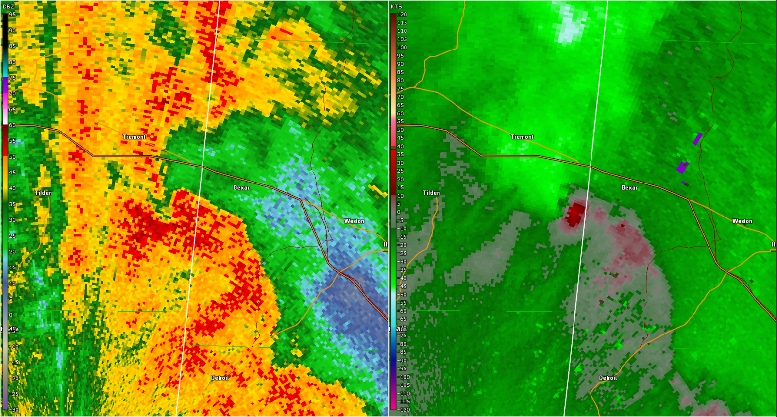
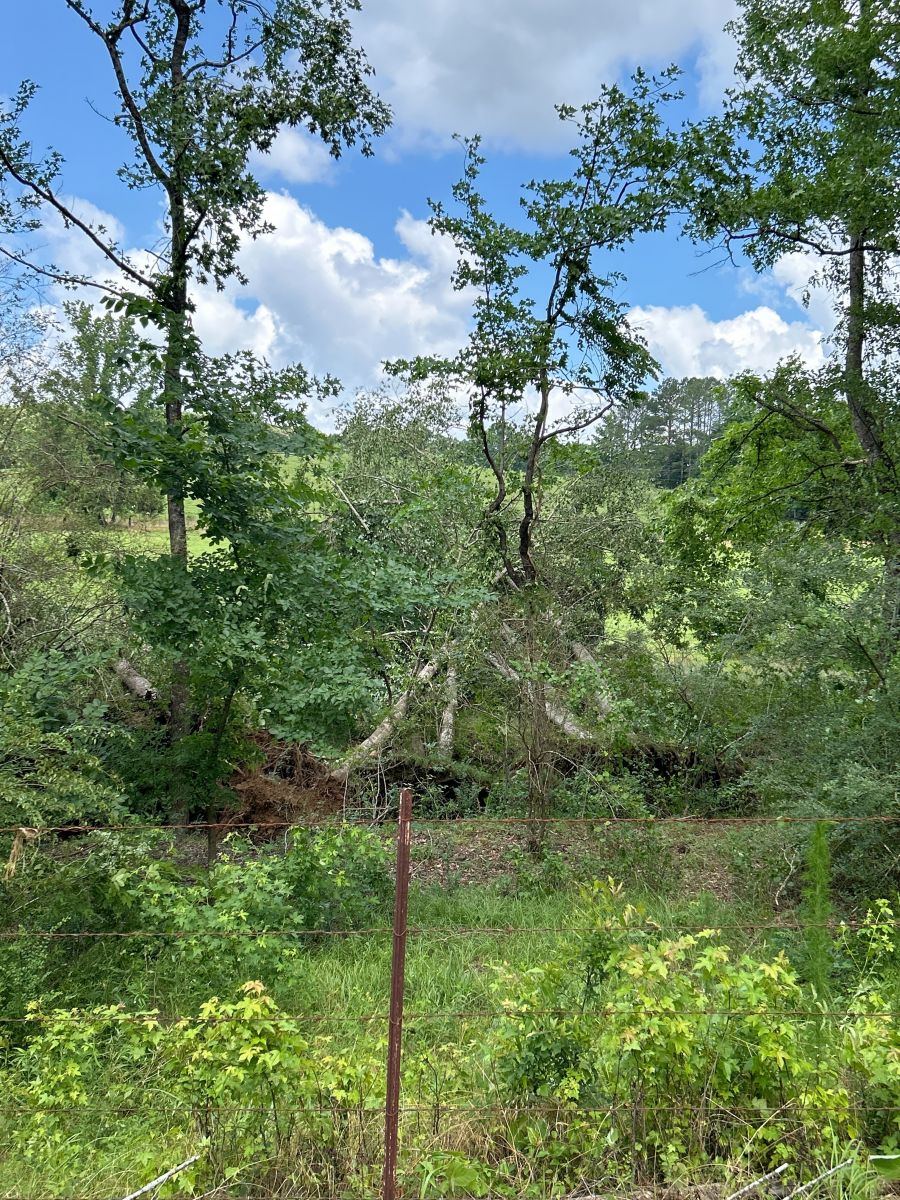
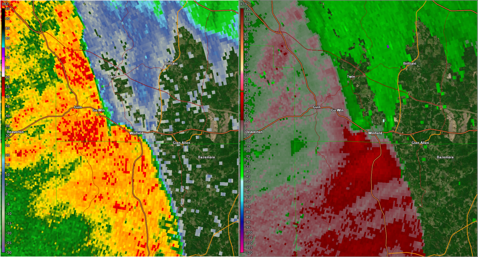
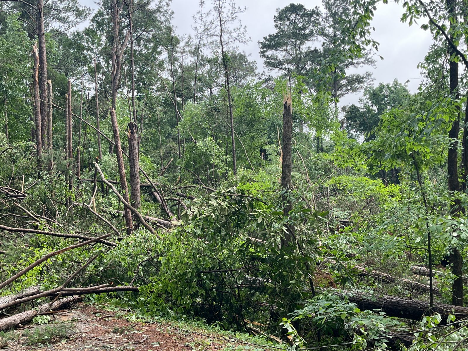
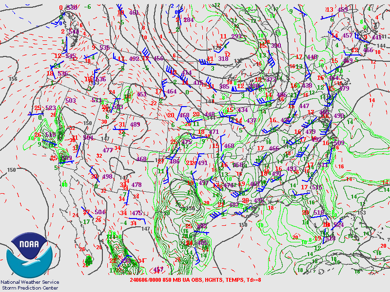
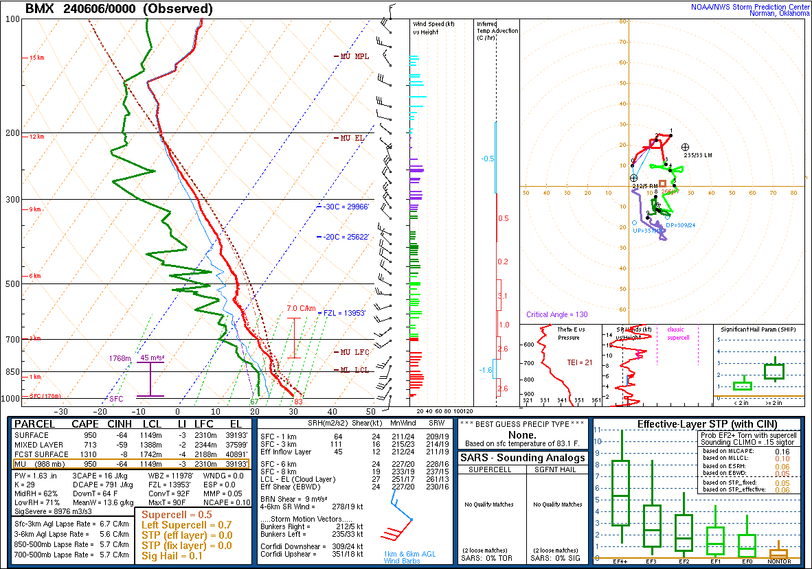
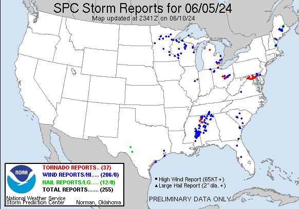
An EF1 tornado developed on the northern flank of an MCS, affecting far northern portions of Fayette County and southern portions of Marion County. The tornado initially touched down near Coffee Creek then moved northeast where it crossed Coffee Creek Road and uprooted a few large soft and hardwood trees in the front yard of a residence. The damage was sporadic as the tornado moved through Fayette County producing mostly timber damage as it crossed into Marion County. One home on Atkinson Road sustained minor damage to the vinyl siding. The tornado began to intensify as it approached US HWY 43 to the west of Winfield. Several trees were uprooted and snapped on Pike Road and Pleasant Drive, and a couple of the homes on these roads sustained minor shingle damage, although one tree did fall on a home. As the tornado crossed US HWY 43, it produced minor cosmetic damage to a few of the stores within the Foodland strip mall, and some of the glass doors were blown out. The highest degree of damage was first noted from Silverleaf Road to Rosewood Street where a large concentration of uprooted and snapped trees was observed. Fortunately, structural damage was quite limited in this area despite the amount of tree fall. The tornado continued northeast across State Highway 253 and County Highway 47 where the timber damage once again became more sporadic, consisting mostly of snapped branches and an occasional uprooted softwood. The tornado lifted in a wooded area shortly after crossing Riley Harp Road.
|