National Weather Service United States Department of Commerce


Tornadoes and Damaging Winds on May 27, 2024

Overview
 

During the early morning of Memorial Day, May 27, 2024, a line of severe thunderstorms impacted portions of Central Alabama. This was part of a storm system that affected a large portion of the central and eastern United States. Storms moved into the area from the north and southwest after 4:30 am CDT, resulting in widespread wind damage across parts of Hale, Tuscaloosa, Bibb, Shelby, Jefferson, Talladega, St. Clair, Calhoun, Clay, Cherokee, and Randolph counties. Additionally, two brief tornadoes, both rated EF-1, struck areas of northern Cherokee and northern Randolph counties. One fatality occurred in Jefferson County when a tree fell on a home in Mountain Brook.

Strong winds led to numerous reports of tree and power line damage, and some trees fell on homes. Radar estimated winds were 60-70 mph, but local gusts could have been up to 75 mph, across the ~23 mile wide wind swath.

 
Interactive Damage Map


**The data below are considered PRELIMINARY.**

Location/Summary
Damage Rating/Estimated Maximum Wind Speeds
Injuries/Fatalities
Damage Path Length/Width
Starting Point/Time
Ending Point/Time
Johnnies Creek Tornado
(Cherokee County)
EF-1
105 mph
None 3.41 miles
550 yards
5 NNE Sand Rock
34.3007/-85.7183
4:27 am CDT
4 NE Yellow Creek Falls
34.2719/-85.6701
4:31 am CDT
County Road 427 Tornado
(Randolph County)
EF-1
110 mph

 
None 3.17 miles
350 yards
4 NW Newell
33.4850/-85.4444
6:52 am CDT
3 N Newell
33.4756/-85.3915
6:56 am CDT
Straight-line Winds
(Hale, Tuscaloosa, Bibb, Shelby, Jefferson, Talladega, St. Clair, Calhoun, & Clay Counties)
Thunderstorm Wind
70-75 mph

 
0/1 Approx. 120 miles
Approx. 23 miles
Near Moundville
5:00 am CDT
Near Pell City
6:10 am CDT
 
Johnnies Creek EF-1
 

Johnnies Creek EF-1 Tornado (Cherokee County)
  May 27, 2024


Event Summary

EF-1
Estimated Maximum Wind:
105 mph
Injuries/Fatalities:
None
Damage Path Length:
3.41 miles
Maximum Path Width:
550 yards
Approximate Start Point/Time:
5 NNE Sand Rock
34.3007/-85.7183
at 4:27 am CDT
Approximate End Point/Time:
4 NE Yellow Creek Falls
34.2719/-85.6701
at 4:31 am CDT


A brief EF1 tornado formed along the leading edge of a QLCS in northern Cherokee County. Minor timber damage began along County Road 768 near County Road 47. The tornado continued to down trees as it crossed County Road 43. The tornado intensified as it paralleled County Road 275, snapping numerous trees along the southwestern slope of the canyon containing Johnnies Creek. The tornado weakened as it moved near the mouth of Little River Canyon, but continued to down trees as it crossed Highway 273. The tornado dissipated as it crossed the Little River near where it flows into Weiss Lake. A separate, non-contiguous area of tree damage occurred near County Road 104 along Weiss Lake, where some trees fell on homes. However, the sporadic and divergent nature of the damage and wider path were more consistent with straight-line winds. 

Radar Image


Radar Image
Reflectivity (left) and velocity (right) in northern Cherokee County as the tornado began.
Images are from KHTX at 4:27 am CDT.


Damage Photo
 Timber Damage along County Road 275
Damage Photo
 Timber Damage along County Road 275
 
County Road 427 EF-1
 

County Road 427 EF-1 Tornado (Randolph County)
  May 27, 2024


Event Summary

EF-1
Estimated Maximum Wind:
110 mph
Injuries/Fatalities:
None
Damage Path Length:
3.17 miles
Maximum Path Width:
350 yards
Approximate Start Point/Time:
4 NW Newell
33.4850/-85.4444
at 6:52 am CDT
Approximate End Point/Time:
3 N Newell
33.4756/-85.3915
at 6:56 am CDT


A brief EF1 tornado formed within a QLCS in northern Randolph County. The tornado began in a wooded area west of County Road 425 and began to snap tree branches and uproot trees. The tornado intensified after crossing County Road 427, snapping numerous trees between there and County Road 51. On County Road 51 multiple windows were blown out of a home with some minor roof damage also occurring. The roof was blown off an outbuilding causing its walls to collapse. Additional timber and outbuilding damage occurred as it crossed County Road 429 before the tornado dissipated in an inaccessible wooded area prior to reaching County Road 37. A tornado debris signature was observed on the KFFC radar.

Radar Image


Radar Image
Reflectivity (left) and velocity (right) of the tornado.
Images are from KFFC at 6:55 am CDT.


Damage Photo
 Roof and window damage to a home
Damage Photo
 Outbuilding destroyed
 
Straight-line Winds
 

Straight-line Winds (Hale, Tuscaloosa, Bibb, Shelby, Jefferson, Talladega, St. Clair, Calhoun Counties)
  May 27, 2024


Event Summary

Thunderstorm Wind
Estimated Maximum Wind:
70-75 mph
Injuries/Fatalities:
0/1
Damage Path Length:
Approx. 120 miles
Maximum Path Width:
Approx. 23 miles
Approximate Start Point/Time:
Near Moundville
5:00 am CDT
Approximate End Point/Time:
Near Pell City
6:10 am CDT


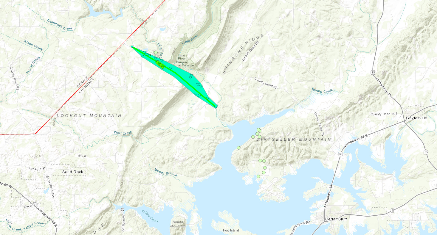
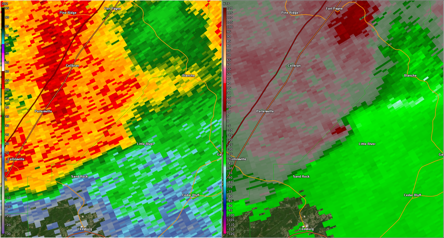
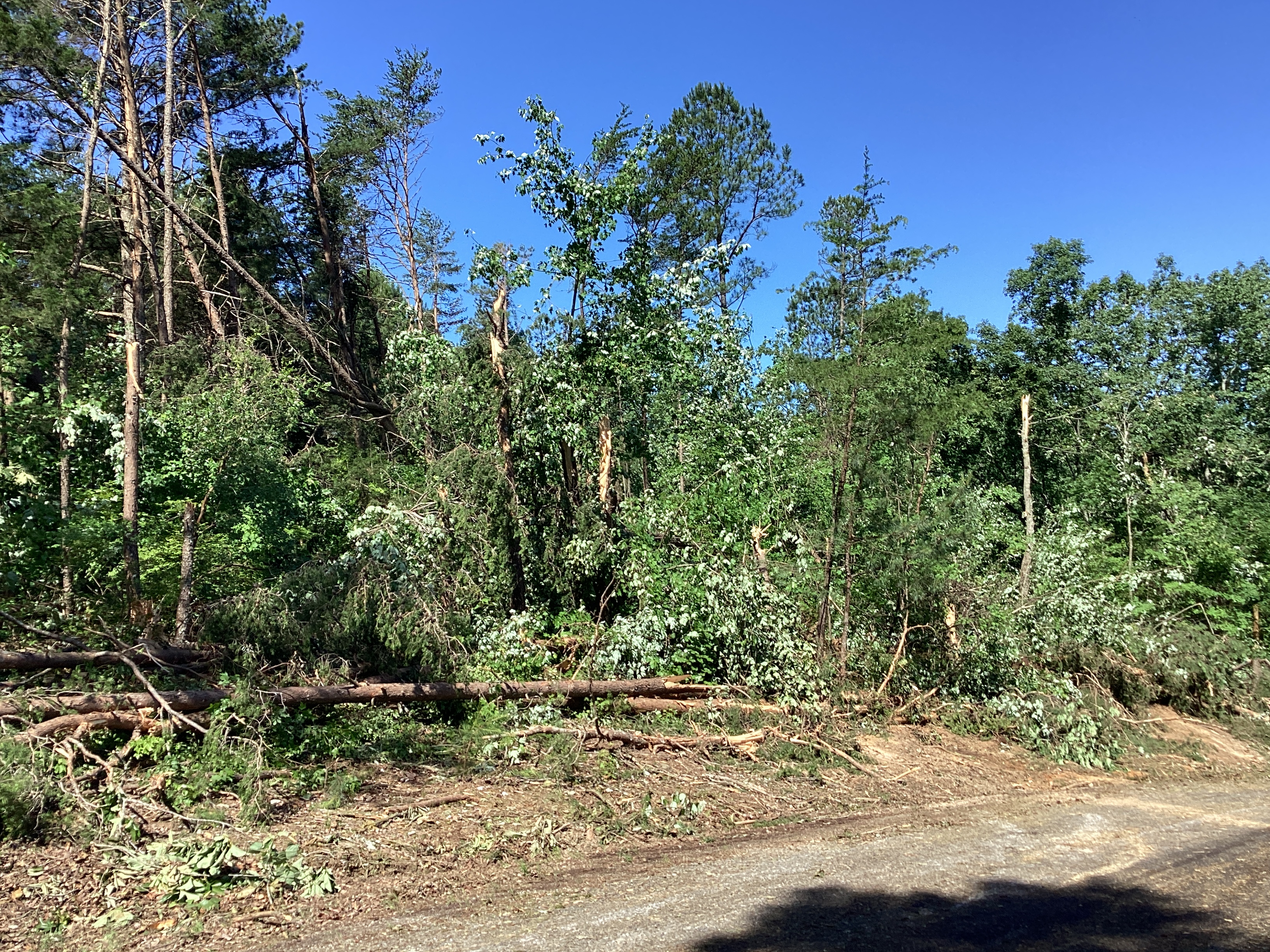
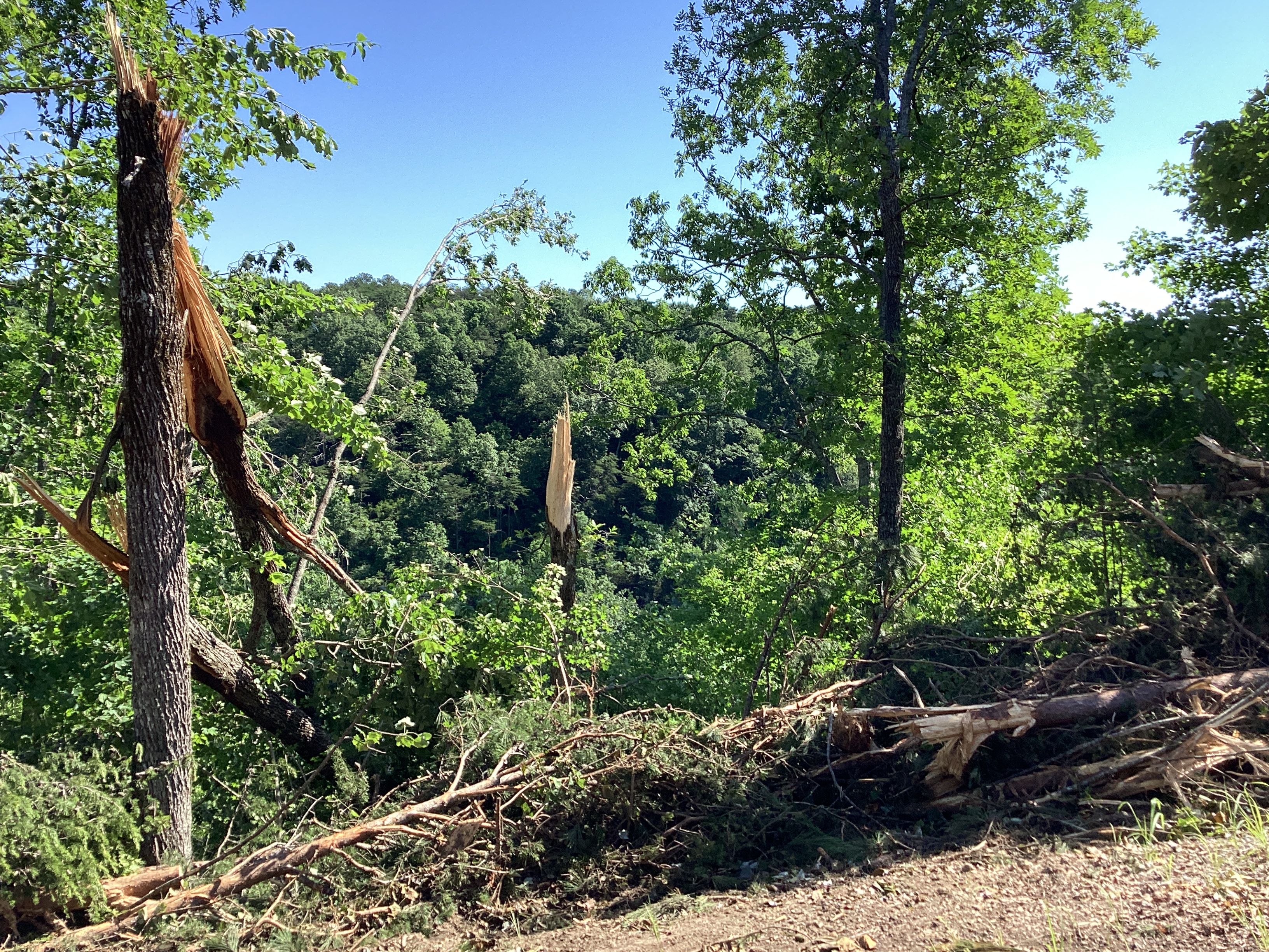
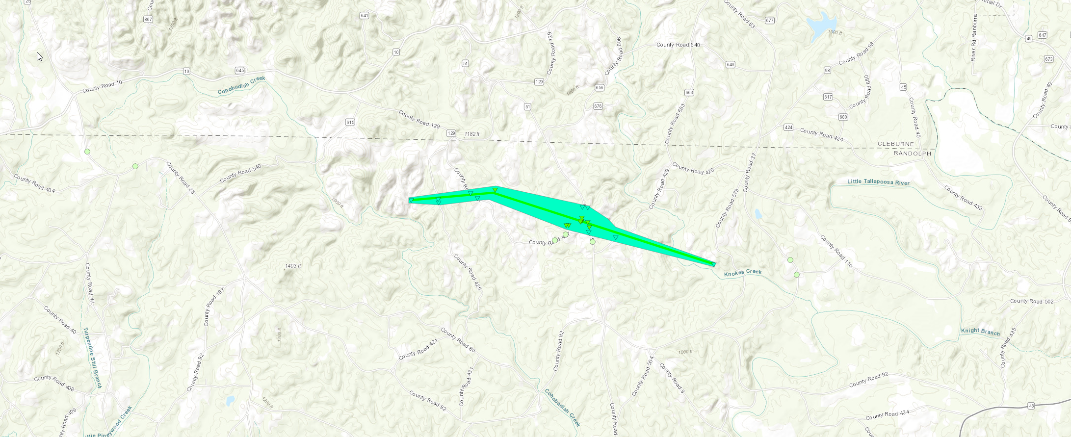
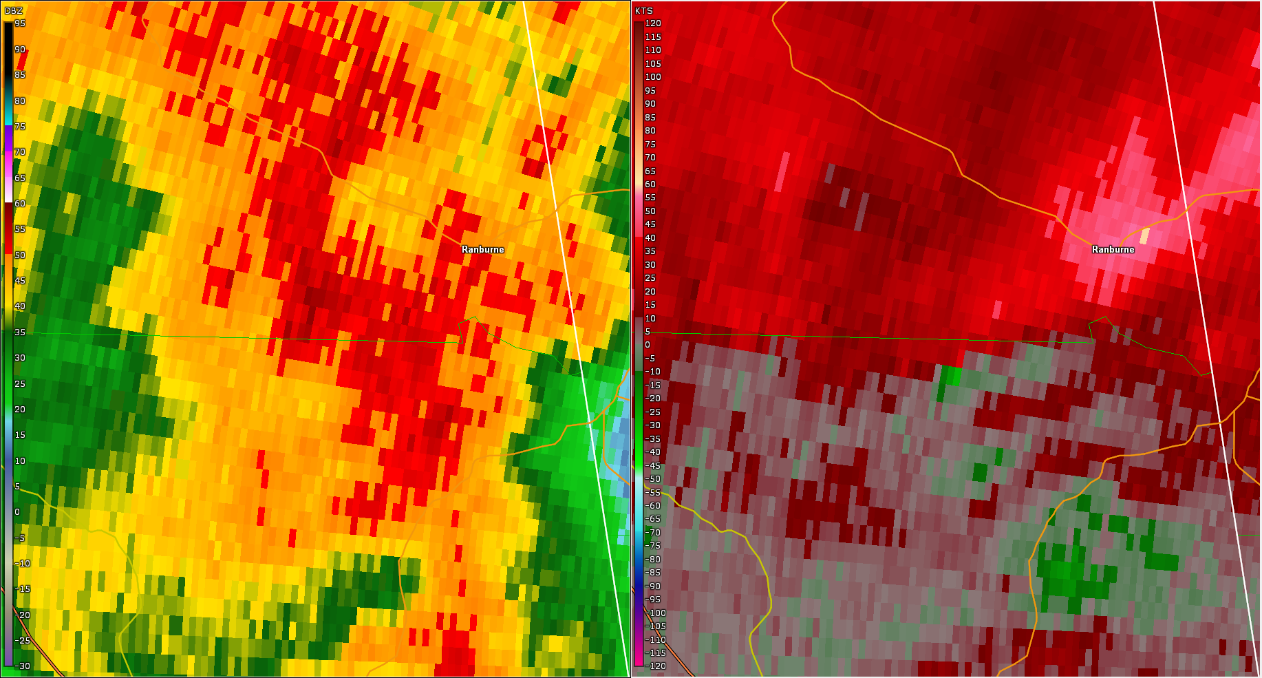
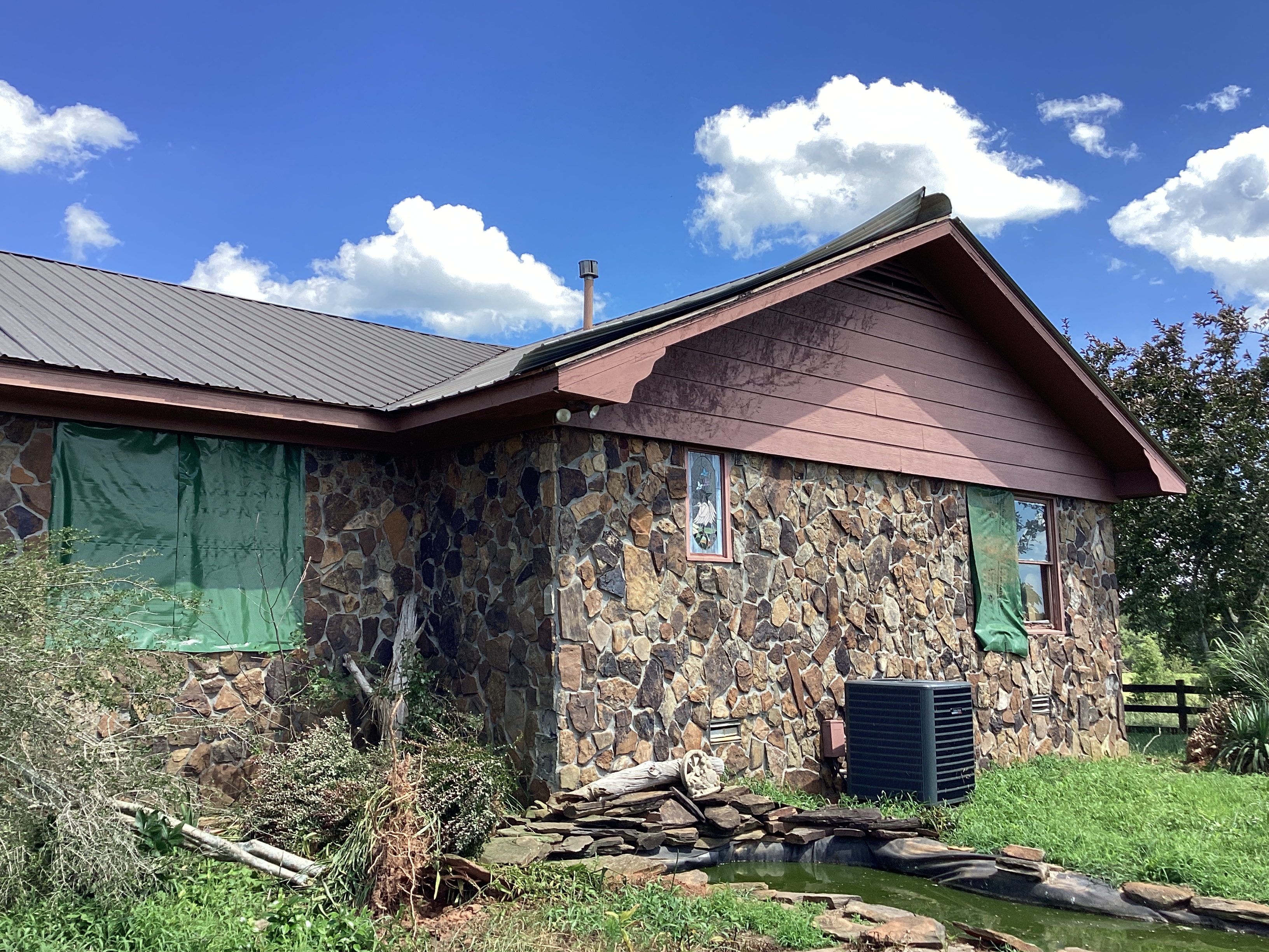
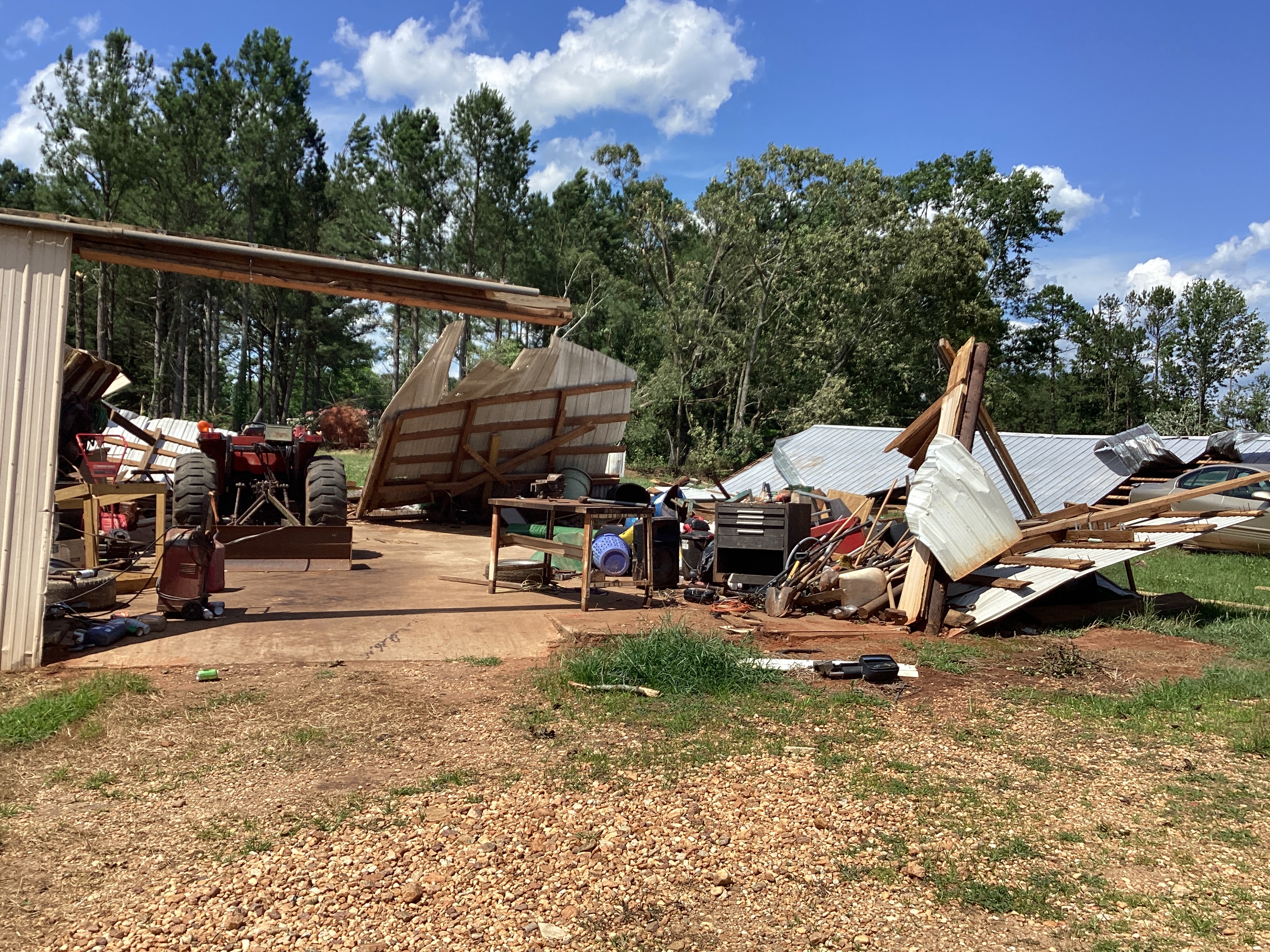
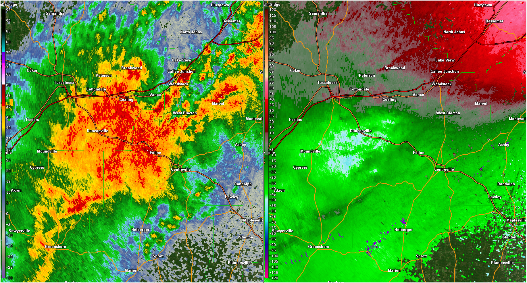
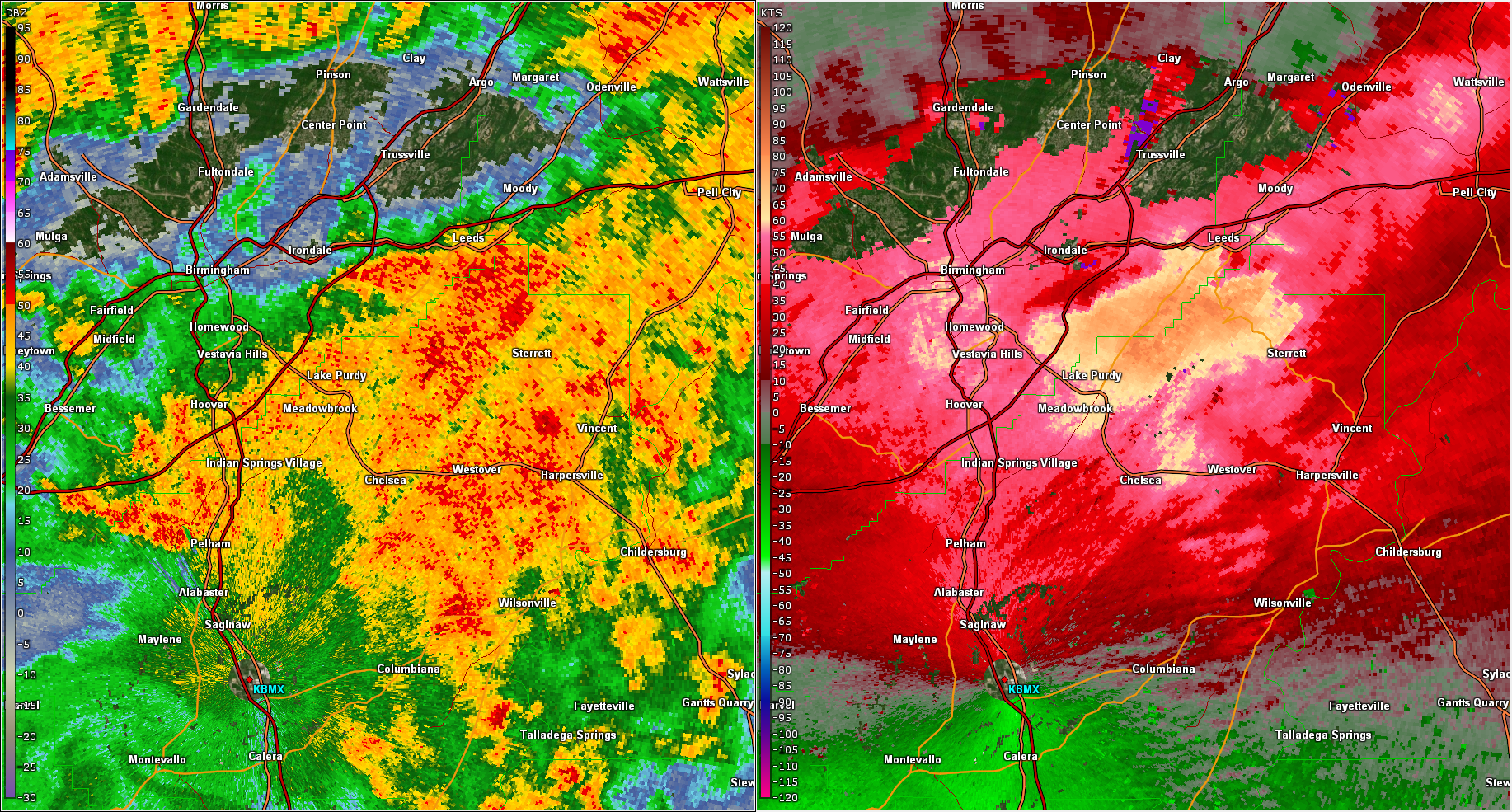
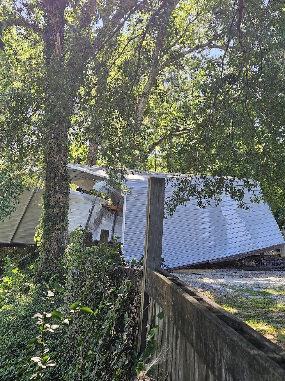
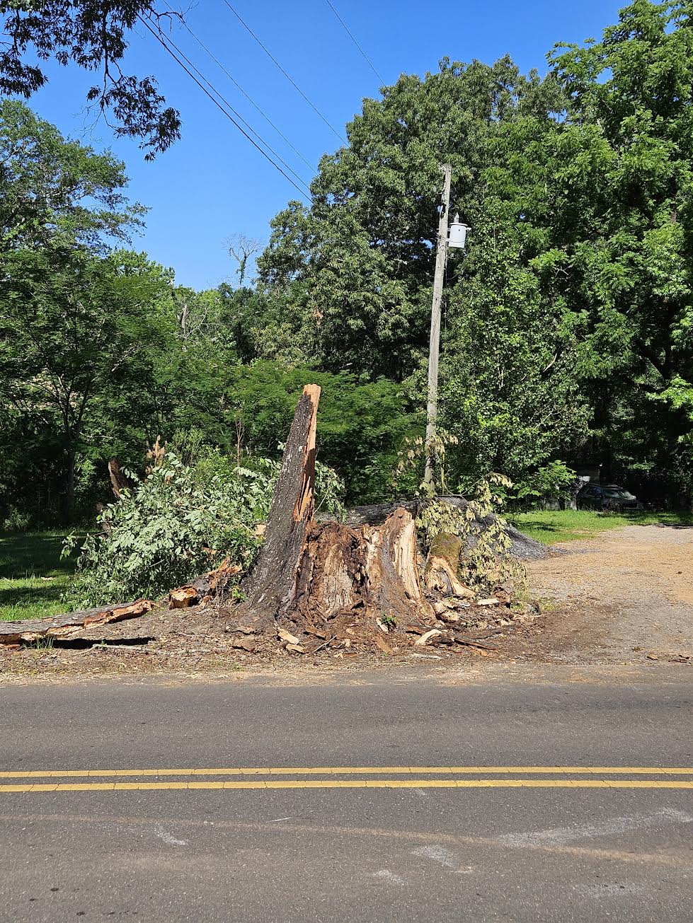
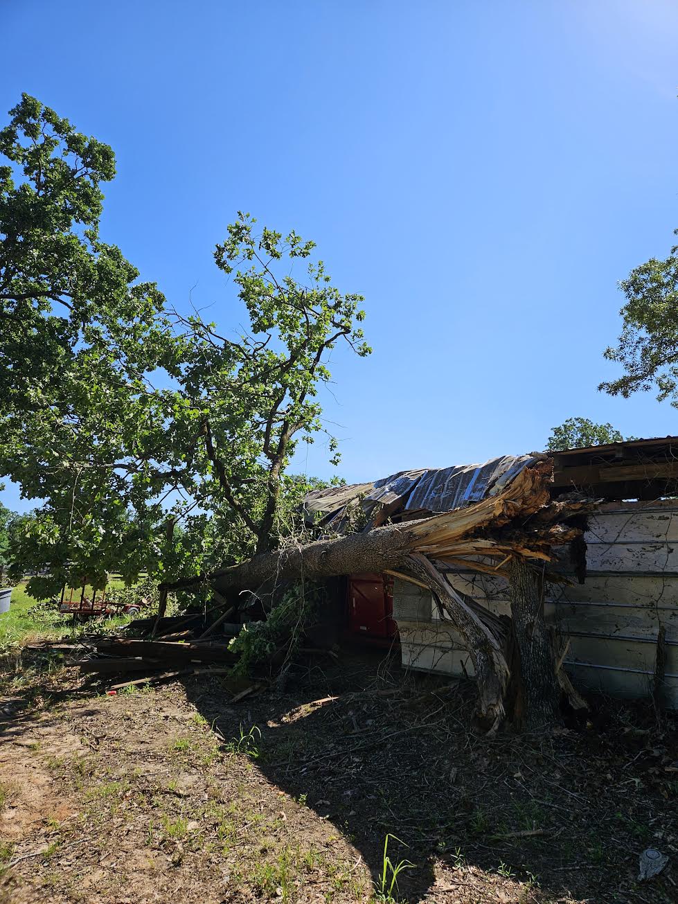
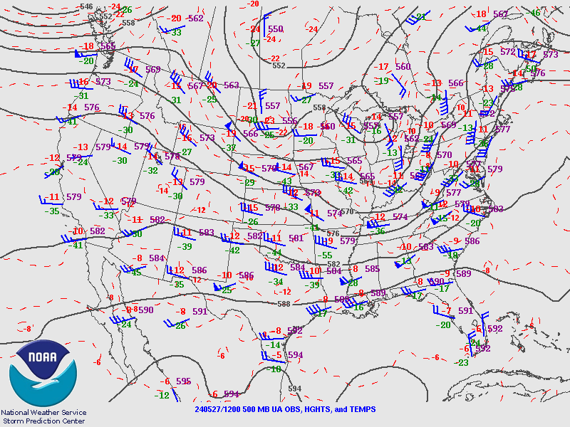
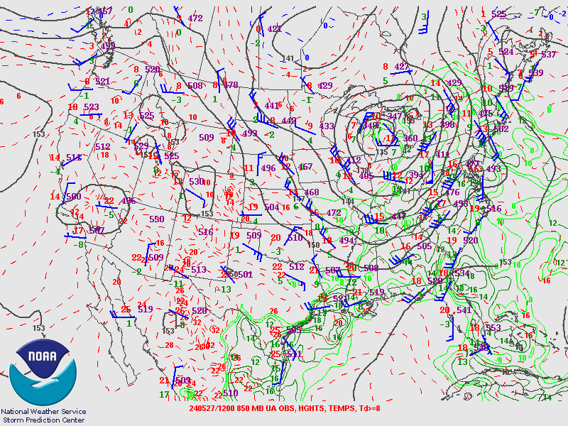
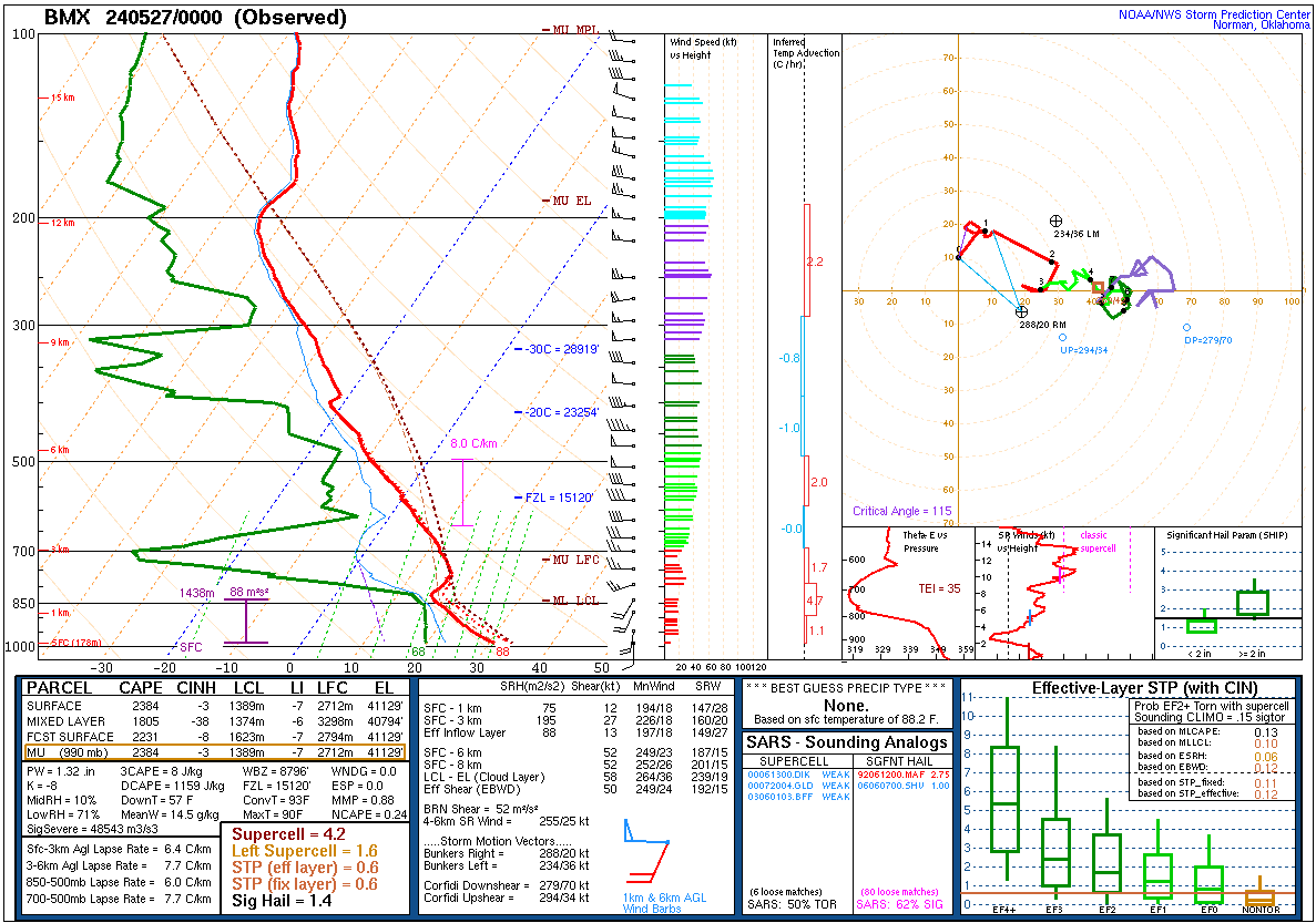
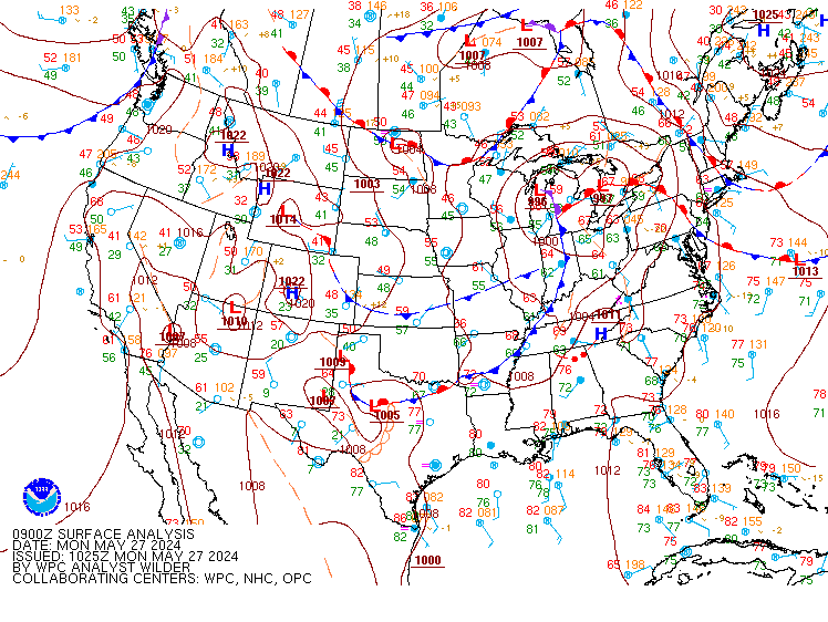
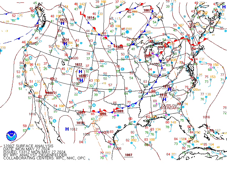
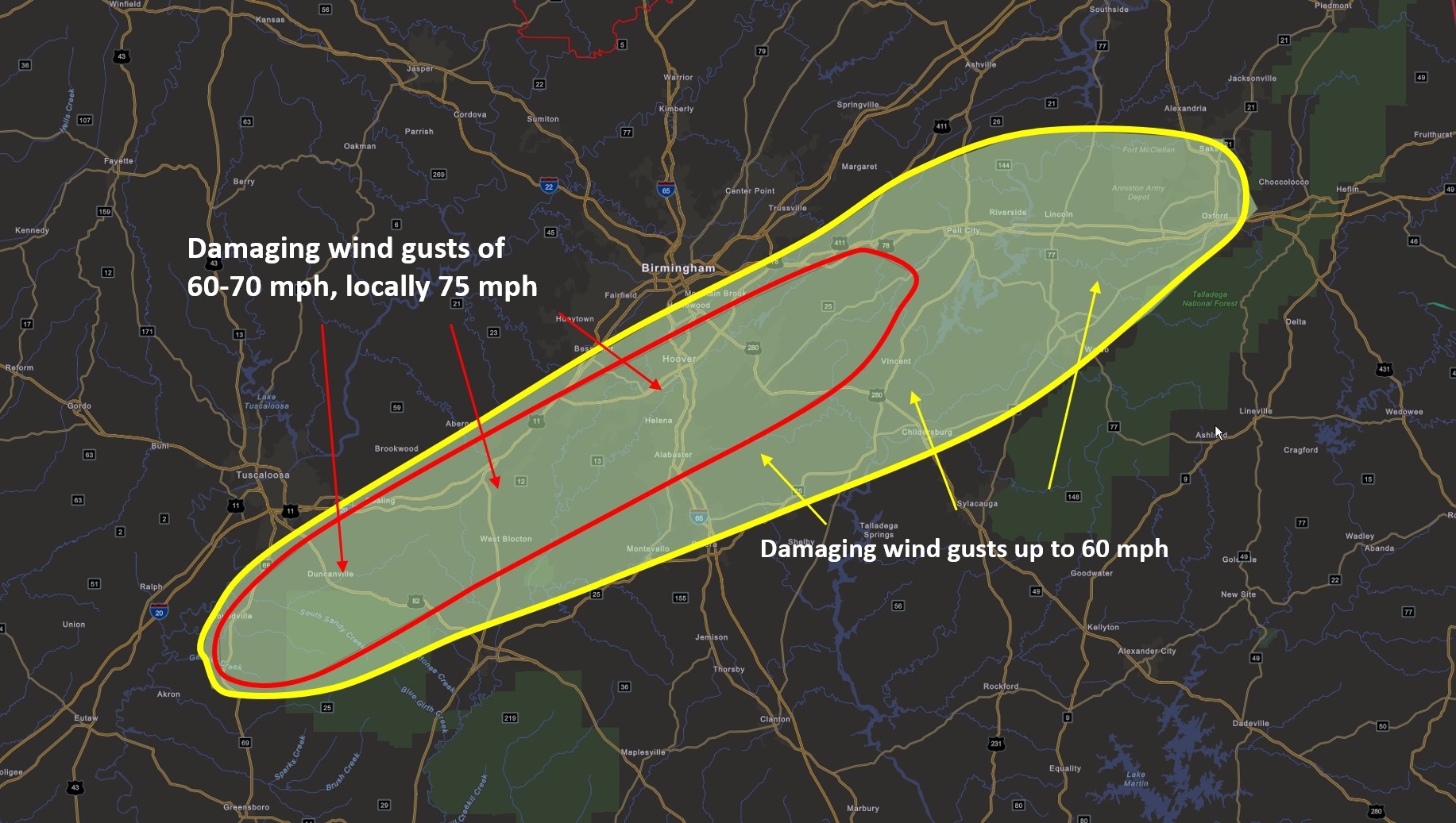
NWS Birmingham conducted a storm survey in areas such as Coaling, Vance, Woodstock, West Blocton, Green Pond, Helena, Pelham, and Alabaster. This survey was to assess a large area of reported wind damage associated with a severe thunderstorm bowing segment evident on KBMX RADAR. Observed damage along this path mainly consisted of uprooted or snapped trees, and fallen large tree limbs. Fallen timber caused damage to homes, vehicles, and power lines. Widespread power outages occurred as a result. One fatality occurred in Jefferson County due to a tree falling on a residence. Wind damage throughout this path was consistent with straight-line winds, or winds that were not tornadic. Gusts of 60-70 mph were evident along a path approximately 10 miles wide and 80 miles long, and some higher intensity timber damage in the Coaling, Vance, West Blocton, Helena, and Alabaster areas suggest wind gusts up to 75 mph. The damage pattern across this path was divergent, and higher intensity damage areas exhibited divergent microburst characteristics. There was no sign of debris lofting on the damage survey, and no signs of rotation or lofted tornado debris after a thorough analysis of KBMX RADAR data. The bowing segment eventually spread out in diameter and weakened slightly after exiting Shelby County, though caused additional wind damage in St. Clair, Calhoun, Talladega, and Clay counties. 

Track Map


Radar Image
Reflectivity (left) and velocity (right) of the line segment that produced the damaging winds over Hale, Bibb, and Tuscaloosa counties.
Images are from KBMX at 5:15 am CST.
Radar Image
Reflectivity (left) and velocity (right) of the line segment that produced the damaging winds over Shelby, Jefferson, and St. Clair counties.
Images are from KBMX at 5:57 am CST.


Damage Photo
  Carport Damage in Tuscaloosa County
Damage Photo
 Tree Damage in Tuscaloosa County
Damage Photo
 Damage to a shed caused by a falling tree in Tuscaloosa County
 
Outlooks & Reports
 

Local Day 2 Outlook
Local Day 2 Outlook
May 25 at 2 pm

Local Day 1 Outlook
Local Day 1 Outlook
May 26 at 2:45 pm

Storm Reports
Storm Reports
Thru 7 AM on May 27

Surface & Upper Air Charts
 

250mb Analysis
250mb Analysis
May 26 at 7 pm

500mb Analysis
500mb Analysis
May 26 at 7 pm

850mb Analysis
850mb Analysis
May 26 at 7 pm

250mb Analysis
250mb Analysis
May 27 at 7 am

500mb Analysis
500mb Analysis
May 27 at 7 am

850mb Analysis
850mb Analysis
May 27 at 7 am

KBMX Sounding
KBMX Sounding
May 26 at 7 pm

BMX Sounding
Surface Analysis
May 27 at 4 am

Surface Analysis
Surface Analysis
May 27 at 7 am