|
Long Track F-4 Tornado -
Hale, Bibb, Perry, Shelby, Talladega and Clay Counties
May 27, 1973
|

|
|
|
F-4
|
|
Estimated Maximum Wind:
|
210-261 mph (from the original F-Scale)
|
|
Injuries/Fatalities:
|
199 Injuries / 7 Fatalities
|
|
Damage Path Length:
|
139.1 miles (Estimated)
|
|
Maximum Path Width:
|
800 yards (Estimated)
|
|
Approximate Start Point/Time:
|
32.5656/-87.8220
at 520 pm
|
|
Approximate End Point/Time:
|
33.4715/-85.8221
|
|
The tornado touched down northeast of Demopolis and traveled northeastward. The tornado produced damage in Greensboro, Brent, Centreville, Montevallo, Columbiana, Wilsonville, Childersburg and many areas in between. The tornado lifted near Mount Cheaha. 72 people were injured and one person was killed in Greensboro. 90% of the town of Brent was destroyed killing 5 people and injuring 56. 216 buildings were destroyed, 570 buildings were damaged, 97 mobile homes were destroyed, and 45 businesses were damaged or destroyed. More than 12,000 acres of timber was destroyed.
Click here for website devoted to the damage in Brent (Bibb County) from this storm.
|
|
|

Radar Smashed on the Ground
|

Weather Service Office Significantly Damaged
|
|

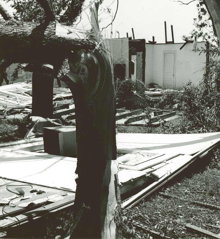
Tree Damage
|

Roof of Weather Service Office Centreville
|
|

Weather Service Office Damage
|

Debris Lofted into the Trees
|
|

Weather Service Office Damage
|
Weather Service Office Damage
|
|
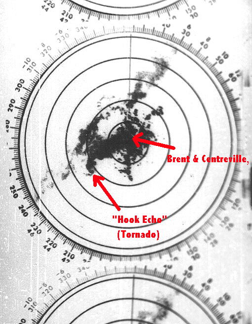
Radar Signature of Tornadic Storm
|

Weather Service Office Damage
|
|

Damage
|

Damage
|
|

Damage in Brent. Picture from The Birmingham News
on Sunday, June 3rd, 1973.
|

Damage in Brent. Picture from The Birmingham Post-Herald
on Tuesday, May 29th, 1973.
|
|

Damage in Brent. Picture from The Birmingham News
on Monday, May 28th, 1973.
|
|
|
|

