Walker County Tornado - May 11th, 2008
|
Rating:
(Click for EF Scale) |
EF-0 in Walker
|
|
Estimated Maximum Wind:
|
80 mph in Walker
|
|
Injuries/Fatalities:
|
None
|
|
Damage Path Length:
|
2.5 miles
|
|
Maximum Path Width:
|
75 yards
|
|
Approximate Start Point:
|
33.8750/-87.0631
at 1237 AM |
|
Approximate End Point:
|
33.8893/-87.0225
at 1241 AM |
|
KML/KMZ File :
|
 |
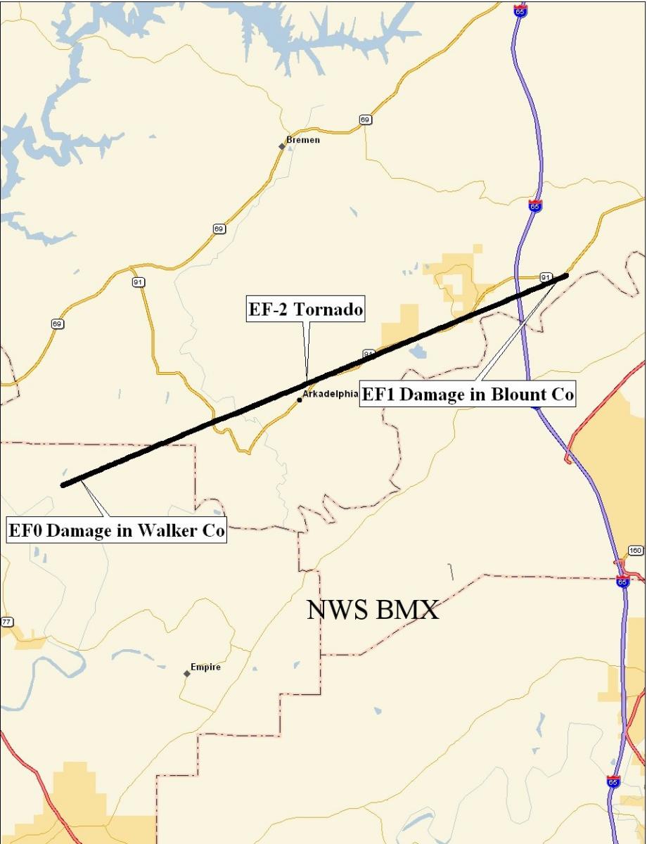
A National Weather Service Storm Assessment Team has determined that the damage in far northeastern Walker County was the result of a tornado. The tornado has been rated an EF2 on the Enhanced Fujita Scale, due to the damage it produced in Cullman County. In Walker County, damage estimates were consistent with winds less than 85 mph which was EF0 damage, but where as high as 120 mph into Cullman County. The tornado damage path in Walker County was 2.5 miles long and was 75 yards wide at its widest point. Additonal damage from the tornado occurred in Blount County. Toward the end of the tornado path, hundreds of trees were blown down and several structures were damage in northwest Blount County. This damage was consistent with winds around 100 mph or EF1.
The tornado touched down east of County Road 77 near the intersection of Gravlee Junction Road and County Road 15. The tornado tracked northeast and entered Cullman County near the intersection of County Road 17 and County Road 19. The tornado appeared to have caused only minor tree damage in Walker County. This storm strengthened and produced significant damage in Cullman County.
|
|
||||||||||||