National Weather Service United States Department of Commerce


Severe Weather & Flooding of May 4, 2021

Overview
 

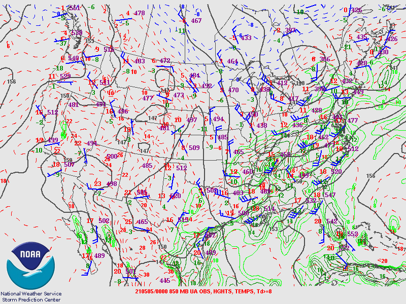
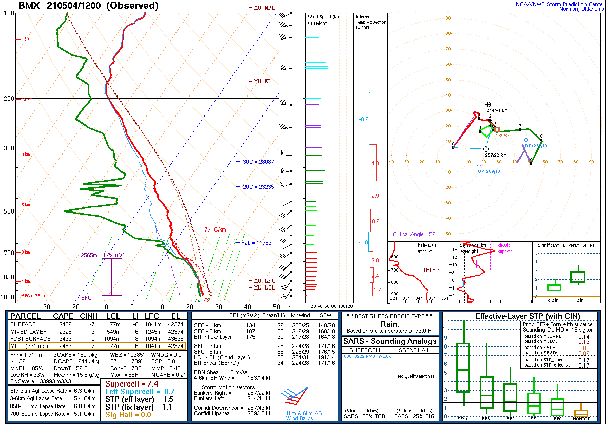
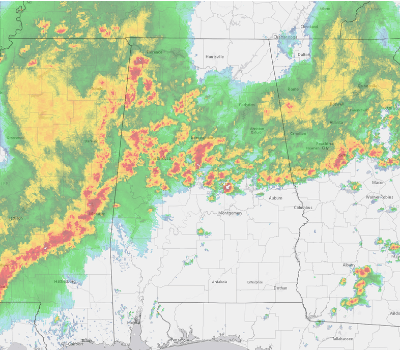
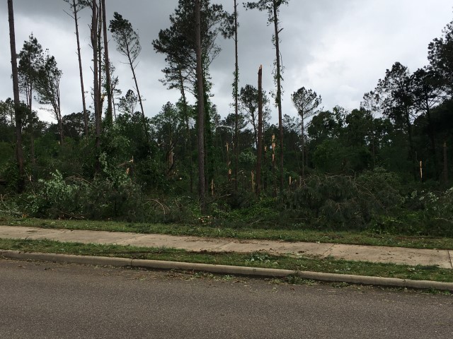
Rain and thunderstorms affected the NWS Birmingham forecast area from morning to evening on Tuesday, May 4th, resulting in significant flooding, widespread straight-line wind damage, and at least 3 low-end tornadoes.

Initially, batches of rain and thunderstorms were most focused near and north of Interstate 20 from morning to early afternoon. As this activity repeatedly moved over the same areas, flooding began to develop. A few storms produced sporadic wind damage. This large area of rain and storms caused an instability gradient to set up across Central Alabama, and a very unstable air mass became established south of Interstate 20. Wind shear values were on the increase, with an upper-level system moving into the region. This set the stage for even more active weather during the hours ahead.

An intense cluster of thunderstorms formed in Mississippi and congealed into a line, which then swept across counties south of Interstate 20 where conditions were most favorable for severe storms. This line produced widespread straight-line winds that took down trees, caused some structural damage, and resulted in lengthy power outages in some communities. The Montgomery Airport recorded a wind gust to 58 mph, with other reports of high winds as well. Curly-Q signatures developed on the front edge of the storms once near and east of Interstate 65, yielding one EF-1 tornado and two EF-0 tornadoes.


Radar Loop

Farther north, steady rain continued to fall with several pockets of embedded heavy storms. This exacerbated the flooding situation as rain totals reached five to seven inches in and surrounding Shelby / Jefferson counties. A rare Flash Flood Emergency was issued to highlight the life-threatening nature of the flooding. Many roads were closed, some structures were flooded, and water rescues were performed.

Calmer weather conditions took hold through the night. Flood water gradually subsided overnight / into Wednesday, May 5th across affected urban, suburban, and rural areas, though runoff pushed some rivers into minor flood stage.

 
Interactive Tornado Map


**The data below are considered PRELIMINARY.**

Location/Clickable Detailed Summary Link
Damage Rating/Estimated Maximum Wind Speeds
Injuries/Fatalities
Damage Path Length/Width
Starting Point/Time
Ending Point/Time
Hwy 183 Tornado
(Perry/Chilton Counties)
EF-0
80 mph
None 25.11 miles
620 yards
4 N Sprott
32.7381/-87.2159
5:19 pm CDT
4 N Pletcher
32.7651/-86.7926
5:44 pm CDT
Prattville-Millbrook Tornado
(Autauga/Elmore/Montgomery Counties)
EF-1
100 mph

 
None 10.73 miles
330 yards
1 NNE Prattville
32.4707/-86.4421
6:17 pm CDT
1 NNE Montgomery Zoo
32.4263/-86.2686
6:28 pm CDT
Chubahatchee Tornado
(Macon County)
EF-0
80 mph

 
None 2.17 miles
50 yards
2 SSW Shorter
32.3667/-85.9491
6:46 pm CDT
2 SSE Hayden
32.3525/-85.9159
6:49 pm CDT
 
Hwy 183 EF-0
 

Hwy 183 EF-0 Tornado (Perry/Chilton Counties)
  May 4, 2021


Event Summary

EF-0
Estimated Maximum Wind:
80 mph
Injuries/Fatalities:
None
Damage Path Length:
25.11 miles
Maximum Path Width:
620 yards
Approximate Start Point/Time:
4 N Sprott
32.7381/-87.2159
at 5:19 pm CDT
Approximate End Point/Time:
4 N Plecher
32.7651/-86.7926
at 5:44 pm CDT


National Weather Service meteorologists surveyed the damage in northeastern Perry County into western Chilton County and determined it was the result of an EF-0 tornado.

Amongst common occurrences of straight-line wind damage associated with a line of severe thunderstorms, an EF-0 tornado track was confirmed from northeast Perry County to southwest Chilton County. The tornado began along J Mitchell Road and moved east-northeastward before taking a right-hand jog and ending just south of Maplesville. Damage primarily consisted of snapped and uprooted trees, with a few TDS signatures noted along its path. 


Radar Image
Reflectivity (left) and velocity (right) of the circulation before the tornado moved into Maplesville.
Images are from KBMX at 5:36 pm CDT.


Prattville-Millbrook EF-1
 

Prattville-Millbrook EF-1 Tornado (Autauga/Elmore/Montgomery Counties)
  May 4, 2021


Event Summary

EF-1
Estimated Maximum Wind:
100 mph
Injuries/Fatalities:
None
Damage Path Length:
10.73 miles
Maximum Path Width:
330 yards
Approximate Start Point/Time:
1 NNE Prattville
32.4707/-86.4421
at 6:17 pm CDT
Approximate End Point/Time:
1 NNE Montgomery Zoo
32.4263/-86.2686
at 6:28 pm CDT


National Weather Service meteorologists surveyed the damage from near Prattville east-southeastward into northern Montgomery County and determined it was the result of an EF-1 tornado.

Wind damage was prevalent along a line of storms that moved through Autauga and Elmore counties, making it hard to distinguish between straight-line wind damage and tornadic damage; however, a corridor of enhanced damage, co-located with a rotational radar signature, was apparent along a path from Prattville to Millbrook. This was associated with an EF-1 tornado. Structural damage caused directly by wind consisted of some shingle loss, including: many residences, the Bass Pro Shop on the west side of I-65, and several hotels on the east side of I-65 at exit 179. A Chevron also had many metal panels blown from the gas pump canopy. Some homes were very heavily damaged by large, fallen trees. There were a few locations where the number / density of snapped hardwood and softwood trees increased, which pushed the rating to EF-1. Uprooted trees were plentiful as well.

The tornado began in a large residential area between Cobbs Ford Road and Alabama State Route 14 / Fairview Avenue. The tornado was at peak intensity along a short segment from S Old Farm Lane on the west side of I-65 to near the intersection of S Cobb Loop Road and Cobb Ford Road on the east side of I-65. The tornado continued southeastward, causing additional timber damage and sporadic minor structural damage before dissipating near the intersection of Alabama River Parkway and Highway 152 on the north side of Montgomery.


Radar Image
Reflectivity (left) and velocity (right) of the circulation just as the tornado crossed I-65.
Images are from KMXX at 6:21 pm CDT.


Damage Photo
 Tree Damage
Damage Photo
 Gas Station Damaged
 
Chubahatchee Creek EF-0
 

Chubahatchee Creek EF-0 Tornado (Macon County)
  May 4, 2021


Event Summary

EF-0
Estimated Maximum Wind:
80 mph
Injuries/Fatalities:
None
Damage Path Length:
2.17 miles
Maximum Path Width:
50 yards
Approximate Start Point/Time:
2 SSW Shorter
32.3667/-85.9491
at 6:46 pm CDT
Approximate End Point/Time:
2 NW Cross Keys
32.3525/-85.9159
at 6:49 pm CDT


National Weather Service meteorologists surveyed the damage in Macon County and determined it was the result of an EF-0 tornado.

An EF-0 tornado path was apparent along Crosskeys Road at Chubahatchee Creek where multiple softwood trees were uprooted. Most of the path was in an inaccessible wooded area to the northwest of the road, where a small, faint TDS is apparent on radar. In all, radar evidence suggests the tornado was brief in duration. 


Radar Image
Reflectivity (left) and velocity (right) of the brief touchdown.
Images are from KMXX at 6:48 pm CDT.


Flooding
 

Flooding Photo
Canterbury United Methodist Church
Mountain Brook, AL
Courtesy Beth Hamer

Flooding Photo
Little Shades Creek at McCallum Park
Vestavia, AL
Courtesy Jerry Griffies

Flooding Photo
Oporto Madrid Blvd
Birmingham, AL
Courtesy ABC3340

Flooding Photo
Rue Maison Rd
Homewood, AL
Courtesy Homewood FD

Flooding Photo
Hwy 119 at Leeds Memorial Park
Leeds, AL
Courtesy Lori Davidson

Flooding Photo
Hwy 31 at Stonehaven Trail
Pelham, AL
Courtesy Pelham FD

Flooding Photo
Homewood, AL
Courtesy Homewood FD

Flooding Photo
County 52 at County Road 33
Pelham, AL
Courtesy Pelham PD

Flooding Photo
Mountain Brook, AL
Courtesy Josh Stone

Flooding Photo
Hwy 31N at Hwy 150
Hoover, AL
Courtesy @torcmatrix

Flooding Photo
County Road 13
Helena, AL Courtesy Nicole Fochtmann

Flooding Photo
Dolly Ridge Rd
Cahaba Heights, AL
Courtesy Nicole Tingle

Flooding Photo
Dickey Springs Road
Bessemer, AL
Courtesy Wayne Campbell (Jeff Co Rd
& Transportation Dept.)

Laurel View Estates
Hoover, AL
Courtesy Natalie Garner

Clairmont Ave
Birmingham, AL
Courtesy Alex Skinner & @mpreaves

Jemison Trail
Mountain Brook, AL
Courtesy Cynthia Gould (ABC3340)

   
Outlooks & Reports
 

Day 3 Outlook
Local Day 3 Outlook
May 2 at 120 pm

Day 2 Outlook
Local Day 2 Outlook
May 3 at 250 pm

Day 1 Outlook
Local Day 1 Outlook
May 4 at 1150 am

Storm Reports
Storm Reports
May 4


Surface Charts
 

Surface Chart
Surface Analysis
May 4 at 7 am

Surface Chart
Surface Analysis
May 4 at 10 am

Surface Chart
Surface Analysis
May 4 at 4 pm

Surface Chart
Surface Analysis
May 4 at 7 pm

Surface Chart
Surface Analysis
May 4 at 10 pm

Surface Chart
Surface Analysis
May 5 at 1 am

Upper Air Charts
 

250 mb
250 mb Analysis
May 4 at 7 am

500 mb
500 mb Analysis
May 4 at 7 am

850 mb
850 mb Analysis
May 4 at 7 am

250 mb
250 mb Analysis
May 4 at 7 pm

500 mb
500 mb Analysis
May 4 at 7 pm

850 mb
850 mb Analysis
May 4 at 7 pm

KBMX Sounding
KBMX Sounding
May 4 at 7 am

KBMX Sounding
KJAN Sounding
May 4 at 7 am