|
Two Tornadoes in West Central Alabama on May 2, 2021
On the afternoon of Sunday May 2, 2021, a shortwave trough moved northeast from the Texas and Louisiana Gulf Coast, generally toward the Tennessee River Valley. This storm system featured an area of showers and thunderstorms that moved northeast across portions of Louisiana, Mississippi, and Alabama. Despite a marginal thermodynamic environment, sufficient low-level and deep-layer wind shear was present across the area. This allowed more robust updrafts to take on rotation and mesocyclones, several of which were able to produce tornadoes. Most tornadoes from this event impacted central and northern Mississippi, although a couple tornadoes hit west-central Alabama.
|
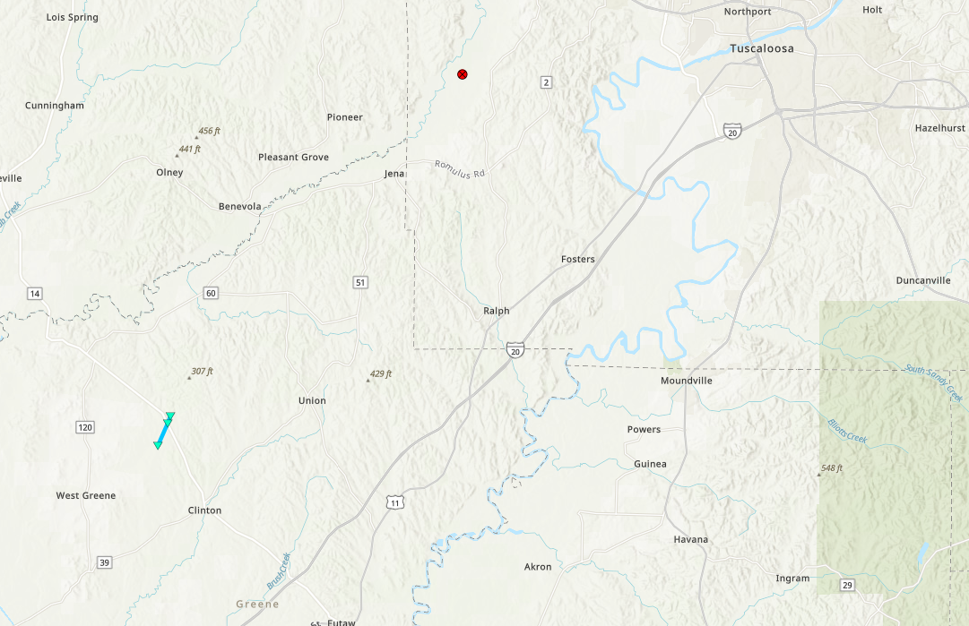
Map of the tornado tracks. |
|
|
|
Tubbs Creek EF-0 Tornado (Greene County)
May 2, 2021
|
Event Summary
|
|
EF-0
|
|
Estimated Maximum Wind:
|
65 mph
|
|
Injuries/Fatalities:
|
None |
|
Damage Path Length:
|
1.42 miles
|
|
Maximum Path Width:
|
45 yards
|
|
Approximate Start Point/Time:
|
3 NW Clinton
32.9550/-88.0286
at 3:45 pm
|
|
Approximate End Point/Time:
|
4 NNW Clinton
32.9739/-88.0187
at 3:50 pm
|
NWS Meteorologists surveyed damage just north of Clinton in Greene County and determined it was the result of an EF-0 tornado.
Damage was only a few uprooted softwood trees and a few large branches broken. This damage was collocated with a tornado debris signature off of KBMX RADAR that afternoon. The majority of the minor timber damage was in an inaccessible area along and near Tubbs Creek.
|
|
![]() |
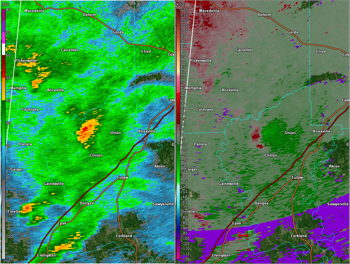
Reflectivity (left) and velocity (right) of the circulation just after the tornado touched down.
Images are from KGWX at 3:45 pm. |
|
|
|
![]() |
|
Sipsey Swamp EF-U Tornado (Tuscaloosa County)
May 2, 2021
|
Event Summary
|
|
EF-U
|
|
Estimated Maximum Wind:
|
Unknown
|
|
Injuries/Fatalities:
|
None |
|
Damage Path Length:
|
0.25 miles
|
|
Maximum Path Width:
|
25 yards
|
|
Approximate Start Point/Time:
|
4 NW Romulus
33.1927/-87.7959
at 5:25 pm
|
|
Approximate End Point/Time:
|
4 NW Romulus
33.1959/-87.7937
at 5:26 pm
|
There are at least three videos indicating a brief and weak tornado occurred near Buhl, AL. One close-range video indicates rising cyclonic motion amidst visible yet wispy vorticity tubes. However, NWS BMX survey personnel could not access or find observable damage given the location it impacted near Sipsey Swamp. General location, time, and estimated path length and width were obtained from video footage and KBMX RADAR data.
|
|
|
![]() |
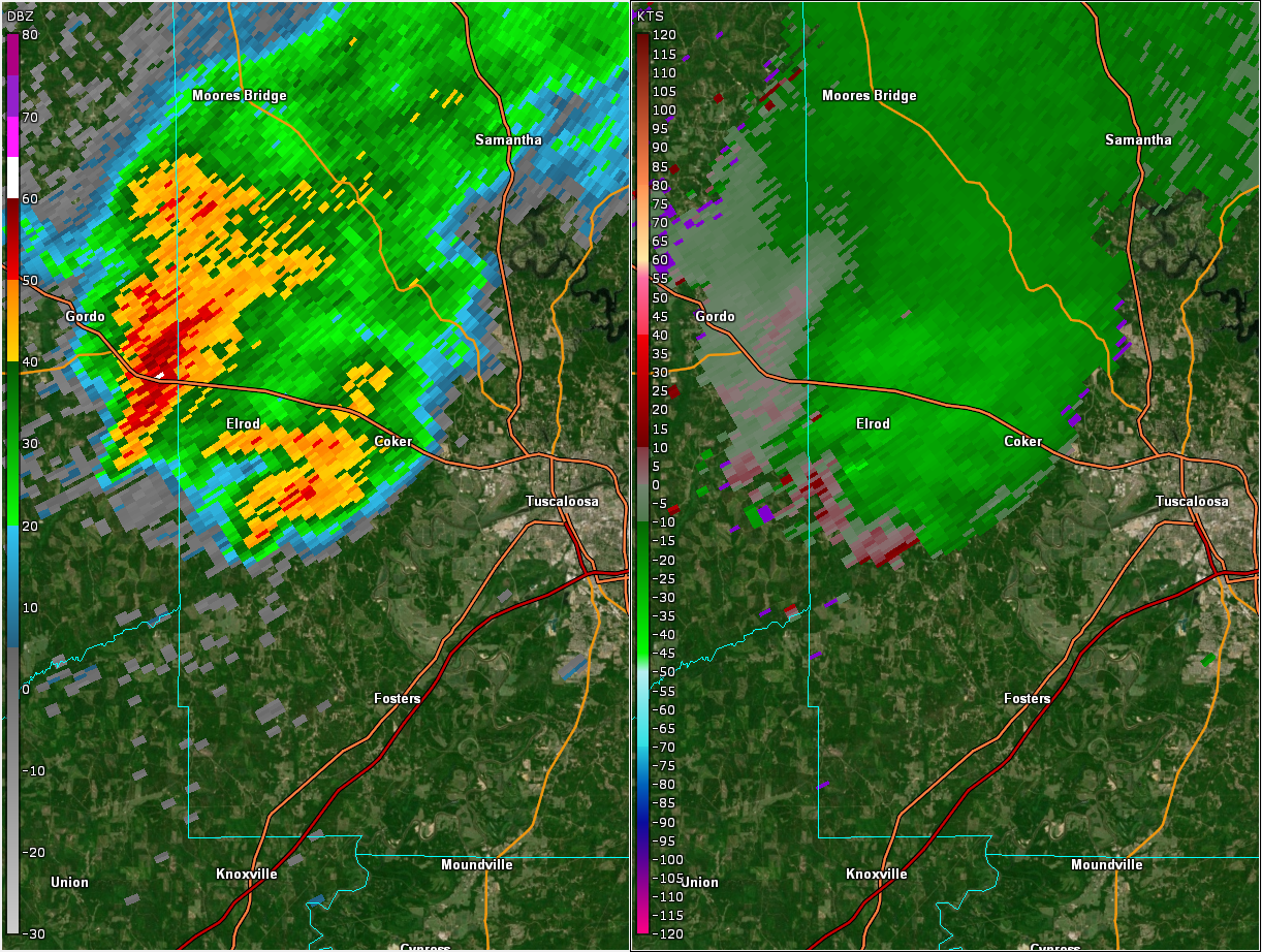
Reflectivity (left) and velocity (right) at the time of the brief tornado.
Images are from KGWX at 5:26 pm. |
|
|
|
![]() |

