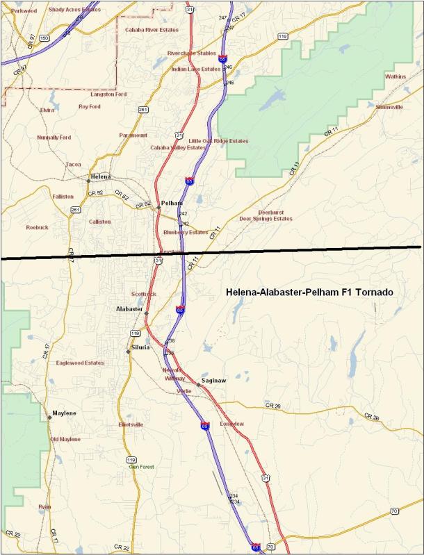
Helena-Alabaster-Pelham F1 Tornado
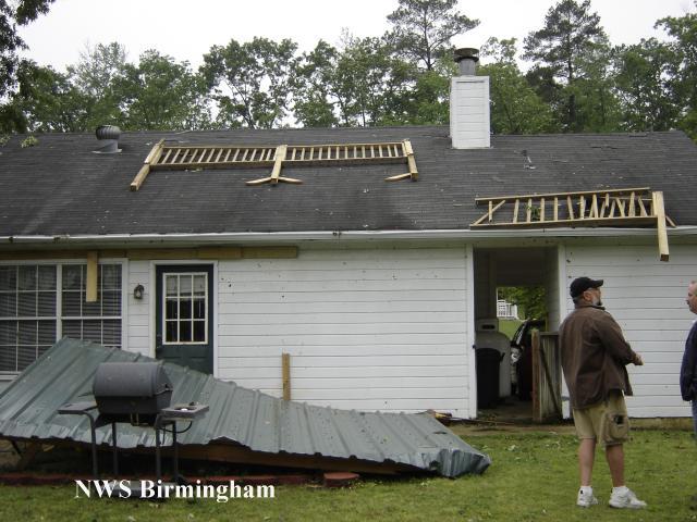
National Weather Service meteorologists surveyed the damage that affected the Helena, Alabaster, Pelham and Chelsea areas early Saturday morning. The tornado has been rated an F1 with winds estimated around 75 miles an hour.
The tornado first touched down just west of County Road 93 near the Cahaba Wildlife Management Area in Helena. The tornado moved generally eastward and crossed County Road 17, County Road 58, US 31, Interstate 65 and County Road 11 before ending near County Road 39. The tornado damage path was approximately 11.4 miles long and 100 yards wide at its widest point. The tornado was on the ground from approximately 504 AM CDT to 518 AM CDT.
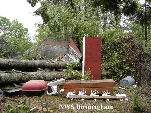
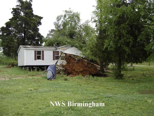
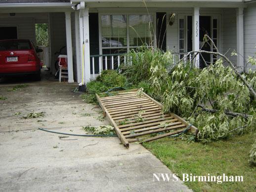
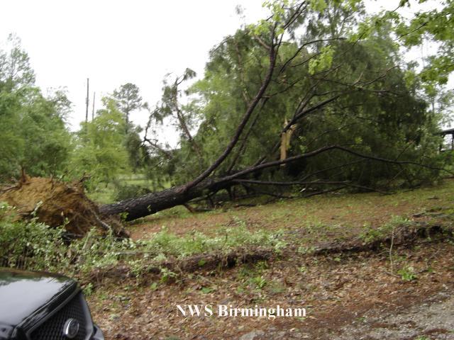
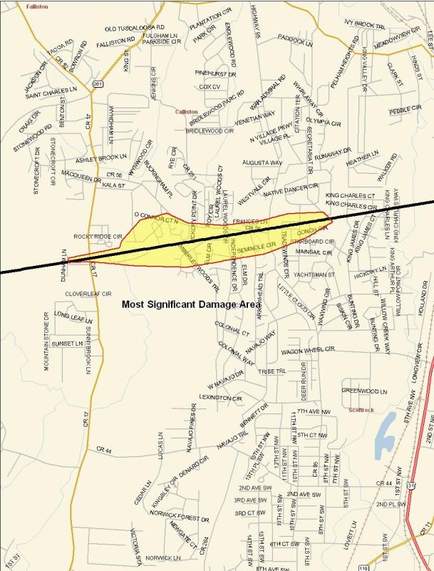
The initial damage was minor with only a few trees uprooted or snapped off west of County Road 17 in Helena. As the tornado crossed County Road 17, it intensified and caused its most significant damage. The most concentrated and significant damage occurred near Scurlock Road and County Road 17 then eastward along County Road 58 to just past County Road 95. Several subdivisions were affected including Braelinn Village, Amberley Woods, Navajo Hills and Port South. Numerous homes suffered shingle and minor roof damage along with a few broken windows. Many trees and power lines were either blown down or snapped off. Power was unavailable for several hours due to downed power poles. A few homes suffered major damage due to fallen trees. Several automobiles and outbuildings were destroyed. A municipal park in Helena sustained minor damage. As the tornado crossed US 31 near Walmart, several large trees and signs were blown down or snapped off. A few homes just east of US 31 were damaged from fallen trees. For the remainder of the tornadoes path, the damage was relatively minor and mainly affected trees. The tornado crossed the Weatherly subdivision and the Ballantrae Golf Course and subdivision before ending just east of County Road 39 near Hidden Ridge.
Watches/Warnings:
Tornado Watch number 215 was in effect from 500 AM until 1200 PM CDT.
A Severe Thunderstorm Warning was in effect from 450 AM until 545 AM.