NWS Birmingham, Alabama
Weather Forecast Office
Bullock County F0 & Wind Damage
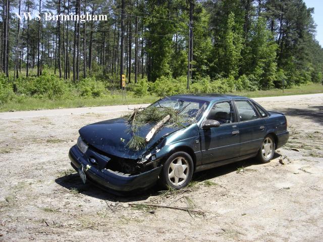
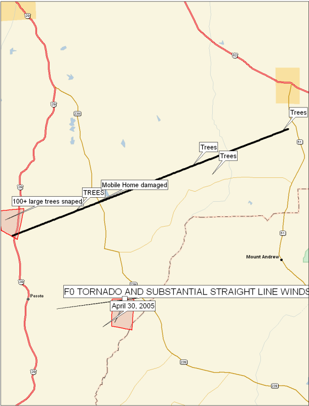
National Weather Service meteorologists surveyed the damage along Highway 14 between Blues Old Stand and areas just south of Midway. It has been determined that the damage was caused by a tornado. The tornado has been rated an F0 with winds estimated around 70 miles an hour.
The tornado touched down near Blues Old Stand around 754 AM CDT. The tornado traveled northeast for approximately 11.5 miles before lifting about one mile south of Midway around 810 AM CDT.
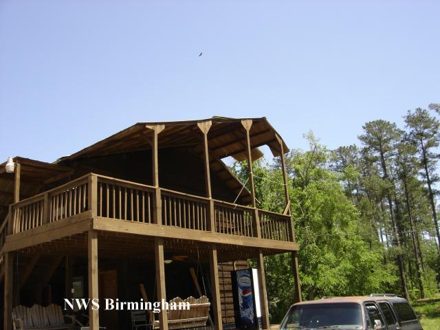
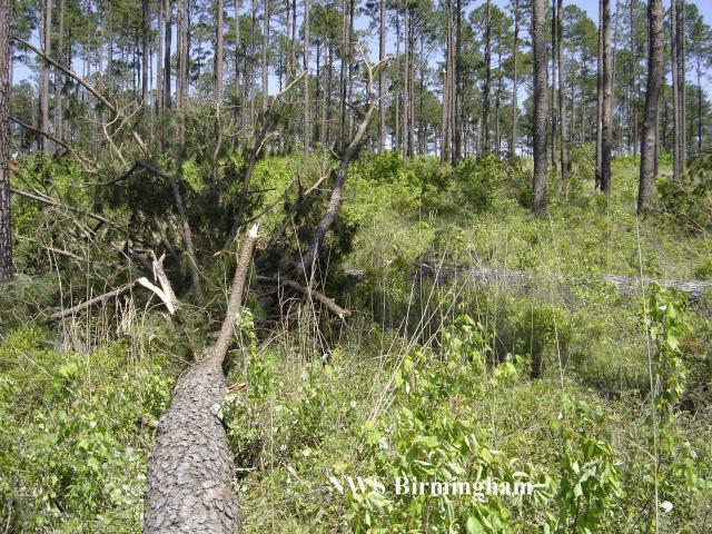
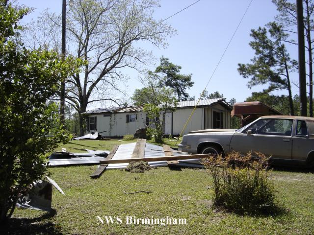
Numerous trees were snapped off and uprooted along the tornado path. One commercial hunting lodge was damaged and one mobile home sustained roof damage.
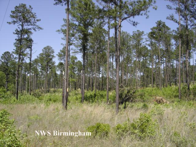
Near the beginning of the tornado path, a large swath of straight lines winds were identified. One hundred or more large pine trees were snapped off 15 to 25 feet above the ground. The area of considerable tree damage was approximately two square miles. Several other trees were blown down across the county as the line of thunderstorms moved through.
Watches/Warnings:
Tornado Watch number 215 was in effect from 500 AM until 1200 PM CDT.
A Severe Thunderstorm Warning was in effect from 730 AM until 815 AM.
Current Hazards
National Outlooks
Tropical
Local Storm Reports
Public Information Statement
Graphical Hazardous Weather Outlook
Current Conditions
Regional Weather Roundup
Rivers and Lakes
Drought Monitor
Forecasts
Forecast Discussion
Air Quality
Fire Weather
Aviation Weather
Graphical Forecasts
Climate and Past Weather
Past Events
Storm Data
Tornado Database
Daily Rainfall Plots
Tropical Cyclone Reports
Warnings and Other Products
Tornado Warnings
Severe Thunderstorm Warnings
Flash Flood Warnings
Winter Weather Warnings
Special Weather Statements
Non-Precipitation Warnings
Flood/River Flood Warnings
Productos en Español
Conciencia y Preparación
Previsión de 7 Días
Weather Safety
NOAA Weather Radio
Severe Weather Preparedness
Severe Safety Rules
Tornado Safety Rules
Severe Safety w/ ASL
Awareness Weeks
Severe Weather
Hurricane Preparedness
Summer Safety Campaign
Winter Weather
US Dept of Commerce
National Oceanic and Atmospheric Administration
National Weather Service
NWS Birmingham, Alabama
465 Weathervane Road
Calera, AL 35040
205-664-3010
Comments? Questions? Please Contact Us.