|
Event Summary
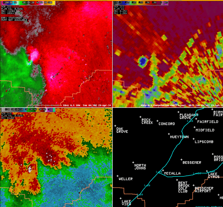
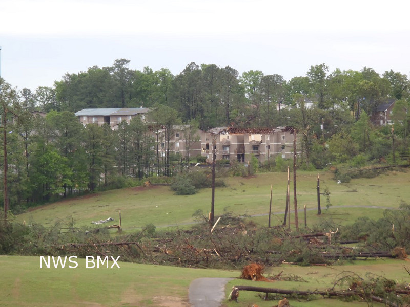
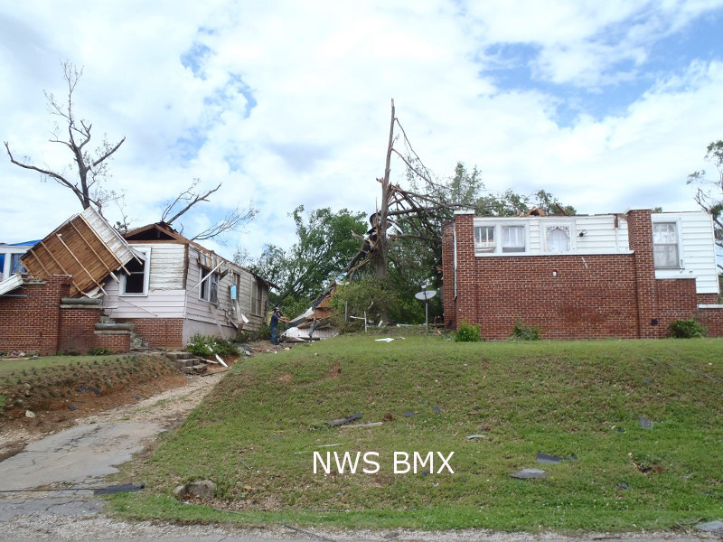
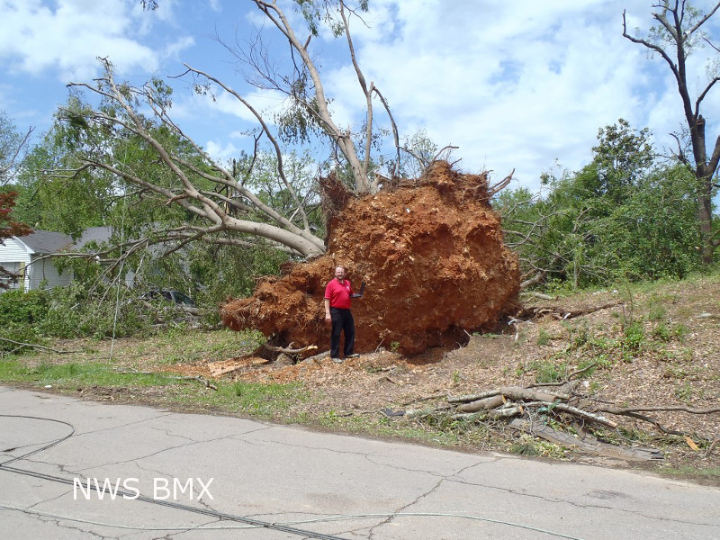
National Weather Service meteorologists surveyed damage in Bessemer and have determined that the damage is consistent with an EF-2 tornado. Maximum winds were estimated to be 120 mph.
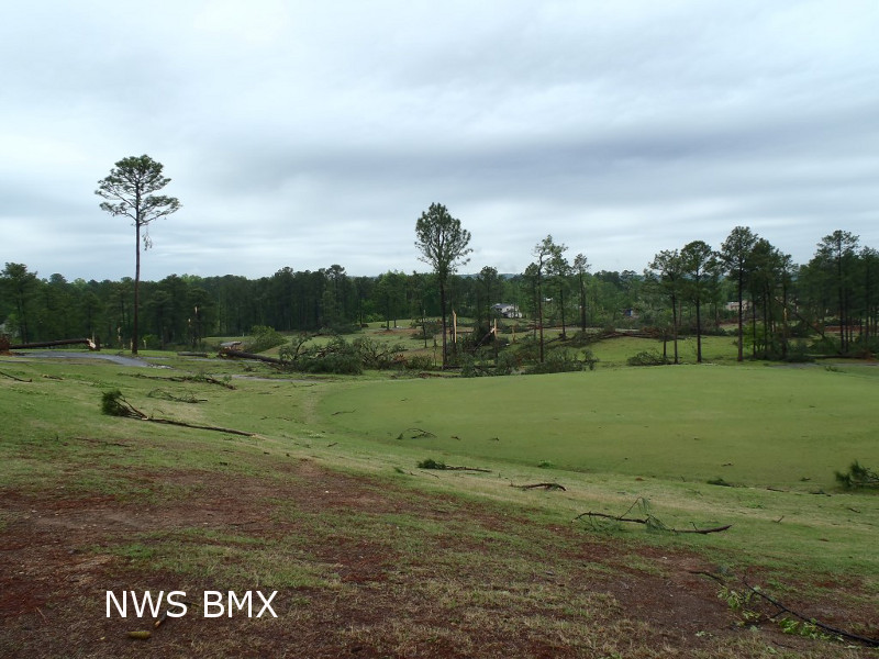
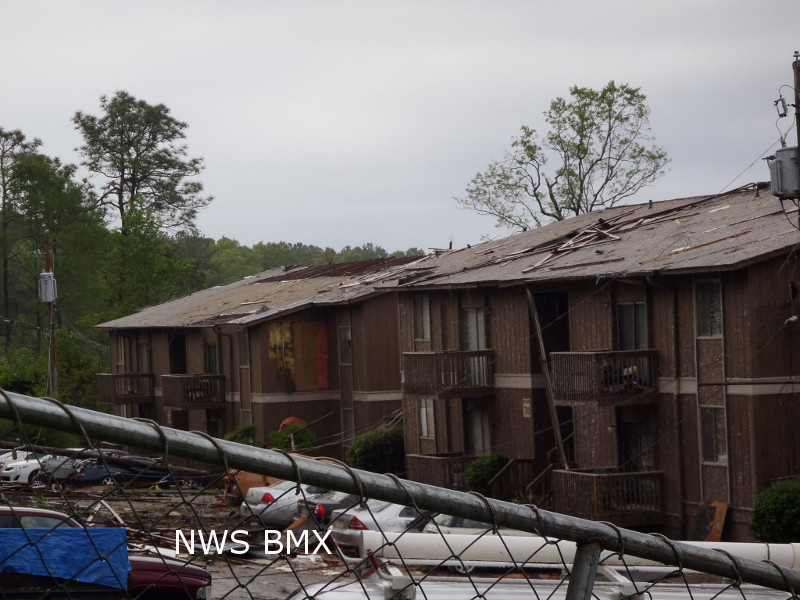
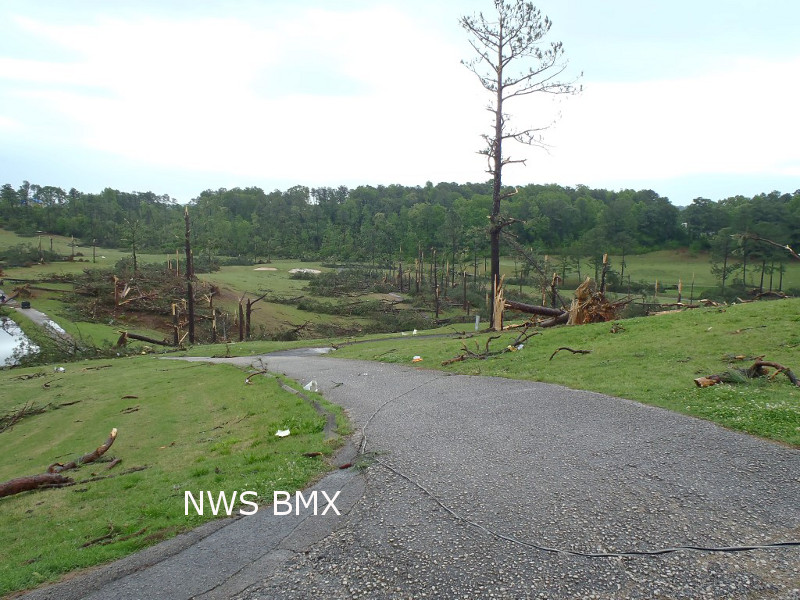
The tornado touched down near Academy Drive. It then traveled to the northeast, snapping and uprooting dozens of trees along its path. In addition, dozens of homes had trees down on them just to the northeast of Academy Drive. The tornado intensified as it neared the Frank House Municipal Golf Course where the clubhouse was destroyed. The tornado continued on its northeast path, snapping and uprooting hundreds of trees. Several homes and an apartment complex experienced minor roof damage near Memorial Drive. The tornado continued to the northeast as it paralleled 4th Avenue North. Hundreds of trees were uprooted before it lifted near the intersection of Dartmouth Avenue and 32nd Street South. More details may be added later.
|