|

300 mb Analysis
Apr 27 at 7 am
|

500 mb Analysis
Apr 27 at 7 am
|

850 mb Analysis
Apr 27 at 7 am
|
|

300 mb Analysis
Apr 27 at 7 pm
|

500 mb Analysis
Apr 27 at 7 pm
|

850 mb Analysis
Apr 27 at 7 pm
|
|

Surface Analysis
Apr 27 at 7 am
|

Surface Analysis
Apr 27 at 1 pm
|

Surface Analysis
Apr 27 at 7 pm
|
|

Day 3 Outlook
Issued Apr 25 at 230 am
|

Day 2 Outlook
Issued Apr 26 at 1 am
|
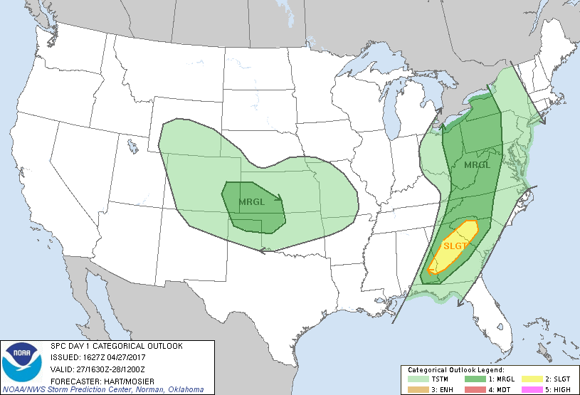
Day 1 Outlook
Issued Apr 27 at 1130 am
|
|

Day 3 Tornado Probabilities
Issued Apr 27 at 1130 am
|

Day 1 Wind Probabilities
Issued Apr 27 at 1130 am
|

Day 1 Hail Probabilities
Issued Apr 27 at 1130 am
|
|
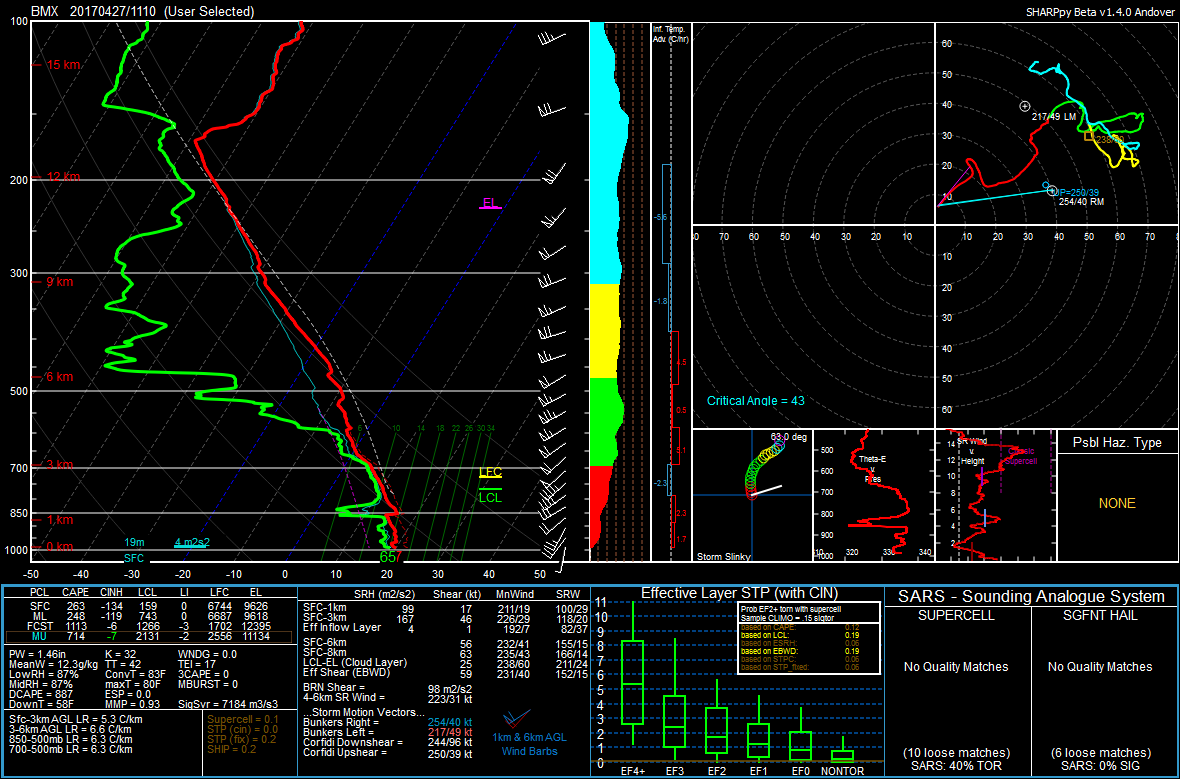
KBMX Sounding
Apr 27 at 7 am
|

KBMX Sounding
Apr 27 at 7 pm
|

Storm Reports
Apr 27
|

