|
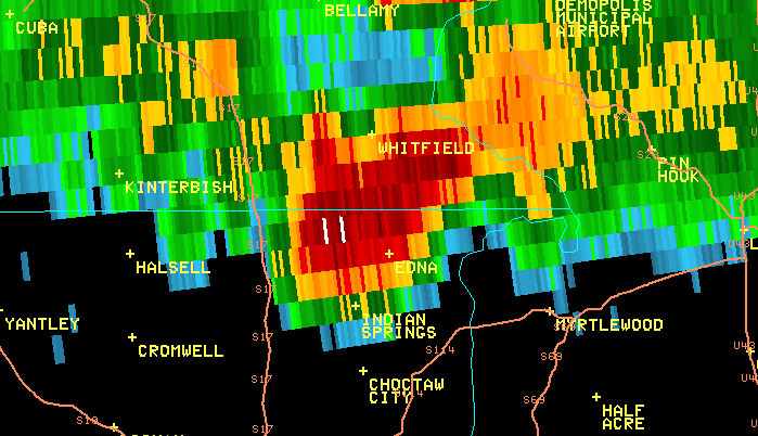
National Weather Service meteorologists surveyed damage from the supercell thunderstorm that moved out of Clarke County Mississippi into west central Alabama during the evening hours of April 27. The NWS survey team found the damage to be continuous from extreme southeast Sumter County across central and northeast Marengo County into extreme southwest Perry County. The tornado moved out of northern Choctaw County just north of Oakchia, then it crossed extreme southeast Sumter County south of County Road 42 and Lock 3 Road. The tornado was an EF-2 tornado at this point, where it uprooted and snapped trees in a 350 yard wide path. The tornado moved into western Marengo County where it crossed the southernmost portion of Old Locke 3 Road then passed just north of Linden near Pin Hook and north of Chickasaw State Park along U.S. Highway 43. The EF-2 tornado continued northeast through the Faunsdale area where it significantly damaged or destroyed several homes and resulted in at least 3 injuries along Nash Road just south of Faunsdale. The tornado continued northeast and passed just north of Uniontown where it crossed Highways 61 and 183. Here, it uprooted trees and damaged structures in a 200 yard wide path. The tornado eventually dissipated just east of Highway 183 in southwest Perry County.
Since the tornado it started in Smith County, Mississippi as an EF-3, the total length of this storm path was 122.04 miles. As it moved into Jasper and Clarke Counties, it intensified into an EF-4, with a width of 1050 yards at its widest point. It weakened slightly as it moved into Choctaw County in Alabama with EF-3 intensity. In all, this storm killed 7 people and injured another 17.
Tornado Warnings for Sumter, Marengo and Perry Counties were in effect from 728 pm until 915 pm.
|