|
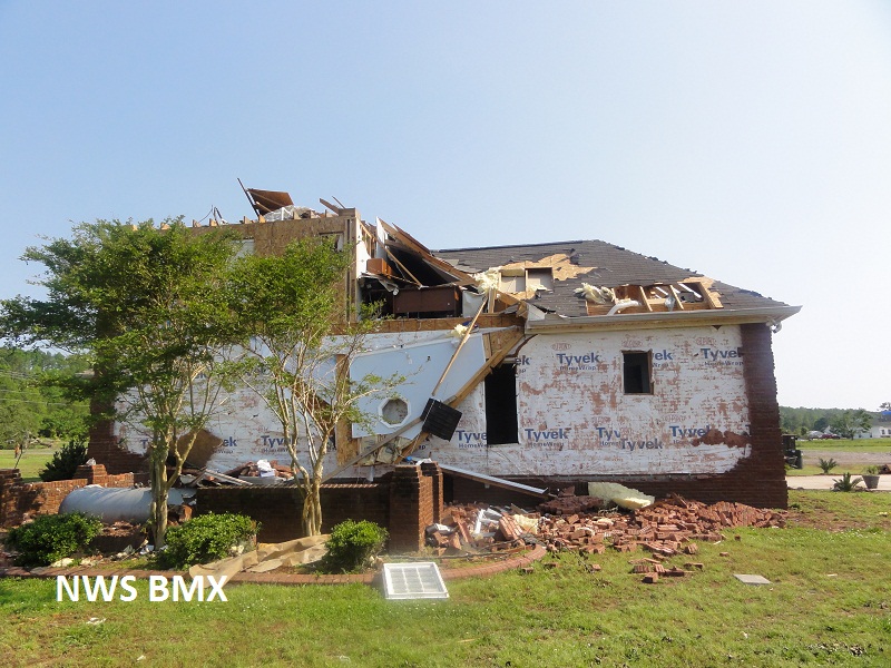
National Weather Service meteorologists surveyed damage across central St. Clair County. Although much of the damage across St. Clair County Wednesday morning was attributed to straight line winds, it has been determined that in a small area near Odenville the damage was consistent with a tornado. Winds were estimated at 120 mph. A tornado developed along a Quasi-Linear Convective System. It touched down in central St Clair County, near Odenville. The tornado touched down in a field southwest of the intersection of AL Hwy 174 and Blair Farms Rd. As it moved northeast, it quickly strengthened to an EF2 rating with winds of 120 mph and caused significant damage to two multi-story brick homes, along AL Hwy 174. One house lost a large portion of its roof deck material. The well built detached garage of the other house was shifted off its foundation. The intact roof landed and squashed the remaining structure. The tornado continued northeast and tracked parallel to US Hwy 411, before it lifted near the intersection of Pleasant Valley Road and Cedar Ln, where a few trees were blown down.
|