|
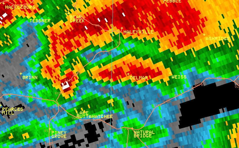
National Weather Service meteorologists surveyed damage across Marion and Winston Counties which impacted the Pea Ridge, Whitehouse, Thornhill, and Haleyville areas. It has been determined that the damage was consistent with a strong tornado with winds estimated to be around 150 mph.
The tornado appeared to touchdown south of Hamilton near Highway 278, County Road 2, and Philadelphia Road where tree damage was noted. The tornado tracked northeastward and strengthened near the Pea Ridge and Whitehouse communities. Along County Road 45, west of AL Route 253, at least two mobile homes were completely destroyed and six well built homes sustained major damage or were completely destroyed. As the tornado approached US Hwy 278 near Whitehouse, several outbuildings were destroyed and a well built home was destroyed with the foundation swept clean. Several injuries were noted in this area. The tornado continued northeastward and caused mostly tree damage as it neared the Winston County line.
In Winston County, the tornado produced significant damage to the Thornhill community and southern and eastern parts of Haleyville. The Winston Furniture Company and Fontaine Trailer Company suffered extensive damage. Many homes were significantly damaged and a couple of homes were destroyed. The tornado continued to produce tree damage as it entered the Bankhead National Forest area in northern Winston County.
Tornado Warnings were in effect for Marion and Winston Counties from 444 pm until 615 pm.
|