National Weather Service United States Department of Commerce

Paul M. Grist State Park (Dallas County) EF-1 Tornado
April 15, 2011


EF-1
Estimated Maximum Wind:
90 mph
Injuries/Fatalities:
None
Damage Path Length:
0.1 miles
Maximum Path Width:
75 yards
Approximate Start Point/Time:
6.0 NNE Summerfield
32.6004/-87.0091  705 pm
Approximate End Point/Time:
6.1 NNE Summerfield
32.6013/-87.0079  707 pm

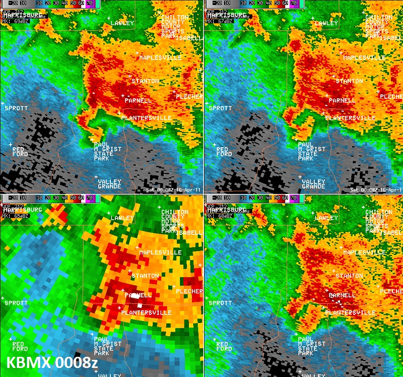
National Weather Service meteorologists surveyed the damage west of the Paul M Grist State Park. It has been determined that the damage was consistent with a tornado. Winds were estimated around 90 mph. The tornado briefly touchdown along County Road 272 where it uprooted several hardwood and softwood trees. The fallen trees caused significant damage to one mobile home. The damage path was 0.1 miles long and 75 yards wide at its widest point.

A Tornado Warning was in effect from 611 pm until 715 pm. 


Reflectivity Image near Paul M Grist State Park.


Storm Relative Velocity Image near Paul M Grist State Park.