|
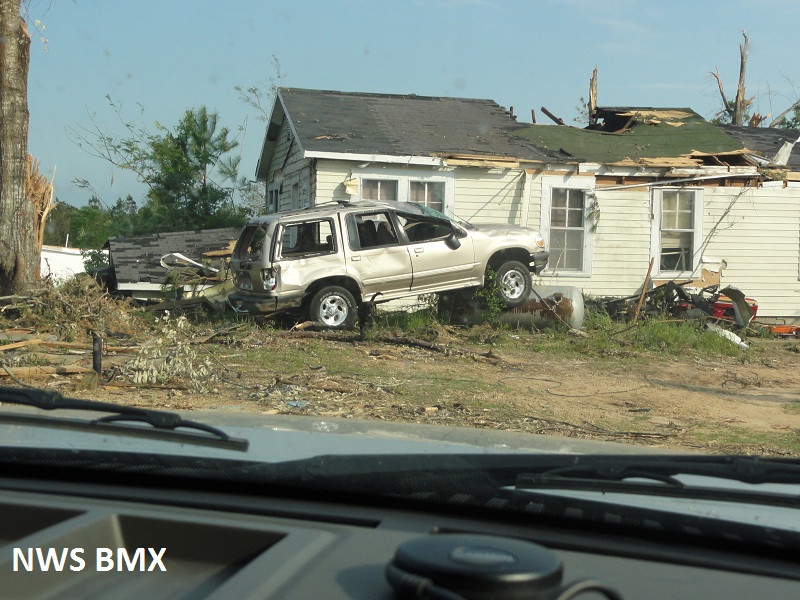
National Weather Service meteorologists surveyed the damage near Nanafalia. It has been determined that the damage was consistent with a tornado. This tornado started in Choctaw County, Alabama. Winds were estimated at 135 mph. Two dozen homes were significantly damaged due to fallen trees and large sections of roofing material were removed by the tornadic winds. The most concentrated damage occurred in Nanafalia, along Alabama Highway 7, north of Sweet Water and in the Octagon/Calvary areas. The tornado touched down southwest of Nanafalia and lifted northeast of County Road 33. The tornado damage path was 21.08 miles long and was 800 yards wide at its widest point.
The touched down in Choctaw County Alabama, therefore the total tornado damage path was 38.31 miles long. The tornado was 800 yards wide in Marengo County. The tornado damage was rated an EF-2 in both Choctaw and Marengo Counties.
A Tornado Warning was in effect from 619 pm until 715 pm.
|