|
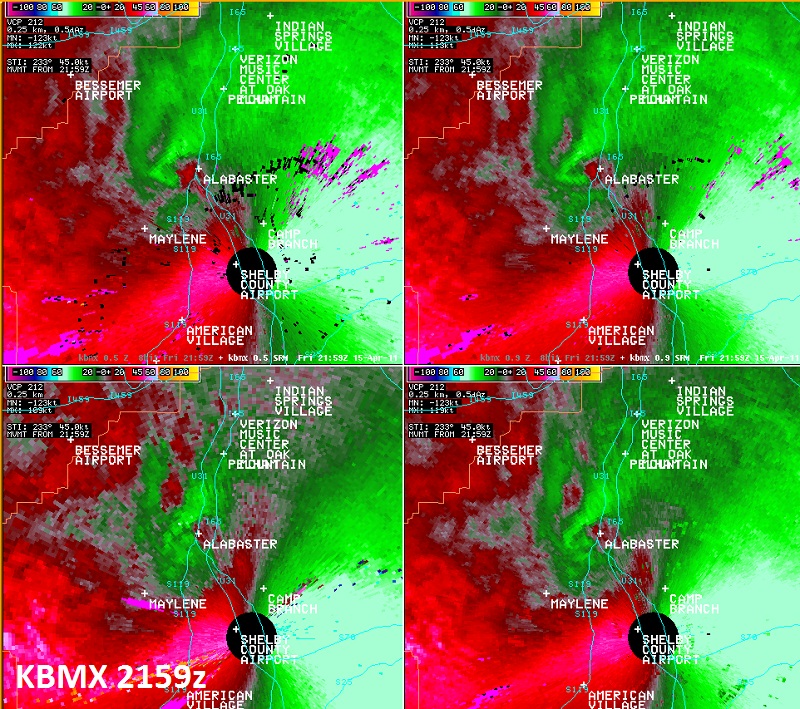
National Weather Service meteorologists surveyed the damage in Alabaster. It has been determined that the damage was consistent with a tornado. Winds were estimated around 70 mph. This tornado was witnessed by several residents including police officers. A weak tornado touched down in Alabaster at the Evangel Church on Thompson Road. The tornado tracked northeastward and lifted near Highway 31 at the Alabaster City Hall. The most concentrated damage occurred along 8th Street SW and 6th Street SW. In this location, several trees were knocked down and several landed on homes. Much of the tornado damage path was much weaker damage and was generally limited to broken tree limbs. The tornado damage path was 1.37 miles long and was 50 yards wide at its widest point.
A Tornado Warning was in effect from 428 pm until 530 pm.
|