|
Event Summary
|
|
EF-1
|
|
Estimated Maximum Wind:
|
100 mph
|
|
Injuries/Fatalities:
|
None |
|
Damage Path Length:
|
2.42 miles
|
|
Maximum Path Width:
|
350 yards
|
|
Approximate Start Point/Time:
|
5 ESE Heiberger
32.7317/-87.2012
at 1014 pm
|
|
Approximate End Point/Time:
|
6 E Heiberger
32.7622/-87.1826
at 1018 pm
|
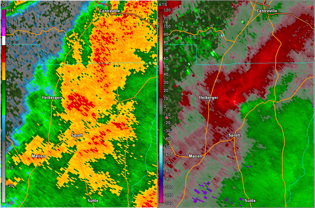
National Weather Service meteorologists surveyed the damage in northern Perry County and determined it was the result of an EF-1 tornado.
A tornado formed along County Road 9 about four miles north of the Sprott community in northern Perry County. The tornado moved northeast and caused extensive tree damage along County Road 2, where the tornado strengthened to a maximum intensity of 100 mph. The Mount Pleasant Freewill Baptist Church had a portion of its roof removed, and the adjacent fellowship hall was destroyed. A short distance to the northeast, the tornado dissipated near Hodgens Road. The tornado damage path was 2.42 miles long and was 350 yards wide at its widest point. The maximum winds were estimated around 100 mph.
|