|
Event Summary
|
|
EF-1
(EF-1 in WFO MOB)
|
|
Estimated Maximum Wind:
|
100 mph
|
|
Injuries/Fatalities:
|
None |
|
Damage Path Length:
|
2.69 miles
|
|
Maximum Path Width:
|
1000 yards
|
|
Approximate Start Point/Time:
|
1 N Vineland
32.0443/-87.6583
at 941 pm
|
|
Approximate End Point/Time:
|
3 NE Vineland
32.0690/-87.6234
at 944 pm
|
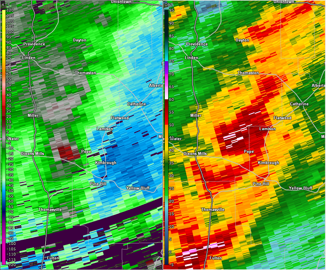
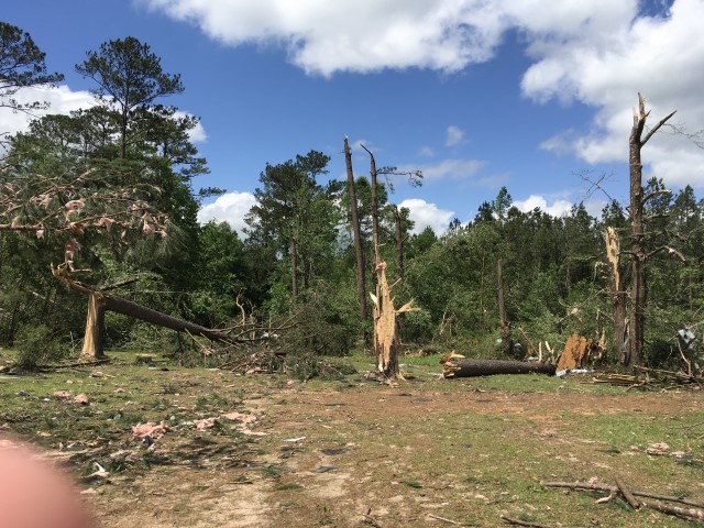
National Weather Service meteorologists surveyed the damage in far southeast Marengo County and determined it was the result of an EF-1 tornado.
A tornado formed along State Route 25 about two miles southwest of the Moores Valley community in extreme southern Marengo County. The tornado moved northeast, causing significant tree damage at Friendship Baptist Church, along County Road 56, County Road 55, and Moores Valley Road. The damage path quickly grew to a width of 1000 yards as it crossed into Wilcox County. Maximum winds were estimated at 100 mph for the Marengo County portion of this track. In Marengo County, the tornado damage path was 2.69 miles long and was 1000 yards wide at its widest point. The maximum winds were estimated around 100 mph.
|