NWS Birmingham, Alabama
Weather Forecast Office
Hoover Tornado - Jefferson County - April 11th, 2008
|
Rating:
(Click for EF Scale) |
EF-0
|
|
Estimated Maximum Wind:
|
75 mph
|
|
Injuries/Fatalities:
|
None
|
|
Damage Path Length:
|
0.2 miles
|
|
Maximum Path Width:
|
30 yards
|
|
Approximate Damage Point:
|
33.3823/-86.7925 at 425 PM
|
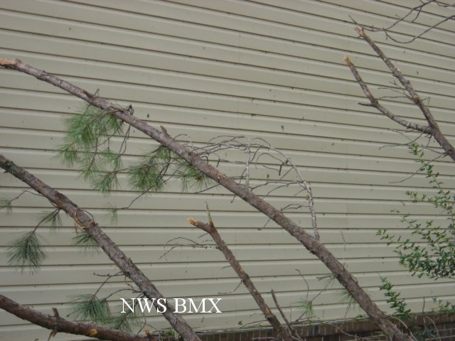
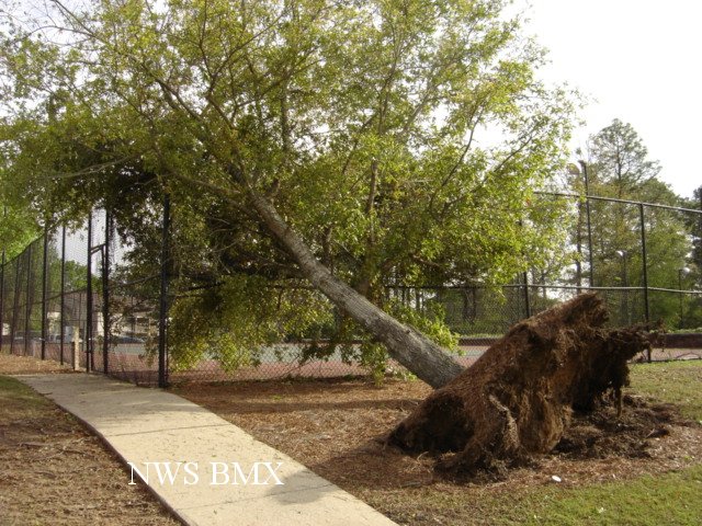
A National Weather Service Damage Assessment Team has surveyed the storm damage in Hoover. It has been determined the damage was the result of a tornado.
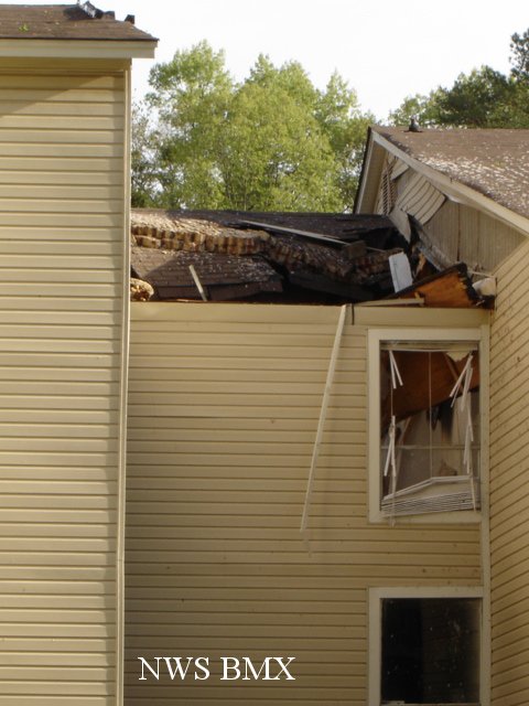
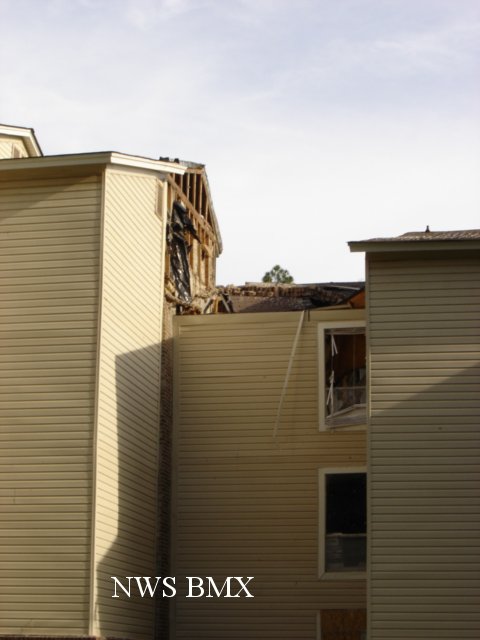
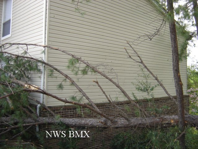
At the Colonial Grand Apartments, mulitple trees were snapped and uprooted. The tornado moved northeast and caused more damage an the Cedar Brook Apartments. Multiple trees were snapped off and major roof damage occurred when a brick fire wall used to separate units collapsed. The path length of the brief tornado was approximately two tens of a mile and was 30 yards wide at its widest point. The tornado has been rated an EF-0 on the Enhanced Fujita Scale as damage was consistent with winds of 75 to 80 mph.
|
|
||||||||||||||||
Current Hazards
National Outlooks
Tropical
Local Storm Reports
Public Information Statement
Graphical Hazardous Weather Outlook
Current Conditions
Regional Weather Roundup
Rivers and Lakes
Drought Monitor
Forecasts
Aviation Weather
Graphical Forecasts
Forecast Discussion
Air Quality
Fire Weather
Climate and Past Weather
Past Events
Storm Data
Tornado Database
Daily Rainfall Plots
Tropical Cyclone Reports
Monthly Climate
Annual Climate
Warnings and Other Products
Tornado Warnings
Severe Thunderstorm Warnings
Flash Flood Warnings
Winter Weather Warnings
Special Weather Statements
Non-Precipitation Warnings
Flood/River Flood Warnings
Productos en Español
Conciencia y Preparación
Previsión de 7 Días
Weather Safety
NOAA Weather Radio
Severe Weather Preparedness
Severe Safety Rules
Tornado Safety Rules
Severe Safety w/ ASL
Awareness Weeks
Severe Weather
Hurricane Preparedness
Summer Safety Campaign
Winter Weather
US Dept of Commerce
National Oceanic and Atmospheric Administration
National Weather Service
NWS Birmingham, Alabama
465 Weathervane Road
Calera, AL 35040
205-664-3010
Comments? Questions? Please Contact Us.