NWS Birmingham, Alabama
Weather Forecast Office
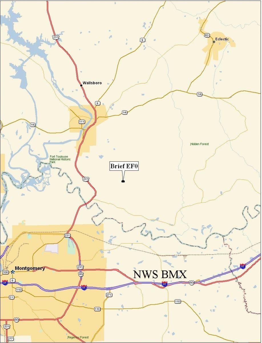
Elmore County Tornado - April 11, 2007
EF-0
National Weather Service meteorologists gathered information along with the Elmore County Emergency Management Agency and have determined a brief tornado occurred in southern Elmore County. The tornado has been rated an EF-0 on the Enhanced Fujita Scale with estimated maximum winds between 70 mph.
A brief tornado touch down occurred about 4.8 miles southeast of Wetumpka. The tornado caused minor damage to at least one home and knocked a few trees over. The damage occurred near Ridgefield Drive near the New Bingham Community. The tornado damage path was less than a tenth of a mile long and 25 yards wide at its widest point. Additional funnel cloud reports were received as the storm moved through southern Elmore County...but no additional damage was discovered. The tornado was on the ground at about 505 PM. A Tornado Watch was in effect for Elmore County from 140 PM until 800 PM. A Tornado Warning was in effect for Elmore County from 427 PM until 600 PM.
Click on the images below for larger picture.
|
|
||||||||||||||
Current Hazards
National Outlooks
Tropical
Local Storm Reports
Public Information Statement
Graphical Hazardous Weather Outlook
Current Conditions
Regional Weather Roundup
Rivers and Lakes
Drought Monitor
Forecasts
Fire Weather
Aviation Weather
Graphical Forecasts
Forecast Discussion
Air Quality
Climate and Past Weather
Past Events
Storm Data
Tornado Database
Daily Rainfall Plots
Tropical Cyclone Reports
Monthly Climate
Annual Climate
Warnings and Other Products
Tornado Warnings
Severe Thunderstorm Warnings
Flash Flood Warnings
Winter Weather Warnings
Special Weather Statements
Non-Precipitation Warnings
Flood/River Flood Warnings
Productos en Español
Conciencia y Preparación
Previsión de 7 Días
Weather Safety
NOAA Weather Radio
Severe Weather Preparedness
Severe Safety Rules
Tornado Safety Rules
Severe Safety w/ ASL
Awareness Weeks
Severe Weather
Hurricane Preparedness
Summer Safety Campaign
Winter Weather
US Dept of Commerce
National Oceanic and Atmospheric Administration
National Weather Service
NWS Birmingham, Alabama
465 Weathervane Road
Calera, AL 35040
205-664-3010
Comments? Questions? Please Contact Us.