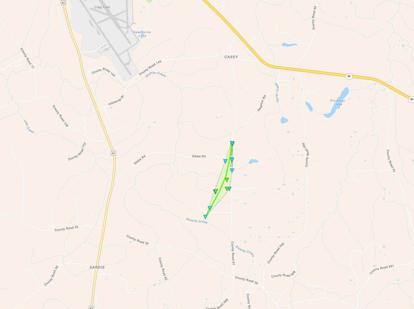
National Weather Service United States Department of Commerce


Two Tornadoes on April 6, 2025

Overview
 

A line of slow-moving thunderstorms affected Central Alabama on Sunday, April 6th 2025. Training thunderstorms resulted in primarily a flash and areal flood event with a few instances of straight-line wind damage. One brief tornado occurred in Dallas County at Sixmile Creek Sunday morning, while a second brief tornado struck Barbour County Sunday night.

 
Interactive Damage Map


**The data below are considered PRELIMINARY.**

Location/Summary
Damage Rating/Estimated Maximum Wind Speeds
Injuries/Fatalities
Damage Path Length/Width
Starting Point/Time
Ending Point/Time
Sixmile Creek Tornado
(Dallas County)
EF-1
95 mph
None 1.32 miles
400 yards
4 SW Tyler
32.2907/-86.9572
10:13 am CDT
3 WSW Tyler
32.3086/-86.9496
10:15 am CDT
Star Hill  Tornado
(Barbour County)
EF-0
60 mph

 
None 0.48 miles
50 yards
2 NNE Boot Hill
31.9009/-85.6234
10:21 pm CDT
2 NNE Boot Hill
31.9076/-85.6216
10:23 pm CDT
 
Sixmile Creek EF-1
 

Sixmile Creek EF-1 Tornado (Dallas County)
  April 6, 2025


Event Summary

EF-1
Estimated Maximum Wind:
95 mph
Injuries/Fatalities:
None
Damage Path Length:
1.32 miles
Maximum Path Width:
400 yards
Approximate Start Point/Time:
4 SW Tyler
32.2907/-86.9572
at 10:13 am CDT
Approximate End Point/Time:
3 WSW Tyler
32.3086/-86.9496
at 10:15 am CDT


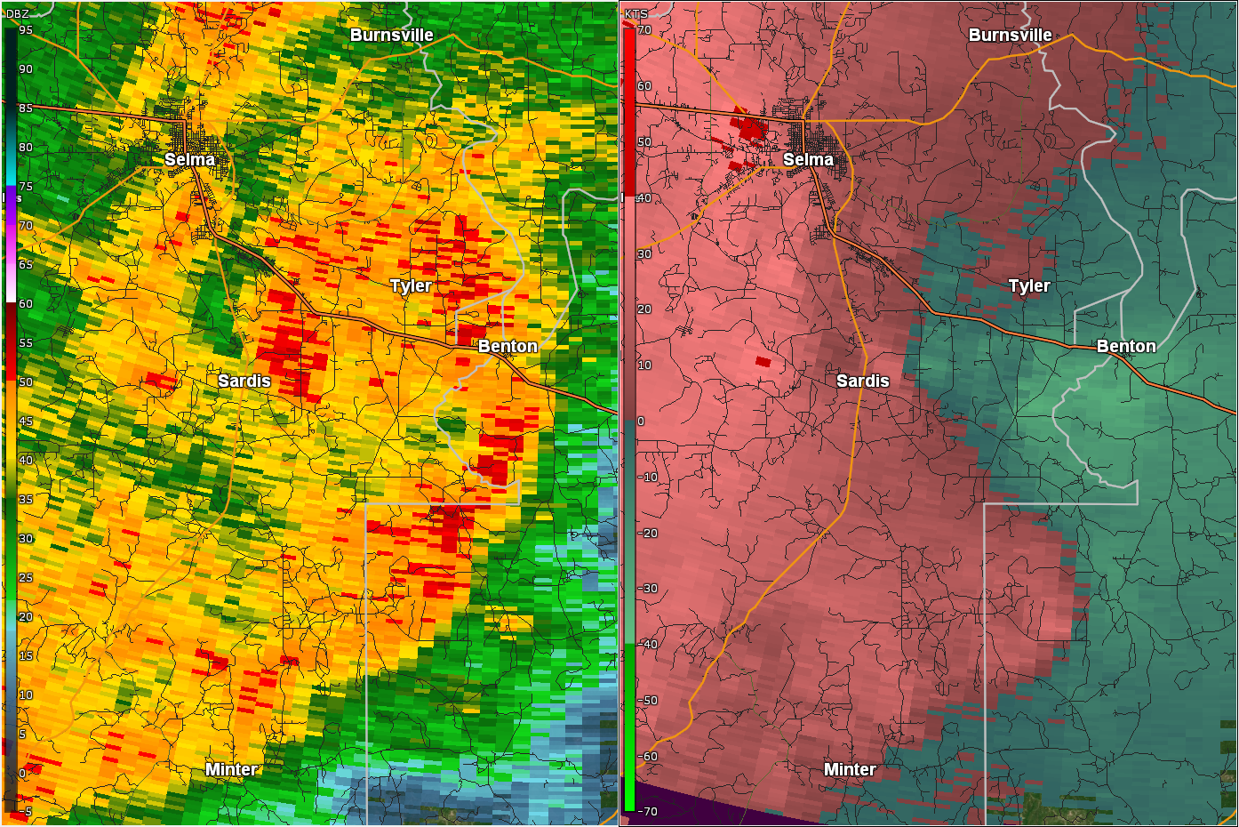
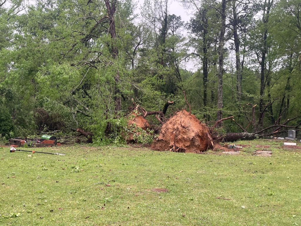
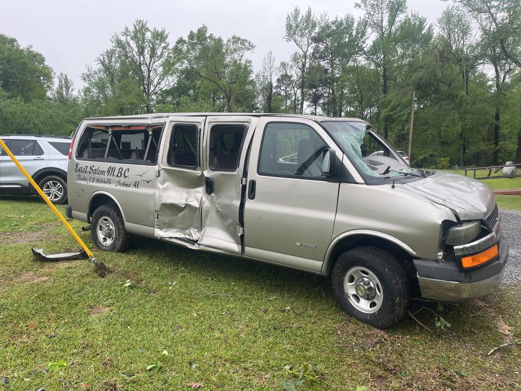
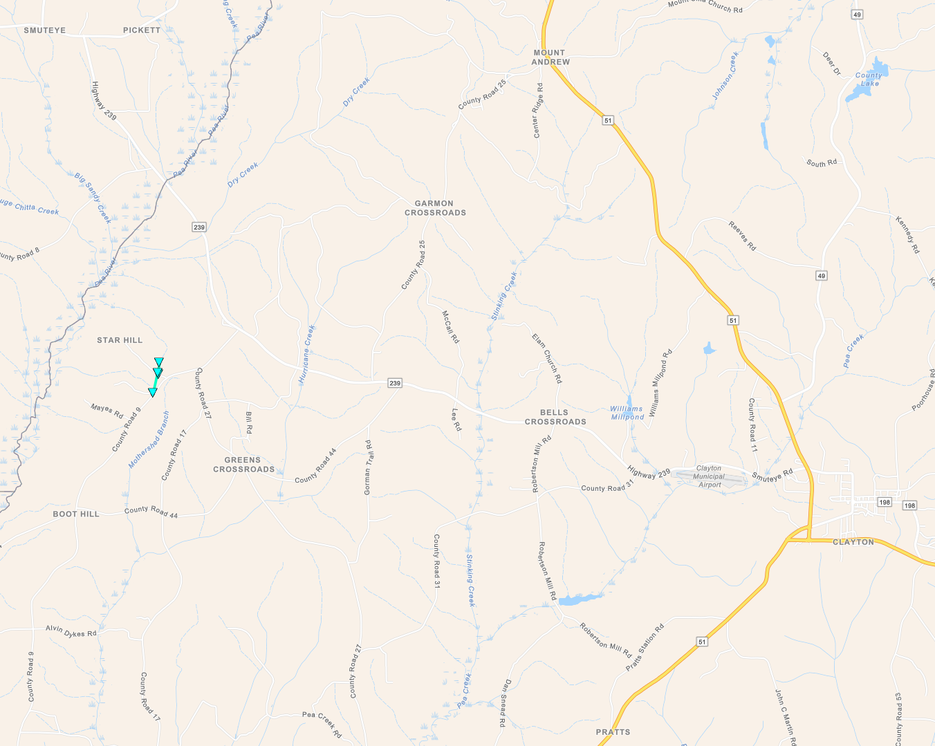
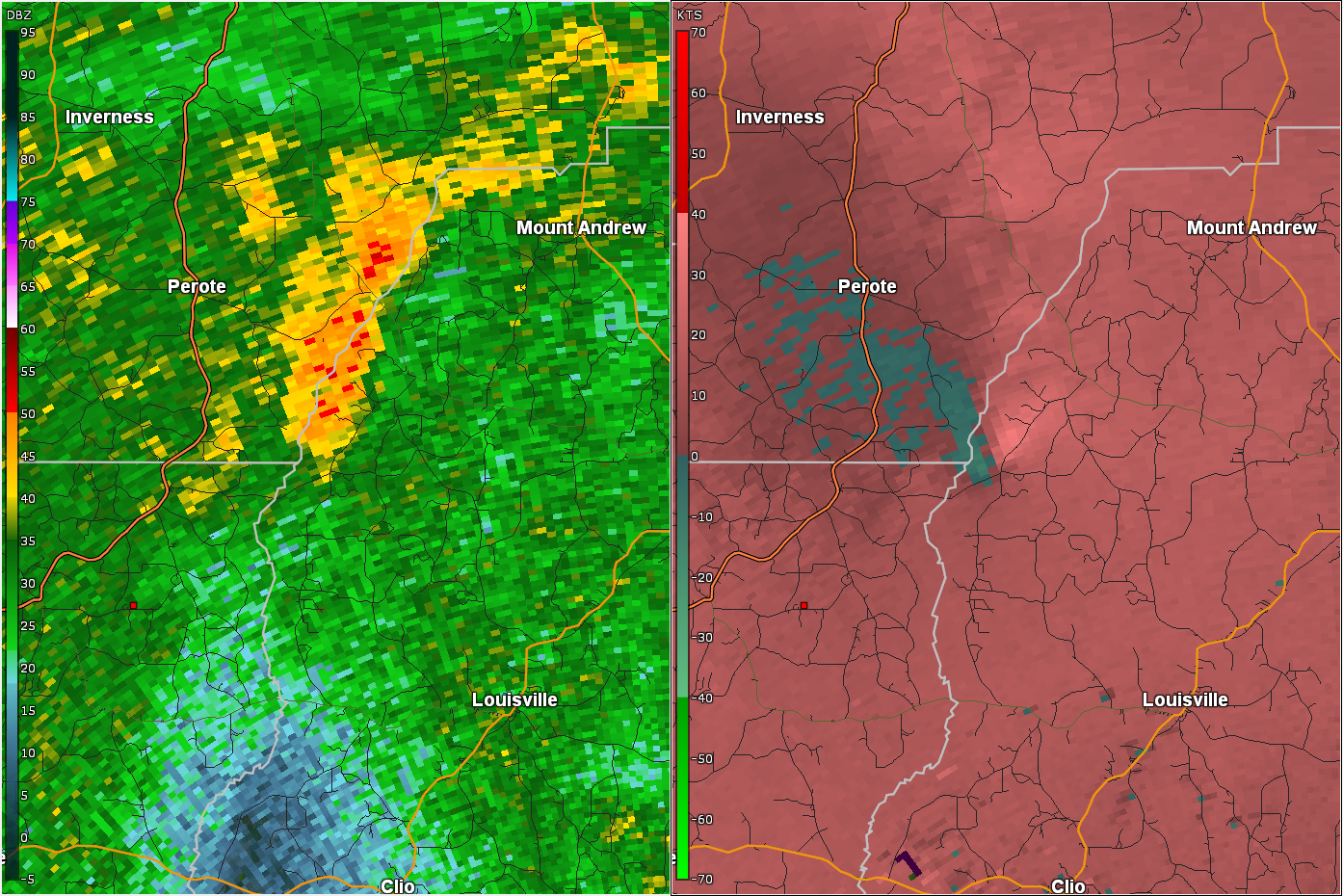
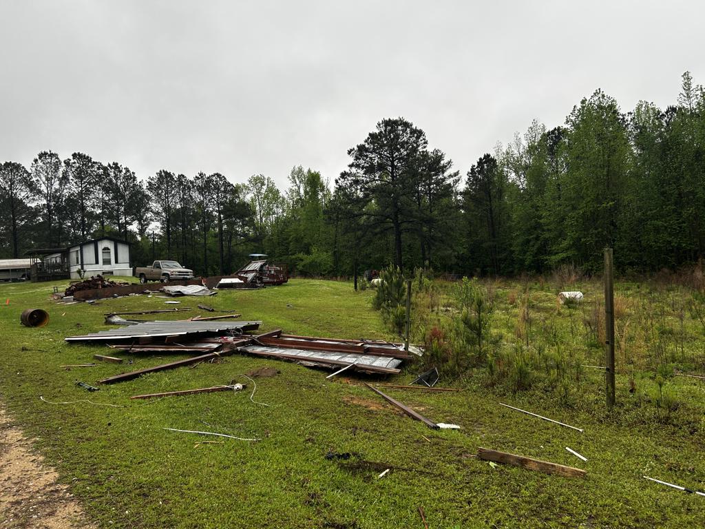
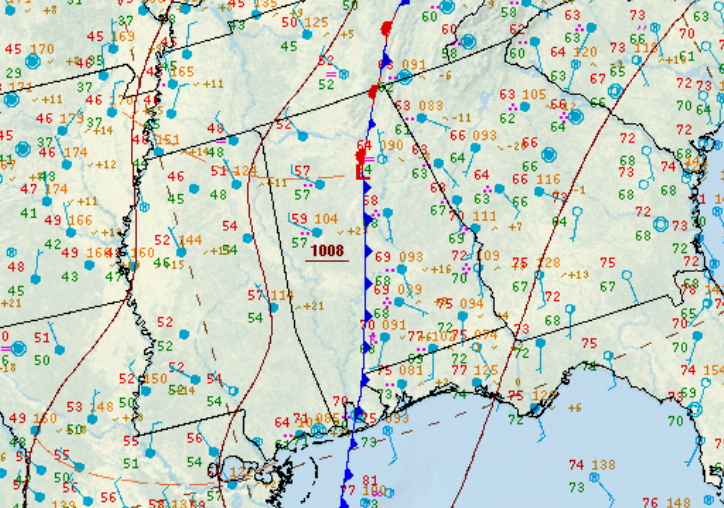
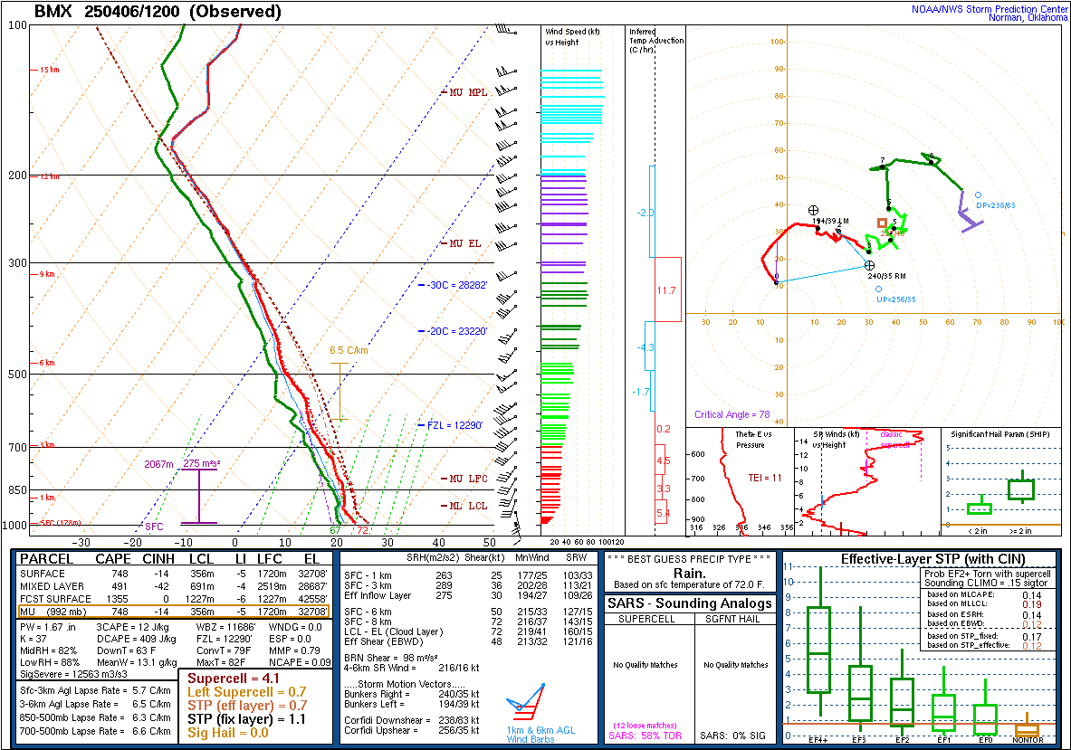
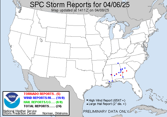
This comma-head tornado touched down on the southern edge of an open field off of Dallas County Road 143, just north of Sixmile Creek. There were a few large pine limbs snapped at this location, while to the north side of this open field it caused more significant tree damage with a few trees snapped or uprooted. It moved north-northeastward, intensifying and growing quickly before reaching its maximum intensity of a 400-yard-wide 95 MPH EF-1 as it crossed CR 405. A van and a truck were overturned in a church parking lot, with the truck tumbling about 50 feet and the van tumbling into, but not snapping a power pole. The tornado continued to uproot and snap trees as it moved northward for several hundred yards, but then began to lose strength just as quickly as it had intensified. The tornado weakened as it curled under the comma-head and dissipated along CR 37 just north of Gibbs Rd. 

Radar Image


Radar Image
Reflectivity (left) and velocity (right) of the tornado from KBMX at 10:14 am CDT.
Damage Photo
 Timber damage
Damage Photo
 Church van damaged
 
Star Hill EF-0
 

Star Hill EF-0 Tornado (Barbour County)
  April 6, 2025


Event Summary

EF-0
Estimated Maximum Wind:
60 mph
Injuries/Fatalities:
None
Damage Path Length:
0.48 miles
Maximum Path Width:
50 yards
Approximate Start Point/Time:
2 NNE Boot Hill
31.9009/-85.6234
at 10:21 pm CDT
Approximate End Point/Time:
2 NNE Boot Hill
31.9076/-85.6216
at 10:23 pm CDT


The tornado touched down just west of CR 9 near the Mays Rd intersection. The tornado continued north crossing Star Hill Rd where a small outdoor shed was damaged along with a few softwood trees. The tornado quickly dissipated shortly thereafter.

Radar Image


Radar Image
Reflectivity (left) and velocity (right) of the circulation a few moments before touchdown. Images are from KEOX at 10:17 pm CDT.
Damage Photo
 Small shed destroyed
 
Surface/Upper Air Charts & Reports
 

250mb Analysis
250mb Analysis
April 6 at 7 am

500mb Analysis
500mb Analysis
April 6 at 7 am

850mb Analysis
850mb Analysis
April 6 at 7 am

250mb Analysis
250mb Analysis
April 6 at 7 pm

500mb Analysis
500mb Analysis
April 6 at 7 pm

850mb Analysis
850mb Analysis
April 6 at 7 pm

Surface Analysis
250mb Analysis
April 6 at 7 am

Surface Analysis
500mb Analysis
April 6 at 10 am

Surface Analysis
850mb Analysis
April 6 at 1 pm

Surface Analysis
250mb Analysis
April 6 at 4 pm

Surface Analysis
500mb Analysis
April 6 at 7 pm

Surface Analysis
850mb Analysis
April 6 at 10 pm

KBMX Sounding
KBMX Sounding
April 6 at 7 am

Storm Reports
Storm Reports
Thru 7 AM on April 7