National Weather Service United States Department of Commerce


Tornadoes of April 2, 2024

Overview
 

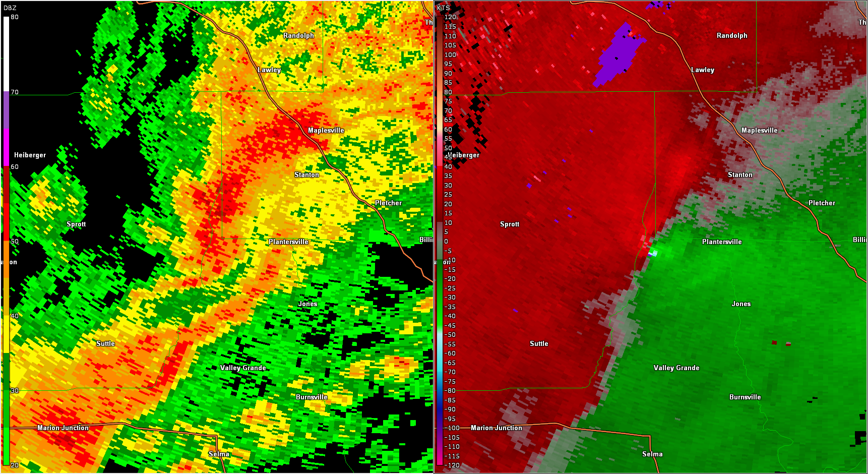
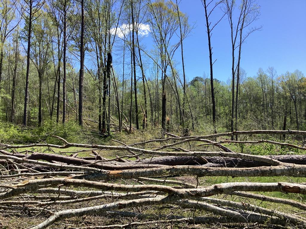
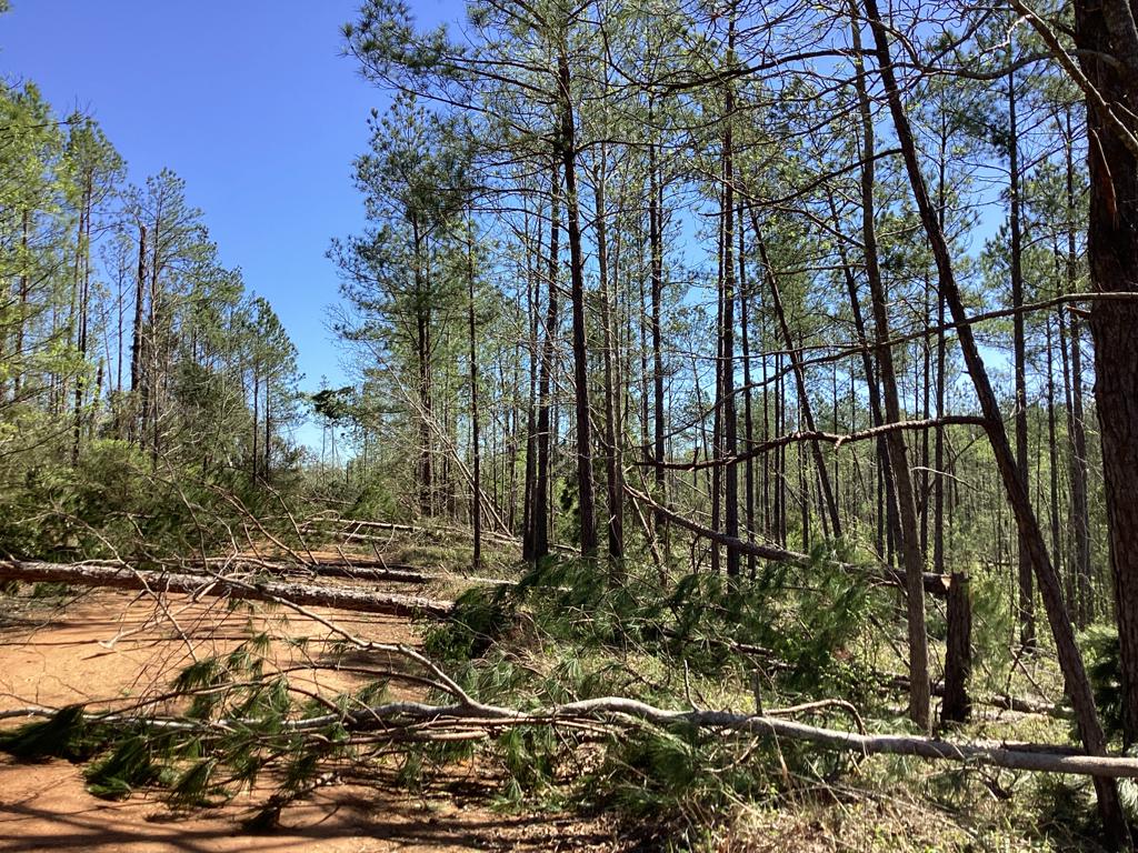
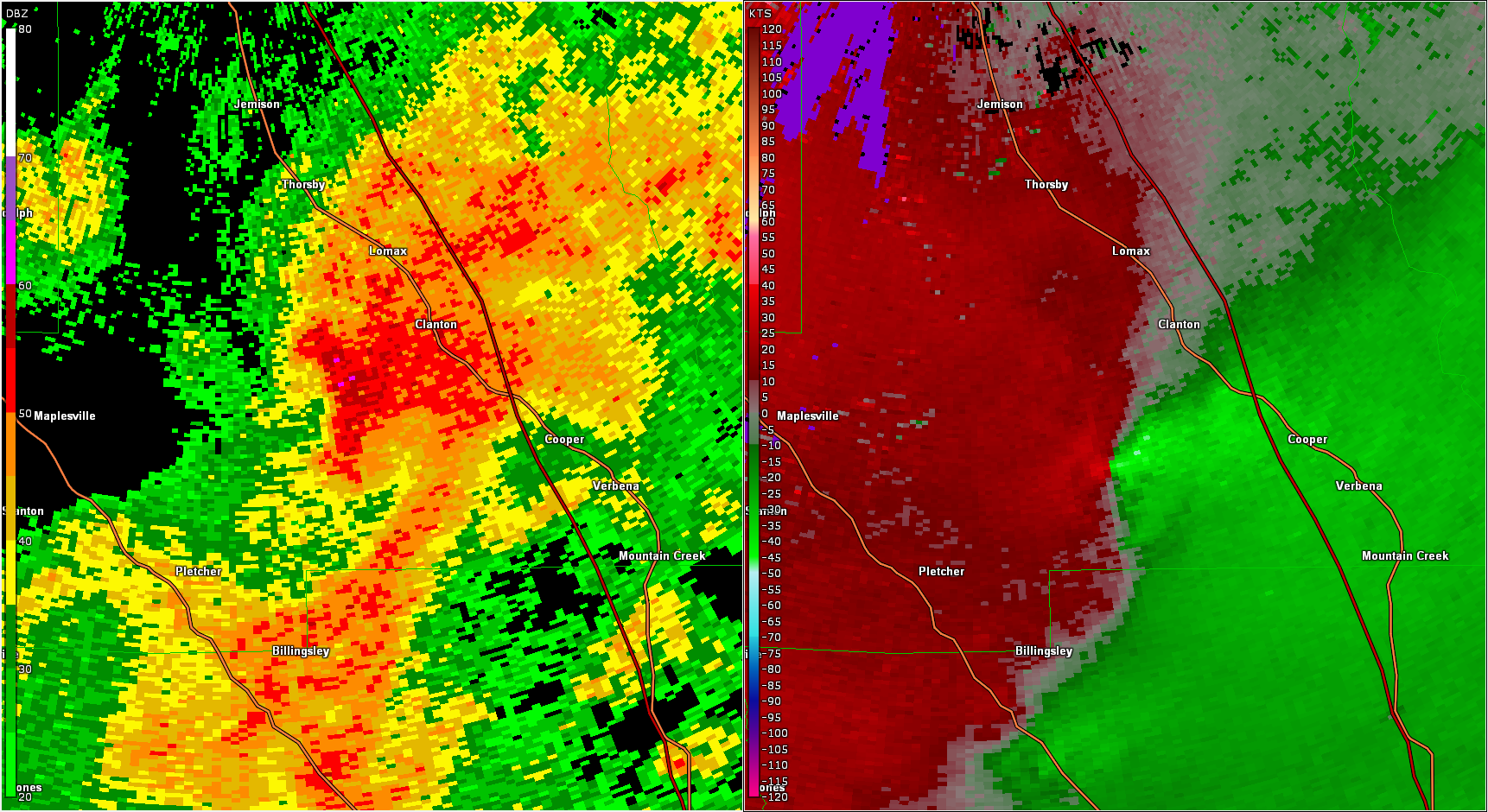
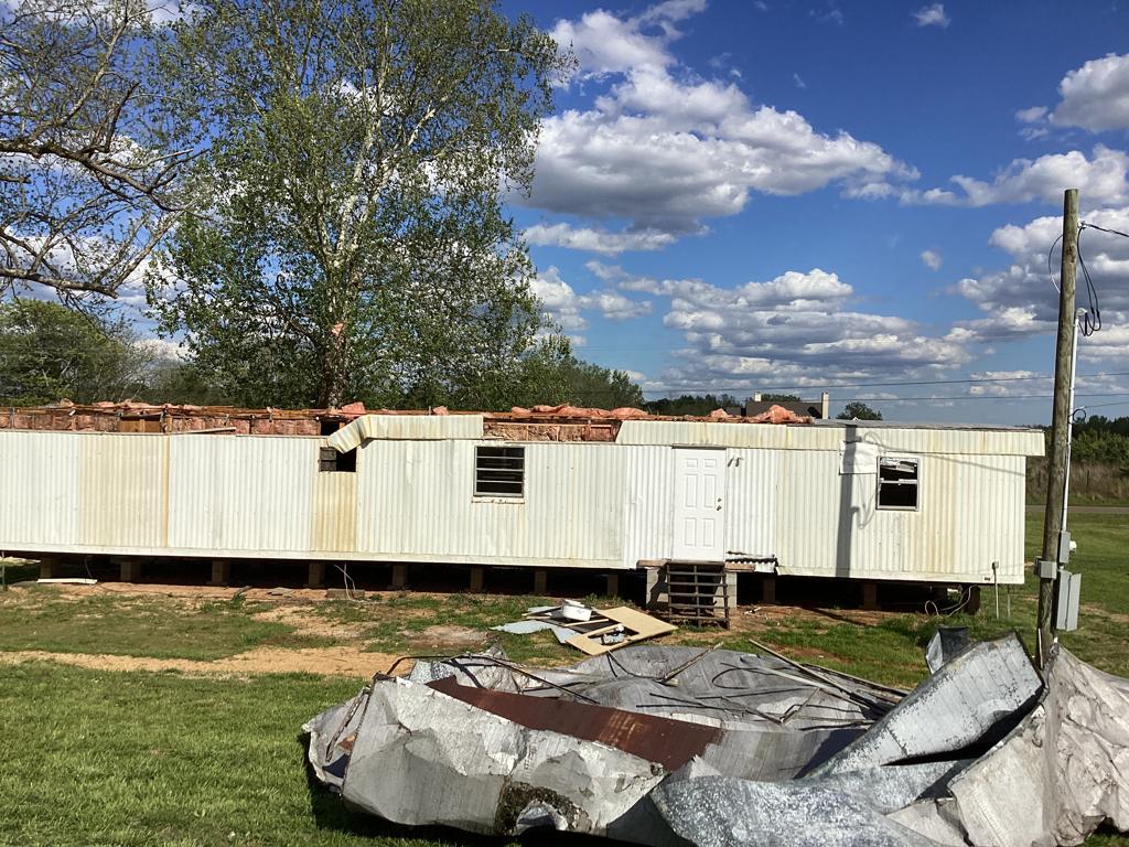
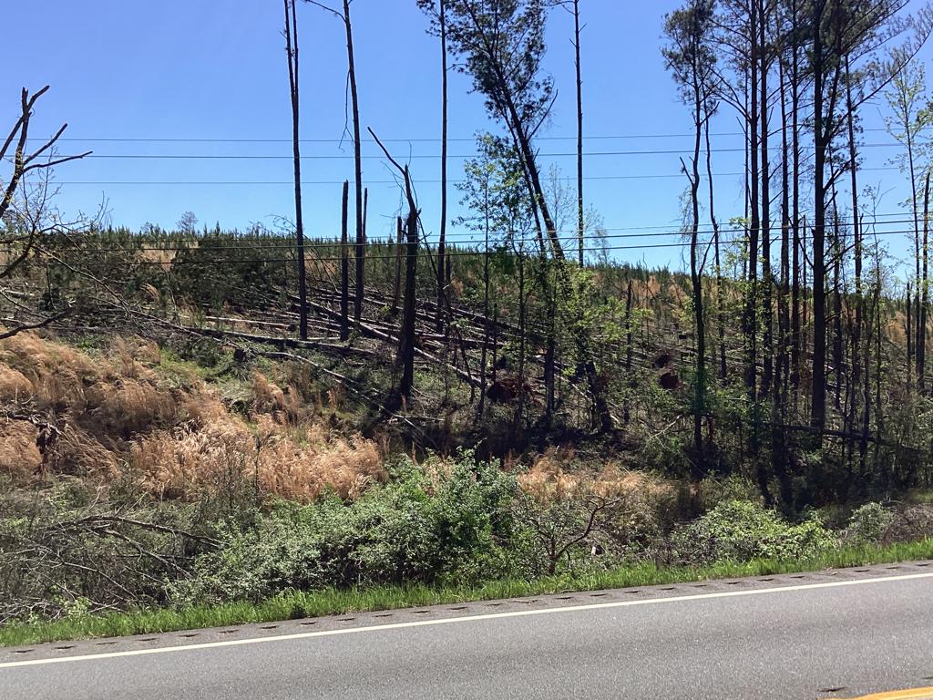
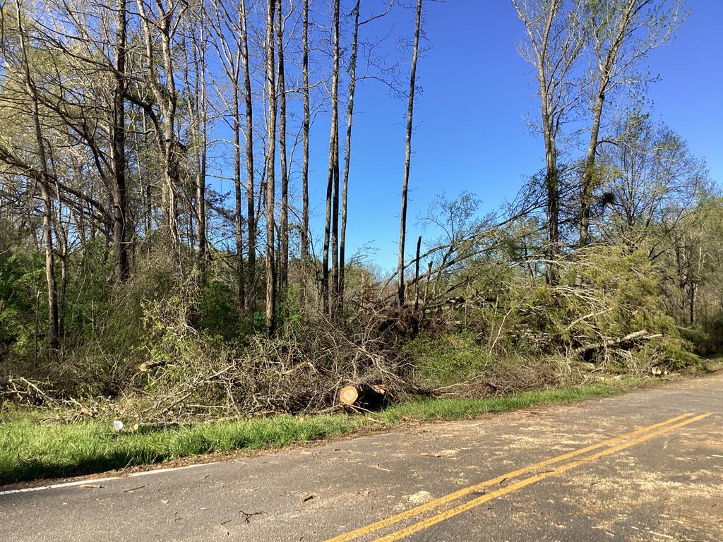
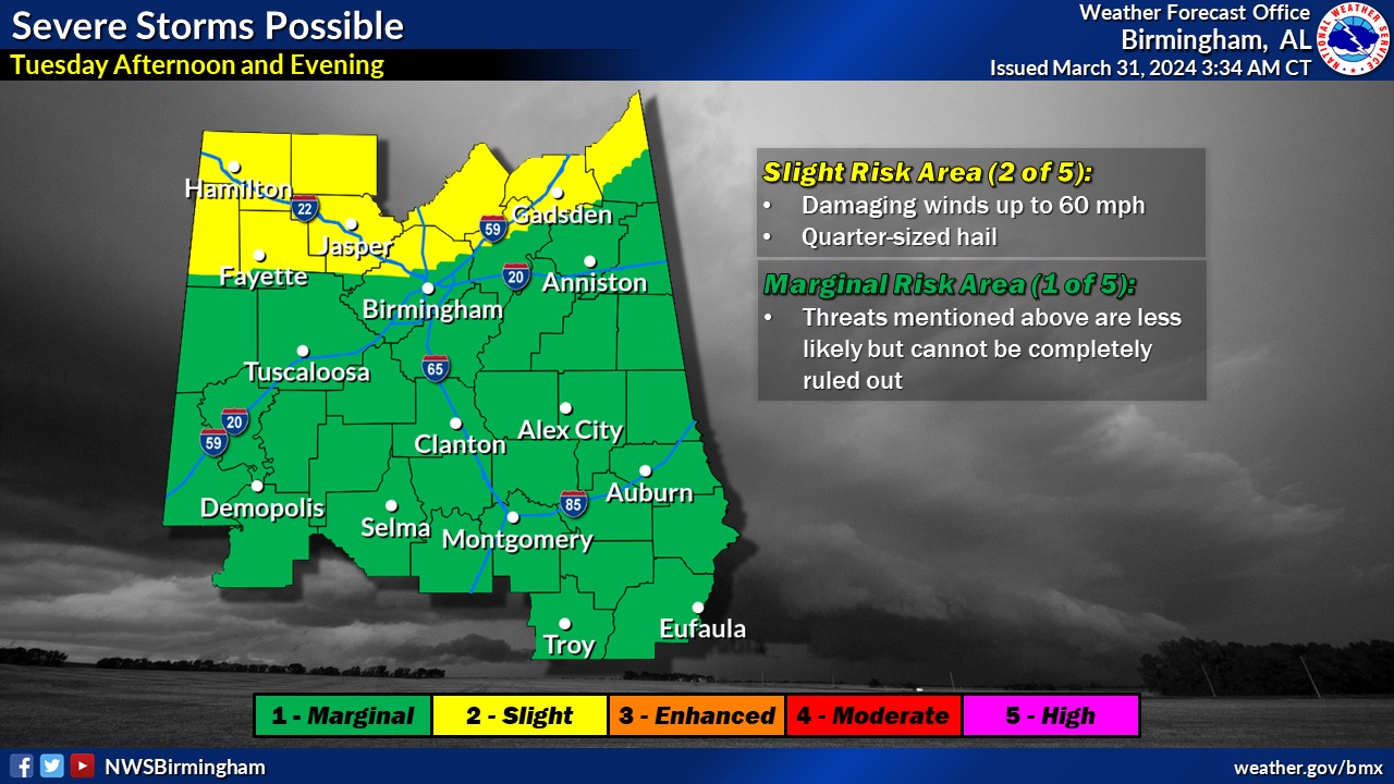
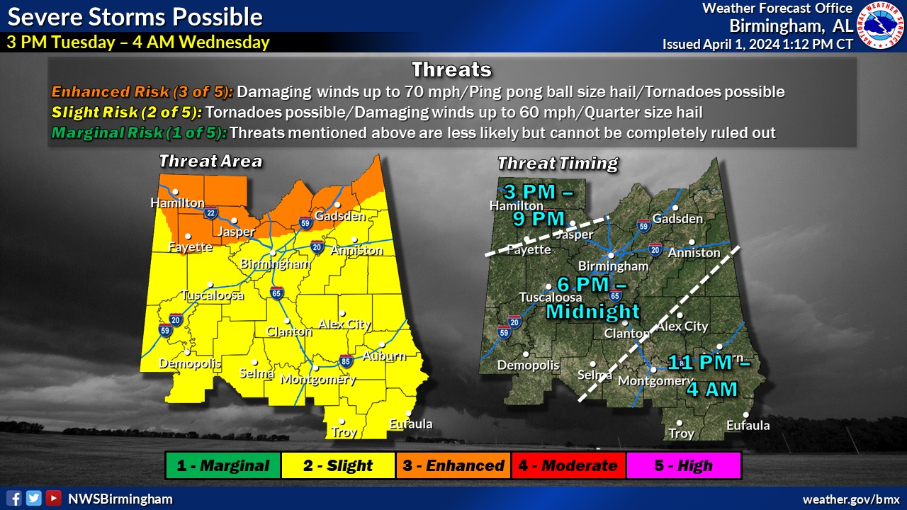
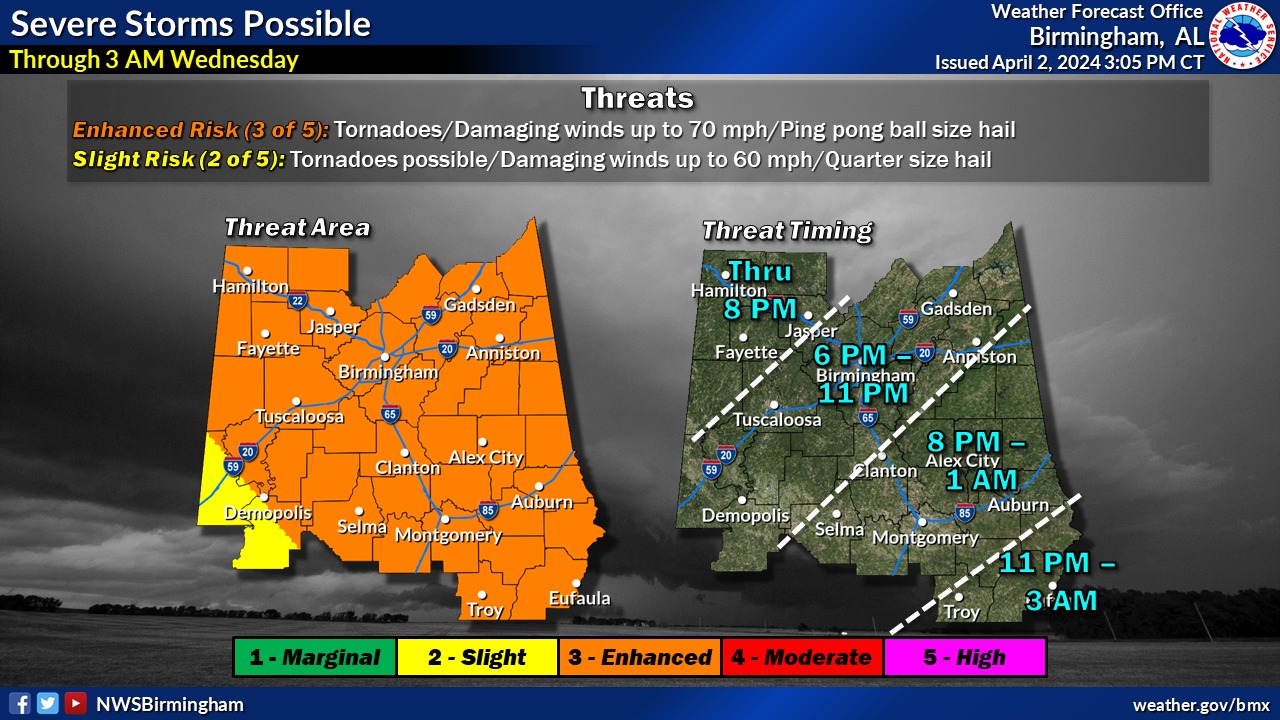
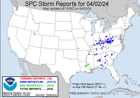
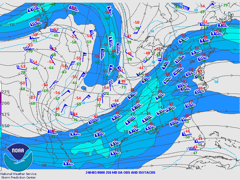
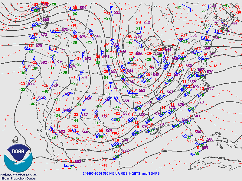
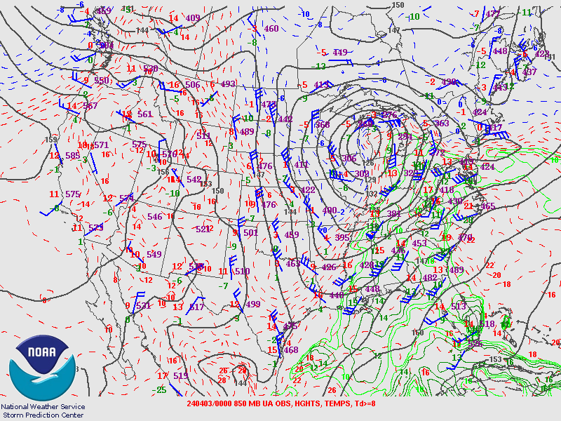
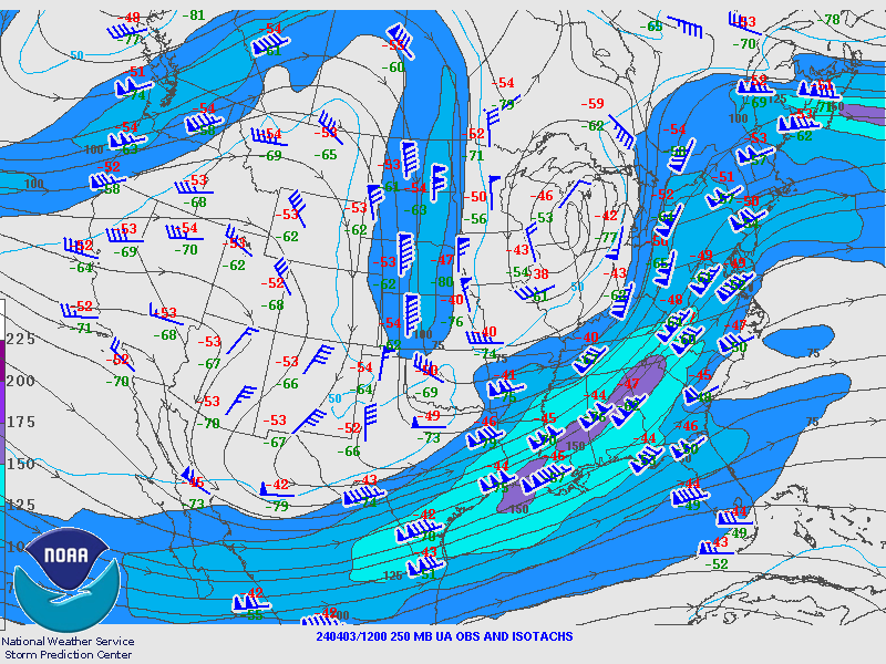
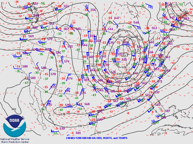
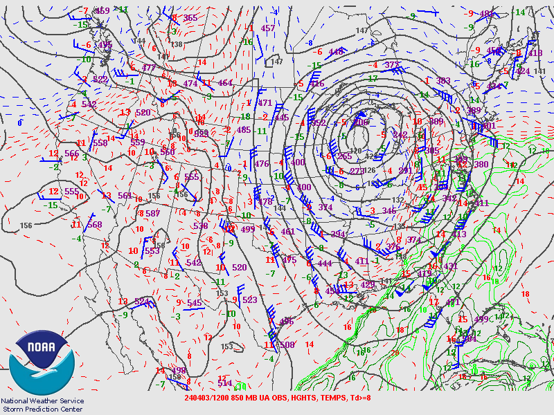
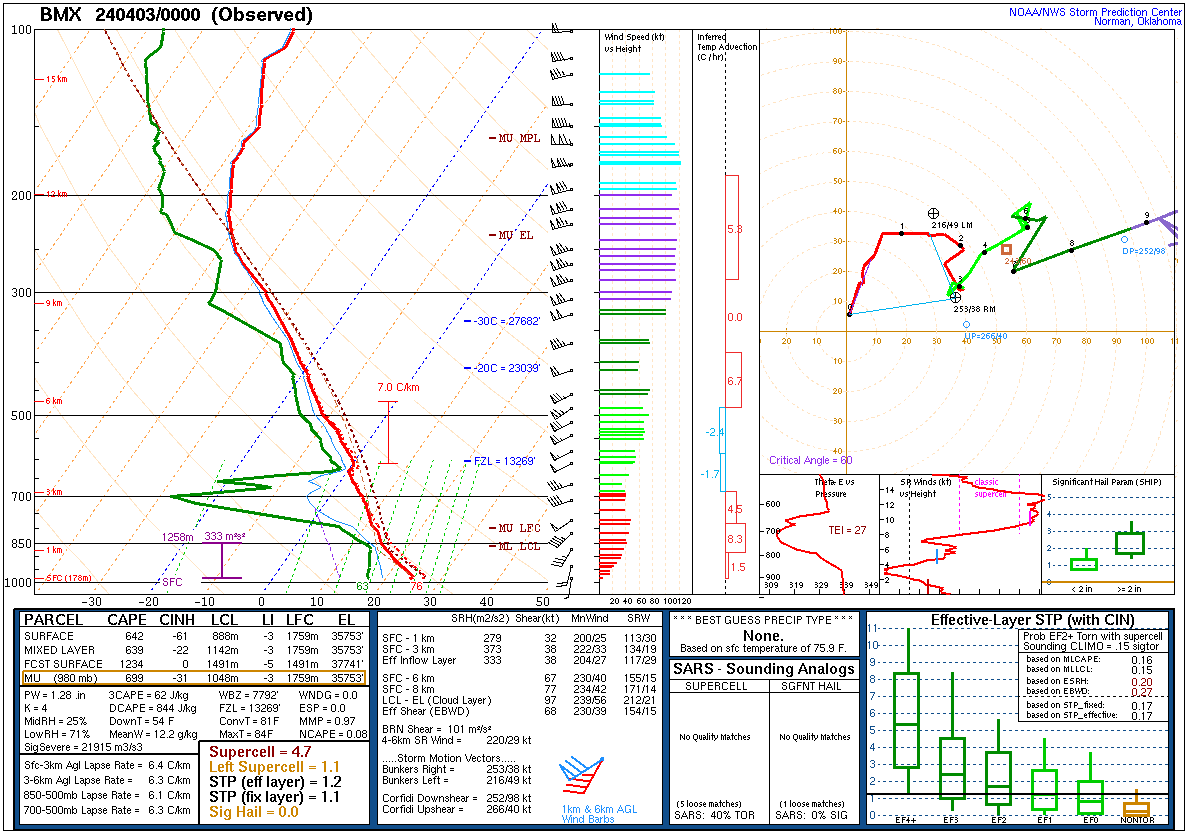
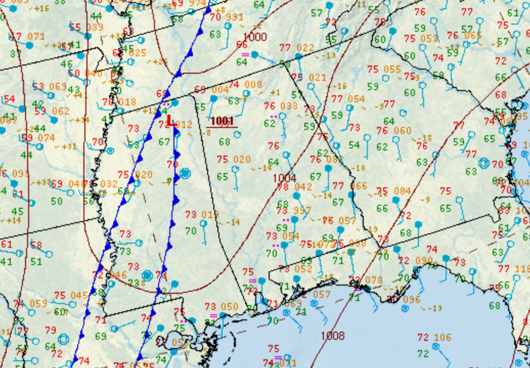
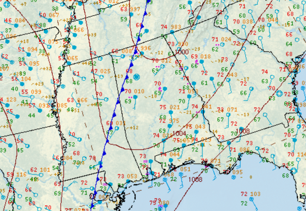
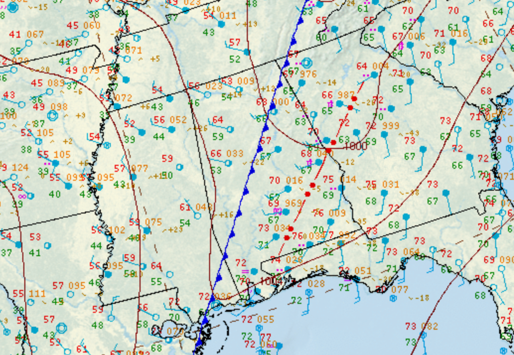
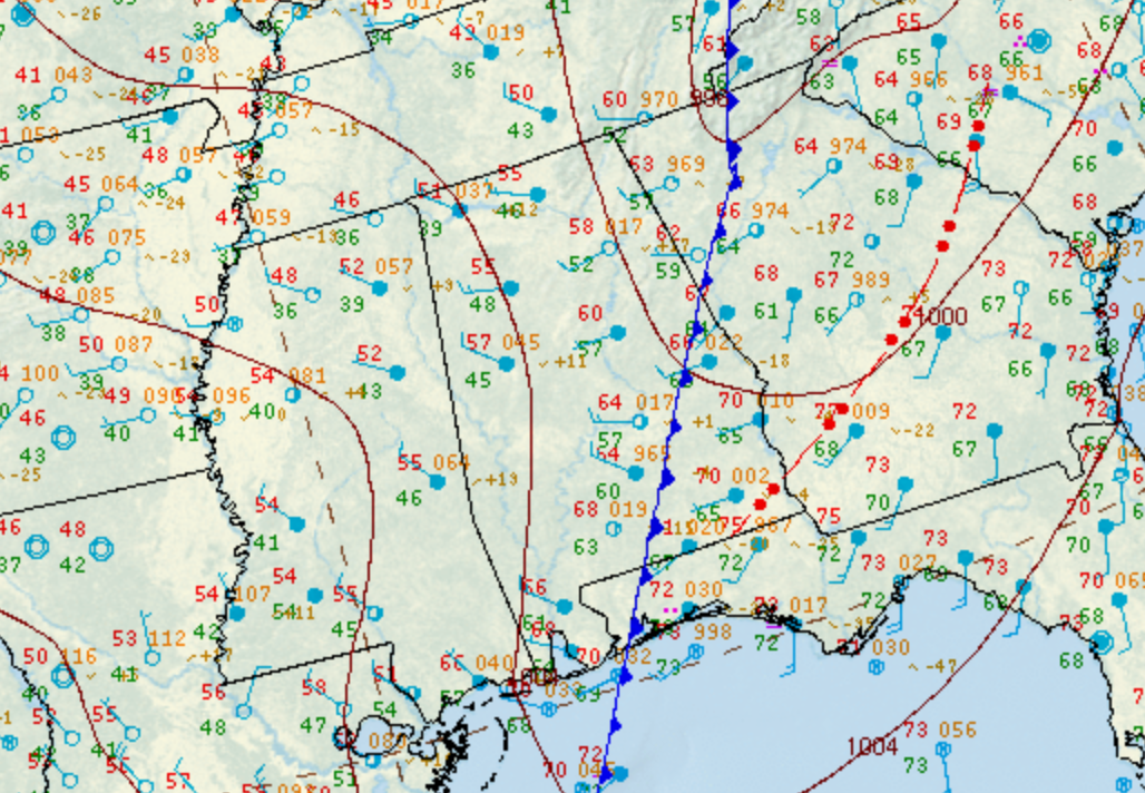
On the evening of Tuesday April 2, 2024, an area of strong to severe thunderstorms impacted portions of Central Alabama. This was part of a storm system that affected a large portion of the eastern United States. These storms were able to evolve in an environment that became increasingly favorable for tornadoes during the evening hours. One such storm intensified as it entered Perry County and went on to produce a total of four tornadoes, as well as pockets of straight-line wind damage, from Northern Dallas County east-northeastward into eastern Coosa County. Thankfully, there were no serious injuries or fatalities.


Interactive Damage Map


**The data below are considered PRELIMINARY.**

Location/Clickable Detailed Summary Link
Damage Rating/Estimated Maximum Wind Speeds
Injuries/Fatalities
Damage Path Length/Width
Starting Point/Time
Ending Point/Time
Plantersville Tornado
(Dallas/Chilton Counties)
EF-1
95 mph
None 8.28 miles
600 yards
4 NW Paul M. Grist State Park
32.6410/-87.0398
10:28 pm CDT
1 SSE Parnell
32.6749/-86.9044
10:37 pm CDT
Pools Crossroads Tornado
(Chilton County)
EF-1
95 mph

 
None 15.07 miles
450 yards
1 NNE Pletcher
32.7121/-86.7786
10:49 pm CDT
2 N Cooper
32.8035/-86.5470
11:06 pm CDT
Kings Bridge Tornado
(Coosa County)
EF-1
90 mph

 
None 2.65 miles
400 yards
3 NW Rockford
32.9182/-86.2450
11:28 pm CDT
3 N Rockford
32.9326/-86.2033
11:31 pm CDT
Kellyton Tornado
(Coosa County)
EF-0
80 mph

 
None 2.28 miles
175 yards
2 SSE Bradford
32.9712/-86.0793
11:40 pm CDT
Kellyton
32.9814/-86.0423
11:44 pm CDT
 
Plantersville EF-1
 

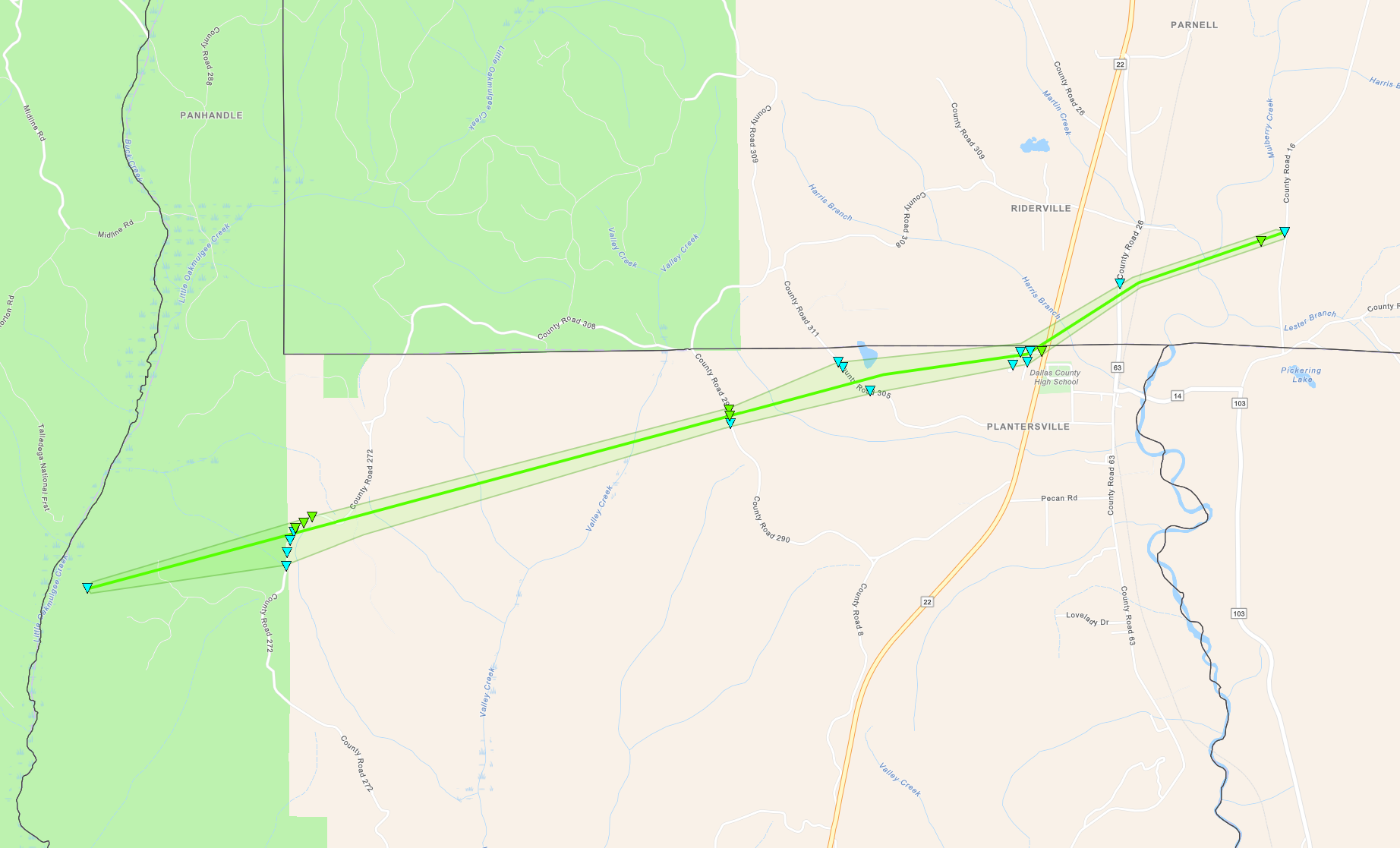
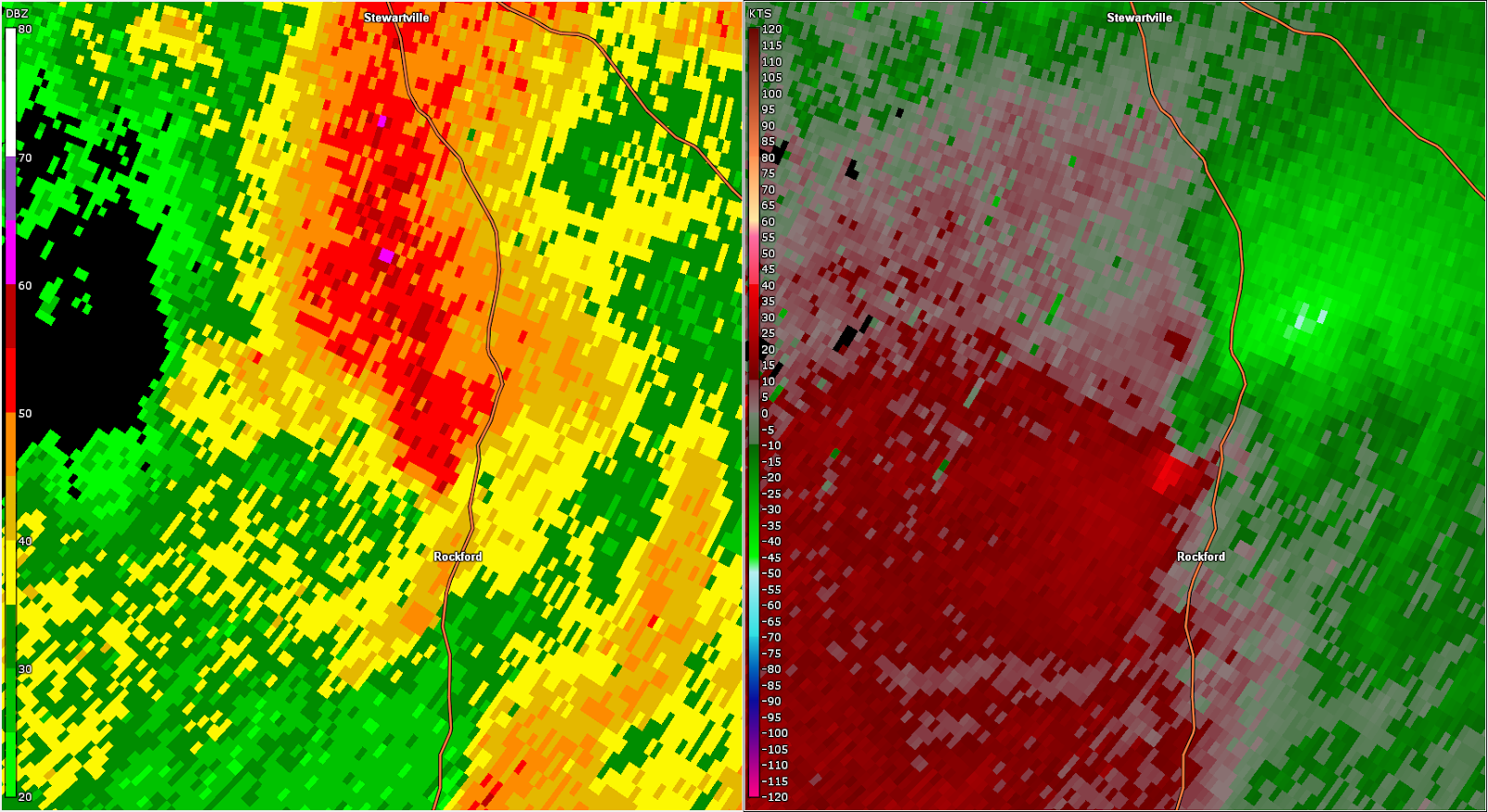
Plantersville EF-1 Tornado (Dallas & Chilton Counties)
  April 2, 2024


Event Summary

EF-1
Estimated Maximum Wind:
95 mph
Injuries/Fatalities:
None
Damage Path Length:
8.28 miles
Maximum Path Width:
600 yards
Approximate Start Point/Time:
4 NW Paul M. Grist State Park
32.6410/-87.0398
at 10:28 pm CDT
Approximate End Point/Time:
1 SSE Parnell
32.6749/-86.9044
at 10:37 pm CDT


The tornado began in a wooded area just east of the Perry/Dallas County line. It quickly reached its peak intensity as it crossed County Road 272 where dozens of trees were snapped or uprooted, blocking the roadway for over a quarter of a mile as it paralleled the road. Additional trees were downed along County Roads 290 and 305, but the tornado weakened as it approached Plantersville. Still, several trees were downed along Dallas County 560 and Highway 22 in Plantersville. The tornado crossed into Chilton County and downed some more trees near residences on County Road 26 and County Road 16 before quickly dissipating as it crossed County Road 16. 

Radar Image


Radar Image
Reflectivity (left) and velocity (right) as the tornado just before it exited the Talladega National Forest.
Images are from KBMX at 10:29 pm CDT.


Damage Photo
 Timber Damage
Damage Photo
 Timber Damage
 
Pools Crossroads EF-1
 

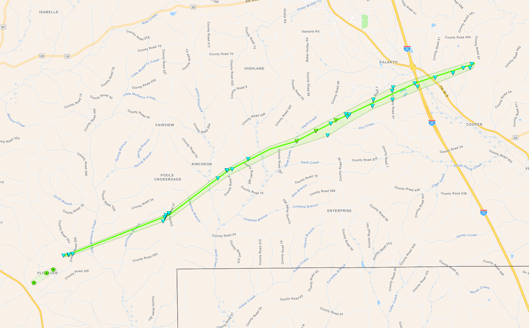
Pools Crossroads EF-1 Tornado (Chilton County)
  April 2, 2024


Event Summary

EF-1
Estimated Maximum Wind:
95 mph
Injuries/Fatalities:
None
Damage Path Length:
15.07 miles
Maximum Path Width:
450 yards
Approximate Start Point/Time:
1 NNE Pletcher
32.7121/-86.7786
at 10:49 pm CDT
Approximate End Point/Time:
2 N Cooper
32.8035/-86.54.70
at 11:06 pm CST


The same storm that produced the Plantersville tornado continued northeastward. Some sporadic minor tree damage was observed around Pletcher but was more consistent with straight line winds. Damage became more consistent with a tornado as it reached a residence along County Road 359 where a couple trees were downed and minor roof damage occurred to the residence. Damage remained sporadic until it reached some residences along County Road 37. There portions of a porch overhang were blown off a residence, and two barns were damaged. One of these was destroyed though minimal damage was observed to nearby trees. A racecar trailer was blown 100 yards downstream and flattened. Minor tree damage continued as the tornado moved northeastward across County Road 9 and additional outbuildings were damaged or destroyed. The tornado intensified as it crossed an inaccessible area east of County Road 387 as depicted on satellite imagery by an area of heavier vegetation/timber damage. Much of the roof was blown off a manufactured home on County Road 49, with another manufactured home having about half of its roofing materials removed. Another pole barn was destroyed near County Road 391 where a personal weather station measured a 95.7 mph gust at an elevation of 7 feet. Occasional trees and limbs were downed as the tornado crossed Interstate 65 near Highway 31, before the tornado dissipated after crossing County Road 480.

Radar Image


Radar Image
Reflectivity (left) and velocity (right) of the tornado.
Images are from KBMX at 10:56 pm CDT.


Damage Photo
 Racecar trailer rolled/damaged
Damage Photo
 Structural Damage
Damage Photo
 Shed Destroyed
Damage Photo
 Damage to Manufactured Home
 
Kings Bridge EF-1
 

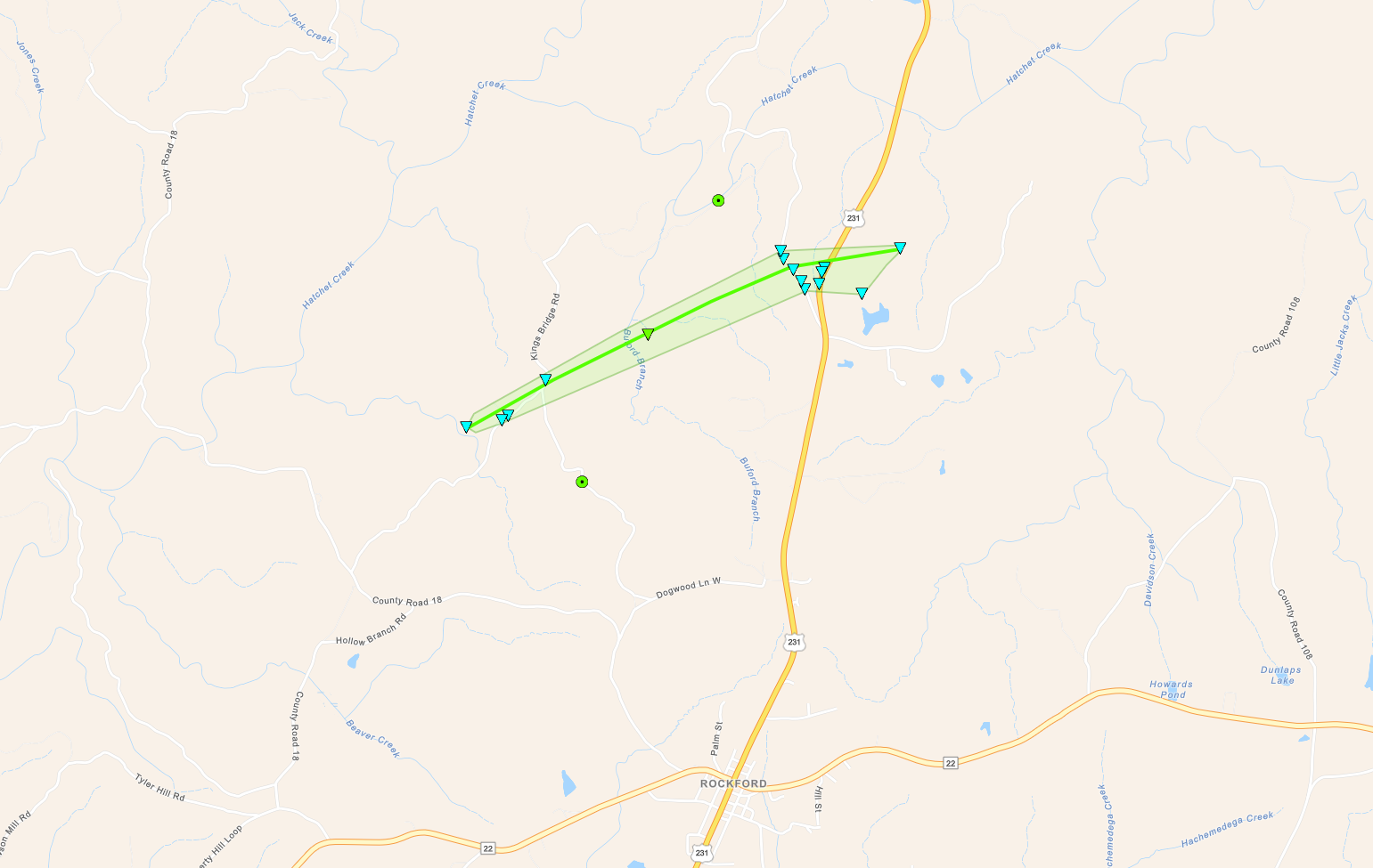
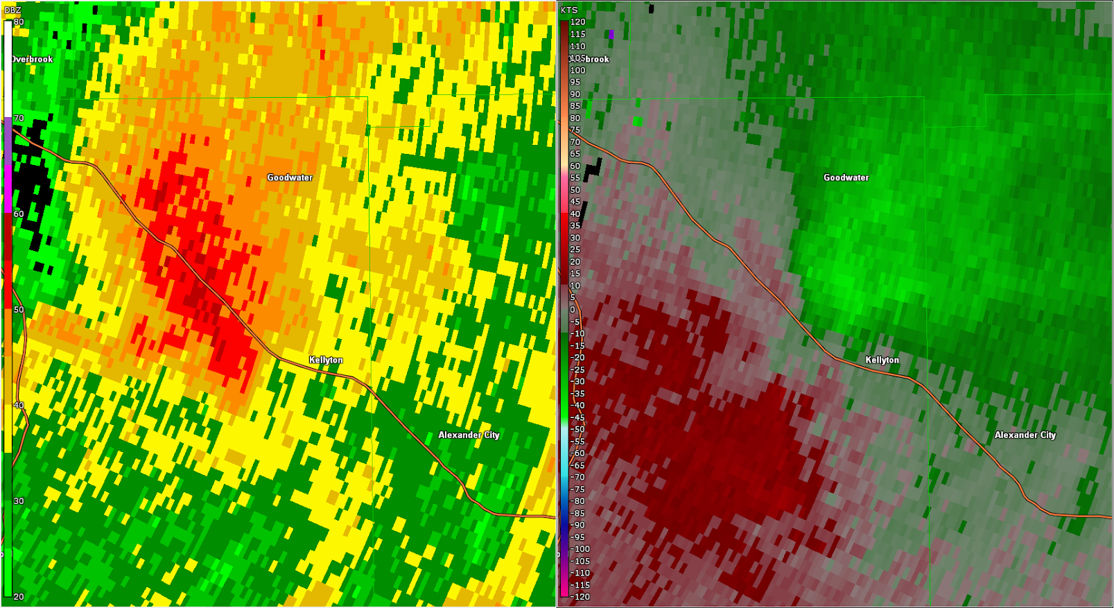
Kings Bridge EF-1 Tornado (Coosa County)
  April 2, 2024


Event Summary

EF-1
Estimated Maximum Wind:
90 mph
Injuries/Fatalities:
None
Damage Path Length:
2.65 miles
Maximum Path Width:
400 yards
Approximate Start Point/Time:
3 NW Rockford
32.9182/-86.2450
at 11:28 pm CDT
Approximate End Point/Time:
3 N Rockford
32.9326/-86.2033
at 11:31 pm CDT


A brief tornado touched down northwest of Rockford near Kings Bridge Rd causing minor timber damage. The tornado continued northeast causing additional timber damage near County Rd 47 and US Hwy 231, dissipating shortly thereafter.

Satellite imagery depicted a swath of heavier vegetation/timber damage between Kings Bridge Rd and County Rd 47 to suggest low-end EF1 intensity. 

Radar Image


Radar Image
Reflectivity (left) and velocity (right) of the tornado just after it touched down.
Images are from KBMX at 11:29 pm CDT.


Damage Photo
 Timber Damage
 
Kellyton EF-0
 

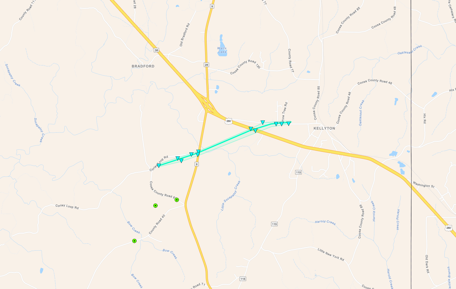
Kellyton EF-0 Tornado (Coosa County)
  April 2, 2024


Event Summary

EF-0
Estimated Maximum Wind:
80 mph
Injuries/Fatalities:
None
Damage Path Length:
2.28 miles
Maximum Path Width:
175 yards
Approximate Start Point/Time:
2 SSE Bradford
32.9712/-86.0793
at 11:40 pm CDT
Approximate End Point/Time:
Kellyton
32.9814/-86.0423
at 11:44 pm CDT


A brief tornado touched down near Kellyton along County Rd 62 causing a corridor of timber damage that was most notable near the intersection with AL Hwy 9. The tornado continued northeast crossing US Hwy 280 where additional timber damage occurred. The tornado dissipated after causing additional timber damage on County Rd 50. 

Radar Image


Radar Image
Reflectivity (left) and velocity (right) of the tornado near the time of touchdown.
Images are from KBMX at 11:39 pm CDT.


Damage Photo
 Timber Damage
 
Outlooks & Reports
 

Local Day 3 Outlook
Local Day 3 Outlook
Mar 31 at 330 am

Local Day 2 Outlook
Local Day 2 Outlook
Apr 1 at 115 pm

Local Day 1 Outlook
Local Day 1 Outlook
Apr 2 at 3 pm

Storm Reports
Storm Reports
Thru 7 AM on April 3


Surface & Upper Air Charts
 

250mb Analysis
250mb Analysis
Apr 1 at 7 pm

500mb Analysis
500mb Analysis
Apr 1 at 7 pm

850mb Analysis
850mb Analysis
Apr 1 at 7 pm

250mb Analysis
250mb Analysis
Apr 2 at 7 am

500mb Analysis
500mb Analysis
Apr 2 at 7 am

850mb Analysis
850mb Analysis
Apr 2 at 7 am

KBMX Sounding
KBMX Sounding
Apr 2 at 4 pm

BMX Sounding
Surface Analysis
Apr 2 at 7 pm

Surface Analysis
Surface Analysis
Apr 2 at 7 pm

Surface Analysis
Surface Analysis
Apr 2 at 10 pm

Surface Analysis
Surface Analysis
Apr 3 at 1 am

Surface Analysis
Surface Analysis
Apr 3 at 4 am