National Weather Service United States Department of Commerce

Samantha Tornado - Tuscaloosa County - April 2, 2009


EF-1
Estimated Maximum Wind:
85-95 mph
Injuries/Fatalities:
None
Damage Path Length:
0.58 mile
Maximum Path Width:
150 yards
Approximate Start Point/Time:
33.436/-87.644 at 343 pm
Approximate End Point/Time:
33.443/-87.638 at 344 pm

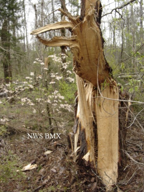
A National Weather Service Damage Assessment Team has surveyed the storm damage in Tuscaloosa County. It has been determined the damage was the result of a tornado. The tornado has been rated an EF-1 on the Enhanced Fujita Scale. Damage estimates were consistent with winds between 85 & 95 mph.

The tornado touched down near the intersection of Lesueur Road and Old Fayette Road. This location is approximately 2.5 miles northwest of Samantha. The tornado tracked northeastward for about one half of a mile. The most significant damage occurred as the tornado crossed Brady Montgomery Road. Numerous hardwood and softwood trees were snapped off and uprooted along the tornado damage path. The tornado damage path was 1/2 of a mile long and was 150 yards wide at its widest point. No injuries or fatalities were reported.


Damage Path

Damage Path

The top image is a KGWX 0.5 degree reflectivity loop. The bottom image is a KGWX 0.5 degree storm relative velocity loop. The green indicates wind blowing toward the radar while red indicates wind blowing away from the radar. This storm exhibited rotation and was on the northern side of a bowing segment.

Damage
Trees Snapped

Damage
Trees Down

Damage
Tree Snapped Off

Damage
Trees Uprooted

Damage
Trees Down

Damage
Tree Snapped

Damage
Tree Damage

Damage
Tree Snapped Off

Damage
Tree Damage