|
Event Summary
|
|
EF-0
|
|
Estimated Maximum Wind:
|
80 mph
|
|
Injuries/Fatalities:
|
None |
|
Damage Path Length:
|
1.61 miles
|
|
Maximum Path Width:
|
80 yards
|
|
Approximate Start Point/Time:
|
1 WSW Troy Municipal Airport
31.8539/-86.0307
at 1034 am
|
|
Approximate End Point/Time:
|
1 SE Troy Municipal Airport
31.8580/-86.0037
at 1036 am
|
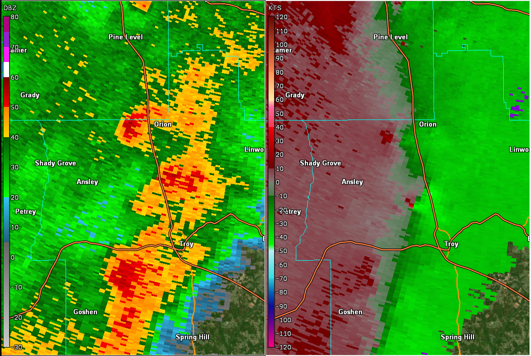
NWS meteorologists assessed damage near the Troy Airport and determined it was the result of an EF-0 tornado.
The tornado formed near the intersection of Lake Road and Oak Grove Road just southwest of Troy Municipal Airport. Branches and a couple trees were downed along Oak Grove Road. The tornado continued east- northeastward, removing the roof from a barn and downing a couple more trees, before crossing the north-south runways at the airport. The tornado passed south of the terminal and very near the KTOI ASOS. Winds backed from 200 degrees to 170 degrees and then veered to 260 degrees while gusting to 47 mph. Minor damage may have occurred to the ASOS pending further assessment. The tornado downed a couple more trees before dissipating west of Highway 231. The tornado was observed on video from the airport.
|