|
Event Summary
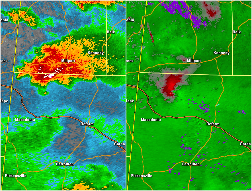
National Weather Service meteorologists surveyed damage in northwest Pickens County just north of Ethelsville and determined that the damage was consistent with an EF-1 tornado. Maximum winds were estimated to be around 95 mph.
The tornado touched down near County Road 75 just south of Highway 34. Numerous trees were snapped and uprooted along County Road 75, and there was some minor roof and siding damage to a single residence. The tornado tracked east-northeast in an area that was not accessible by vehicle. The next damage area was along Mineral-Springs Church Road just south of Highway 34, where numerous trees were uprooted and snapped. The tornado continued eastward along Highway 34 and produced loss of shingles to a home and destroyed several outbuildings. The tornado crossed Shockley Road and produced considerable damage to a metal roof of a wood framed home and damage to several outbuildings. The tornado lifted just east of this damage.
|