|
Event Summary
|
|
|
|
Estimated Maximum Wind:
|
125 mph
|
|
Injuries/Fatalities:
|
None |
|
Damage Path Length:
|
16.96 miles
|
|
Maximum Path Width:
|
1350 yards
|
|
Approximate Start Point/Time:
|
1 NE Slater
32.0049/-88.0851
at 935 PM CDT
|
|
Approximate End Point/Time:
|
Half Acre
32.1959/-87.9047
at 957 PM CDT
|
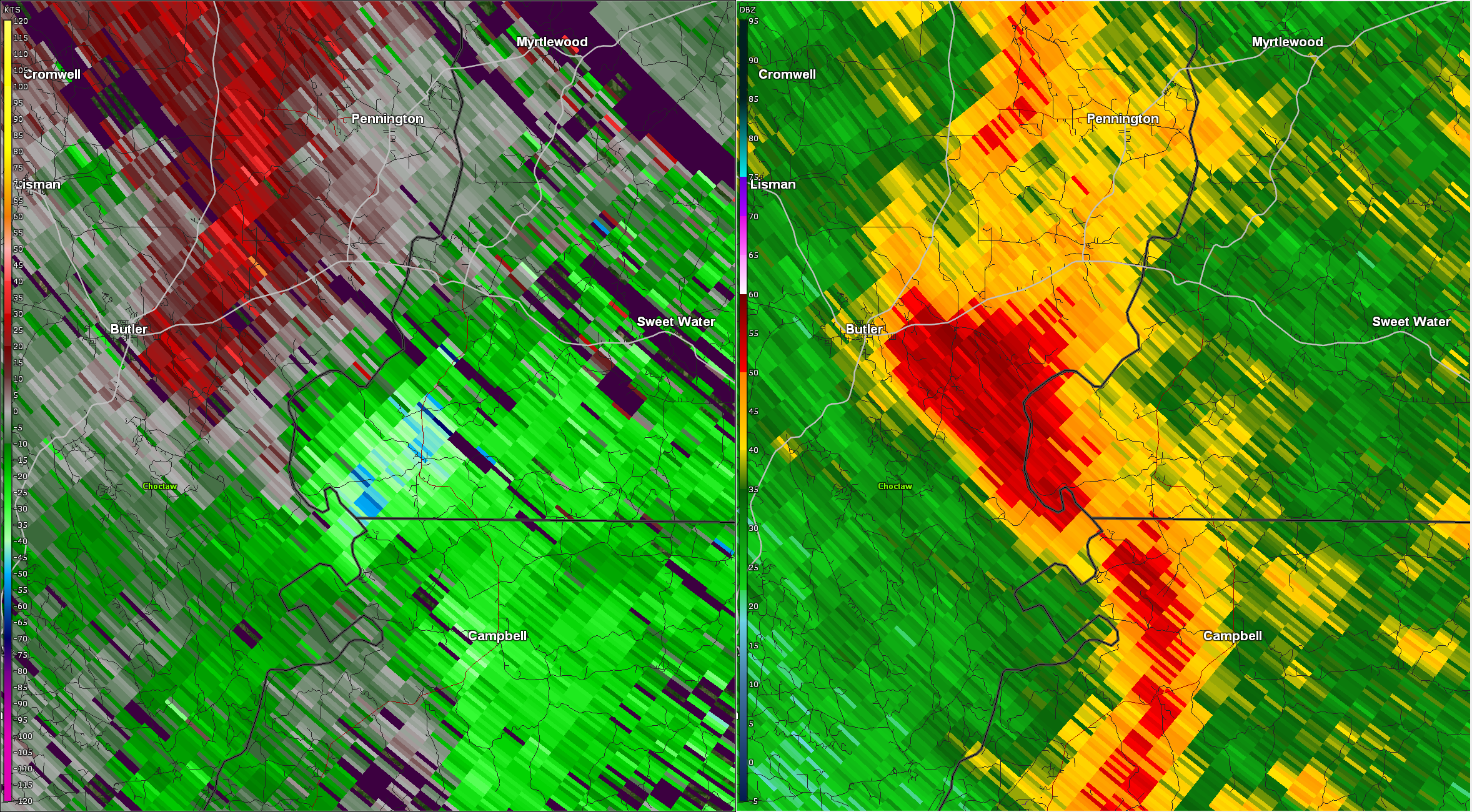
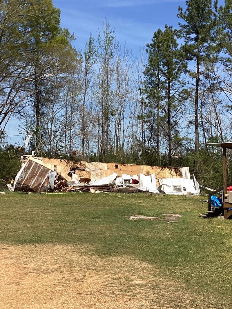
NWS Meteorologists surveyed damage in southwest Marengo County and determined it was the result of an EF-2 tornado.
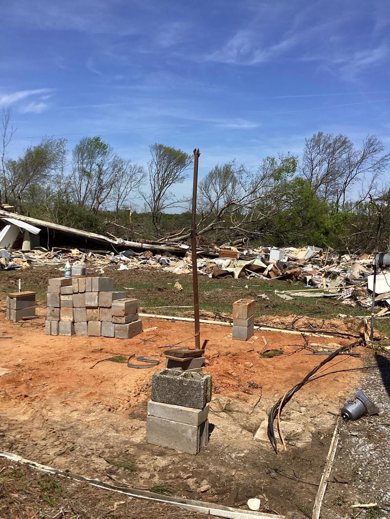
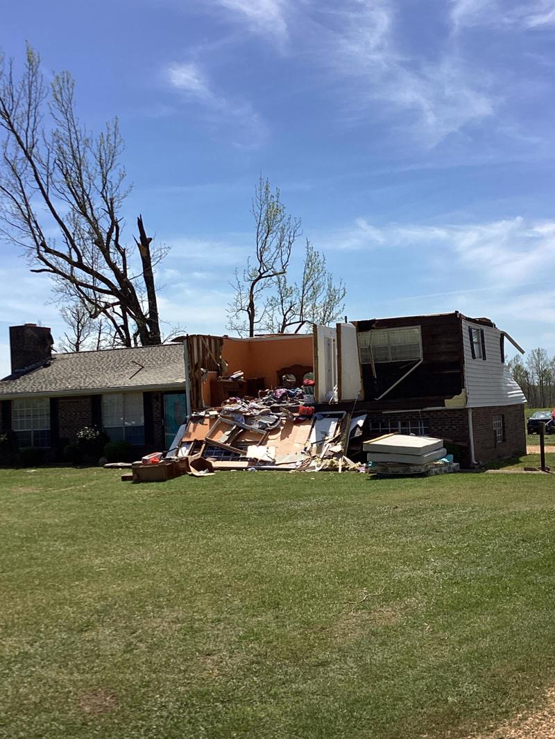
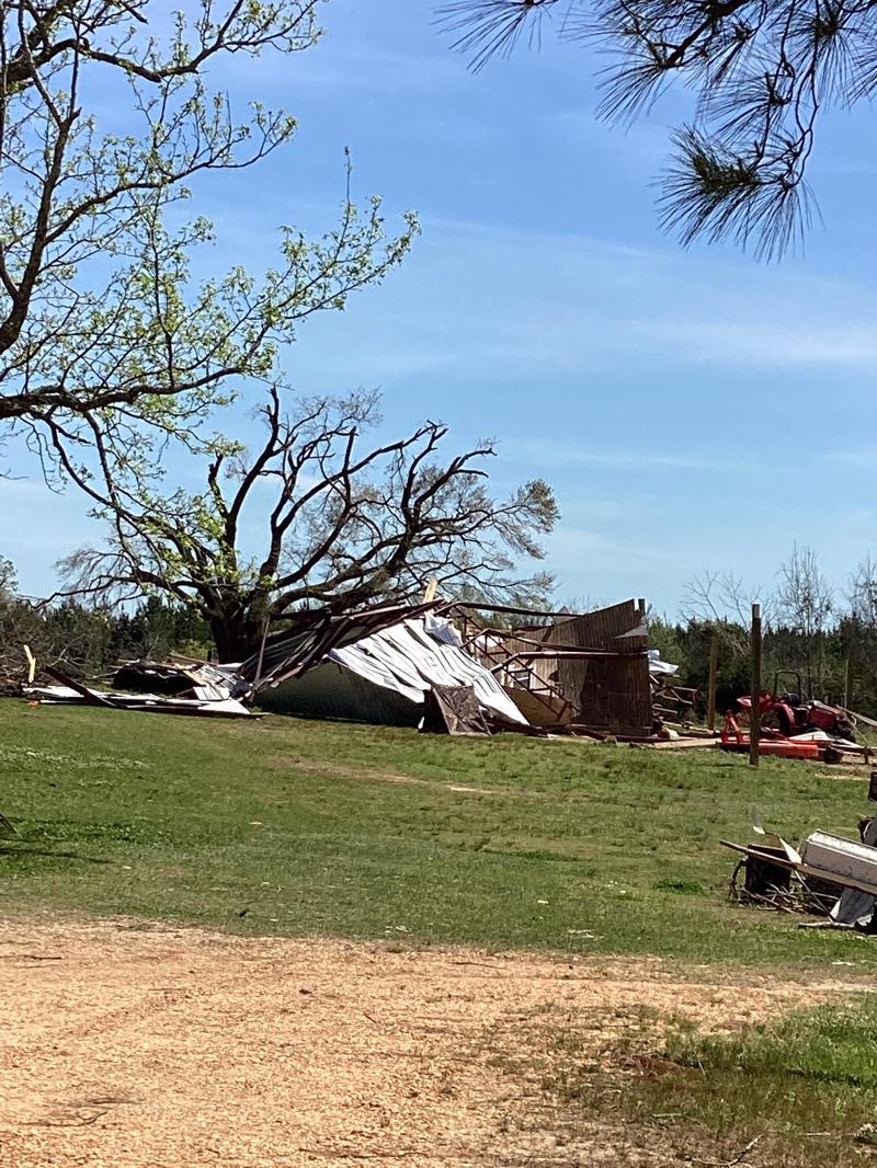
A swath of damage was surveyed in western Nanafalia and determined to be consistent with a strong tornado which originated in Choctaw County before crossing into extreme southwest Marengo County. A corridor of uprooted softwood trees was first observed near the Marengo County line where the trees were toppled across Blue Rock Road. The tornado tracked northeast where additional damage was surveyed near the intersection of AL Highway 69 and County Road 9. This area contained the highest degree and widest swath of damage noted on the survey where the tornado was likely at its strongest. There were considerable and continuous swaths of uprooted hardwood and softwood trees in addition to multiple snapped trunks. A manufactured home on County Rd 9 was completely destroyed as the undercarriage rolled at least 30 yards from its foundation. A brick home next door also sustained roof damage not only from the winds, but also from a tree which fell onto the bedroom. The tornado continued northeast where it removed large portions of the roof and exterior walls from a single family residence on Highway 10. Other nearby residences sustained minor damage in addition to continued tree damage. After the tornado crossed Highway 10, it nearly paralleled AL Highway 69 as it continued northeast. Eventually the tornado reached Half Acre Circle where multiple trees were uprooted and a few residences sustained minor damage. On County Road 17, an abandoned and structurally unstable manufactured home was rolled onto its side. At this point, observed damage indicated that the tornado was likely weakening before it eventually lifted in the woods just to the east of Half Acre.
The data is PRELIMINARY and may be subject to change.
|