|
Event Summary
|
|
EF-0
|
|
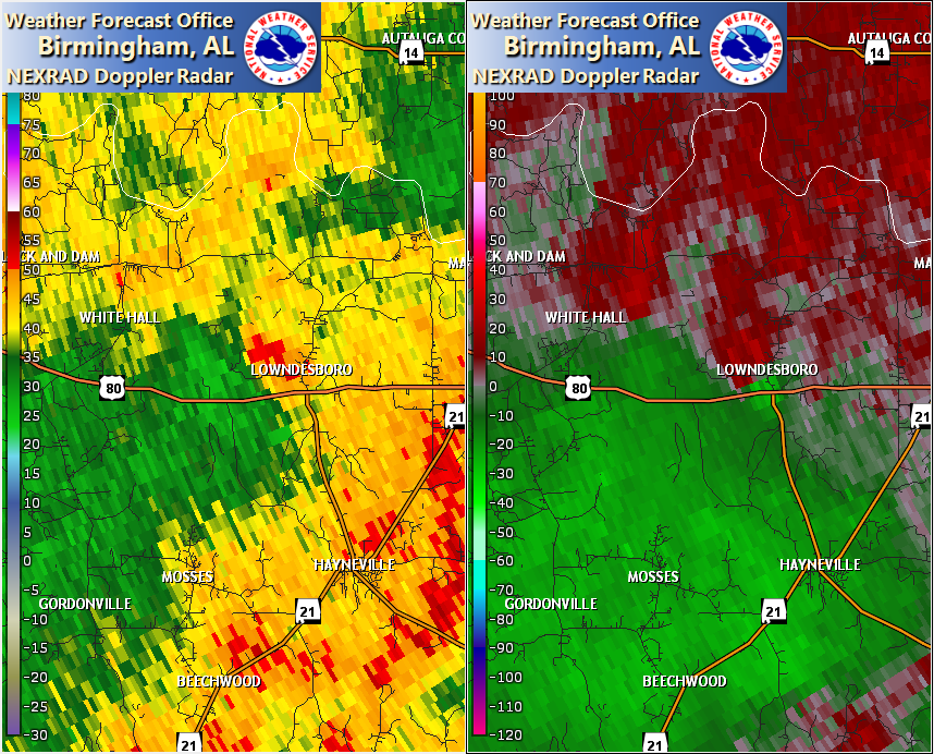
Estimated Maximum Wind:
|
85 mph
|
|
Injuries/Fatalities:
|
None |
|
Damage Path Length:
|
2.89 miles
|
|
Maximum Path Width:
|
125 yards
|
|
Approximate Start Point/Time:
|
1 S Lowndesboro
32.2663/-86.6128
at 1209 AM CDT on Mar 31
|
|
Approximate End Point/Time:
|
2 N Lowndesboro
32.3067/-86.6014
at 1213 AM CDT on Mar 31
|
NWS Meteorologists surveyed damage in Lowndesboro in northern Lowndes County and determined it was the result of an EF-0 tornado.
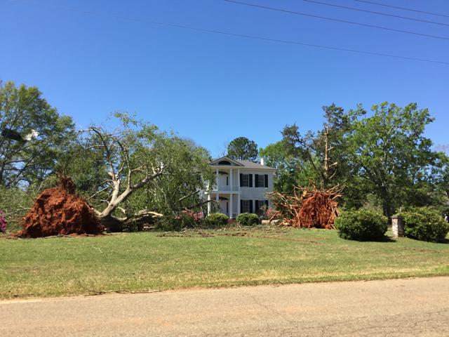
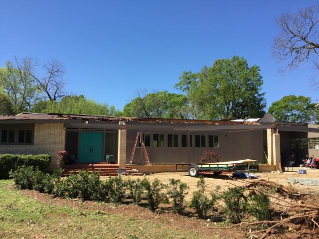
The tornado began at Fice Cemetery along Highway 80 on the south side of Lowndesboro, where a couple of trees were snapped. The tornado strengthened as it moved northward toward the center of town along Broad Street. At Lowndes Academy, one building lost its metal roof. Numerous historic homes sustained minor roof damage, and a couple dozen very large mature trees were uprooted at these homes. Only one home sustained partial roof removal due to uplift along the front porch. The tornado weakened as it moved north of the historic district and eventually dissipated near the intersection of Broad Street and Brown Hill Road.
The data is PRELIMINARY and may be subject to change.
|