|
Event Summary
|
|
EF-1
|
|
Estimated Maximum Wind:
|
100 mph
|
|
Injuries/Fatalities:
|
None |
|
Damage Path Length:
|
5.62 miles
|
|
Maximum Path Width:
|
600 yards
|
|
Approximate Start Point/Time:
|
3 N Old Mallard Airport
32.5479/-88.2675
at 851 PM CDT
|
|
Approximate End Point/Time:
|
Livingston
32.6004/-88.1957
at 902 PM CDT
|
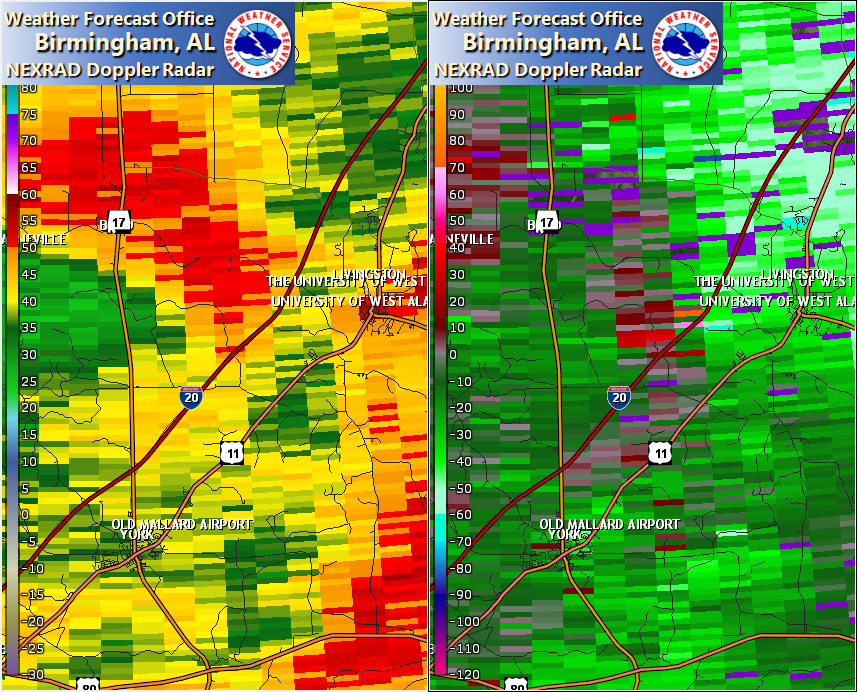
NWS Meteorologists surveyed damage in central Sumter County west of Livingston and determined it was the result of an EF-0 tornado.
The tornado is believed to have touched down somewhere near Greenwood Rd and Interstate 20. This area was heavily wooded and inaccessible, leaving the exact touchdown point estimated by radar. However, timber damage was found along portions of Greenwood Rd and Interstate 20 where swaths of snapped and uprooted trees were observed from the highway. This associates with a tornado debris signature seen on KBMX and KGWX RADARs. The tornado continued northeast crossing County Rd 12 where additional trees were snapped and uprooted. The tornado then moved between Livingston Country Club and Livingston Park before dissipating near the UWA campus on Lake Dr.
The data is PRELIMINARY and may be subject to change.
|