|
Event Summary
|
|
EF-1
|
|
Estimated Maximum Wind:
|
100 mph
|
|
Injuries/Fatalities:
|
None |
|
Damage Path Length:
|
1.17 miles
|
|
Maximum Path Width:
|
270 yards
|
|
Approximate Start Point/Time:
|
4 NW Akron
32.9285/-87.7809
at 938 PM CDT
|
|
Approximate End Point/Time:
|
Half Acre
32.9353/-87.7626
at 940 PM CDT
|
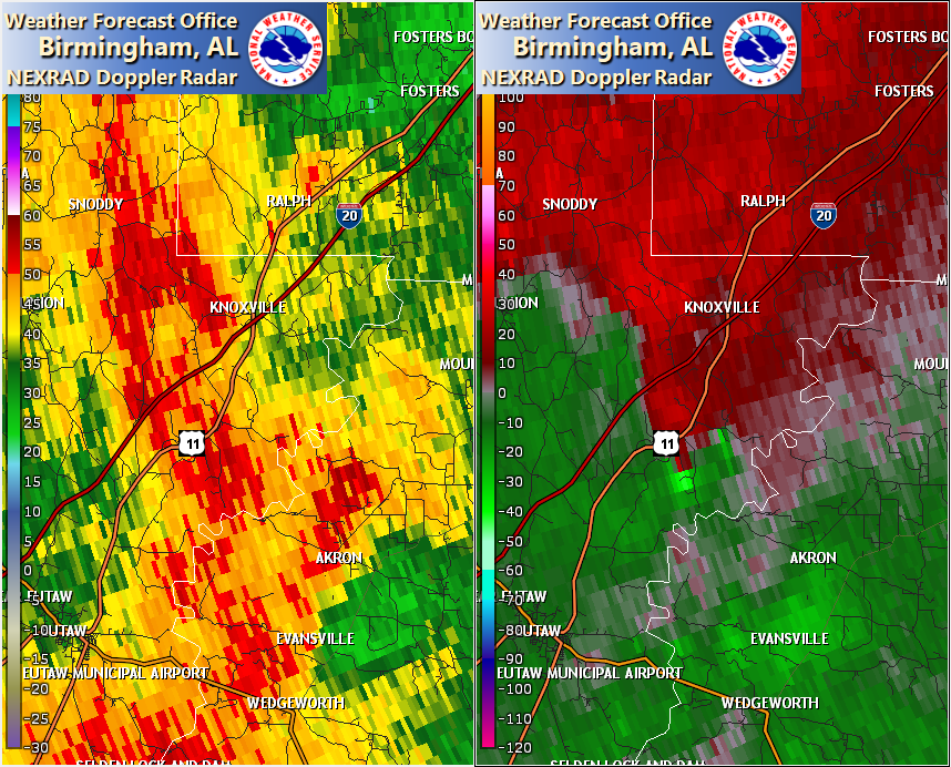
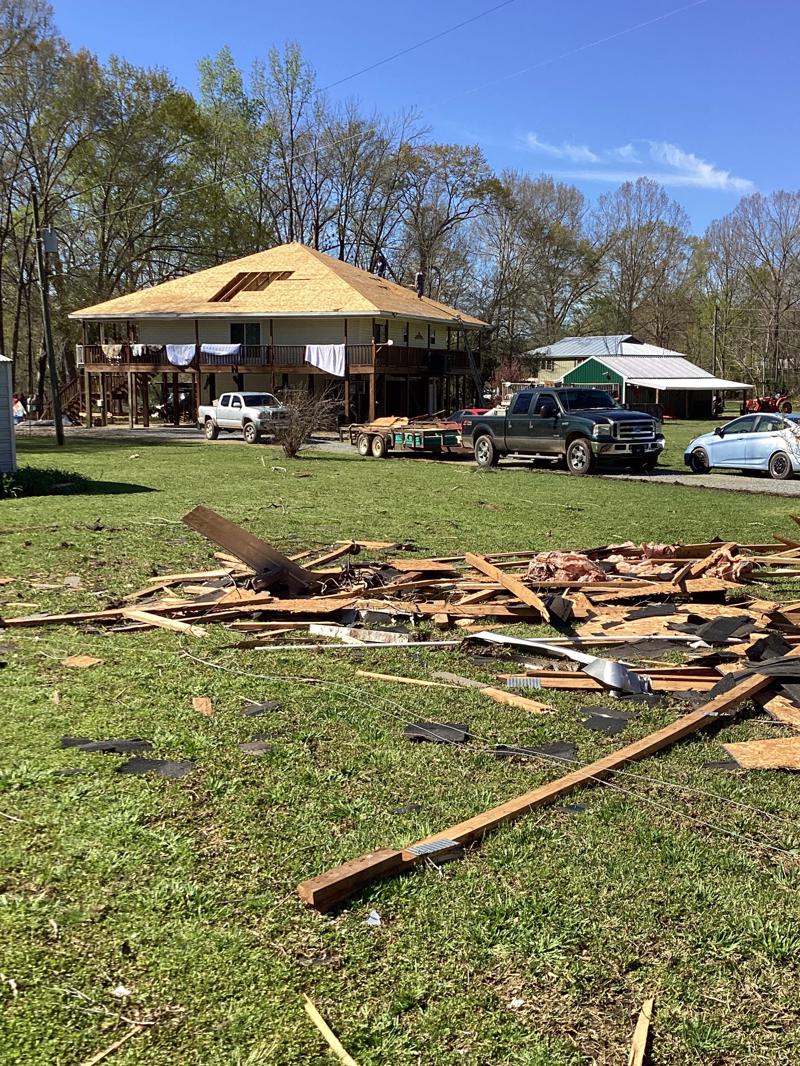
NWS Meteorologists surveyed damage in northeast Greene County and determined it was the result of an EF-1 tornado.
The tornado touched down near Flag Rd, near and along portions of the Black Warrior River. The tornado snapped and uprooted dozens of trees, some of which fell onto residences. Some homes sustained significant roof damage, with debris blown in a north direction and splatter on south and east facing walls. The tornado continued northeast snapping and uprooting more trees near Sims Creek. The damage path may have continued beyond the last observable point as there was no further access from there. Further evaluation is intended.
The data is PRELIMINARY and may be subject to change.
|